Tourist destination
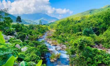
Khe Ram Valley
Khe Ram Valley is an ecological destination of wild beauty, located in the mountains and forests northwest of Da Nang city. According to the new administrative boundaries, the former Hoa Bac area, where Khe Ram is located, now belongs to Hai Van ward, Da Nang city. Khe Ram impresses with the harmonious combination of green mountains and forests, fresh streams and peaceful small valleys. The stream weaves through the rocky slopes, sometimes gentle and clear in the dry season, sometimes becoming strong with white waterfalls in the rainy season, creating a diverse and attractive natural landscape. Not only has beautiful scenery, Khe Ram is also a space for visitors to experience many activities close to nature such as bathing in streams, sightseeing, picnicking, camping, fishing and exploring green paths around the valley. The streamside grounds, forest canopy and fresh water create favorable conditions for rest and relaxation trips with family and friends. Another attractive feature of the Khe Ram area is the cultural space of the Co Tu people in the villages of Ta Lang and Gian Bi. Visitors can learn about traditional life, customs, culture and enjoy dishes with mountain and forest flavors prepared by local people. This is a factor that helps the journey to explore Khe Ram not only stop at experiencing the landscape but also connect with community culture. With its attractive natural landscape, mountain ecosystem and indigenous cultural values, Khe Ram has great potential for developing eco-tourism and community tourism. This is a suitable destination for tourists who want to leave the bustle of the city and find a green, fresh and peaceful space right in Da Nang city.
Da Nang
50 view









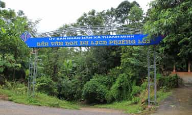
Phiêng Lơi Cultural Tourism Village
Located about 7 km north of Dien Bien Phu city center, Phieng Loi Cultural Tourism Village is home to the Thai ethnic minority. Nestled against the mountains and overlooking the Nam Rom River, the village appears peaceful with its traditional stilt houses nestled amidst the lush green mountains and forests, creating a destination rich in cultural identity in the Dien Bien region. A distinctive feature of Phieng Loi is the relatively well-preserved system of traditional Thai stilt houses. These houses, built from wood, bamboo, and rattan, are notable for their exquisite decorative patterns on window sills, window frames, and architectural details. This is not only a place to live but also a space preserving many traditional cultural values of the community. Visiting Phieng Loi, tourists have the opportunity to learn about the traditional clothing, weaving, musical instruments, folk songs, folk dances, festivals, and folk games of the Thai people. In particular, experiencing the local cuisine is a major attraction of this destination. Local products are prepared using traditional methods, with signature dishes such as grilled stream fish, bitter bamboo shoots with chili dipping sauce, buffalo meat, wild vegetables, and salads that reflect the unique flavors of Thai cuisine. The cultural atmosphere becomes more vibrant during community gatherings, when tourists and locals gather around a fire, enjoying the food and immersing themselves in Thai dances. Through this, visitors not only sightsee but also directly experience the life, culture, and friendliness of the local community. With its peaceful landscape, distinctive stilt house architecture, and the rich Thai cultural heritage preserved through generations, Phiêng Lơi is a suitable destination to explore community culture and appreciate the rustic, distinctive beauty of Điện Biên.
Dien Bien
42 view











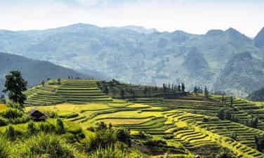
Din Ngai Restaurant
Quan Din Ngai is a highland village imbued with the cultural identity of the Mong people, now belonging to Bac Ha commune, Lao Cai province. Located in the midst of endless mountains, this place attracts tourists because of its pristine natural landscape and traditional cultural, daily life and labor life still preserved for many generations. Coming to Quan Din Ngai, visitors can see terraced fields stretching along the mountainside, creating a colorful natural picture at each time of the year. During the rainy season, terraced fields sparkle like mirrors among the mountains and forests; When the rice matures, the fields turn green, then take on the warm yellow color of the harvest season. This is also a space closely linked to the lives of the Mong people, where each field is the result of the process of exploration and cultivation over many generations. Not only the scenery, Quan Din Ngai also brings typical cultural experiences of the Bac Ha highland. Visitors can explore houses with mud walls, explore the traditional craft of casting plowshares, learn the art of Mong Khen and observe the simple working life of indigenous people. These cultural features create a space rich in identity, rustic but full of appeal. Din Ngai Restaurant is also located in the typical cultural space of Ban Pho area - a place famous for traditional corn wine and products associated with Mong people's life. Coming here, visitors not only admire the scenery but also have the opportunity to feel the rhythm of highland life, learn about customs, enjoy local products and immerse themselves in nature. With a harmonious combination of mountains, forests, terraced fields, traditional architecture and indigenous culture, Quan Din Ngai is an attractive destination for those who want to explore the authentic, idyllic and rich beauty of the Bac Ha highland.
Lao Cai
50 view
Ba Ho Stream
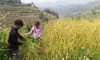
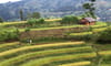
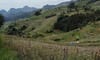
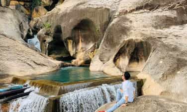
Ba Ho Stream, also known as Ba Ho Waterfall, is an outstanding natural destination located in Ba Ho village, Cong Hai commune, Khanh Hoa province. This place is likened to a "wonderful valley" in the middle of the mountains and forests because of its wild beauty, clear blue water and amazing natural cliffs. The stream originates from the Song Trau protection forest area, weaves through the mountain slopes and forms three large lakes at different altitudes. Each lake has its own beauty, but the third lake is loved by many tourists because of its wide lake bed, cool clear water and open space, surrounded by majestic mountains and forests. The second lake is located among green trees, bringing a cool, peaceful feeling; While the first lake area has higher and more rugged terrain, suitable for those who love to explore. Coming to Ba Ho, visitors can immerse themselves in nature, watch waterfalls cascading between cliffs, bathe in streams, take photos and organize picnics. For those who like to experience, the journey along the stream and through the paths in the forest is also an interesting part of the discovery trip. Not only attractive by its scenery, Ba Ho also brings a sense of relaxation when visitors temporarily leave the urban space, listen to the sound of flowing water and enjoy the fresh air of the mountains and forests. This is a suitable destination for those who love nature, like to explore and seek a peaceful space in the middle of the mountains.
Khanh Hoa
49 view











Chu Va - Lai Chau
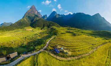
The Chu Va mountain range is located in Son Binh commune, Tam Duong district, Lai Chau province, about 30 km from Sa Pa along National Highway 4D towards Lai Chau. This is a relatively unspoiled destination, especially attractive to nature lovers, explorers, and those who enjoy capturing magical moments of clouds and mountains. Standing out amidst the mountains, Chu Va peak rises majestically like an arrow reaching towards the sky, often shrouded in white clouds. Depending on the weather and light of the day, the mountain range takes on different beauties. Most impressive is when layers of clouds embrace the mountain's body, revealing only the peak amidst a vast sea of clouds, creating an enchanting image likened to a "scarf wrapped around the neck." From the main road, visitors walk about 1 km to reach the foot of the mountain. Especially in early September, Chu Va is at its most beautiful when the terraced rice fields turn a golden yellow, blending with the green of the mountains and forests and the white clouds, creating a majestic and poetic natural landscape. Not too noisy or crowded, Chu Va offers a peaceful and pristine feeling, making it an ideal stop for those who want to immerse themselves in nature and capture beautiful moments amidst the mountains and forests of Northwest Vietnam.
Lai Chau
58 view











Khau Coc Cha Pass
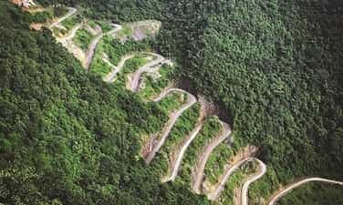
Khau Coc Cha Pass – a majestic road amidst the mountains and forests of Cao Bang. Located on National Highway 4A, in Xuan Truong commune, Cao Bang province, Khau Coc Cha Pass is one of the most impressive and treacherous mountain passes in the northern mountainous region. The pass is approximately 2.5 km long, notable for its 14 hairpin bends forming 15 layers of steep slopes, winding around the slopes of Coc Cha mountain. Viewed from above, the continuous curves make Khau Coc Cha resemble a giant snake coiling itself amidst the lush green mountains. One side is a cliff, the other a deep ravine, and in the distance, towering mountain ranges create a scene that is both majestic and challenging. To fully appreciate the beauty of the pass, visitors can hike up to the viewpoint on the mountainside. After about 30 minutes of travel under the green forest canopy, a spectacular view unfolds: all 14 bends of Khau Coc Cha are clearly visible amidst the pristine natural landscape. Not only is Khau Coc Cha captivating for its majestic beauty, but it also bears the mark of humanity's journey in conquering rugged terrain. Today, it has become a favorite check-in spot for adventure enthusiasts, especially those who love traveling to mountainous regions.
Cao Bang
80 view







Tia Lo Community Tourism Village
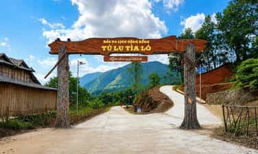
Bản du lịch cộng đồng Tìa Ló – điểm đến bình yên bên mây ngàn vùng cao. Nằm nép mình bên dãy núi Phù Lùng hùng vĩ, Bản du lịch cộng đồng Tìa Ló, xã Pu Nhi, huyện Điện Biên Đông, tỉnh Điện Biên, đang trở thành điểm đến hấp dẫn dành cho những ai yêu thích vẻ đẹp thanh bình của núi rừng Tây Bắc. Điểm nhấn nổi bật nhất nơi đây là đồi cỏ tranh Tìa Ló. Mỗi khi vào mùa, những vạt cỏ tranh trắng muốt bung nở bạt ngàn, phủ kín cả một triền đồi mênh mông, đung đưa nhịp nhàng trước gió. Xa xa là ruộng bậc thang, những đồi thông xanh ngắt và mặt hồ Noong U phẳng lặng thơ mộng, tất cả hòa quyện thành một bức tranh thiên nhiên mộc mạc, trong trẻo. Đến Tìa Ló, du khách có thể dạo bước quanh bản làng, ngắm cảnh, chụp ảnh check-in bên đồi cỏ tranh trắng xóa và tận hưởng bầu không khí trong lành, mát mẻ của vùng cao. Đặc biệt, vào những buổi sáng sớm rực rỡ ánh bình minh hoặc buổi chiều dịu nắng, không gian đại ngàn trở nên đẹp hơn với mây phủ bồng bềnh và tiếng khèn Mông vang vọng xa xăm. Không ồn ào, náo nhiệt, Tìa Ló mang đến một không gian gần gũi và thư thái, nơi du khách có thể tạm rời xa nhịp sống phố thị để hòa mình vào thiên nhiên và trải nghiệm nét văn hóa bản địa nguyên sơ. Nếu có dịp đến Điện Biên Đông, hãy ghé Bản du lịch cộng đồng Tìa Ló, thưởng ngoạn sắc cỏ tranh và lưu lại những khoảnh khắc đẹp giữa một miền cao xanh mát, bình yên.
Dien Bien
68 view








Dai An Community Tourism
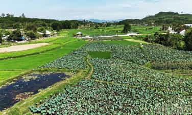
Located along the main canal of Phu Ninh Lake, Dai An Community Tourism Area, in Dai An village, Phu Ninh commune, Da Nang city, is becoming an attractive destination for those who love the peaceful beauty of the countryside. The most prominent highlight here is the Dai An lotus pond. During the season, pink lotus blossoms rise from the green water, emitting a gentle fragrance, creating a dreamy and peaceful scene. In the distance are rice fields, green trees, and Phu Ninh Lake, all blending into a simple, pristine natural landscape. At Dai An, visitors can stroll around the lotus pond, admire the flowers, take photos, and enjoy the fresh air of the countryside. Especially in the early mornings or afternoons with gentle sunlight, the lotus pond becomes even more beautiful with natural light and the faint scent of lotus carried on the breeze. Without the hustle and bustle, Dai An offers a close and relaxing space where visitors can temporarily escape the city life and immerse themselves in nature. If you have the chance to visit Phu Ninh, be sure to stop by Dai An community tourism site, admire the lotus blossoms, and capture beautiful moments amidst a lush, peaceful countryside.
Da Nang
79 view







Nam Nghiep Village
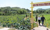
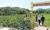
Nam Nghiep Village – the season of hawthorn blossoms amidst the vast forests of Northwest Vietnam. Located at an altitude of nearly 2,500m above sea level, Nam Nghiep village in Ngoc Chien commune, Son La province, is a Hmong village that still retains its pristine and rustic beauty. Small houses nestled among the mountains and forests, winding roads, and fresh air create a peaceful space, suitable for those who want to reconnect with nature and live at a slower pace. Especially, the hawthorn blossom season, around March and April, is when Nam Nghiep is at its most beautiful. Ancient hawthorn trees burst into bloom, covering the mountain slopes with white flowers, interspersed with the green of the forest and the Hmong houses, creating a dreamy scene like a painting in the vast forest. In Nam Nghiep, visitors can stroll around the village, experience the life and culture of the Hmong people, admire the mountain scenery, camp, chase clouds, or trek towards Ta Chi Nhu. After exploring the area, visitors can also stop by Luot village to experience the natural hot springs amidst the mountainous landscape of Ngoc Chien. Not too noisy or bustling, Nam Nghiep is attractive because of its pristine, simple beauty and the pure white flowers blooming in seasons. This is an ideal destination to experience the pure, majestic, and culturally rich Northwest region.
Son La
83 view



M-shaped slope
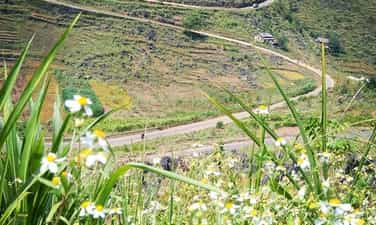
The M-shaped Pass – a winding road through the rocky plateau. The M-shaped Pass is one of the special routes on the journey to explore the Ha Giang rocky plateau, located on the road connecting Meo Vac and Yen Minh. It's named this way because the road winds through the hills, forming a gentle M shape amidst the majestic rocky landscape. From a high vantage point, the entire pass is clearly visible with its continuous curves hugging the mountainside, below which lies a vast valley, with cultivated fields interspersed among the jagged limestone mountains. The contrast between the narrow road and the vast mountain forest creates a scene that is both powerful and poetic. The special thing about the M-shaped Pass is that each season brings a different beauty. When the fields are covered in green, the area is full of life; during the dry season, the gray color of the jagged rocks highlights the pristine beauty of the plateau. On cloudy days, the road becomes even more mystical amidst the mountains and forests. This is also a popular stop for tourists to check in and admire the panoramic view of the road from above. However, because it is located on a mountain pass with many curves, tourists, especially motorcyclists, need to slow down, observe carefully, and ensure safety when stopping to take photos. The M-shaped slope is not just a road to travel on, but also a unique feature amidst the mountains and forests of Ha Giang – where the majestic beauty of the rocky plateau is created by its gentle and impressive curves.
Tuyen Quang
82 view