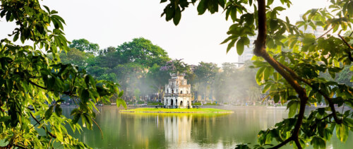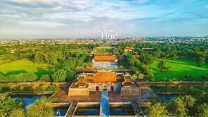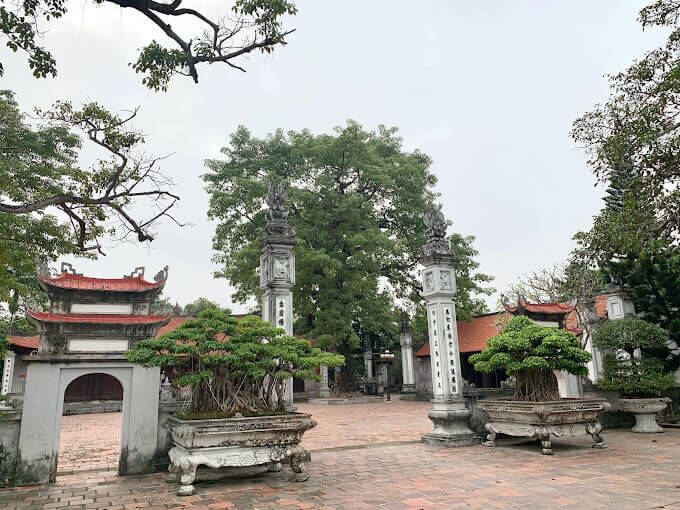
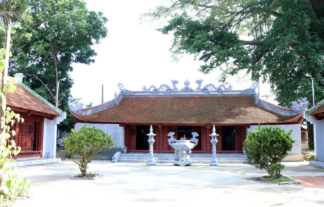
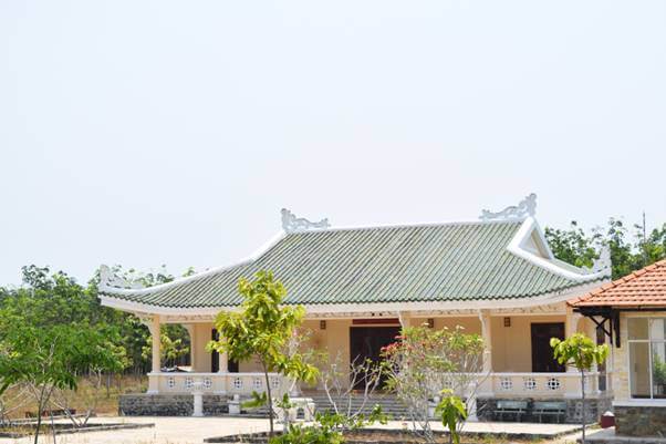
Tu Luong Xam is one of the "Four sacred words" of the ancient district of An Duong and is now one of the three sacred "words" of Hai An district (Tu Luong Xam, Phu Thuong Doan, Phu Xa Temple). The temple worships King Ngo Quyen - the man who defeated the Southern Han army on the Bach Dang River in 938. Tu Luong Xam is a historical and cultural relic of special significance for Hai Phong, because it contains content related to the first Bach Dang victory of our army and people under the talented leadership of Ngo Quyen. That victory paved the way for us to defeat the Southern Han invaders, bringing our nation to a new era of independence and self-reliance. Luong Xam was formerly the name of a commune in An Duong district, Kinh Mon district, Hai Duong town (now Nam Hai ward, Hai An district, Hai Phong city). Tu Luong Xam is located in the Northeast of Nam Hai commune, the main architecture faces East. According to historical books, Luong Xam was built magnificently in the Later Le period and restored in the Nguyen dynasty. Therefore, all current architecture has the artistic style of the Nguyen Dynasty, only some architecture has the artistic style of the Le Dynasty. Looking at the whole picture, the temple has a closed, continuous "internal and foreign" layout. That is, enter the main door, exit the main door. Located on a large, tall land with many ancient trees, on the base of Ngo Quyen's headquarters and warehouse to fight against the Nam Han invaders in the past. The stationing in the Luong Xam area where Ngo Quyen returned many times to command combat is mentioned in the genealogies of the communal houses and temples worshiping him in this Northeast region. Not only the architecture, the antiques in the word every time you admire them will give visitors a different feeling. In the still preserved words, there are 3 Bach Dang stakes as evidence of the Bach Dang battle in 938. Up to now, Tu Luong Xam still preserves 25 main ordinations and more than 20 copied ordinations dating from 1522 to in 1924. Among those ordinations, many dynasties honored King Ngo Quyen as "The Most Highest Great King", "Ngo Vuong Thien Son" and many beautiful names. With all that value and meaning, On December 12, 1986, Tu Luong Xam was ranked a national historical relic by the Ministry of Culture, Sports and Tourism. Besides the long history and unique architecture, the Tu Luong Xam festival held from January 16 to 18 every year commemorating the Bach Dang victory and the death of King Ngo Quyen) is a collection of customs. society, beliefs, and folk knowledge. This has been done since ancient times. After conducting the national ceremony at Tu Luong Xam, it was the turn of the governors and surrounding villages to organize the ceremony to worship Ngo Vuong; In terms of levels, Ngo Quyen sacrifices are conducted at three levels: by the state (the Ngo, Dinh, Early Le, Ly, Tran dynasties) later by the district level, by the general level and by the local villagers. During the Tu Luong Xam festival, the ceremony of dozens of villages carrying palanquins from their communal houses to worship created a strong spiritual emotion towards their roots. All palanquins are placed in the large area in front of Linh Tu Luong Xam gate for judging. Whichever palanquin is the best will next time have the honor of standing on behalf of the entire palanquin group to pay homage to the Holy King in front of the royal bed. The ritual of worshiping Ngo Vuong in Tu Luong Xam is quite special, the offerings must include a cow, a pig, and a goat, slaughtered alive (Cà thai lao). After the sacrifice, the meat must be eaten as a feast at the temple and distributed to the people. nail; In the years of " Phong Dang Hoa Coc " in Tu Luong Xam, there was also a ritual for district-level ceremonies and general-level ceremonies. During the festival, there are many cultural performances, traditional music and dance performances recreating the Bach Dang victory, folk games: blindfolded pot beating, blindfolded goat catching, spring swing, Chinese chess, human chess, Organize football, volleyball tournaments... With many great historical and cultural values left to posterity, Tu Luong Xam is not only a place of worship to commemorate the merits of King Ngo Quyen, but also the pride of Hai Phong people in particular and the whole country. water in general. Source: Multilingual Foreign Affairs Information Portal of Hai Phong City
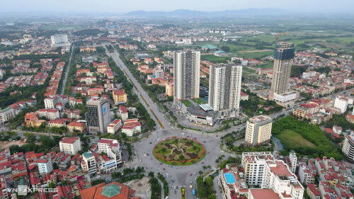
Hai Phong 3875 view
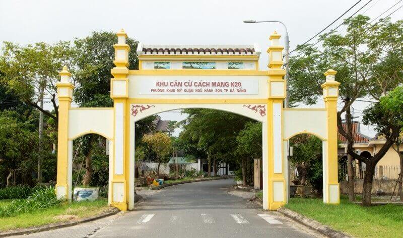
The K20 revolutionary base is considered a symbol of the resilient and indomitable revolutionary spirit of the people of Da Nang in general and of Ngu Hanh Son district in particular during the resistance war against the US to save the country. The name K20 - is the code name to refer to the Da Man revolutionary base, where the District III Party Committee and the Da Nang City Party Committee are stationed to lead the revolutionary movement. In 1965, the situation in Da Man and Bac My An in particular, and Da Nang city in general, was extremely complicated. The US began sending troops into the South, implementing the "Local War" strategy, building many large military bases in the South, including Da Nang. The US goal is to build Da Nang into a military base that combines the Navy, Army, and Air Force in a solid, long-term manner, located in the North; protect the capital of the puppet puppet regime in the South, so the US built more bridges across the Han River, built a helipad in Nuoc Man, expanded and strengthened Da Nang airport and sent 17 orders. The American and Wei Dynasty arrived in Da Nang. For the US, this is a very important place, with facilities concentrated for the war in the Central region. As for us, the K20 revolutionary base is located in Da Man 5 residential area, Khue My ward, Ngu Hanh Son district, about 10 km southeast of Da Nang city; The Northeast borders the sea, the West is the Han River, the South is sunken fields and the Vinh Dien River; At the same time, it is adjacent to Hoa Vang district and Da Nang city, and is a gateway to block and protect the city from the Southeast. After the Geneva Accords, the United States and Ngo Dinh Diem's lackey government built many posts around Da Man Base to form a closed military belt and an evil government apparatus to restrain the people. people and prevent revolutionary forces from entering. That's why Da Man is considered a buffer zone for our soldiers, officers and guerrillas to use as a springboard to attack US and Puppet bases. That shows that K20 has an important strategic position in the resistance war against the US to save the country. The "steel" land to build and develop the revolutionary struggle movement right in the heart of the enemy, the connection point between the local revolution and the surrounding areas of the city and Quang Nam province and an important springboard for Our armed forces raided enemy military bases. Also since 1965, Party cadres, all levels, branches and armed forces who came to the inner city of Da Nang to direct the revolutionary movement all passed through and stayed at Nuoc Man base, operating right in the enemy's heart. to continue building the base, destroy evil, support the people fighting for civil rights and democracy in the city, protect the safety of Nuoc Man base, and take partial control of surrounding areas such as Ma Da, Da Phuoc, My Thi. The question is, right in the heart of the enemy, how can revolutionary cadres keep secrets and fight within the enemy's siege? At this time, relying on the people is considered a vital issue of the revolution and answers that urgent question. An underground battlefield was formed, which was a system of sturdy secret tunnels and trenches dug right in people's houses. In 1968, the District Party Committee of District III led by comrade Dang Hong Van instructed the people on the model of secretly digging tunnels, creating a network of underground tunnels in the village to hide revolutionary cadres. Hundreds of households actively dig tunnels day and night, forming a tight system. Each such cellar housed four to five revolutionary cadres. Although the enemy launched many raids in the village to destroy the core force, they were unable to detect it. Tunnels are dug everywhere in the house, under the bed, in the garden, on the porch... creating a solid fortress. Da Man created a revolutionary battlefield right underground during that time. The cellars were made very elaborately by the people. The tunnel mouth and entrance are very narrow, but the inside is wide enough for revolutionary cadres to do their daily activities. In addition to the main tunnel mouth, there is also a fake tunnel mouth. If there is a henchman to point out, the people will smash the mouth of the tunnel, pretending to be bricks and stones, falling down to cover the mouth of the main tunnel, both deceiving the enemy and signaling the soldiers to escape. The highlight of the secret fortification system built in K20 during this period is its high mobility and large scale. In many families, or between neighboring families, there are connecting branch tunnels that can hide many people at the same time, creating a continuous situation that is very convenient for movement, avoiding the discovery of appeared, swept away the enemy. An underground battlefield was built with a dense system of secret bunkers, sometimes up to 157 bunkers. Currently, there are still a number of secret vaults left in churches such as Mr. Huynh Phien's church, Mrs. Nhieu's church, Huynh clan's church and Mr. Huynh Trung's house. These four locations have been ranked as historical relics in the K20 National Historic Site area. Thanks to this secret tunnel system combined with revolutionary self-awareness and solidarity for the goal of liberating the homeland, the K20 army and people have achieved many glorious victories. Typically, the battle at Nuoc Man airport on October 28, 1965 was carried out by the armed forces of Da Nang City. Successfully organizing the memorial ceremony for President Ho Chi Minh, in the midst of enemy siege, the ceremony was still held very solemnly, solemnly and safely as if it were taking place in a liberated area. In particular, on the morning of March 29, 1975, the K20 people coordinated with the Quang Da armed forces to simultaneously rebel and attack all US and puppet facilities in the area. At 9:00 a.m., the flag of the National Front for the Liberation of South Vietnam was planted at Nuoc Man airport, signaling the complete victory of the army and civilians in the base area, contributing to the excellent completion of the cause of national liberation. with the role and function of a resistance base inside the enemy. Source: Da Nang Electronic Newspaper
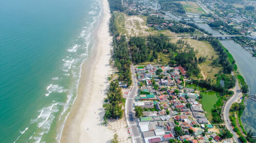
Da Nang 3717 view
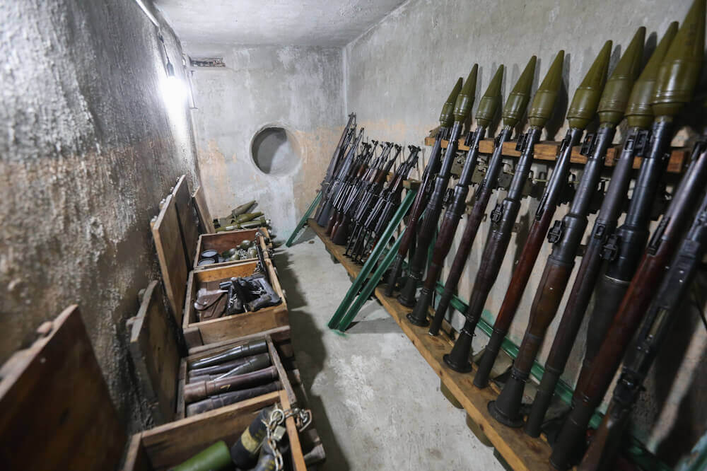
The weapons bunker used to attack the Independence Palace was one of the bases of the special forces to prepare for the General Offensive and Uprising in the Spring of Mau Than 1968. This is a townhouse located in a row with the same facade structure. iron sliding door. The head of the household is contractor Tran Van Lai (also known as Nam Lai) and uses the house to both park his car and store construction materials. The house is located near the beginning of Tran Qui Cap alley (today Vo Van Tan alley). The apartment was purchased in early 1967 in agreement with the commander of Mr. Nam Lai's unit: Mr. Nguyen Van Tri, political officer of the Bao Bao unit of the Saigon - Gia Dinh Military Region. Mr. Nam Lai is an officer of this unit. After buying the house, Nam Lai started repairing it. Wearing the outer coat is a contractor named Nam U - SOM (Mr. Nam often goes to the US U - SOM agency to bid). While repairing the house, he secretly carried out a plan assigned by the unit: building a secret bunker. Therefore, under the floor, inside the chamber, there are two cellars next to each other. Each tunnel has a large sewer line that can fit people through, leading to the back of the house. The weapons bunker is 2m long, 1.2m wide, 2.5m high; The tunnel walls and floor are thickly cemented for waterproofing. As for the tunnel mouth, Mr. Nam personally installed it himself. Lid with screw latch. Use the latch to lift the lid up so there is enough space for one person to get under. In mid-1967, the tunnel was completed and was notified to the Guarantee unit (with code number J9 T - 700). After inspection, the unit commander ordered to continue implementing the plan. To transport a large quantity and many types of weapons (pistols, guns, AK bullets, B40, explosives... to a secret hidden bunker location. On the 29th of Tet Mau Than, in Loc Thuan commune, Trang Bang district (Tay Ninh province), a team of 5 special forces practiced preparing for the attack. On the morning of the first day of Tet, following the flow of people celebrating Spring, the soldiers of the 5th Special Forces took turns using many vehicles to gather at the house on Hoang Dao Street (now Tran Van Dang), Ward 11, District 3. Head of household is also a special forces soldier named Le Tan Quoc (alias Bay Rau Mong). At this time, the entire team of 5 commandos had 15 soldiers, including a female codename Chin Nghia, commanded by Truong Hoang Thanh. At 10 p.m., as planned, the entire team of 5 special forces moved to Nam Lai's house on Le Tan Quoc's 2 cars. Two cars parked on Tran Qui Cap Street, the soldiers of Team 5 got out and entered Nam Lai's house through the front and back doors. Then, under Ba Thanh's command, several team members went down to the basement to bring weapons, AK guns, grenades and explosives, checked them and put them in a car parked inside the house. At 1:30 a.m. on the 2nd day of Tet, we moved near the Independence Palace on Nguyen Du Street. Enemy guards discovered us and forced us to stop. The convoy kept moving forward, they shouted the alarm. The soldiers in the first vehicle opened fire to kill these guys and used explosives to break open the gate for the vehicle containing explosives to rush in. Unfortunately, the explosives did not explode due to technical problems. However, the breakout team managed to get inside. The enemy opened fire, two soldiers died, the rest had to temporarily retreat, two were injured. The enemy came from all sides inside and sealed the gates. At 4 a.m., another captain, Truong Hoang Thanh, died. Near morning, when there were only 8 people left, the brothers retreated to house number 56 Thu Khoa Huan and organized a defense on the 3rd floor. Hungry and tired amidst the enemy encirclement, 8 tenacious soldiers fought all day January 31, 2019. 1968 is the 2nd day of Tet. The brothers fought to the last bullet, removed their guns, threw them away, and used bricks, stones, and wood to block the enemy. Comrade Le Tan Quoc (Bay Rau Morning Glory) with an AK on duty blocking the stairs heroically sacrificed his life. (Martyr Le Tan Quoc was honored as a hero of the armed forces). After the attack on the Independence Palace by Saigon commandos made the enemy tremble in fear, they confiscated all property, hunted down and placed a reward of 2 million VND on Tran Van Lai's head. His entire family had to withdraw from Saigon, but he himself continued to operate and instructed the remaining bases of the Thanh Rangers to continue strengthening and building their forces. In 1972, he was captured by the enemy and detained in Son Tinh prison (Quang Ngai), but they did not know that they had captured the special forces soldier who had contributed greatly to the battle that directly attacked the enemy's brain in 1968. The house number 287, alley 70, Nguyen Dinh Chieu has been recognized by the Ministry of Culture and Information as a national historical and cultural relic and its former owner became the custodian and conservator. Source: People's Committee of District 3, Ho Chi Minh City
Ho Chi Minh City 3547 view
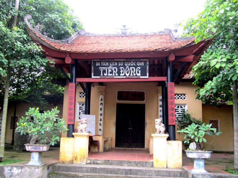
Tien Dong Base National Historical Relic Area is located in Tien Luong commune, Cam Khe district, Phu Tho province. Tien Dong in the past (when General Ngo Quang Bich chose it as a resistance base) was a swampy, sunken field, surrounded by rugged mountainous terrain. From Tien Dong base, when advancing, you can use boats to follow the Gianh river to the Red River to Thanh Ba, down to Cam Khe district town, or up to Ha Hoa. When you quit, you can go to Yen Lap, go to Nghia Lo to the Northwest. Famous person - General Ngo Quang Bich was born on May 7, 1832 in Trinh Pho village, Truc Dinh district, Kien Xuong district, Nam Dinh province (now Trinh Nhat village, An Ninh commune, Tien Hai district, Thai Binh province) . According to official history, his original family name was Ngo, a descendant of King Ngo Quyen, but because his grandfather changed his maternal family name to Nguyen, so history books also called him Nguyen Quang Bich. In 1858, he passed the baccalaureate exam; In 1861, he passed the bachelor's exam and was appointed as a mandarin by the Nguyen court, but he submitted a petition asking that he temporarily not take office to continue his studies and open a teaching school. In 1869, during Tu Duc's reign, he passed the Second Giap Doctoral Examination of Dinh Nguyen (ie Hoang Giap). After that, he was successively appointed to the positions of Tri Phu Lam Thao (present-day Phu Tho); Dien Khanh Tri Phu (present-day Khanh Hoa); Murder in Son Tay province; Teu Quoc Tu Giam (Hue); Murder case in Binh Dinh province; Chief envoy of the mountain room and patrol of Hung Hoa province (including present-day Phu Tho province). When the French colonialists sent troops to attack Hung Hoa, Mr. Ngo Quang Bich, as "Chief of mountain defense and patrol of Hung Hoa province" led the army and people to fight against the French, winning many important victories. However, with the superior strength of the French army, on April 12, 1884, Hung Hoa citadel fell. Ngo Quang Bich withdrew his troops to Tien Dong, Tien Luong commune, Cam Khe district, established a base, raised an uprising flag, and responded to King Ham Nghi's Can Vuong Edict against the French. The flag of the insurgent army was embroidered with the four words "Binh Tay Bao Quoc" and the oath "Vietnamese nation will never change, Lac Hong immortal restores its integrity" affirming national sovereignty. King Ham Nghi issued an edict appointing him the position of General of Tonkin as a military minister, with the title of Thuan Trung Marquis, in charge of organizing the resistance in Tonkin (literature from Counselor, martial arts from De Doc were given the right to use the official documents). Since then, with his prestige, General Ngo Quang Bich not only directly commanded the Tien Dong uprising, but also sought to contact and coordinate with other resistance leaders such as Phan Dinh Phung in Thanh-Nghe; Deo Van Tri, Nong Van Quang, Cam Van Hoan, Cam Van Thanh were scholars and chiefs of the Kinh, Thai, Muong, and Mong ethnic groups in the region who participated in the fighting or supported the resistance. While the resistance war was going smoothly, on January 5, 1891, General Ngo Quang Bich suddenly became seriously ill and passed away at the age of 58. His body was buried by soldiers at Ton Son mountain, Yen Lap district. Not only was Ngo Quang Bich a patriotic scholar and resistance leader, he was also a poet and cultural activist. He left behind the work "Ngu Phong Thi Tap" (Ngu Phong Poetry Collection), including 112 poems in Chinese, most of which were composed during the years he led the insurgent army against the French in Tien Dong. In addition, he also wrote poems and couplets to pay tribute to his fallen comrades. Especially the "Letter in reply to the French army" with its clear words and determination to sacrifice for national independence. (When the French sent him a letter urging him to surrender, promising to grant him a title and high benefits, he firmly replied: "If I win, if I live, I will be a court soldier. If I lose unfortunately, if I die, I will also act as a demon and kill the enemy. I would rather be guilty of a temporary offense than a sin of the world!") In 1884, after Hung Hoa citadel fell and withdrew his troops to station at Tien Dong, General Ngo Quang Bich built this place into a continuous fortress system, ensuring reasonable defense and attack. became a solid base for the resistance war against the French in the Northern Midlands and Mountains. The base's headquarters is located on a high mound that people now call Quan Dai mound. This is a hill about 150m high above the level of the area, bordering Tong Hai mountain. The top of the hill is quite flat and has a convex mirror surface with 3 peaks. The middle peak is Tuong Quan hill, where the headquarters of the insurgent army is located (and also where the Ngo Quang Bich temple is built today). On the right is Ho Gia peak, blocking the road through Tong Hai mountain to Yen Lap (he later withdrew his troops to Yen Lap via this road). On the left is the Cong Don mound (this is the guard post protecting the headquarters). Each hillock is about 300m apart. Near the foot of the current hill, there are traces of a well and a place where the insurgents' horses were tied in the past. In the Tien Dong base area, there are also famous landmarks such as: Tuong Quan hill, Flag Pillar hill, Mai mound, Don hill, Muc mound, Co Rac hill... which are places associated with the names of famous people and generals. Ngo Quang Bich army with Can Vuong martyrs and the anti-French uprising movement at the end of the 19th century. On February 12, 1999, Tien Dong base was ranked as a national historical and cultural relic by the Ministry of Culture, Sports and Tourism. In the temple, there is a statue worshiping General Ngo Quang Bich, and epitaphs record the will and courage of him and the Can Vuong martyrs. On the stele on the road leading up to the temple, there are lines of poetry written by the Regent Ton That Thuyet, praising the will and patriotism of the General: Artifacts on display in the gallery include: 1 set of teapots, 1 eel-skin colored porcelain rice bowl, 1 Hoa Mai gun and some bullets and shells of the insurgents. Regarding the tea set and porcelain rice bowl, these are utensils that served General Ngo Quang Bich in daily activities, found in 1979 by Ms. Tuan Hue's family in Tien Dong while digging in the garden ( When finding the artifact, through information from the family, researchers confirmed that in the past, her grandfather was a bodyguard of Mr. Ngo Quang Bich, and still used this Phung to brew rice for him). Tien Dong is the resistance base of the entire northern midland and mountainous region, led and operated directly by the North's military minister Ngo Quang Bich, so it is also a gathering place for many literati and intellectuals. Famous patriots throughout the country such as Tong Duy Tan, Ton That Thuyet, Nguyen Thien Thuat, Ngo Quang Huy, Nguyen Cao... came here to discuss the restoration of the country. Therefore, this is a historical relic marking the history of the glorious resistance against the French of the Can Vuong movement. Source: Cam Khe District Electronic Information Portal
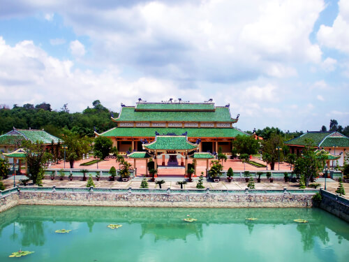
Phu Tho 3380 view
Luc Giap Temple, also known as Vat Temple, is located on the left bank of the Cong River, in Dac Son commune, Pho Yen Town, 4 km west of Pho Yen district capital and about 35 km west of Thai Nguyen city center. southern. Every year, the temple opens its main festival on March 15 (lunar calendar) to commemorate famous people Duong Tu Minh, Luu Nhan Chu, and Do Can. In ancient times, the temple was just a small shrine worshiping the gods of the villagers in Son Cot region. In the 12th century (Ly Dynasty) to commemorate and recognize the merits of national hero Duong Tu Minh, the people here built a temple to worship him. In the 15th century (Le dynasty), Do Can from Thong Thuong village, present-day Minh Duc commune, passed his doctorate and was appointed government official of Thanh Hoa (present-day Thanh Hoa). He had skilled workers use good wood to carve and carve a complete house frame in Thanh Hoa and then brought it back to build it here to replace the old small temple. From then on, people in the six neighboring areas of Son Cot village worshiped and Luc Giap temple got its name from there. Luc Giap Temple is also called Mieu Vat, associated with a historical event: in the 15th century (Le Dynasty), a general of Le Loi, Luu Nhan Chu, came to this area to recruit insurgents. While recruiting soldiers here, he organized a wrestling competition (Wrestling Festival) at Luc Giap temple grounds. Later, when the Ming army was defeated, Liu Nhan Chu once returned to visit and write a souvenir at the temple. But unfortunately, due to time and war, currently no trace of Liu Nhan Chu has been found, only the name Mieu Vat is associated with his name and events in this area that still circulate today. The main area of Luc Giap temple is 1,360 m2 wide, including the worship house and the back palace, in front of the temple there is a large yard, in the middle of the yard there is a pedestal to place incense and flowers, the temple is covered with the foliage of a large 6-year-old banyan tree. Up to 7 people can't hug it. Luc Giap Temple is an ancient architectural work of the Le Dynasty. The columns are all made of ironwood and have remained glossy black over the centuries. All pillars, pillars, and planks in front of the harem are delicately and elaborately carved with the images of Dragon, Ly, Quy, and Phuong. In particular, the two main doors to the harem are embossed with two dragons flanking the moon of the Le Dynasty, very beautiful, reaching the level of sophisticated traditional art. The worship objects here such as: pedestals, shrines, statues, offerings... are all painted with gold and gilded, majestic and solemn. Up to now, the temple still retains a number of precious artifacts of the Nguyen Dynasty such as: a bell, two bronze altars, a number of large ancient porcelain worship bowls. The number of artifacts left at the temple today is very small but there are artistic and historical value. With those values, Luc Giap Temple was ranked as a national historical and artistic relic on June 21, 1993. Luc Giap Temple Festival is held on the 15th day of the third lunar month every year, including a ceremony and festival solemnly organized by local people. For many years now, the Luc Giap Temple Festival has been a cultural destination attracting a large number of people in the region and tourists from all over. The ceremony has typical activities related to spiritual beliefs such as: sacrificing to gods, serving bronze, offering incense, procession... The festival recreates folk games such as: traditional objects, singing for love, pulling fighting, cockfighting... Source: Thai Nguyen City Cultural and Media Center
Thai Nguyen 4042 view

Sa Khao Cave is a famous archaeological site located in the northwest limestone mountain range of Na Khao pine, Phu Thuong commune, Vo Nhai district, Thai Nguyen province. Sa Khao Cave is approximately 30km long, passes through 5-6 mountains, located about 2km from the center of Dinh Ca town, Vo Nhai district. Entering Sa Khao cave, visitors will be overwhelmed by the beauty of the multi-shaped stalactites, with traces carved by the flow of time. The cave's dome is high and wide, below is a clear stream gurgling with gurgling water, creating a watercolor painting with thousands of stone fibers clinging to the cave walls hanging down below, the rock patterns curling due to erosion. of water stacked down from the ceiling of the cave. The cave ceiling is about 20m high, below is a vast sand floor. The special thing here is that there are tree-shaped mushrooms and palm mushrooms growing all over the path along with many strange animals. Throughout history, experiencing two fierce wars of resistance against the French and the Americans, Hang Sa Khao was the place where important meetings of revolutionary cadres took place. Comrades Vo Nguyen Giap, Tran Dang Ninh, Hoang Van Thu, Hoang Quoc Viet, Le Duc Ton, Chu Quoc Hung... once sheltered and worked in this place. Sa Khao Cave is also a safe evacuation place for officials and people of Vo Nhai District. From 1965 to 1972, many generations of primary school students in Phu Thuong commune studied at Sa Khao cave. Vo Nhai District agencies evacuated here and set up tents next to the cave entrance to work. Not only that, in Hang Sa Khao there is also a hall for meetings and a stage for musical performances. During the years of the fiercest anti-American resistance war, in this place, the people of Vo Nhai District also enjoyed famous revolutionary songs with the spirit of "Singing over the sound of bombs" by singers Thu Hien and Quoc Huong. .. With majestic beauty and poetic mountains, it is associated with historical events of the revolutionary struggle of revolutionary comrades, as well as of the people of Vo Nhai district through the two resistance wars against the French and the Vietnamese. In the United States, in 2010, the Ministry of Culture, Sports and Tourism ranked Sa Khao cave as a national historical relic, an indispensable discovery point in ecotourism, cave exploration and also is a journey to the source, the place of educating the revolutionary tradition of Thai Nguyen province. Source: Thai Nguyen Tourism
Thai Nguyen 3702 view
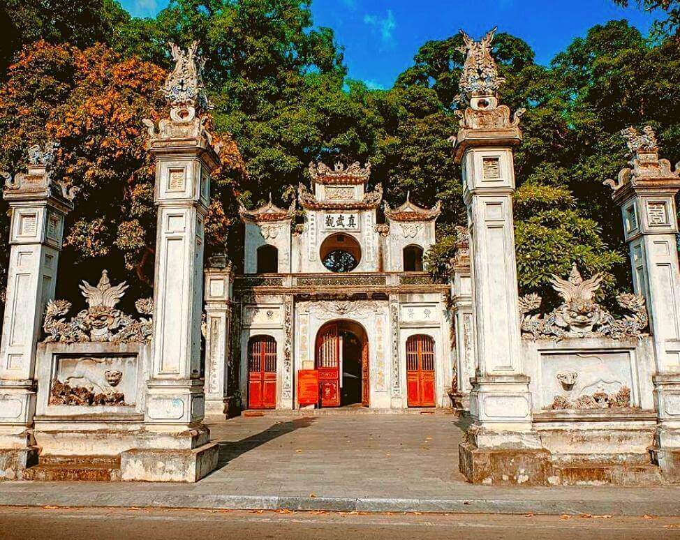
Quan Thanh Temple, the literal name is Tran Vu Quan, dates back to the reign of Ly Thai To (1010 - 1028), worshiping Huyen Thien Tran Vu, one of the four gods whose temple was established to guard the four gates of Thang Long city in the past. (Thang Long four towns). Quan Thanh Temple in the north (Bach Ma Temple in the east, Voi Phuc Temple in the west and Kim Lien Temple in the south). Quan Thanh Temple is located in Quan Thanh ward - Ba Dinh - Hanoi. The temple is located at the corner of Thanh Nien Street and Quan Thanh Street, overlooking West Lake. At this temple, the national treasure - the black bronze statue of mandarin Tran Vu, weighing 4 tons, is currently being kept and worshiped. Huyen Thien Tran Vu, a god who many times helped the Vietnamese people fight against foreign invaders, helped An Duong Vuong eliminate ghosts when building Co Loa citadel. To remember his gratitude, the King had the temple built. According to Taoist theory, Huyen Thien is a God who is always worshiped in the North direction. Huyen Thien statue was first made of wood, but in the 2nd year of Vinh Tri during the reign of King Le Hy Tong (1677), it was cast in bronze, 3.96m high, weighing 4 tons, and the pedestal circumference was 8m. The statue sits majestically, with a square face, straight eyes, long beard, no hat on the head, hair flowing down the back, wearing a black Taoist robe and walking on the back of a turtle, the sword has a snake wrapped around it. Snakes and turtles symbolize the power and immortality of God. The massive, majestic, and heroic bronze statue of Huyen Thien worshiped in the North of Thang Long Citadel carries great significance for National self-defense, demonstrating the nation's resilient spirit through the struggles against foreign invaders. invaded many centuries ago. Regarding architecture, Quan Thanh Temple has gone through many renovations and the current architectural style is mostly from the Nguyen Dynasty in the 19th century, including: three gates, worshiping yard, pre-emperor, middle-emperor and harem. On the middle gate of the three gates, there is a statue of the god Rahu in Indian mythology, who swallowed the moon and sun, causing lunar and solar eclipses. This is the integration of Vietnamese beliefs. In addition, the wooden architectural details at the temple are carved very delicately, bearing the artistic style of the Le Dynasty. In the 19th century, King Minh Mang changed its name to Chan Vu Quan (this name was carved in Chinese characters on the roof of the three-entrance gate. The diaphragm in the worship hall still had the old name Tran Vu Quan). With typical historical, cultural and artistic values of the era and national stature. The statue of Tran Vu at Quan Thanh Temple was recognized as a National Treasure by the Prime Minister on December 22, 2016. In 2022, Quan Thanh Temple will be recognized as a special national monument. Every year, Quan Thanh Temple festival takes place on the 3rd day of the third lunar month. Source: Hanoi Department of Tourism
Hanoi 2622 view
Tran Van Ho ancient house is located at 18 Bach Dang Street, Phu Cuong Ward, Thu Dau Mot Town, Binh Duong. Mr. Tran Van Ho (Tu Dau) - former Governor of the Palace during the French colonial period. The project was built by Mr. Dau's father, Mr. Tran Van Lan, in the year of the Tiger (1890), and was recognized as a national historical - architectural and artistic relic on April 29, 1993, with a total remaining area of 1,296m2. . The front of the house faces southwest, toward the Saigon River. The house was originally a large house including: main house, annex, horse stables... But after liberation, due to no owner, the state took over and confiscated it. Currently, there is only one main house left, this is the large family house used mainly for worship in the middle space. The front yard is covered with miniature natural landscapes of flower gardens, ornamental plants, and rockery fully decorated with scenes of "Fish - Tieu - Canh - Muc" activities. The house has a slightly low appearance from the outside, with a moss-tiled roof, creating a natural landscape of antiquity and purity, completely separate from the hustle and bustle of the market street outside. Stepping inside is a ostentatious scene, showing the abundance of materials made up of precious wood such as rosewood, rosewood, rosewood, rosewood, honey... used to decorate layer after layer, from the roof to the hammock door and even the steps. quota. From the wooden bars and square lines to the reliefs, all are arranged symmetrically down to every detail, creating a solemn appearance, demonstrating hierarchy, order and royal style. The architecture of the house is in the form of the letter "Ding", the total construction area is 200m2. The house is built in the style of 3 compartments, 02 wings including 36 round columns, 6 rows of round columns from front to back, each row has 6 columns placed entirely on boulders, the floor is tiled. In addition, the left side of the house has 3 single-wing doors leading to the outside, except for the front of the house, the remaining 3 sides are built with brick walls. The yin-yang tile roof is long and gentle... From the solid, somewhat low roof system, inside the inner temple is divided into two U-shaped false walls to create depth. The array between the wall and the altar are paintings of the Royal Concubine painted in golden steel, and mausoleums with parallel sentences decorated with mother-of-pearl attached to the pillars. The middle space above is an altar with a scroll embossed with the image of the four majestic gods. In the middle of the scroll are three rows of letters with the names of the gods being worshiped. On the left is the worship of the Kitchen God with the title "Dong Tru Tu Mang", in the middle is the worship of heaven with the title "Hiep Thien Dai De", on the right is the worship of the blessed god with the title "Phuc Duc Chanh Than", the bottom is to worship the ancestors many lives. With the closed-scale architecture of a traditional Vietnamese house in the 19th century, the house has left Binh Duong an ancient architectural work, contributing a part of the historical value - true traditional art of the nation. precious, proving the existence and strong development of the land and people of Binh Duong, both in the past and present. It is worthy of respect and preservation. On both sides of the middle altar are two main chambers (rooms); Mr. and Mrs.'s room. On the two chamber doors there are two horizontal paintings: Ngu Duoc, Dien Phi (jumping fish, flying kite: Indicating hope of taking the exam or being promoted to a position). This place also has beautiful and elaborately decorated bamboo panels. Symmetrically on both sides of the bedroom are two beautiful mother-of-pearl cabinets... Source: Department of Culture, Sports and Tourism of Binh Duong Province
Ho Chi Minh City 3634 view
Chau Thoi Mountain scenic relic is a famous scenic spot of Binh Duong province ranked by the Ministry of Culture and Information as a national scenic relic on April 21, 1989, with outstanding values in history, culture, natural landscape. Chau Thoi Mountain is located near Highway 1K in Binh An ward, Di An city, Binh Duong province. Chau Thoi Mountain is 85m high, at the top there is a majestic ancient pagoda, with lush greenery all year round. According to research sources, Chau Thoi Pagoda was built around 1612 by Zen Master Khanh Long from a small thatched hermitage, at that time the pagoda was named Hoi Son Tu. However, based on the records kept at the pagoda with the words "Tan Dau year, chief moon, first day of worship", it can be determined that Chau Thoi pagoda was built in 1681 and was the earliest pagoda built. Binh Duong province and belongs to the oldest group in the South. With more than 300 years of history, Chau Thoi Pagoda has experienced 13 generations of abbots; Through historical upheavals, the pagoda has been renovated many times: In 1930, the Ancestral Church and Lecture Hall were restored; In 1971, 220 steps were cemented up the mountain; In 1993, the main hall was restored. After that, other items such as stupas, great roses, Buddha statues, flanking dragons... were also built and completed. Besides historical religious values, Chau Thoi Pagoda also carries revolutionary historical values of Di An land. During the resistance war against the French, relying on the mountain and Chau Thoi pagoda was a refuge and meeting place for revolutionary activists. With a dangerous terrain, there are patriotic monks, so it is very convenient to serve as a meeting point, stopping place, and hiding place; Chau Thoi pagoda was once a place to practice martial arts for members of "Thien Dia Hoi", a stopping place for Dao Tay Son troops and a refuge for revolutionary soldiers. Famous figures at that time such as Huynh Van Nghe and Huynh Tan Phat also came to the temple and worked here. During the two resistance wars, the monks here donated money, rice, fabric, and medicine to the soldiers; In times of need, Chau Thoi Pagoda supported Dai Hong Chung to help the ammunition foundry's soldiers fight the enemy... Chau Thoi Pagoda is listed as one of Vietnam's Ancient Pagodas; Pagodas, mountains, and surrounding landscapes create a charming feng shui landscape, poetic, green scenery... architectural elements blend together, creating a highlight for the natural scenery, exuding cultural values. Outstanding architectural and cultural landscape. Chau Thoi Pagoda still preserves many valuable antiques, including 3 Buddha statues carved more than 300 years ago; system of wooden statues and terracotta statues; In particular, the pagoda also preserves the over 100-year-old jackfruit wooden statue of Avalokiteśvara, crafted by Venerable Thich Thien Hoa. Although the main items of the pagoda are built of concrete and reinforced steel, they are performed by talented craftsmen, so the overall pagoda still exudes an ancient beauty, rich in national colors. The complex of pagodas and temples on Chau Thoi mountain includes: Main hall, Patriarch's house, Thien Thu Thien Nhan temple, Linh Son Thanh Mau temple, Dieu Tri Kim Mau temple... some items are decorated with beautiful ceramic pieces. eye. In 1994, the pagoda mobilized people to contribute to casting 4 bronze statues, each weighing over 1 ton and 2.5m high by a group of veteran workers from Hue. These were the first bronze statues in Binh Duong province. In addition, the pagoda also has a 22.5m high statue of Avalokiteśvara, surrounded by a pair of large dragons that can still be seen from dozens of kilometers away. With its historical, cultural, architectural values, the landscape of Chau Thoi pagoda on top of Chau Thoi mountain was recognized as a national historical and cultural relic and scenic spot in 1989. Source: Department of Culture, Sports and Tourism of Binh Duong Province
Ho Chi Minh City 4366 view
Di An Communal House is located in Nhi Dong 1 Quarter, Di An Ward, Di An Town, Binh Duong Province. The communal house was built in 1838. In 1853, King Tu Duc granted a decree to worship Thanh Hoang Bon Canh, an ancient communal house - a place to preserve the traditional historical and cultural values of the nation. During the two resistance wars against the French colonialists and the spring invasion of the American imperialists, the communal house was the place where local revolutionary soldiers trained, molded their will, and organized their forces to destroy the enemy. The communal house is where the "Dao Son Tay soldiers" operate. In particular, during the resistance war against the American invasion, the communal house was also a stopping place and garrison for the armed forces of Thu Dau Mot province. In the communal house grounds, there are still a number of secret bunkers of the armed forces. At the same time, the communal house is also a place for cultural activities of the people in the area. Looking at the overall architecture, Di An communal house is designed in the form of the word "first", including: martial arts, martial arts, main hall, guest house, dormitory,... Vo ca is the place for the Xay adoration ceremony and boi singing. every Ky Yen holiday, built with steel concrete and corrugated iron roofing. The stage, built 0.8m high, has two ink paintings on both sides. Martial arts is the place where dignitaries worship, worship (when singing boi), meet, and also prepare for performances and for guests. This place is decorated with parallel sentences in Chinese characters. The main hall is the main place of worship of the communal house, with columns, rafters, rafters, rafters... all made of wood; The roof is covered with fish-scale tiles, with an oval and two dragons attached to the roof; brick walls; yellow ceramic tiled floor. The main hall is divided into 15 compartments, including 3 main worship compartments and 12 secondary worship compartments. The inside of the main hall is arranged according to the layout: The first room is where the altar of the Internal Council is located, decorated with exquisitely carved wooden panels and gilded lacquer. Next is the altar of Giang Son - the place to worship the god's ordination. Parallel to the altar of Giang Son are the altars of Ta Ban and Huu Ban. The main altar of the god is placed in a solemn position, on both sides are placed statues of two white horses, a dragon, and a hammock; In addition, the bag is also decorated with lacquered wood and gilded with parallel sentences in Chinese characters. Behind the main hall and southwest of the communal house are two rows of guest houses with many rooms decorated quite solemnly. The house is built with 80 precious wooden columns, a tiled roof, and the entire house is painted black to create an ancient look. This is a place used to live and welcome guests during family ceremonies. Every year, the communal house has two major worshiping ceremonies: the Cau Bong Ceremony (worshiping the Ancestors and Patriarchs) takes place on the 16th day of the 6th lunar month with the purpose of praying for favorable weather and good harvests, and the Ky Yen Ceremony is Held on the 15th and 16th of the lunar calendar (once every 3 years) to pray for peace and prosperity in the country. In addition, Di An communal house is also a place that fuses many beliefs: Worshiping Thanh Hoang, Goddess (Nguyen Nieu of Five Elements, Dieu Tri Dia Mau, Kim Hoa Nuong..); Temple of King Hung, temple of heroic martyrs and Vietnamese Heroic Mothers...represents the fine, generations-old tradition of Vietnamese people "when drinking water, remember its source". Di An communal house was ranked by the People's Committee of Binh Duong province as a provincial historical-cultural relic on March 18, 2011. On March 28, 2019, the Ministry of Culture, Sports and Tourism ranked Di An communal house as a national monument. Source: Department of Culture, Sports and Tourism of Binh Duong Province
Ho Chi Minh City 4623 view
Tan An Communal House - Ben The is located in Quarter 1, Tan An Ward, Thu Dau Mot City. This is a provincial-level historical and cultural relic ranked on June 2, 2004. On April 26, 2014, Tan An Communal House was recognized by the Ministry of Culture, Sports and Tourism as a National Architectural and Artistic Monument. The communal house was built in 1820 by the first class of residents who came to this land to make a living. Initially, it was built as a few simple thatched houses, so it was named "Tuong An Temple", by the people of 4 communes: Tuong Binh (now Tuong Binh Hiep), Tuong An (now Tan An), Tuong Hoa (now Dinh Hoa) and Cau Dinh (now Tan Dinh) were established to worship the god Thanh Hoang Bon Canh, the communal house is located in Tuong An village. About 30 years later, the ancestors of the Nguyen family (who held the position of Board of Examiners) took charge of rebuilding the communal house on a large scale, taking on the shape it has today. On the other hand, the Nguyen family was one of the first classes of residents to come to Tan An land to reclaim land to settle down and had the merit of restoring the village communal house, so they were honored by the villagers as "Previous Sages - Later Sages" and worshiped in the temple. main hall to pay respect. On November 19, the 21st year of Tu Duc's reign (1869), King Tu Duc ordained Tan An communal house to recognize the communal house and confer the title of Thanh Hoang god so that people could know and worship. The ordination is always kept at the Nguyen family church (currently Mr. Nguyen Tri Quan's house). According to the decree given by King Tu Duc, the main deity worshiped in the communal house is Tien Quan Co Nguyen Van Thanh, a royal official of the Nguyen Dynasty, a great mandarin of King Gia Long. Nguyen Van Thanh was a founding father of the Nguyen Dynasty, but was entangled in the "literary" case of his son Nguyen Van Thuyen, was suspected of treason by Gia Long, was forced to death, and was only exonerated more than half a century later. there (in 1868). Regarding the architectural overview, the communal house is made entirely of Sao wood, has a Tam-shaped architectural style, also known as the Doi Doi style, folk called the three-roof communal house, in the style of Xuyen Dinh, two roofs, two wings, including 40 square wooden pillars, wide hallway with 30 wooden pillars (due to the rain and sun, some pillars on both sides of the hallway were damaged, so they were replaced with pillars made of bricks and lime). The communal house's roof is covered entirely with fish fin tiles that have been covered with moss over many years of rain and sun, looking very ancient. The communal house is decorated with images of two dragons and pearl paintings, and at the corners of the roof are decorated with images of fish turning into dragons. The floor is tiled with hexagonal red tiles (Chinese tiles). The entire communal house is 50m wide and 70m long, built on an area of more than 10,000m2. In particular, the entire interior of the communal house such as altar artifacts, altar cabinets, diaphragms, bamboo panels, wooden pillars, couplets... are all made of precious wood, delicately carved by artisans with many different themes. enhances the unique artistic architecture of the communal house. In addition, the communal house also stores a very rich Chinese writing that remains to this day through pairs of parallel tureens, horizontal panels, and deities... Every year, according to ancient rules, the festival takes place for 3 days and 3 nights from November 14 to 16 (lunar calendar), a bright moon occasion for people to conveniently have fun and travel. This is also the occasion for high tides and according to people's beliefs, it is a sign of a good harvest, good things, and abundant money... Tan An communal house is a historical - cultural relic with bold architectural, artistic and scenic features. In particular, the communal house also preserves the decree of King Tu Duc. During the years of resistance against foreign invaders, Tan An communal house was a place of local revolutionary activities. Source: Binh Duong Electronic Newspaper
Ho Chi Minh City 3706 view
Phu Long communal house, also known as "Phu Long spiritual temple", is located in Hoa Long quarter, Lai Thieu ward, Thuan An city, was ordained in the 5th year of Tu Duc and recognized as a Historical - Cultural Monument. national level in 2001. After nearly 200 years, despite many restorations, the architecture and valuable artifacts are still preserved at the communal house. The communal house was built by local people to worship the god Thanh Hoang Bon Canh. At first, the communal house was built of bamboo and wood on a rough ground. After that, the communal house was restored many times in 1865, 1935, 1997... Currently, the communal house has a total usable area of 5,828m2, construction area of 1,258m2. The communal house was built in a three-letter style, in the style of "coincide to the sky", roofed with yin and yang tiles, and floor lined with floral tiles. The communal house's gates, vertical and horizontal walls are carved with patterns and motifs, most of which are meticulously decorated with pieces of ancient porcelain enamel, colorful, rich with many diverse images and legends, with unique nuances. Enemies of harmonious natural water areas. Regarding architecture, the entire facade and concrete part of the communal house are covered with colorful ceramic pieces, creating the unique beauty of traditional ceramic art in the architecture of communal houses and pagodas in Thu Dau Mot. The entire electricity bill has wooden panels carved with fruit themes such as apricot, orchids, chrysanthemums, pomegranates, grapes, and bananas, symbolizing fertility and proliferation. In the space between the central hall and the main hall, there is a blue glazed ceramic panel, decorated with images of dragons, unicorns, scenes of the Eight Immortals, Long Hai generals, fish turning into dragons... On the roof of the central hall, in the middle there is a sun and moon shape, the gables are shaped like dragons, unicorns, turtles and phoenixes. The roof of the back hall also has patterns of fish turning into dragons and two dragons painting pearls. Inside the roof of the central hall and back hall are two sets of wooden load-bearing trusses, structured in a striped pattern, two rows of columns consisting of six wooden trees, with a diameter of 40cm. In the middle of the main hall is an altar worshiping the deity Thanh Hoang Bon Canh given by King Tu Duc, on both sides worshiping Ta Ban and Huu Ban. Here, people who have contributed to the village are also worshiped, with the communal house in order, each altar has a tablet. Particularly, the highest altar is in the shape of a square wooden chair, carved with images of apricot, orchid, chrysanthemum, and bamboo, with embossed dragon leaves looking very majestic (called Ngu). The main hall has many incense burners arranged in an orderly manner for visitors from all over to burn incense and worship to show their respect. Next to the incense burner are a pair of tortoises and cranes standing in adoration, symbolizing sustainability. On the gable end, on the left is the Ngu Hanh Nuong Nuong altar, next to it is a 1.8m long snare, on the right is the altar of Mr. Ho, next to it is a drum for use in worship and festivals. The altars of Before Hien and Later Hien are also solemnly decorated. Looking straight into the main hall from the outside, there is a row of ceremonies, including many types of weapons with four pairs of cranes standing on the backs of turtles. The communal house still retains many parallel sentences engraved on the pillars, incense burners..., all of which are intricately carved and brilliantly gilded. Decorative patterns inside and outside the communal house include fish transforming into dragons, stylized dragons, scenes of the Eight Immortals... In addition to its artistic architectural values, Phu Long Communal House was once a place of refuge and weapons for many generations of local revolutionary officers and soldiers during the two resistance wars against the French and Americans. Source: Binh Duong Province Tourism Promotion Center
Ho Chi Minh City 3545 view
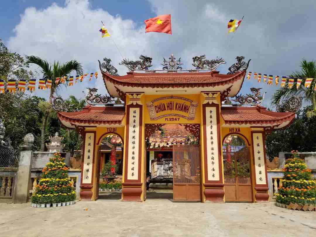
Hoi Khanh Pagoda is located at 35 Yersin Street, Phu Cuong Ward, Thu Dau Mot City, is the largest religious and artistic architectural work in the province, recognized as a National Historical-Cultural Monument on September 7. January 1993. The pagoda was built in the 18th century (1741), at the foot of the hill, 500m east of Thu Dau Mot city center. In 1861, the pagoda was destroyed by the French invaders. In 1868, the pagoda was rebuilt at its current location with a construction area of 1,211 square meters. In 2007, the pagoda built a 27m high 7-storey tower and recreated the "Four Hearts" Buddhist site, including: Lumbini Garden (where Buddha was born), Bodhi Dai Trang (where Buddha practiced Buddhism), Deer Park (the place where Buddha first preached) and Ta La Song Tho (Buddha's nirvana) have profound meanings about the Dharma. In 2008, a large-scale, 22m high Buddha stand was built in the land in front of the pagoda. The ground floor is a row of buildings 64m long, 23m wide used as a Buddhist School, Library... The upper floor is decorated with a statue of Master Shakyamuni entering Nirvana, 12m high, 52m long. This is a proud fine art work of Binh Duong Buddhism, solemnly inaugurated on March 30, 2010 (February 15, 2010 lunar calendar) to celebrate 1,000 years of Thang Long - Hanoi. The structure of the pagoda consists of four main parts: The front hall - the main hall, this architectural lecture hall has 92 precious wooden columns, the East and West corridors of the pagoda are arranged in a "paired" style, connected to each other with an "overlapping terrace" architecture. "duong luong" - this is a special variation in architecture following the ancient pagoda tradition of Cochinchina; The main hall with pillars, wooden walls and three sets of curtain doors, also has nearly 100 wooden statues, Arhats and ten Minh Vuong palaces with different shapes made of jackfruit wood painted with gold and lacquer. In particular, there are two reliefs carved with images of 18 Arhats and Bodhisattvas, creating a beautiful sculpture with high artistic value typical of the ancient Binh Duong wood carving style. Regarding interior decoration art, worship statues are sculpted and carved very elaborately and sharply... especially the set of "Thap Eight Arhats" (created in 1921), the painting "Four times" reliefs cover the two columns in front of the main hall. The elaborately carved altars were completed in the year of At Suu (1925). The pagoda still retains a set of woodblocks printed on sutras from over 120 years ago. The pagoda's great bell was cast in the year of the Goat (1883) and donated by Buddhist monk Duong Van Lua. During the years 1923 - 1926, Hoi Khanh Pagoda was also a place of refuge for notables: Confucian scholars and patriotic monks jointly established the "Honorary Society" with the participation of Venerable Tu Van, Vice President Nguyen. Sinh Sac (Uncle Ho's father), Mr. Tu Cuc... the Association's purpose is to promote a lifestyle that upholds morality, respects honor and love for fellow countrymen. Although the Association only operated for a short time, it made a significant impact. After the August Revolution of 1945, Hoi Khanh Pagoda was the headquarters of the Buddhist Association for National Salvation in Thu Dau Mot province, contributing a lot of effort, enthusiasm, and blood of the monks and Buddhists of the pagoda. During the local people's resistance war against foreign invaders since 1953, the pagoda was the headquarters of patriotic Buddhism in Binh Duong province and in 1983, Hoi Khanh Pagoda was the headquarters of the Binh Duong Buddhist Association. In 1995, here, the Provincial Association built the Basic Buddhist School of Song Be province (Binh Duong). Currently, Venerable Thich Hue Thong is the abbot of Hoi Khanh Pagoda (since 1988) and is the Standing Deputy Head of the Binh Duong Buddhist Association. Source: Binh Duong Province Electronic Information Portal
Ho Chi Minh City 3588 view
The Ho Chi Minh Campaign Front Command Relic is located in hamlet 1, Minh Tan commune (formerly Minh Thanh commune), Dau Tieng district, Binh Duong province (the location was also determined by General Van Tien Dung in 1987). The relic was ranked as a national revolutionary historical relic by the Ministry of Culture, Sports and Tourism on May 11, 2010. The Ho Chi Minh Campaign Forward Command Relic is a typical relic, reflecting the correct, direct and creative leadership and command of the Central Department, the Regional Military Commission and the Campaign Command. Although the relic is a temporary agency, it has demonstrated a correct and wise leadership role in the war strategy of the new era, which is directly the historic Ho Chi Minh campaign. The reason it is called the Ho Chi Minh Campaign Forward Command Relic is because the Ho Chi Minh Campaign Command was established at the South Vietnam Liberation Army base in Ta Thiet Krom hamlet - Loc Thanh - Loc Ninh , Song Be. After the meeting on March 25, 1975 of the Politburo and Central Military Commission, according to the assignment of the Politburo, on the same day, comrade Le Duc Tho entered Loc Ninh to join comrades Pham Hung and Van Tien Dung. On behalf of the Politburo, directly directed the campaign to liberate Saigon. When the campaign was about to begin, in order to directly command the campaign from the beginning close to the agency's combat situation, the Ho Chi Minh Campaign Command was directly assigned by the Politburo, comrade Le Duc Tho, and co-comrade Le Duc Tho. Chief Van Tien Dung decided to move to the forward base closer to the battlefield and chose Cam Xe as the Cam Xe Command Post, also known as the forward command post of the Ho Chi Minh campaign. With this location that has been determined to be relocated, the Ho Chi Minh Campaign Forward Command Headquarters relic is one of the important locations that determines the correct and wise, direct, and agile direction to facilitate beneficial for the victory of our army and people in the historic Ho Chi Minh campaign. The Ho Chi Minh Campaign Forward Command has successfully completed the historic task assigned by the Politburo to liberate Saigon - Gia Dinh, liberate the South before the rainy season, successfully ending 30 years of fighting. complete revolution and armed uprising of our people in the fastest possible time. The relic is located in a forest area, there are many small and short streams flowing into the large Cam Xe stream such as Cac Lieu stream, Ong Lo stream, Bien Loc stream, Ba Gia stream, Ba Thanh stream... (Cam Xe according to calendar). The local history is a long-standing land, with a primeval forest with many types of precious trees, and next to this stream, with its powerful "martial" characteristics created many advantages for our army and people to expel the enemy in the two resistance wars against the French colonialists and the American imperialists). This is a regenerated forest, the old forest has been cut down, the regenerated forest has also been burned many times. Because the relic is a temporary institution, the camps and trenches here are mainly made of available wood materials. After a long period of destruction by rain and sun, only faint traces remain, only The bomb crater where comrade Van Tien Dung got water for daily use is still quite intact. According to the people living here, every March they burn it to grow cassava. Currently, the landscape of this area has changed a lot compared to before, vast rubber forests surround the relic area. The remaining traces such as: bomb craters for drinking water, traces of trenches are also faded, grass and trees grow quite a lot, it is very difficult to find old traces hidden by grass and trees. In 1987, General Van Tien Dung and a number of comrades from the region visited and determined the location based on the remaining traces. After that, the Binh Long district team and the people of Minh Thanh commune built a stele as a marker here. The stele is made of reinforced concrete, 3m high, 2.5m wide, on the stele is a star, under the star is written the words Ho Chi Minh Campaign Command, April 30, 1975, Minh Thanh commune. On August 20, 1990, Military Zone 7 Museum built another stele about 3m away from the old stele, 15m high, 1.5m wide, the stele was also made of reinforced concrete. In 2005, it was restored with marble until now. Source: Binh Duong province electronic information portal
Ho Chi Minh City 3683 view
War Zone D was formed in February 1946 with the initial area including 5 communes: Tan Hoa, My Loc, Tan Tich, Thuong Lang, Lac An in Tan Uyen district, Bien Hoa province (now part of Tan Uyen Town). , Binh Duong Province). During each historical period of the resistance war against colonialism and imperialism, the scope of War Zone D changed. War Zone D is the code name for the headquarters of Zone 7, located in the system of areas of the zone in alphabetical order (A: Communications base, B: Logistics base, C: Area standing army). Later, the code name D was used to refer to the entire large war zone. In addition, there are a number of other explanations: D means "red", referring to the resilient revolutionary war zone, a "red address" of the whole country; D is the first letter of the place name Dat Cuoc - where Huynh Van Nghe's soldiers built their first base; D is the abbreviation for Dong Nai war zone, Eastern war zone, first war zone... Based on the original scope of 5 communes in Tan Uyen district, from 1948 onwards, War Zone D was expanded, taking Road 16 from the west and Dong Nai River from the south as the boundary to expand to the north. to Phuoc Hoa and east to Be River; then continue to cross the Be River and develop forever to the north and northeast. However, the main scope of the war zone lies on the land: To the west, it borders Road 16, from Tan Uyen town to Green Gate; The north borders Be River, the section from Phuoc Hoa bridge to Chanh Hung; The east still borders Be River, from Chanh Hung to Hieu Liem intersection, and the south borders Dong Nai river, from Hieu Liem intersection to Tan Uyen town. During the resistance war against the US, from the old war zone (mainly located in Tan Uyen area), we gradually moved the center of the base to the northeast. By early 1975, the base was completely built, with its maximum scope expanded. At that time, War Zone D was located within: The south bordered Dong Nai river; The west borders Binh Duong province and cuts through the two provinces of Phuoc Long and Binh Long (now Binh Phuoc); The north reaches far to the Vietnam - Cambodia border (section from Bu Dop to Bu Dang); The east borders Binh Thuan and Lam Dong provinces. War Zone D is considered a center of resistance, the birthplace of the armed forces of the Southeast region. During the resistance war against the French colonialists, War Zone D was one of the important bases of Party committees at all levels, government organizations and military command agencies in many neighboring districts, provinces and even Zone 7. , Eastern and Southern inter-regional division. This is also the birthplace of armed units in the early days of the resistance war, such as: Detachment 1, Detachment 10, Regiment 301, Regiment 310, Inter-Regiment 301 - 310, Main Battalion 303, Battalion transport convoy 320... During the resistance war against American imperialism, War Zone D was the place where the Party's leading agencies and the armed forces from districts, provinces, inter-provinces, military zones to Central China were built and stood. Central Department. War Zone D was the birthplace of the special forces fighting style, starting with the battle of the Ba Kien bridge watchtower in Tan Uyen on March 19, 1948, from which the special forces were formed, developing the special forces fighting style to the whole world. water. War Zone D is also a place associated with resounding victories of the troops and people of the Southeast region. In particular, this was the starting place of the 12-day and night campaign (from April 9 to April 21, 1975) to liberate Long Khanh town, smashing Xuan Loc steel door - the last line of defense of the Saigon puppet government. paving the way for the historic Ho Chi Minh campaign to win, completely liberate the South, and unify the country. Existing for nearly 30 years (1946-1975), War Zone D is a milestone in the heroic history of the "hard-working but heroic East". With the historical significance, stature and contribution of War Zone D through the two resistance wars against the French colonialists and the American imperialists, on May 11, 2010, the Ministry of Culture, Sports and Tourism ranked War Zone D is classified as a national historical relic. Source: Binh Duong Electronic Newspaper
Ho Chi Minh City 5185 view
Southwest Ben Cat Tunnels (Iron Triangle) is located on the land of 3 communes: An Dien, An Tay, Phu An in the southwest area of Ben Cat town, Binh Duong province. With its position and stature in the two resistance wars against invaders, the Southwest Ben Cat Tunnels were ranked by the Ministry of Culture, Sports and Tourism as a National Historical-Cultural Monument on March 18. /1996, with a total area of 230,000 square meters. During the previous resistance war against the French colonialists, the land of 3 southwest communes of Ben Cat was soon famous for the An Thanh War Zone. At that time, An Thanh was once the stopping place of the resistance headquarters of the Eastern Region, the Southern Party Committee, the Saigon - Gia Dinh Special Region Committee,... thanks to which the local people were soon enlightened. revolution and faced many of the fiercest challenges during the resistance war against the US to save the country, full of hardships and sacrifices of our people. In 1948, the first tunnel system appeared from this land. Then in 1960, Cu Chi guerrillas came to learn from experience and build a tunnel system in their locality. During the resistance war against America, the enemy attacked again and again, but they could not conquer the hearts of the people here. When the US imperialists massively sent expeditionary troops to directly fight in the South, in 1967, using all kinds of powerful soldiers and the most modern killing means, they launched a large-scale raid with 30,000 troops. , 400 tanks, 80 warships, 100 cannons and many types of bombers, including B52 aircraft to destroy this important target. But thanks to the winding and interlaced tunnel system, our army and people sometimes hide and sometimes appear secretly, suddenly launching a fierce counter-attack. In the end, the American enemy had to retreat. With the disastrous defeat, 3,200 American puppets were killed, 149 tanks and armored vehicles were destroyed, 28 planes were shot down, 2 warships were sunk and burned... In this battle, a hero emerged. sniper - Nguyen Van Duc, only 10 bullets killed 9 invaders or Vo Thi Huynh - hero of the armed forces who rolled under bombs and bullets to care for and protect wounded soldiers. After consecutive failures, the enemy was helpless, they had to call this area the "Iron Triangle" area. The Southwest Ben Cat Tunnels do not simply have a geographical meaning but are a symbol of revolution and resistance. With the rudimentary means of a hoe blade and a bamboo shovel, the soldiers and people of the three communes created a massive project with hundreds of horizontal and vertical tunnels underground, connecting the communes together like a "Village". implicit". Every family in the belt area dug tunnels and trenches connected to the tunnels, creating a continuous position to both maintain production and fight the enemy to protect the village. Connected to the tunnels, there are large tunnels for resting after battle, places to store weapons, food, drinking water, wells, cooking tunnels, working tunnels, command tunnels, and wounded nursing tunnels. soldiers. The Southwest Ben Cat Tunnels with their activities played a particularly important role in the two resistance wars, especially during the period of resistance against the Americans to save the country. During the 20-year war against the American imperialist invasion, the Southwest Ben Cat Tunnels promoted the effect of a war tunnel. Relying on the tunnel system, the soldiers and civilians of the three Southwest communes fought to bury thousands of enemies, fire and destroy hundreds of tanks and armored vehicles... Especially during the 1968 Mau Than campaign and the spring of 1975. , Southwest Tunnels is where many large armies gathered from here to attack Saigon, contributing to the victorious resistance cause of the country's army and people in 1975. Source: Binh Duong province electronic information portal
Ho Chi Minh City 3932 view
Phu Loi Prison Relics is located on Mot Thang Twelf Street, Phu Loi Ward, Thu Dau Mot Town. The current total area is 77,082m2, and was recognized by the state and ranked as a national historical relic on July 10, 1980. Existed for eight years (1957-1964). But with an indomitable spirit of resilience, Phu Loi prisoners united and fought heroically to victory. With the plot to invade the South, using demagoguery and terrorism to the campaign of "denouncing communism" and "destroying communism" within just 2-3 years after the Geneva Agreement, My Diem caused countless incidents. Many crimes throughout the South. By saying "it's better to catch a wrong person than miss one", they have built more prisons. Phu Loi Prison is one of the major US-Diem prisons in the South, built in mid-1957 to imprison and torture revolutionary soldiers and patriots at that time. The first number of prisoners they brought to Phu Loi was 4 women and about 100 men, and by the end of 1957 it had increased to 3,000 prisoners. They divided the prison into many areas: administrative area, soldiers' family area, An Tri Vien area - called "An Tri Vien" area but actually a prison camp. The prison area includes 3 camps: Chi Lang, Bach Dang, Dong Da. All 3 camps have 9 cells marked A,B,C,D,... each camp is separated by a thick barbed wire wall. Surrounding the three camps are two high walls, with several layers of barbed wire, and an electric lighting system at night, completely isolated from the outside. In the middle of the prison there is a high dome to observe the entire camp. There are 4 entrance gates and 4 strictly guarded bunkers around. There are two main gates: the first gate carries the sign "Phu Loi Correctional Center", the second gate carries the sign "An Tri Vien". By the end of 1958, the number of prisoners reached nearly 6,000 people, of which 1,000 were female prisoners. Prisoners from all over the country unfortunately fell into the hands of the enemy and were gathered here. The harsh regime of Phu Loi prison was no different from many other prisons at that time, eating rotten rice, rotten fish, salt, fish sauce with maggots... Living in filth, lacking water, lying in cells, tiger cages, labor forced labor for diseases without treatment... and brutal beatings... and they set up very harsh "24 prohibitions" as an excuse to beat prisoners. In the face of both terrorist and demagoguery tactics, scenes of brutal torture and extreme exile, the brothers and sisters in prison still maintained their steadfastness and strong will to fight. That is thanks to the Party's leadership and the self-discipline in cultivating and training the revolutionary moral qualities of patriots and communists. Through practical experience in the secret movement, in just a short time, Party members in the camps were able to organize communication lines with each other, and groups of Party members in secret cells were formed one after another. create. In early 1958, Phu Loi Central Party Committee was established. During their years here, the prisoners were directed by our Party's secret organization. The Representative Board, the Tam Giao Team, or the Compatriots in each prison act as the core of the struggle, step by step fighting with the enemy demanding to improve life, against repression, and against torture of prisoners. It's all thanks to the steadfastness of the members of the Communist Party of Vietnam. Phu Loi Prison became a proof of US and puppet crimes in South Vietnam; This place is a symbol of the courage of party officials, revolutionary comrades and patriots who fell in prison for independence, freedom, peace and happiness for their homeland. Source: Binh Duong province electronic information portal
Ho Chi Minh City 4484 view
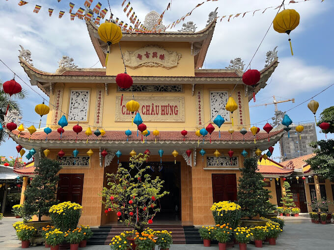
Chau Hung Pagoda is located at 37 Cay Keo Street, Quarter 1, Tam Phu Ward, Thu Duc City. Established in 1884 with a simple structure, it has been restored and repaired many times. The pagoda was completely newly built in 2006 and completed in 2009, with a construction area of 365 square meters on a total area of 5,796 square meters. Before April 30, 1975, Chau Hung Pagoda was built on Go Cat land, surrounded by rice and morning glory fields. This is a red address, used to be a facility to hide guerrilla cadres and soldiers to stand at the gateway of Saigon. The monks, monks, and abbots here are people who always have revolutionary aspirations. The undercover forces in this area always use the temple as their base of operations. In early 1973, when the Paris Agreement was signed, the enemy gathered troops to protect Saigon, so the Northern Thu Duc battlefield at that time was like a pocket containing enemy units to block the northeast direction of Saigon, preventing the enemy's forces from attacking the enemy. Our forces sent troops down to attack Saigon, so they continuously organized sweeps and cleared the terrain. At this time, our forces had a very difficult time holding on. The pagoda was built according to the structure of Vietnamese culture, creating cool ventilation and harmony between people and nature. With separate architecture such as the living room, the house of rebirth and the temple grounds with many types of ornamental plants and rockeries. The pagoda has a two-letter floor plan structure and a gate built in the form of a three-entrance gate. Seen from the outside, the pagoda is built of reinforced concrete with the main yellow color of Buddhism, including two separate towers: Tower 1: Is the front of the pagoda above the front hall. The tower has 2 floors and at the top of the tower is attached a Dharma wheel. In the middle of the 2nd floor is written "Chau Hung Co Tu" in Chinese characters. The lower floor is written "Chau Hung Pagoda" in the national language, and on both sides there are two pairs of parallel sentences in Chinese characters. The ground floor is the main hall door, only open on major holidays or full moon days of the month. Tower 2: Has 2 floors, higher than tower 1, on both sides of the tower are the words "Van" and "Buddha" in Chinese characters. Chau Hung Pagoda is a religious facility with cultural and historical value, ranked as a City-level relic on August 18, 2011. Like other temples, Chau Hung Pagoda is a place for people and believers to find encouragement, comfort, and relieve pressure in life; is a place to wish and wish for a good future, and at the same time is also a place to teach people to know how to live a good life. Although the pagoda has been restored many times with solid materials, the ancient pagoda is no longer valuable, but in the pagoda there are still 14 ancient statues, 4 dragons and a horizontal plate engraved with 4 words " The group of seals and lights has existed for a long time. Not only that, Chau Hung Pagoda also contributed significantly to the struggle for national liberation. Through two long resistance wars, the pagoda has sheltered, cared for, and sheltered countless generations of officers and soldiers in fierce bomb and bullet situations. Many Buddhists of the pagoda were suspected by the enemy or arrested and brutally beaten and tortured. However, the Buddhists of the pagoda still stood firm in the face of many difficulties and challenges and were a solid base of operations for the revolution until the day of national unification. Source: Thu Duc City Cultural Center
Ho Chi Minh City 4046 view
Lang Le Bau Co relic site is located in Tan Nhut commune, Binh Chanh district, Ho Chi Minh City. Lang Le Bau Co is associated with the resistance war against the French invasion in 1948 with major battles that went down in history. Lang Le Bau Co relic was recognized as a city-level historical relic in 2003. The reason it is called Lang Le Bau Co relic area is because the name of Lang Le Bau Co relic area was given by local people. The hamlet was established next to the interlaced canals and rivers. Lang Le Bau Co is located inside a large field with many shrimp, crabs, and fish. Along with many species of birds such as mallards, storks, teal, nuthatches, gongs, partridges, herons, and red armpits come to feed here. Therefore, Tan Nhut people call it by the familiar and rustic name Lang Le Bau Co. Lang Le Bau Co relic is considered the gateway to move to the center of Vuon Thom base and attack the enemy headquarters in Saigon. Previously, Lang Le Bau Co relic area was originally a field of overgrown reeds. On April 15, 1948, the French colonialists sent 3 thousand soldiers and many modern weapons to simultaneously attack the Lang Le Bau Co area to destroy the Vuon Thom base. At that time, the revolutionary armed forces in Lang Le - Bau, because of their small force and rudimentary weapons, had the help of local people along with the advantage of terrain. After just over half a day of fighting, it turned to attack, causing the French army to suffer a large number of casualties. The victory at Lang Le Bau Co killed 300 enemies, captured 30 mercenaries, and destroyed many machines, military vehicles, and guns of all kinds of the enemy. However, on our side, there are many officers and soldiers who heroically sacrificed their lives at a very young age. On October 14, 1966, in Lang Le, the Republic of Vietnam Army Ranger Battalion was destroyed by tourist militia. Lang Le Bau Co relic site has great historical significance for the people of Saigon in particular and the whole country in general. Faced with hatred for the French colonialists, Lang Le Bau Co's army and people fought a war of great historical significance that opened the door for our side and the enemy. For our side, the battle opened the door to heroism in a strong resistance position. As for the enemy, they had to retreat into a strategic position and were destroyed. The French colonialists could no longer form a strategy to defeat the Viet Minh. Moreover, at Vuon Thom base, Lang Le Bau Co also took place a determined battle to protect our base and destroy all sabotage plans of the enemy. Lang Le Bau Co relic area, after the Dong Khoi movement in 1960, was also a logistics and springboard for the armed forces to liberate Long An - Saigon - Gia Dinh. To commemorate the sacrifices of our compatriots and soldiers, in 1988 Binh Chanh district built a historical building in Lang Le Bau Co land with an area of 1000m2. Source: Ho Chi Minh City Electronic Information Newspaper
Ho Chi Minh City 14483 view
Tan Hiep Prison, also known as "Tan Hiep Correctional Center", is located in Quarter 6, Tan Tien Ward, Bien Hoa City. Tan Hiep Prison Relic was ranked as a national relic by the Ministry of Culture and Sports on January 15, 1994. Tan Hiep Prison is one of the six largest prisons in South Vietnam and the largest prison in the Southeast region, built in an important military position, northeast of Bien Hoa town. Ahead is National Highway 1; Behind is the North - South railway line. This is an isolated location, convenient for transportation, easy for protecting, guarding, receiving prisoners from other places and transferring prisoners to Con Dao, Phu Quoc... Tan Hiep Prison has an area of 46,520 square meters with 8 prisons, including 5 prisons for communist prisoners and patriots. The prison is surrounded by 4 layers of barbed wire with 9 bunkers, 3 watchtowers with a team of guards and a modern alarm system. It's called "Correctional Center" but inside is actually a gun warehouse, an interrogation and torture room with the most modern tools. Each prison only has an area of nearly 200 square meters but holds 300-400 people, sometimes up to a thousand people. In particular, there are "repentance" rooms and "tiger cages" that are very small and narrow and living conditions are extremely harsh, prisoners live like in a crematorium. The diet was extremely unhygienic. The prison guards bought rotten rice and rotten fish to fertilize the fields, and fried them in oil to feed the prisoners, leading to many people being poisoned. With the determination to escape the imperial prison, return to the Party and the people to continue fighting and liberating the nation, on December 2, 1956, with the agreement of the Eastern Inter-Provincial Party Committee, the soldiers Communists were "detained" in Tan Hiep prison under the direct direction of comrade Nguyen Trong Tam (Bat Tam) - in charge of the prison Party Committee and a number of other comrades who suddenly broke the shackles. was able to free nearly 500 comrades and patriots. This event caused a stir in the Pentagon. America - Diem hastily mobilized both main forces and security forces, civil guards defending the three provinces of Bien Hoa, Ba Ria, Thu Dau Mot and two special forces to encircle and capture the prisoners, but all were defeated. failure. Our comrades and compatriots who escaped from Tan Hiep prison received help and protection from local facilities and returned safely to base. Among the escaped prisoners were comrades: Bay Tam, Hai Thong, Ly Van Sam... who became the core nucleus of the Dong Khoi movement later. In 2001, to partly recreate the crimes of the US - Diem against our comrades and compatriots imprisoned at Tan Hiep prison and describe the entire Tan Hiep uprising on December 2, 1956. , Dong Nai Museum has collected images, documents, and artifacts displayed at the relic and made a model to serve the research and sightseeing needs of all classes of people. Every day, the monument is open to visitors. Source: Dong Nai Electronic Newspaper
Dong Nai 13224 view
Nguyen Huu Canh temple, also known as Binh Kinh communal house, is located on the left bank of Dong Nai river, formerly belonging to Binh Kinh hamlet, Binh Hoanh village, Tran Bien canton, now Nhi Hoa hamlet, Hiep Hoa commune, Bien Hoa city. It was ranked as a national historical relic by the Ministry of Culture, Information, Sports and Tourism on March 25, 1991. Nguyen Huu Canh Temple was built around the end of the 18th century. Initially, the temple was small in scale, with walls made of boards and a yin-yang tile roof, about 400m south of the current temple. Documents say: the temple was first rebuilt in the fourth year of Tu Duc (1851); By 1923, the temple was rebuilt at its current location. Nguyen Huu Canh was born in 1650 in Gia Mieu, Tong Son district, Thanh Hoa province in a family with many famous generals in the dynasty. He was a man of both literature and martial arts, accomplished many great victories and was trusted, loved and respected by Lord Nguyen. In the spring of the year Mau Dan (1698), he obeyed Lord Nguyen's order to invade Dang Trong while it was still very desolate. Arriving in Dong Nai, he set up his headquarters at Cu Lao Pho (now Hiep Hoa commune); took Dong Nai land as Phuoc Long district, built Tran Bien palace, took Saigon land as Tan Binh district, built Phien Tran palace, the land expanded thousands of miles. He recruited immigrants to settle down, organized the administrative apparatus gradually and systematically, encouraged land reclamation, and promoted Cu Lao Pho to develop into one of the busiest and most dynamic port towns throughout the century. 18 and officially annexed the new land of the South into the Dai Viet map. After returning from the invasion of the South, the following year he again served Lord Nguyen Phuc Chu's command to lead an army to suppress King Chan Lap and maintain the southern border region. In April of the year Canh Thin (1700), after completing his mission, on the way back to Rach Gam (Tien Giang), he fell ill and passed away on the 16th day of the 5th lunar month, at the age of 51 years old. On the way to his hometown for burial, his coffin was stopped at the land where he once had his headquarters on Cu Lao Pho so that local people could have the opportunity to say goodbye to him one last time. At the mandarin's communal house, local people built a tomb to remember this event. When hearing the news of Nguyen Huu Canh's death, Lord Nguyen was extremely sorry and conferred on him the title of High-ranking official of the Town Chancellor with the title: Thanh Marquis Ceremony and had his tablet enshrined at the Thai temple. Source: Dong Nai Electronic Newspaper
Dong Nai 11100 view
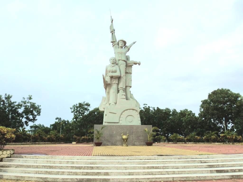
La Nga Victory Relic (at km 104-112 on Highway 20 to Da Lat, in Phu Ngoc commune, Dinh Quan district) was ranked a national historical relic by the Ministry of Culture on December 12, 1986. To cheer for the Viet Bac victory in the fall-winter of 1947 and also to deal a fatal blow to the enemy, the command board of squad 10 decided to organize a big battle, to show the enemy that the Vietnamese people were , Vietnamese people do not easily submit to any enemy; With a spirit of courage and ingenuity after nearly half a year of preparation, studying the terrain, and choosing a location: at 15:12 on March 1, 1948, the La Nga ambush battle began and ended at 15:12 on March 1, 1948. 15:57 on the same day, in just 45 minutes. The victory of La Nga delighted the people of Dinh Quan in particular and the people of Dong Nai in general. This is a victory that demonstrates the cunning and courage of our army and people, causing the enemy to be stunned and defeated. From this victory, our force grew stronger and stronger, contributing to defeating the enemy's plan to attack quickly and win quickly, forcing them into a passive position. The scenic complex of Chong Rock, Mai Waterfall, La Nga River and La Nga Victory Monument is an interesting tourist complex of Dinh Quan. The amazing beauty of Hon Ba Chong, Da Voi Mountain, Hon Dia, along with the natural pagoda at the foot of the rocky mountain are typical clusters that create a harmonious beauty for the Da Chong scenic area. Dinh Quan Da Chong Complex is also a place that retains traces of prehistoric life. Here, under the stone roofs, along the streams and on the slopes along the valley, many production and daily life tools of the ancients made of stone, bronze and terracotta were discovered. During the 30-year resistance war. Dinh Quan is an important part of War Zone D. Da Chong witnessed the formation, development, stationing, and combat deployment of revolutionary forces. Today, a part of the land of Da Chong Dinh Quan scenic area has been used and built into the Dinh Quan District Cultural and Sports Center. In the near future, Da Chong Dinh Quan scenic area will be invested in and renovated, contributing to making the natural landscape more beautiful and becoming an attractive eco-tourism destination. Source: Dinh Quan District People's Committee
Dong Nai 10984 view
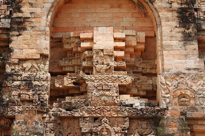
Chot Mat Tower Historical-Cultural Relic, located in Xom Thap hamlet, Tan Phong commune, Tan Bien district, Tay Ninh province, was recognized by the Ministry of Culture and Information (now the Ministry of Culture, Sports and Tourism) as historical - cultural relic on July 23, 1993. Also one of the last three ancient towers remaining in the South of our country. Having undergone many restorations in 1938, 2003 and most recently in 2013. Despite undergoing restorations, the Chot Mat ancient tower relic site has given itself a new look but still remains retains the spirit of ancient architecture. The entire Tower is built of brick and slate with the top of the tower tapering upward, from the ground to the highest point of the tower is estimated to be 10m. In addition, this ancient tower is located on a high mound in the middle of the field, so from a distance it looks like a pen rising gradually. In 2003, the People's Committee of Tay Ninh province decided to approve the investment project to restore, embellish and preserve Chot Mat tower relics and carried out the restoration, restoration, display and opening of the excavation pit in 2003. into use. On November 27, 2019, the Provincial People's Committee issued a Decision regulating the decentralization of management, protection and promotion of the value of historical and cultural relics and scenic spots in Tay Ninh province. Decision to assign the People's Committee of Tan Bien district to directly manage 4 relics, including the National Historical-Cultural relic Thap Chot Mat. In particular, the Chot Mat Tower Historical-Cultural Relic in Tan Phong commune, Tan Bien district was chosen to be part of the tourism development link of Tay Ninh Province. This is a tourist destination worth exploring, contributing to tourism development in Tan Phong commune in particular and Tan Bien district in general. Source: Tay Ninh province electronic information portal
Tay Ninh 10718 view
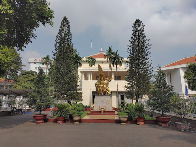
Hoc Mon District Palace is located at No. 1, Ly Nam De Street, Hoc Mon Town, (next to the District People's Committee headquarters) and is the place where many outstanding fighting events have been recorded throughout the long history from 1885 to the Southern days. Complete liberation of the People of 18 Betel Garden Villages. After defeating Chi Hoa Fort, the French colonialists built a 3-storey wooden house here to use as a military post. When Tran Tu Ca took office as Governor of the Palace, he used the Station as the Palace of Binh Long district. Originally a cunning drunkard of the French colonialists, Tran Tu Ca was led by a group led by Mr. Phan Van Hon (Quan Hon) and Nguyen Van Qua (Chanh Lanh Binh) of nearly 1,000 insurgents who came to burn the District Palace, captured and head cut off in the middle of the market. That was February 8, 1885, At Dau Tet. Afterwards, Hoc Mon District Palace was rebuilt with a blue stone foundation, brick walls, and a defense system from the upper floors to the fence. The architecture is similar to the Military Fort, so the locals call it Hoc Mon Fort. Tran took over from Tran Tu Ca as Governor of Ngon district, moving to Tra District and then Tho District. This was a long period of time when the people of the Hoc Mon region suffered from many cruel and despicable scenes from the French colonialists and their oligarchic henchmen mentioned above. With the indomitable tradition of Hoc Mon people. On June 4, 1930, around 6 a.m. in front of the District Palace, hundreds of Hoc Mon people protested demanding "abolition of poll tax, reduction of license and market taxes, and granting land to poor farmers." Tra District invited the leaders into the Palace to negotiate, but they cunningly arrested them, including Mr. Le Van Uoi (Secretary of Tan Thoi Nhi Commune), who was the leader of the protest. People were undaunted and fiercely demanded that Tea District release those detained. The protest group became more and more crowded, the fighting spirit spread somewhat, causing Tra District to give in. On the one hand, they released the detained people, on the other hand, they called the officials in Saigon for help. 2 hours later, the struggle was led by two men, Blachole and Nobbot, who opened fire on the protest group, causing many casualties. But the most impressive historical event at Hoc Mon District Palace was the Southern Uprising on November 23, 1940. Hoc Mon Fort is very solid, built of green stone like a fortress, about 15 meters high, has a gun emplacement and a defense system with battlements guarded by a platoon of green soldiers. On November 22, 1940, France reinforced one more platoon to deal with the situation. On the afternoon of November 22, 1940, Mr. Do Van Coi's army broke into the town, disguised as civilians, ambushed behind the Station waiting for orders to rob the Station. Another army wing has the task of destroying bridges, cutting down trees blocking roads, and occupying offices and houses... The army wing from Phuoc Vinh An, Tan Thong, Tan An Hoi, Tan Phu Trung is led by Mr. Pham Van Sang and Dang Cong Binh commanded, started from Ben Do hamlet, attacked the house, killed 1 person, collected 4 guns, and took control of the situation here (Tan Phu Trung). Immediately this army was ordered to pull back to Hoc Mon. The Long Tuy Thuong army was commanded by Mr. Bui Van Hoat. The army of General Long Tuy Trung was commanded by Mr. Do Van Day and Le Binh Dang. At around 24:00 on the night of November 22, 1940, the sound of artillery fire had not yet been heard in Saigon. After consulting, the army commanders united to attack the enemy's post. Immediately the troops headed straight to Fort Hoc Mon, where District Chief Bui Ngoc Tho resided. Two insurgents named Nghe and Kinh volunteered to enter the front gate and sacrificed their lives. Insurgents from all directions rushed into the Fort like water bursting its banks. Faced with the power of the insurgents and the masses, the soldiers in the Station no longer had the spirit to resist and fled in disarray. The insurgents completely occupied the inside of the station, but upstairs, the enemy still stubbornly used guns to shoot sporadically, at the same time calling Saigon and Thu Dau Mot for emergency help. Because he was eager to capture the name of Tho District, comrade Do Van Day climbed up to the upper floor of the Station by clinging to the gutter. Halfway up, he was hit by bullets, the comrade fell and died later. The battle was at a standstill when enemy reinforcements arrived. Unable to hold out, the insurgents withdrew from the town, dispersed to the villages, the armed forces withdrew to Ben Do hamlet (Tan Phu Trung) and then moved to My Hanh hamlet (Duc Hoa). Although the attack on Hoc Mon Fort (later called Hoc Mon District Palace) failed, it left a deep impression in the hearts of all civilians admiring the courage of revolutionary soldiers in the fight against colonialism. steal the country. During the historic Ho Chi Minh campaign, at 7:00 a.m. on April 30, 1975, Hoc Mon town was completely liberated, the National flag fluttered above the District Palace, where District Chief Nguyen Nhu Sang and his gang sai has been running away since last night. Today, Hoc Mon District Palace is chosen as the District Museum, where many documents are displayed, illustrating the ups and downs of historical periods as well as the revolutionary fighting spirit of the army and people in Hoc Mon district over the past two years. resistance war against French colonialism and American imperialism. A monument placed in front of the Hoc Mon District Palace relic represents the indomitable sacrifice of the army and people of 18 Betel Garden Villages, recognized as a national historical and cultural relic. Source: Hoc Mon District People's Committee
Ho Chi Minh City 10219 view
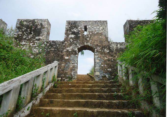
During the period when the Mac dynasty had its capital in Cao Bang, in order to prevent the Le dynasty from attacking, the Mac dynasty restored and repaired Na Lu citadel (now in Hoang Tung commune, Hoa An) and Ban Phu citadel (now in Hung Dao commune). ), Phuc Hoa citadel, in addition to building many other citadels in Cao Bang, making Cao Bang a political and military center in the far Northeast border region at that time. Na Lu citadel and Phuc Hoa citadel are two citadels built before. According to the records of Be Huu Cung in Cao Bang Thuc Luc, Na Lu citadel and Phuc Hoa citadel began in the reign of Tang Y Tong in the year Giap Than, the 5th Ham Thong era (874). Based on the presence of many ancient tombs with stone inscriptions containing the names, addresses, and hometowns of the citadel builders who died here during the Ham Thong Dynasty, it can be confirmed that these two citadels were built during the Tang Dynasty. Na Lu Citadel was built over many different dynasties. When the Mac dynasty came to Cao Bang, it was rebuilt with bricks. Na Lu citadel has a nearly rectangular shape, has a total area of about 37.5 hectares, a length of about 800 m, a width of about 600 m, the citadel has 4 gates. Ban Phu citadel in the capital of Nam Binh, Nam Cuong country of Thuc Phan in the past in Cao Binh (Cao Bang), the Mac dynasty renovated the royal palace in the inner circle of the old capital of Nam Binh and called it Ban Phu citadel or Royal Palace. In the ancient capital of Nam Binh of the Nam Cuong country and the Mac dynasty, Ban Phu citadel still has clear traces. The capital city of Nam Binh consists of two citadels, to protect the citadel, the outer ring has a circumference of about 5 km, including a low hillock area, around the foot of the hill is covered with vertical canvas like a wall, convenient for navigation. Build defense lines. The western wall of the citadel runs parallel to the bank of the Bang River to the beginning of Bo Ma village, connecting the southeast wall of the citadel, flowing in front of Ban Phu, following the foot of the hill to meet National Highway 4, the northeastern side running along the foot of the hill close to the outside of National Highway 4. , up to the top of the mound is the northwest side, continue running along the foot of the hill, out to the river bank and meet the west wall, forming a closed citadel. When the Mac Dynasty established the capital, it repaired and built a number of additional works, in which Ban Phu Citadel (inner citadel - the king's working place) was built higher on the old citadel walls from the Thuc Phan period. The citadel is located on a flat land. Along with rebuilding the capital, the Mac dynasty also built a system of posts and ramparts quite thick around the capital and a number of important border points, forming a system of protecting the capital and protecting the border. gender. Phuc Hoa citadel (Phuc Hoa district) was built in a square style, about 400 m in each direction, including two citadel rings, the distance between the two rings is 80 m. Currently, the southern wall has been completely destroyed. Phuc Hoa Citadel has 2 main gates: The North Gate is open to the national highway to Ta Lung Border Gate today, people often call it Pac Gate, this gate is built in a rectangular style, 8 m wide, 5 m high. , including two gates made of thick, very sturdy wood; The second gate is in the south, opening to the river bank. Both gates were flattened long ago, and now there are no traces left. Near the citadel, in the northwest suburbs along the riverbank, there are many traces of brick kilns. People said that during the process of labor and exploration, many intact brick kilns were found in this area. Through research and surveys, it has been shown that in Cao Bang, the Mac dynasty renovated, embellished and built many citadels and fortresses, including repairing, embellishing and rebuilding Ban Phu citadel, Na Lu citadel, and Phuc citadel. Hoa. These fortifications have formed a quite solid system of protecting the capital. Up to now, of the ancient citadels built by the Mac Dynasty during the capital period in Cao Bang, some of the citadels built of earth only have traces left, but the citadels built of stone are still very clear. Source: Cao Bang Electronic Newspaper
Cao Bang 10142 view
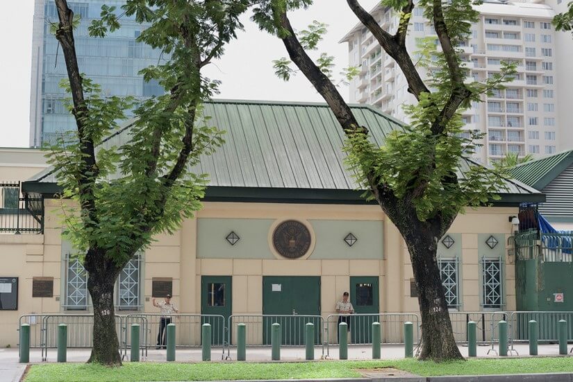
The US Embassy relics, also known as the "White House of the East", are the origin of sinister military and political plots aimed at long-term annexation of Vietnam. The relic site is a 5-storey building built Built in modern architecture, located at the corner of Mac Dinh Chi - Le Duan Street, Ben Nghe Ward, District 1, Ho Chi Minh City, on a plot of land nearly 5,000 square meters. Previously, the US embassy was located at 39 Ham Nghi Street. At around 10:00 a.m. on March 30, 1963, the US embassy on Ham Nghi Street was hit with explosives by the F21 Commando team, collapsing three floors: 1, 2, 3, so the US decided to rebuild it. Construction began on the building in 1965, most of the materials and construction machinery were transported from the US, under the control of American engineers. According to the design, the building is surrounded by 7,800 Taredo stones that can withstand mines and artillery shells. The main door is equipped with thick steel, the other doors are blocked by a special thick bulletproof layer. All doors use automatic systems, including iron doors blocking the way to the upper floors. Inside the building there are 140 rooms with 200 staff serving day and night. In addition, next to the building is also built an additional row of houses called the "Norodom" area exclusively for C.I.A. employees. When inaugurated, the building had only 3 floors. At the end of 1966, two more floors and a terrace were built to serve as a landing place for helicopters. Surrounding the building is a 3m high wall, at both ends of the wall close to Le Duan Street, 2 high blockhouses are built, guarded day and night. The Embassy was completed in September 1967 with a defense system such as a fortress with 60 guards, a bomb shelter, and a radar screen system to control the facade. Immediately after the building was completed, on September 24, 1967, thousands of students flocked to the gate of the US Embassy to fight for "America to stop bombing the North", "America to go home" and issued a notice denouncing the US for "trampling and seriously violating the right to self-determination of the Southern people". But the outstanding event that happened at the US Embassy was the battle of the City Rangers during the General Offensive and Uprising in the Spring of 1968. The target of attacking the US Embassy was added on January 24, 1968 by Ngo Thanh. Van is in charge of general affairs. Ranger Team 11 took on this important mission, including captain Ut Nho (military region reconnaissance captain) and soldiers: Bay Truyen, Tuoc, Thanh, Chuc, Tran The Ninh, Chinh, Tai, Van, Duc, Cao Hoai Vinh, Mang, Sau and 2 drivers: Tran Si Hung and Ngo Van Thuan. Another equally humiliating event for the US Embassy was the chaotic escape that occurred on April 29 and 30, 1975 by the US and its accomplices. Faced with the rapid attack of the Vietnamese army and people in the historic Ho Chi Minh campaign, over 1,000 Americans and more than 5,000 pro-American Vietnamese jostled, pushed, and kicked each other to compete for a place on the terrace of the building. building to be rescued by helicopter. This relic was granted a certificate of recognition by the Ministry of Culture on June 25, 1976. Currently, the US Embassy building has been demolished and a new consulate in Ho Chi Minh City has been built, but next to it is a memorial stele forever remembering the achievements of the special forces soldiers who died in the battle. . Source: Ho Chi Minh City Youth Union
Ho Chi Minh City 10063 view
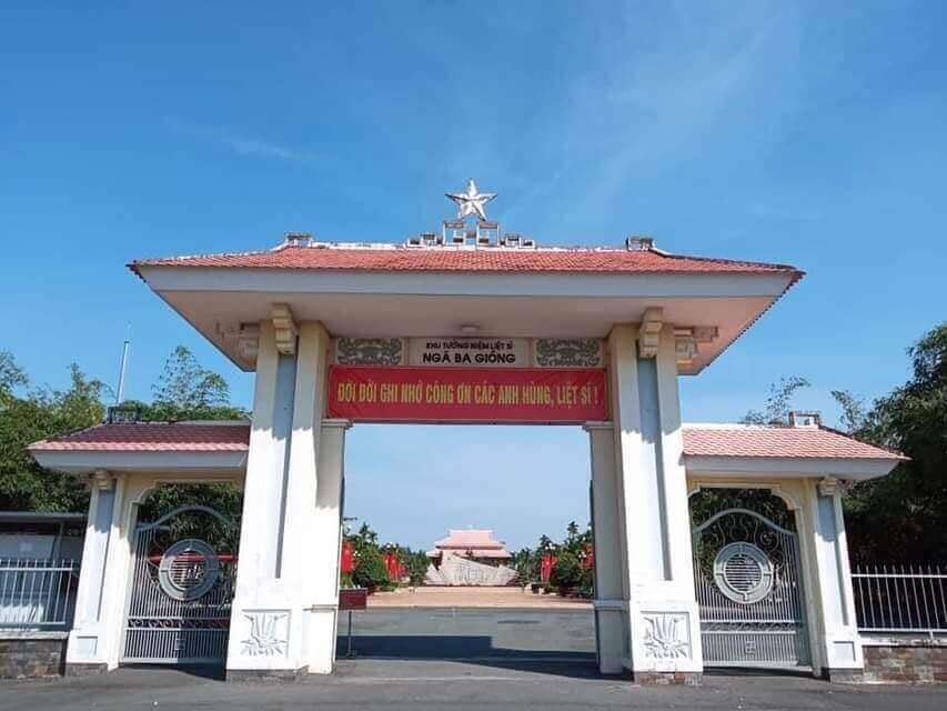
Nga Ba Giong relic is a revolutionary historical relic located in Hamlet 5, Xuan Thoi Thuong commune, Hoc Mon district. Surrounded by three roads: Phan Van Hon, Nguyen Van Bua and Provincial Road 19. Nga Ba Giong relic site is a memorial site for historical events in two wars against foreign invaders. Recognized as a national historical site in 2002. Giong Junction (also fully known as Giong Bang Lang Junction) is located in Xuan Thoi Tay village, part of 18 old betel garden villages formed from 1698 to 1731. For a long time, Giong Junction is a place with a folk name that has entered the history of the hometown of 18 betel garden villages of Hoc Mon - Ba Diem. Legend has it that in the past, this place was a relatively high land and a place where many linden trees grew, so this place got its name from there. After the Southern Uprising (November 23, 1940) failed, the French colonialists increased their repression and fierce terror against the revolutionary movement in the Hoc Mon - Ba Diem region. They set up three shooting ranges in Hoc Mon to kill Party leaders and patriotic comrades from their hometown of Hoc Mon and surrounding areas. Giong intersection is the third shooting range to record the heinous crimes of the French enemy and his henchmen against the people of Hoc Mon. Learning from the experience of 2 previous shooting ranges (1 at the old theater in the center of Hoc Mon District, 1 next to the well behind Hoc Mon Hospital today), they executed public shootings, forcing people to come and watch for the purpose of intimidation. revolutionary spirit of Hoc Mon people. But that firing squad backfired. The Hoc Mon people witnessed with their own eyes the cruelty of the French colonialists and the noble sacrifices of the communist soldiers, so their patriotic fire flared up even more fiercely. . For this third shooting range, they did not dare to build it near the center of the District anymore, but moved it to the Giong Junction area as a desolate, sparsely populated area to avoid people's resistance. Here, they built a shooting range with a solid mound of land 12m long, 2.2m high, in front of which were planted 6 shooting posts, each 1.7m high, the shooting direction facing the field (Ba Tram Lac). In 1941, here they secretly executed many times without letting the people see, hundreds of communist soldiers and patriots were killed by them. With the extremely sacred historical significance of Giong Junction, the place that marked the barbaric crimes of the French invaders, the place that demonstrated the indomitable fighting will and noble sacrifices of our comrades and compatriots later on. the Southern Uprising (November 23, 1940); After the complete liberation of the South (April 30, 1975), Hoc Mon district quickly restored and embellished the Nga Giong Junction revolutionary historical relic site to educate traditional generations of youth. This place has become a tourist attraction and a place to organize traditional festivals during major annual holidays of Hoc Mon district and the city, especially the anniversary of Southern Uprising Day (November 23). Currently, with the consent of the city, the district is renovating and building Giong Junction into "Giong Junction Martyrs' Memorial Area". Source: Hoc Mon electronic information portal
Ho Chi Minh City 9800 view
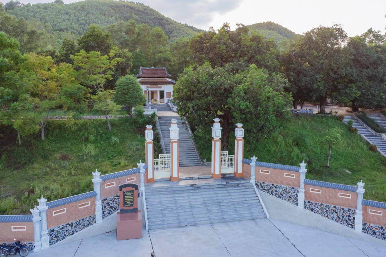
Mai Xuan Thuong was the leader of the Can Vuong movement against the French at the end of the 19th century in Binh Dinh. Mai Xuan Thuong was born in the year of Canh Than, 1860, died in the year of the Pig, 1887, from Phu Lac village, Phu Phong district, Tuy Vien district, Binh Dinh province (now Phu Lac village, Binh Thanh commune, Tay Son district, Binh Dinh province). His father, Mai Xuan Tin, was the chief father in Cao Bang. His mother, Huynh Thi Nguyet, was the daughter of a noble family in the village. Mai Xuan Thuong is inherently intelligent and eager to learn. At the age of 18 (1878), he passed the Baccalaureate at Binh Dinh Examination School. At the age of 25 (1885), he passed the bachelor's exam. Responding to King Ham Nghi's Can Vuong edict, Mai Xuan Thuong returned to his hometown of Phu Lac, recruited insurgents, set up a base on Sung island to raise the Can Vuong flag against the French, then Mai Xuan Thuong brought his forces to join the army. The insurgent army was led by Dao Doan Dich and was appointed by Dao Doan Dich to the position of Military Salary Officer (in charge of food for the insurgent army). From then until 1887, the Can Vuong movement in Binh Dinh developed strongly and spread to Quang Ngai, Phu Yen... attracting tens of thousands of people from all walks of life to participate. On September 20, 1885, Dao Doan Dich died and assigned all his forces to Mai Xuan Thuong. He chose the Loc Dong mountain area (now in Binh Tuong commune, Tay Son district) as his headquarters and organized a flag worshiping ceremony, calling on scholars, literati, and people to join the movement to fight against the French. During that ceremony, insurgents from many regions in Binh Dinh province agreed to honor him as the Marshal leading the uprising and raised the slogan: "First to kill the left, later to attack the West". In early 1887, the French army under the command of Lieutenant Colonel Cherrean and the royal army led by Tran Ba Loc along with Minister Trira launched a major attack on the headquarters of the Can Vuong movement in Binh Dinh, the battle The fighting between the insurgent forces and the French enemy was extremely fierce, the fight was unequal, and in the end the insurgent force was pushed back. In March 1887, after a fierce battle in Bau Sau (An Nhon town, Binh Dinh province), Mai Xuan Thuong was seriously injured, the insurgents withdrew to Linh Dong secret area. On April 21, 1887, Tran Ba Loc surrounded and captured the Linh Dong secret base and captured a number of insurgents, including Mai Nguyen Soai's mother. On the night of April 30, 1887, Mai Xuan Thuong sent a suicide squad to break into Tran Ba Loc barracks, relieve the captured people, and he and a group of 50 subordinates crossed the mountain into Phu Yen and continued to resist. battle, but when she reached Phu Quy Pass (boundary between Binh Dinh and Phu Yen), she was captured by Tran Ba Loc's ambush and taken to be beheaded at Go Cham (East of Binh Dinh Citadel). The mausoleum of patriot Mai Xuan Thuong is located on a high hill of the Ngang mountain range (in Hoa Son village, Binh Tuong commune, Tay Son district, Binh Dinh province) about 50km northwest of Quy Nhon city; The mausoleum was built on a land area of 1988m2, inaugurated on January 22, 1961. Overall, the mausoleum is designed in the style of an ancient mausoleum, surrounded by low walls. The Lang gate (three gates) is made up of 4 square pillars, the top is tied in the style of a gourd and a vase, bearing the architectural appearance of a communal house or temple gate of the late 19th century. In the middle of the Mausoleum is Mai Xuan Thuong's tomb, rectangular in shape in the East - West direction; At the head of the grave is a stone stele engraved with an inscription recording the biography and career of Mai Xuan Thuong: The relic was ranked at the National level by the Ministry of Culture and Information on April 20, 1995. Source: People's Committee of Tay Son District, Binh Dinh Province
Gia Lai 9765 view
Download the Travelviet app


 vn
vn en
en ja
ja ko
ko zh
zh