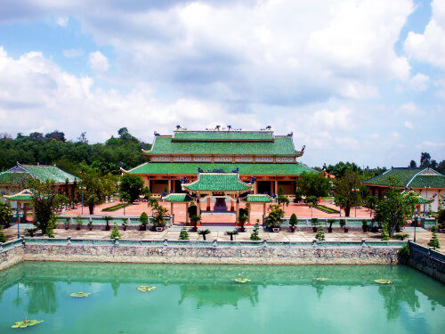
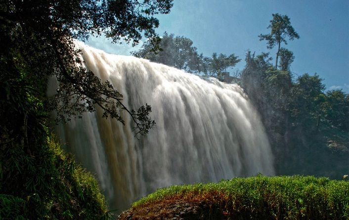
Cat Tien National Park was established on the basis of merging Nam Cat Tien forbidden forest, Tay Cat Tien Nature Reserve and Cat Loc rhinoplasty reserve, located in the area of 3 provinces of Binh Phuoc, Dong Nai and Lam Dong. The central area of the garden is 71,920 ha, of which, 39,627ha is located in Dong Nai province, 27,850ha in Lam Dong province and 4,443ha in Binh Phuoc province. Cat Tien National Park is a preservation area of many rare and precious animals and animals; It is an important area to maintain a wide -leafy green forest ecosystem - the only (current) living environment of a one -horned rhino in Vietnam, the Indochinese region as well as in the world. The coverage of natural forests in this area is up to 80%, with a diverse ecosystem: moist green forest, meadow and flooding. Natural terrain alternating with Bau, lagoons, streams, plus more than 90km of Dong Nai River has created a typical landscape for Cat Tien Garden, with rapids, waterfalls, flooded and semi -flooded areas, ... Geological traces, geography proves the transformation of nature in this area millions of years ago. Currently, Cat Tien National Park is one of the world biosphere reserves in Vietnam, has been enrolled by UNESCO. According to statistics, in Cat Tien National Park there are 1,610 species of plants and 1,568 animals. In particular, 31 species of plants and 84 animals named in Vietnam Red Book, 50 species of birds are prioritized to protect at the global level and are recorded in the IUCN Red Book, 2008). In particular, there are 3 species and endemic subspecies of Vietnam in the risk of destroying, namely black foot shank, one -horned rhino and Southern horns. Cat Tien National Park has been ranked national monuments in 1997. In Cat Tien area, there are many beautiful landscape locations, such as skyfall, Ben Cu waterfall, Buoi waterfall, Xoo waterfall, Neugrit waterfall - Mainrand ... One of the outstanding ecosystems here is the river system and the Bau. Dong Nai River, with a basin area of 40,800 km2; The section flowing through Cat Tien National Park is about 90km long. Dak Lua stream is about 20 km long, gathering water from the Bau to the river. Bau crocodile is the largest Bau, with an area of 92.63 ha. There are about 100 sapodilla crocodiles in Bau. This area is also home to famous lentils. Bau Ca is a natural lake, with a water surface of 74.3 ha. Bau Beo has an area of 23.92 ha. Around Bau is surrounded by many large timber trees ... In Cat Tien area, there is a fairly large meadow area, where preserving rare and rare animals (gaurs, holidays), well protected, almost no human impact. Regarding the flora of Cat Tien area: The highlight is the wide green forest, with an area of 17,819 hectares, where the plants are mainly belonging to the Dau family, such as oil, hair oil, ... Cam Lai Ba Ria, Cam Lai, Knot, Giang Huong, ... and large woods ...; Half -green forest is 5,097 hectares, including deciduous trees in the dry season, such as guava, shady, etc., large wood deciders and recovering in the rainy season; Bamboo intercropped wood forest has an area of 14,361 ha ...; Pure bamboo forest has an area of 29,805 hectares, formed under the impact of humans, with bamboo species, mum, bamboo (La Nga); Wet and semi -flooded vegetation has an area of 3,516 hectares, distributed mainly in the center of Nam Cat Tien. Archaeological traces show that in this area there has been an ancient culture. Historically, Cat Tien and surrounding areas are the residence space of many ethnic minorities: Ma, Choo, S’tieng, Mnong, Tay, Nung, H'Mong, Dao, Hoa, Muong, Ede, ... These ethnic groups still preserve many cultural activities, beliefs, special festivals, such as the sacrifices of the S’tiena and Sayang festivals, the new rice festival of the new rice festival (new rice) S’tieng and Mnong ethnic groups ... With the historical, cultural, scientific and aesthetic values of the monument, the Prime Minister decided to recognize Cat Tien National Park as a special national monument (Decision No. 1419/Decision -Prime Minister dated September 27, 2012). Source of cultural heritage.
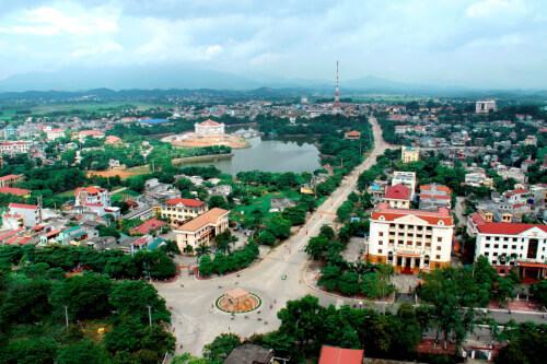
Lam Dong 1189 view
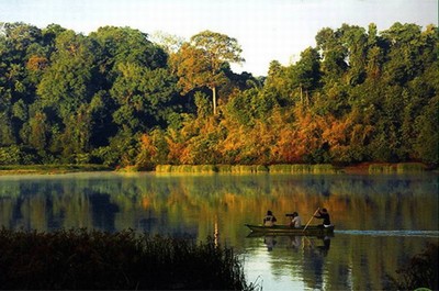
Located 10 km from the center of the district, Da Teh lake appears in the blue cover of the primeval tropical forest and the majestic O -mountain mountains. In 1990, Ho Da Teh was started construction. The Buon of the Ma people in the lake is relocated to a higher land right next to the lake. The large dam connecting the two slopes of the mountain has prevented the stream so that the water no longer flows meaninglessly but gathered to the Liu to rise to the lake. At that time, Ho Da Teh was the "3 most" irrigation project of Lam Dong province: the largest investment capital, the most complete irrigation project, bringing the highest economic efficiency. In 1997, Ho Da Teh completed became the largest irrigation project in Lam Dong province. The lake surface has an area of more than 100 hectares stretching to nearly 10 km, the widest place 400 m, containing 24 million cubic meters of water, covered with primeval mountains. The lake has brought water to irrigate more than 2,300 hectares of agricultural land to make green and rich fields in My Duc, Quoc Oai, Trieu Hai, Quang Tri and Da Teh towns, each day making the new countryside become a worthy countryside, making Da Teh district a new rural district in 2020 is one of the first 3 districts of Lam Dong "to finish" the new countryside. In the language of the people (the owner of this land), Da Teh means hot water (Đà: water, teh: hot). Perhaps, an area of the pan is surrounded and shielded by hills, so the climate here is hot, dry, the water flowing here has also become hotter than other places; Therefore, the whole land of sunshine and dust is called Da Teh. No more harsh heat, the cool water from the primeval forest makes the lake water all year round, both irrigating crops, and providing daily -life water for people in the district, Da Teh Lake also contributes to improving, changing the ecosystem and natural environmental landscape, regulating the environment, radiating cool steam to make the climate soothes, reducing the heat of the whole area. In 2004, Ho was recognized as a national landscape monument. Source of the website of Da Teh district, Lam Dong province.
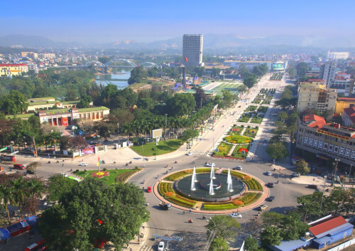
Lam Dong 1091 view
Lieng Rowoa waterfall, also known as Voi Waterfall, is located in Nam Ban town, Lam Ha district, 25km southwest of Dalat city. Elephant Waterfall is one of the beautiful waterfalls of the majestic Central Highlands with a height of over 30m and about 15m wide. The old K'Ho villages residing in this land said: In the past, the chief of Jiu Bieng Mountain had a very beautiful daughter. Every time the female painted the voice, the forest leaves stop rustling, the birds stopped singing to listen. Her lover is the son of the chief of the village. He is loved by many people, not only because of his muscular physique, handsome face but also because of the bravery, brave, few people can match. They gave the promise so the husband and wife, but the boy had to set out to kill the enemy and then many moon seasons passed without seeing returning. The miserable girl came to the deserted mountain that they had dated before, singing earnestly and sorrowfully in the hope that the dream people to find the old place. The singing makes B'Ling birds touched. They invited each other to fly far away to detect the news and then let her know that the boy died on the battlefield. However, Son Nu still refused to accept that harsh truth. She kept singing, singing until she was exhausted, collapsed and never got up again. The elephant -covered herd listened to her singing for a long time. Suddenly there was a loud explosion, the sky and earth shook, causing the mountain to break and a stream of waterfall suddenly flowing, flowing white foam. The sound of the waterfall murmur and the rustling of the forest, the sound of the birds singing like continuing the lyrics, the sound of the beautiful and loyal female paint. The K'Ho people named the Waterfall Lieng Lieng Rooa Jiên Bieng - the waterfall of the elephants to restore stone before the passionate love, iron lipstick. It will be a pity to come to Da Lat - Lam Dong without going to Lieng Rooa (Voi Voi) mysterious and poetic. This waterfall is associated with this loyal and tragic love affair has been recognized as a national landscape. The clear water flowed through the marble mountainside to look spectacular, especially when the brilliant sunlight shone down the waterfall, making the rainbow seven colors. To get down the foot of the waterfall, visitors must "conquer" 145 steps of the races: When the stone steps "eat" into the climbing cliffs, when the planks of the beautiful wooden bridge are on the edge of the abyss. The sight is the thousands of forest with the old trees hundreds of years old, the stems and branches are interlaced with vines. In the middle of the vast gills, the green forest layer or dotted with bright red leaves like fire, bright yellow or purple carpets are strangely beautiful. At the foot of the waterfall and in the forest, some large rocks appeared like elephants. Therefore, the sound of the waterfall that made people enjoy it seemed like there was a herd of elephants racing or launching a fountain to play with each other. Behind the white waterfall is launching the dusty dust are deep caves full of mysteries. It is a bat cave that is ingrained to the ground up to 50m with cliffs with very strange shapes and colors. The roots and vines are interwoven, the deeper the cave is thanks to and cold as the witch's dynamic. It was a wind cave with a very narrow entrance but the inside was quite wide, soaring the flute of the wind. Besides the charming and poetic beauty, Voi Thac used to be revolutionary in the two wars against France - America. Newly embellished into tourist attractions in recent years. In 2001, Voi Waterfall was recognized as a national monument - a national landscape. Source of the electronic portal of Lam Dong province.
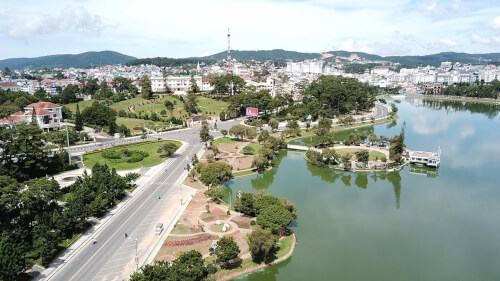
Lam Dong 1030 view
Love Valley is one of the most poetic landscapes in Da Lat, about 5 km north of the city center, the Valley of Love has the address at 7 Mai Anh Dao, Ward 8, Da Lat City. It is the place where Da Thien Dam brings together small streams flowing from high hills and mountains, the clear and clear lake of the valley is shaded with green pine. In the 1930s, Governor -General of Indochina and French lovers often chose this scene for dating, then named Valleé D'Amour. By the time of King Bao Dai, this region was called Hoa Binh valley. In 1953, Mr. Nguyen Vy - Chairman of Da Lat Town Council at that time - proposed to change his name to the Valley of Love. Beautiful and attractive love valley by deep valley and pine hill all year round. In 1972, a block of water was built across the valley to form Da Thien Lake, increasing the charm of the common landscape, and appearing two other names besides the valley of love, Dam 3 and Da Thien 3. From here, the valley of love appears in a beautiful eye like a vivid picture. In 1998, the Ministry of Culture and Information recognized Ho Da Thien - Valley of Love was a national landscape. Source of electronic portal of Da Lat city, Lam Dong province.
Lam Dong 1004 view
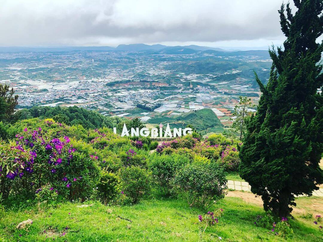
Lang Bian Mountain is located in Lac Duong district, 12km north of Dalat city center. This is a suitable place for ethnologists, for tourists who love traditional culture to cultural research of the ethnic groups of the South Central Highlands. Lang Bian Mountain is also known as Mother Mountain, including 2 tops, with an altitude of 2,167m. The old story said that there was a couple of talented and loving boys and girls in love with each other - K'Lang and her Ho Bian. Due to the curse of the two tribes, the two had to separate. She after death transformed into a mountain range that the Ho-Lach ethnic group called the mother mountain and milk from her breasts has flows into the fresh streams and waterfalls for life. Since then, the two mountains have been named Lang Bian. Lang Biang Mountain, also known as Ba Mountain with a height of 2,189m of the legendary Bidoup series, has long become a regular destination for visitors. Langbiang mountain is also famous for its legend associated with the history of the indigenous people about the famous Heavenly History of Lang and Biang. Since 2004, the Ministry of Culture and Information has recognized Lang Biang as a national landscape monument. Source Department of Culture, Sports and Tourism of Lam Dong Province
Lam Dong 1024 view
Prenn Waterfall is a waterfall in Da Lat city in Lam Dong province. Prenn Waterfall is located next to Highway 20, at the gateway to Dalat city is one of the eco -tourism areas of forests and streams. Waterfall at the foot of Prenn pass is about 10 km from the center of Dalat. The waterfall is located in the remaining primeval forest. The water from the rocky rapids with a height of more than 20m high poured into white like a strip of white silk looks like the hair of the White Mao Tien. Maybe so that some tourists call Tien Sa waterfall. Prenn waterfall originates from Prenn stream, originating from the area of shrimp pit, Bao Dai stream (valley after palace 1 - Da Lat). Prenn stream is also known as the Prenn and Prenn Waterfall, also known as Liang Tarding. Coming to Prenn Waterfall, visitors can visit, entertain and visit Au Lac temple, King Hung temple in Lam Dong province. The legend of Prenn Waterfall is also associated with the development history of the Cham dynasty in the seventeenth century of the Poôme dynasty (1625 - 1651). Since 1998, Prenn Waterfall has been ranked by the Ministry of Culture and Information. Source Department of Culture, Sports and Tourism of Lam Dong Province
Lam Dong 1032 view
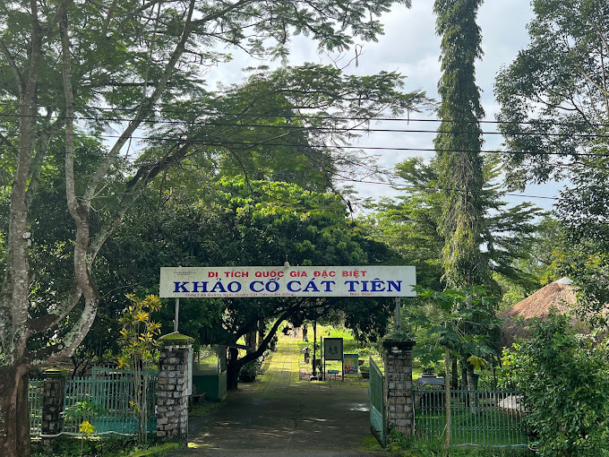
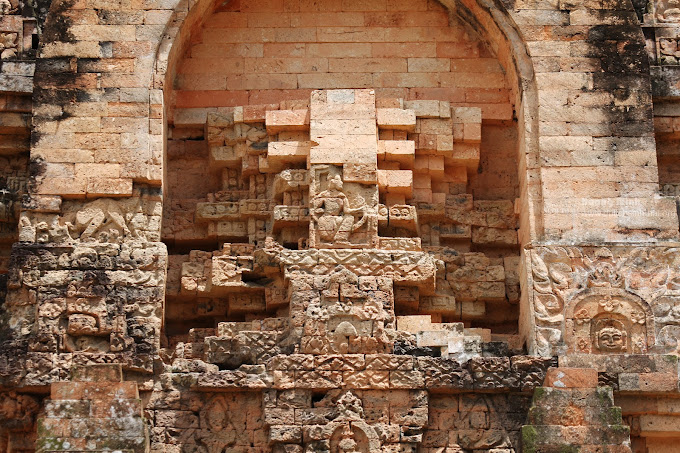
Cat Tien Archaeological Site is a complex of brick architectural ruins with a very large scale, stretching about 15km according to Ta Ngan Dong Nai River from Quang Ngai commune to Duc Pho and Gia Vien communes (Cat Tien district - Lam Dong province). Archaeological excavation results (from 1994 to 2006) many architectural ruins of temple tower, tomb, long house, water trough system, ancient rocky roads, ... have been revealed. The architecture here is large and small, depending on the function, with square or rectangular plots, the main door turned to the east. The excavation process has found more than 1,000 artifacts including many materials such as gold, silver, copper, gemstone, ceramic, ... rich in type such as: idol Linga - Yoni, Ganesa, UMA god, rings, chain seeds, floating gold leaves of the gods, Balamon mascots. Through the type of architecture, the artifact is found that this is a religious mecca influencing the Indian religion and the trace of a unique culture in the past. Cat Tien Archaeological Relic is a big finding of Vietnamese archeology in the late twentieth century, which is important in studying ancient cultures in the South and the Central Highlands. Archaeological excavations show that Cat Tien culture has a fairly long development process: the early period around the fourth century - VI and the late period of the Seventh - 10th century AD. Especially, the development process of Cat Tien culture has a close relationship with the Champa culture in the South Central Coast and Oc Eo - Oc Eo culture of the Southern Delta of Vietnam. In the opinion of the late Professor Tran Quoc Vuong in the scientific conference of Cat Tien archaeological monument, (March 2001) concluded: “This relic has many unique native elements (endogenous) and also has many external factors (external - exogenous). The external factors saw from the southwest are Chan Lap and from the Northeast is Champa, including physical and formless culture. It is possible that the cultural elements are slightly inclined to Chan Lap and the inhuman elements are inclined to the Champa. Therefore, this monument is "standing between and it is itself". Cat Tien archaeological relic is located in the middle of the provincial road 721 connecting Highway 20 (Madagui junction - Domhuoai district - Lam Dong province) with Highway 14 (Sao Bung junction - Bu Dang district - Binh Phuoc province). The relic center is located on the north bank of Dong Nai River close to the core area of Cat Tien National Park, about 190km from Da Lat (north) and Ho Chi Minh City. Ho Chi Minh City is about 180km (south), this is a pretty location on the tourism map, very convenient for tours from Ho Chi Minh City, Da Lat and the Central Highlands provinces to visit. Cat Tien Archaeological Relic is also known as the Holy Land of Cat Tien, which preserves the evidence of a unique culture more than 1,000 years ago. With the wide scene of the monument and a rich number of artifacts and special values such as the floating yellow leaves shaped by the gods, the Balamon religion and the collection of Linga - Yoni of gold, copper, stone, gemstones ... including the giant Linga - Yoni idol is identified as the largest in Southeast Asia (compared to the relics of the same quality). In addition to the Cat Tien archaeological site in Cat Tien district, visitors can also visit the historical and resistance relics of the Party Committee of the Vi area and some living points of the Ma people and the long -standing indigenous people who have been living on this legendary land. Cat Tien Archaeological Archaeological Area bears the indigenous culture, but still shows the absorption of the quintessence of other cultures throughout the historical length from the fourth century to IX. It is associated with an organized and large -scale ancient community, with a unified and tight socio -economic system with high levels of development (the most convincing evidence is the appearance of writing on golden pieces). The formation and development of the monument plays an important role in the historical process of the South Central Highlands - Southeast. With a special special value, Cat Tien archaeological monument (Cat Tien district, Lam Dong province) was ranked as a special national monument by the Prime Minister (in Decision No. 2408/Decision -Prime Minister dated December 31, 2014) Source of cultural heritage.
Lam Dong 1081 view

B’lang volcano (also known as Chu R’luh volcano), in Buon Choah commune and Nam Da commune. This is a volcano formed in the final stage of Geological Development History - Global Geological Park (CVDCC) UNESCO Dak Nong. This is the only volcano in Dak Nong Geological Park to create the lava cave system, the most large and unique in Southeast Asia. According to the survey, research by scientists, the process of operating lava lines from the b’lang crater flows in all different directions (Northwest, Northeast, Southwest and Southeast). Up to now, 4 cave systems have been detected, including 50 caves with distribution characteristics and mechanisms to form a cave, rich and diverse cave doors and beautiful. There are many caves distributed in the shallow floor, but there are also many cave distributed in the deep floor tens of meters. B’lang volcano, distributed at an altitude of about 601m above sea level with a depth of the crater is about 59m. The mountain axis is about 160m long, short axis about 100m; The crater area is about 4 hectares, the volcano area is about 1.6 km2. B’lang volcano area is located near carbon, rich in cultural traditions of the M’nong and Ede ethnic groups ... With traditional festivals, professions and cultural and scenic historical sites, the ranking has been ranked favorable to connect tours, tourism routes, exploit and develop tourism in the future. On March 12, 2024, the Ministry of Culture and Sports -Lich issued Decision No. 611 of the national monument ranking for B’Lang volcanic landscape, Buon Choah commune and Nam Da commune. Source of electronic portal of Krong No district, Dak Nong province.
Lam Dong 1161 view
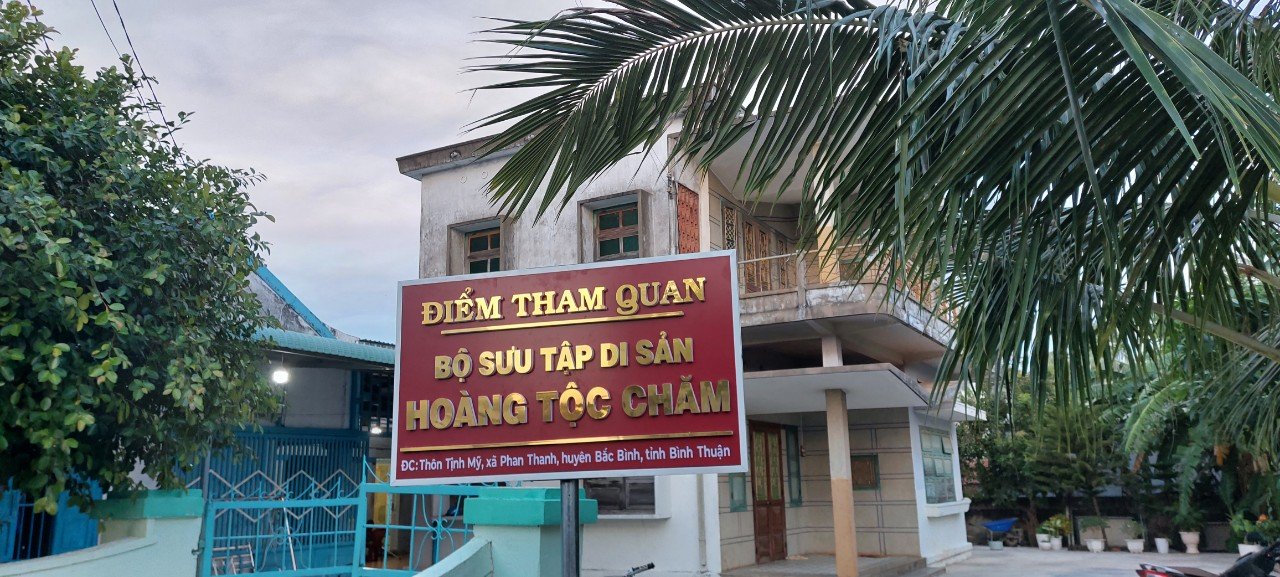
The warehouse opened the Cham Royal Heritage collection located in Tinh My village, Phan Thanh commune, Bac Binh district, Binh Thuan province. It displays more than 100 original artifacts with bold cultural historical value of the Cham nation and is classified into 8 collection groups. In particular, the most valuable is the crown of King Po Klaong Man and the bun of Queen Po Som with gold material with a very sophisticated and unique pattern carved lines in the early seventeenth century. The collection of the Cham Royal Heritage is a place that fully converges the values of the birth of the ancient Cham dynasty, the costumes, jewelry, crowns, weapons, utensils in the palace, ... being kept by the Descendants of the Cham King, transmitted from this generation to the next generation, over 400 years. Before 1975, the collection of Cham Royal Cultural Heritage was kept tightly in the warehouse for spiritual reasons, beliefs and other important parts such as security and safety for heritage and heritage guard. Until the years 1991 - 1992, the survey, research and scientific records of Po Klaong Mânai temple and the new collection were gradually conducted and completed submitted to the Ministry of Culture and Information ranked in Decision No. 43/Culture/Decision on January 7, 1993. After being ranked, aware of the long -term protection of the remaining collection of the remaining ancestors, the Cham Descendants' family, Ms. Nguyen Thi Thuyen (1911 - 1995), agreed to step by step for the Binh Thuan Museum to design and display the collection in the form of "open warehouse". However, because the house of Mrs. Tham was built in the early years of the 1960s, the space was quite cramped, the lower floor to stay and the upper floor was divided into 2 rooms for display, the family was only open to the research teams, the politicians were the main, not widely served for visitors to admire the original artifacts. Over the years, authorities at all levels and functional agencies have also implemented many things to preserve and promote the value of the Cham Royal Heritage collection. However, the effective promotion is still modest, not commensurate with the value of the heritage. Therefore, it is necessary to have a new approach for the collection to really promote the value in the development of social life, especially the outbreak of cultural tourism. Over the time of surveying and statistics, the Museum of Binh Thuan Province classified the collection of Cham royal heritage into 8 collections as follows: Collection of crowns of the king and queen; Weapons collection: Executioner, sword; Collection of instruments (Pheng La); Collecting worshiping items (beliefs, spirituality); Collection of fabric (brocade and fabric from abroad); Ceramic collection; Collection of paper: Sac Phong a number of Nguyen Dynasty King and some types of documents on land, geography, administrative documents copied in Han Nom characters from the ordained the Nguyen kings; Wood collection: Royal chest, guard hat. Source of Department of Culture, Sports and Tourism of Binh Thuan Province.
Lam Dong 1322 view
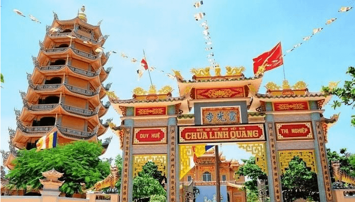
Since creating up to now, people on the island called the temple name "Linh Quang Tu" to pray for the glory and light of the temple always enlightened to save the people on the island to have a peaceful and happy life. Linh Quang Tu is the beginning of the temple associated with the spread of Buddhist light in Phu Quy. Not only is a beautiful place, but Linh Quang Tu is a typical temple in the fields of historical, literature and art compared to other temples on the island. Linh Quang Tu is a famous ancient temple in terms of scale as well as architectural art, religion, ritual, with diverse natural scenes that deserve to be the famous landscape of Phu Quy Island. If the official chronology of the temple followed the genealogy, the pagoda was created and renovated in the year of the Rabbit 1747 of King Le Hien Tong - the 8th Canh Hung dating. Up to now (2017) the temple has dated 270 years and so far this is one of the earliest temples in Binh Thuan. With these typical values and meanings, Linh Quang Pagoda was ranked by the Ministry of Culture and Information Ranking of the National Landscape in Decision No. 51 Decision/Minister of January 12, 1996. Source of electronic portal of Phu Quy district, Binh Thuan province.
Lam Dong 1296 view
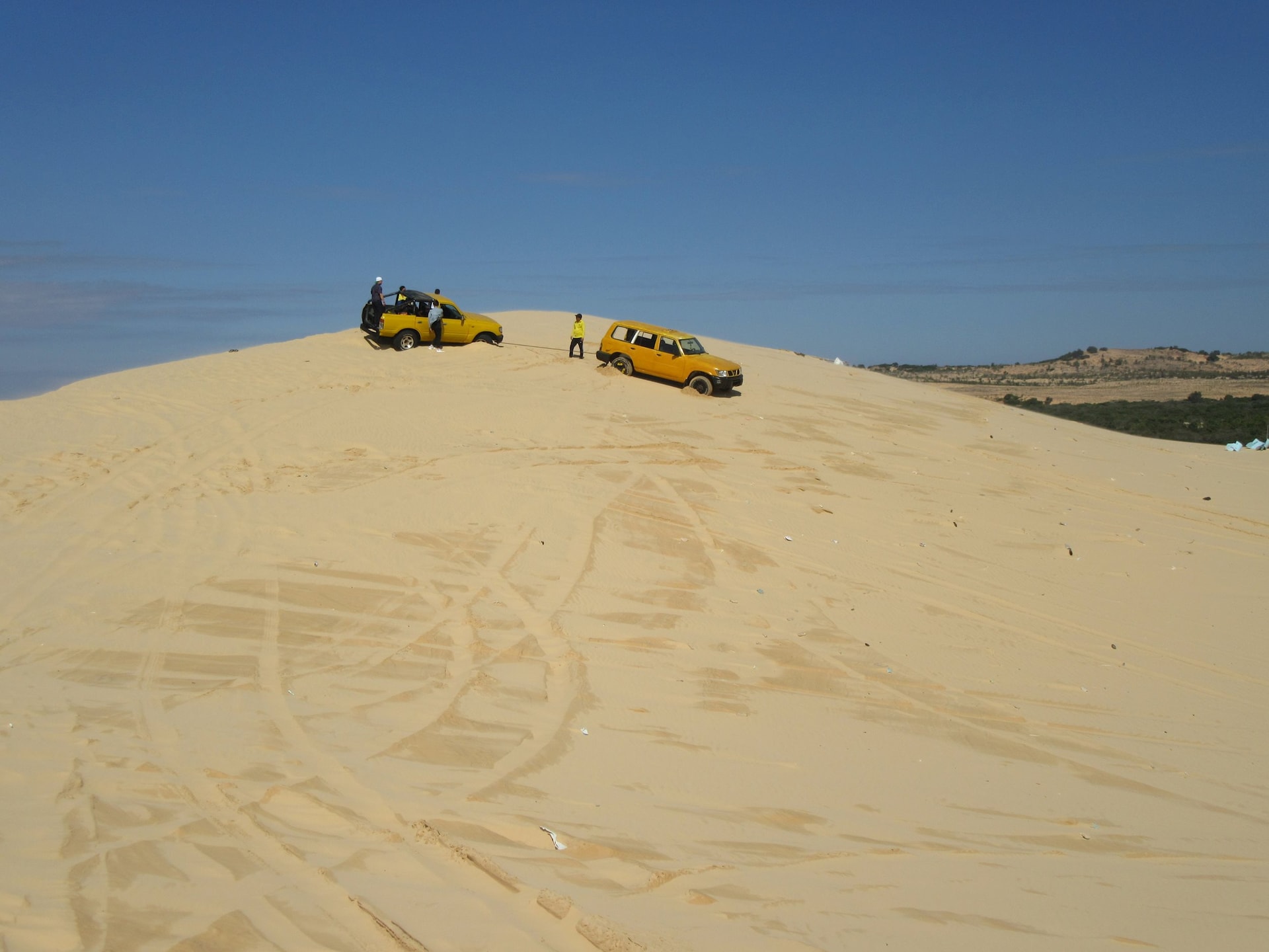
Bau Trang (or Bau Cat, Bach Ho, Bau Sen) is a freshwater lake in Binh Thuan province, about 62 km northeast of Phan Thiet city, in Hong Lam village, Hoa Thang commune, Bac Binh district (formerly in Binh Nhon commune, old Hoa Da district). According to legend this place is a large lake, after the people cover the sand dam and run across the lake to pass. This large lake has since been divided into 2 parts: Tieu Ho and Dai Ho. Because "Bau" in the local language means "lake", for a long time, the local people have called Tieu Ho as Bau. In 1867 when Ho Chi Minh passed by here, seeing the beautiful scenery of Bau Trang that he called "Bach Ho". "Bach Ho" began to appear in Nguyen Thong's poetry and also from there became the poet who assigned Bau Trang. Bau Trang is divided into 2 parts by a sand hill across. The people here have been called Bau Ong and Bau Ba. Bau Ba is larger than Bau Ong and contains more water. The depth of Bau Ba is 19m in the rainy season. Around Bau Ba planted a lot of lotus. Lotus is planted by residents for the purpose of harvesting seeds and looking. Because of planting lotus in this area, the landscape is more special. Small than Bau Ba, but there is a dike separating the two lakes. Bau Ong is more shallow and not as sweet as Bau Ba. Possessing a rare natural beauty, Bau Trang is a famous sight that most tourists cannot ignore when choosing Binh Thuan is a resort, sightseeing, entertainment. With a total area of about 45 hectares, the tourist destination consists of 23.2 hectares of 3 types of forest types managed by Le Hong Phong Protection Forest Management Board, the remaining 2.8 hectares of land and 19 hectares of water surface managed by the People's Committee of Hoa Thang commune. In 2013, this place was recognized as a place in the top 100 impressive destinations of Vietnam, in the period of 2014 - 2016, continuing to receive the title of ASEAN favorite destination and the top 100 favorite points in the South. Especially in 2019, Bau Trang was honored to receive the ranking of national landscapes at the decision of the Ministry of Culture, Sports and Tourism. Source of information portal in Bac Binh district, Binh Thuan province.
Lam Dong 1312 view
Ta Cu mountain pagoda (locals or simply calling the mountain pagoda) is a temple located on Ta Cu mountain at an altitude of more than 400 m, in Thuan Nam town, Ham Thuan Nam district, Binh Thuan province, near Highway 1, 28 km south of Phan Thiet. This pagoda is a national historical and cultural relic of Vietnam. In the middle of the 19th century monk Tran Huu Duc (1812-1887) Dharma name Thong An, Huu Duc's Dharma from Phu Yen to Binh Thuan built a draft in Kim Thanh village (Bau Tram) who had just practiced and picked medicine. He used to practice and contribute a lot of effort to take care of Buddha in many pagodas in Binh Thuan such as Co Thach Pagoda, Linh Son (Tuy Phong), Phuoc Hung (Phan Thiet) and some pagodas in Phu Quy island. In 1872, the monk went to Ta Cu Mountain to practice in a rock cave (later called the nest cave). Until the time of death, Master Huu Duc did not go down the mountain anymore. At the same time, the monk Huu Duc was a good physician. In the 33rd year of Tu Duc (1880), the Empress Dowager was seriously ill, the gods asked to receive the monk to help treat the disease but the monk refused, only sent people to the court. The Empress Dowager was gone, King Tu Duc gave the name of the pagoda, Linh Son Truong Tho and the monk was "Venerable Venerable". Until the monk Huu Duc President passed away (on October 5, 1887 in the lunar calendar), the Master Tam Hien set up a new temple below, later called the lower pagoda or Long Doan pagoda and Linh Son Truong Tho pagoda as the temple. Above the temple, about 50 m from the nest cave is the statue of Shakyamuni Buddha, 49 m long, 7 m high. The work was chaired by Mr. Truong Y, casting with reinforced concrete in the restoration of 1963. About 50 m from the bottom is the Tam Ton Ton Ton statue group, built on the lotus: A Amitabha statue in the middle of 7 m high, the left is the statue of Avalokiteshvara and the right of Dai The Chi statue is 6.5 m high. The tomb tower of the ancestors and the abbot of the abbot was divided into two clusters in front of the church and after the temple. The nest tower is located in front of the temple, besides the tomb of the tiger, it is tamed by Master Huu Duc. Source of portal port of Binh Thuan province.
Lam Dong 1392 view
Tu Luong communal house was called by the name of Tu Luong village before. At the beginning, the communal house built with simple leaf paintings and gradually decades after that they were embellished in a solemn appearance. Like other communal houses in Binh Thuan, Tu Luong communal house is created by all the incense and people in the village. In 1995 - 1996, through surveys, comparison from architectural structure, construction techniques, art decoration art, the remaining ancient relics in the communal house and the genealogy of some people who settle down for a long time Life in the village, museum and Department of Culture and Information Binh Thuan determined to create Tu Luong communal house in the early nineteenth century. Currently, the communal house is located in Duc Long ward, about 1.5 km southwest of Phan Thiet city center. According to Mr. Nguyen Huu Tu - Head of Management Board of Tu Luong village communal house, at the beginning, Tu Luong is one of the villages with an ideal position, convenient for business and early economy. Dinh in Phan Thiet. In Tu Luong communal house, there is still a picture of the ancient horizontal screening of Han characters clearly about the geography and landscape of the village. The architectural complex of Tu Luong communal house at the beginning of creating quite a large scale, the superficiality includes the temple of the god, the road, the three gate, the gate, the room, the worshiping space And the wall surrounded. Tu Luong communal house has a unique architectural structure, here using two typical local folk architecture forms, which are the "four -pillar" and "coincidence" architecture combined . In architectural structure, wood, bricks play an important role. In which wood is the main material to create the link frame of each roof of the communal house, followed by the blending mortar with folk experience from lime, shells, sand, molasses, asphalt ... to make The adhesives build solid walls and solemn and ancient communal houses. The roofing materials and floors are still reserved, which are ancient yin and yang tiles and Bat Trang bricks that were commonly used in folk structures at that time in the locality. In addition, in the communal house, there were 2 bronze casters dating back to the late nineteenth century. Both Dai Hong Chung plays an important role in Dinh's annual music reconciliation. 6 Dragon examination, 4 incense, 3 covers and 2 mail projects. These are precious wooden -made, carved, elaborate and sharp relics. These relics have an important function in the decoration of worship in the interior. 20 diaphragm and 16 couplets, the whole carved ancient Han characters on good wood. Each picture has different sizes, some have the border around the image of Giao Long, elegant flowers. The content of praising the authority of the god, passing on to the descendants of the great gratitude of grandparents and ancestors; The generation only follows the fine customs and fine traditions of the nation ... Tu Luong communal house was ranked by the Ministry of Culture and Information of the National Architectural Architecture Monuments in 2001. This is the place where folk festivals take place in cultural space. Every year, the communal house organizes many sacrifices. The biggest are two Le Xuan Thu Ky in February and August of the lunar calendar. Through this, today's generation understands more about the local history, from which to be aware of preserving the good cultural value of the ancient ancestors. Source of electronic portal of Duc Long ward, Phan Thiet city, Binh Thuan province.
Lam Dong 1339 view
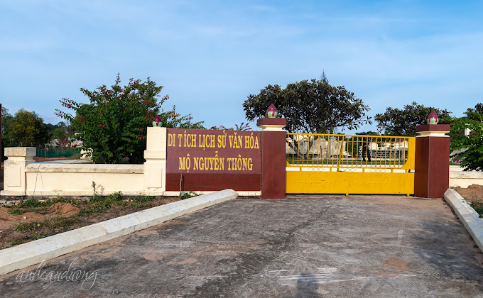
He was born on May 28, 1827 in Binh Thanh Village, Thach Hoi Ha General, Tan Thanh District, Tan An District, Gia Dinh Province (now Phu Ngai Tri Commune, Chau Thanh District, Long An Province), whose name is self. Hy Part, Ky Xuyen, Nickname Am. . Smart, eager to learn but Nguyen Thong soon orphaned. With his rise efforts, he was a monk. When France invaded Cochinchina, he and his scholars here refused to cooperate and go to the land in Binh Thuan. His whole life, he wholeheartedly worried about the country, for the people ... When he was 10 years old, his mother died. 7 years later, his father also died. His family has since fallen in misery, so Thong has to make a living to take care of the whole family. Eager to learn but there is no teacher with the couple, so the two brothers have to study themselves. Until Mr. Nguyen Nhu Hien was appointed by the court to work in Tan An, the two brothers came to ask for life. The time of studying Mr. Hien was not long, the teacher was sent to the capital. In 1849 (in the Year of the Rooster, the reign of King Tu Duc), Nguyen Thong passed the bachelor's exam, but by the festival, he was dropped just because of the reason that the test was covered with ink. Also because of the poor family, Thong could not continue his career in book lights and he received the training in Phu Phong - An Giang Province. In 1855, he went to Hue, and then a year was promoted to the Academy of Division, in the cabinet, participating in the preparation of the book "Human Resources Kim" (the golden mirror illuminated the human work). When France invaded the Southeast of the Ky in 1859, Nguyen Thong volunteered the army and worked as a powerful advice for the Governor of the Military Service of Ton That Hiep, looking after the secret work. Chi Hoa station was lost in 1861, then Bien Hoa province was also occupied by France. After fighting in the peaceful battle, his brother Trinh Quang Nghi and his friend Phan Van Dat recruited the Mo Nghia to fight against the French army in Go Cong and Tan An. Nguyen Thong participated in that movement. Phan Van Dat was killed by the French, and Thong was lucky to escape. The following year, Mr. Truong again helped Truong Dinh very effective in the position of military service. In 1862, France forced us to cede 3 Eastern provinces, thanks to Phan Thanh Gian nominated, Nguyen Thong was appointed as the Doctor of Vinh Long. Here he still kept in touch with him, and still contacted the patriotic scholars, including the scholars who moved their families from the East to. At the same time, he rebuilt Van Thanh Temple of Vinh Long. In 1867, France used to occupy Vinh Long citadel, he and many Nam Ky scholars refused to cooperate, so they went out in Binh Thuan. Nguyen Thong and his comrades discussed the investigation and contact with Bien Hoa, and also actively developed agriculture and food production for long -term concerns. He himself organized the exploration of La Ngu and Ba Dau plateau (Binh Tuy), stating the terrain and terrain of the ability to reclaim and draw clearly the map. After that, he was mobilized to Khanh Hoa, then went to Quang Ngai, Hue. At the end of 1867, he was a project close to Khanh Hoa province and offered to award the name of Thuy to Phan Thanh Gian and hearing 4 issues of benefit of the country but was rejected by the Hue court. In 1870, Nguyen Thong made an argument for the image of Quang Ngai. Especially in Quang Ngai for 3 years, he has done many things to benefit farmers, especially irrigation. At the same time, he was involved in an unjustly accused of being sentenced to the court, so he was dismissed by the court, imprisoned into prison and trial. The people and soldiers all loved him so he asked Quan Kham Sai Nguyen Binh to take office in Quang Ngai to review his crime. Some people voluntarily come to the city to meet the king to complain to him. The king of love should forgive him and for the new investigation or this incident was because Cuong Hao Le Doan accused him of him. During this time, he was accepted by the court two aspirations, namely: Organizing planting trees and defining the history of history, please issue a book to study schools. In 1876, he returned to Hue to work as a career in Quoc Tu Giam. He and Mr. Bui Uoc and Hoang Dung Tan approved the "Kham Dinh Viet history". And also on the occasion of the Hue capital this time, he composed the "Vietnamese history of judges". At the same time, he offered and prepared to exploit the Central Highlands from the Cambodian border to Quang Tri, to collect the people of the South. But in the end this was opposed by the French, so the Nguyen court ordered to abolish it. In 1880, Nguyen Thong was the deputy vice -artist and the Doctor of Binh Thuan Province, he also discussed with the compatriots of the countryside. Binh Thuan after running from the South. He built a small house next to the Phan Thiet River (now the area of Duc Thanh relics), named Ngoi Du Sao (the team is playing) to read books, write poems, on the wall, there are some typical scenes that Mr. Trai's life. He officially considered Binh Thuan as his second home. In 1884, Nguyen Thong died. His tomb was built at the foot of Co Mountain (Ngoc Son Mountain) in Ngoc Son village - Phu Hai ward - Phan Thiet city - Binh Thuan. The tomb of Doanh Dien Porcelain Binh Thuan Nguyen Thong was built quite simply and close. The tomb has a length of nearly 9 and a half meters, nearly 6 and a half wide. The main part of the tomb covers the unicorn like the ancient tombs of the ancient people. Around the tomb is very beautiful ornamental plants, looking at the tomb of Doanh Dien Binh Thuan now looks very monumental. This tomb area was ranked by the State in 1999. , historian ... Nguyen Thong for our nation. Source of electronic portal of Phu Hai ward, Phan Thiet city, Binh Thuan province.
Lam Dong 1352 view
Right on the campus of Regiment 726, Quang Truc commune, Tuy Duc district (Dak Nong), there is an old, white house, built in French architectural style. According to experts, this place was formerly the site of So Tea built by the French in Dak Nong. Around the 30s of the twentieth century, French colonialists entered the Central Highlands to open plantations, grow crops such as coffee and tea and hire ethnic minority workers. In 1962, the Plantation at that time was about 20 hectares large and there were about 80 workers working here. Among them, there are about 40 ethnic minorities working at the plantation. In particular, there were 12 political prisoners arrested to work here. Workers working at the plantation are paid 30 VND/month. There are people who don't take money and will exchange it for rice or salt. At the end of the year, you will be rewarded with beef. One day, workers at the tea plantation work from 7 a.m. to 5 p.m., and are given food and rest at noon. Around 1966, the plantation was dissolved. Through surveys, the historical site of So Tra was preserved quite intact with a structure built with reinforced concrete structures, following the French architectural style of the early 20th century. Currently, there are no specific documents about the process of building the house on which date, month or year. The area of the house is about 200m². The house is almost intact with 1 ground floor, 1 floor and 1 mezzanine. Inside the house there are 8 rooms and a fireplace built from the ground floor to the first floor and mezzanine for warmth when it's cold. Behind the room on the ground floor there is a secret escape hatch, but the mouth of the tunnel is covered. Up to now, although managed by Regiment 726, this secret tunnel has not been discovered. Near the construction area there are a number of fruit trees and ancient tea trees that, according to local people, are about 100 years old. Among them, 2 tamarind trees have been recognized as Vietnamese heritage trees in September 2022. So Tra historical site is recognized as a provincial historical site. Source: Dak Nong Electronic Newspaper
Lam Dong 2710 view
Phan Thiet water tower located on the Ca Ty river was built nearly 90 years ago, designed by Prince Xuphanuvong (Laos), and is currently a symbol of Binh Thuan province. Phan Thiet Water Tower (also known as "Water Tower") was built by the French from 1928-1934 according to the urban planning policy of the contemporary government, serving to provide domestic water for the French Legation (now the headquarters of Binh Thuan People's Committee) and people in Phan Thiet city. The location for the water tower is located on the land of Long Khe village, on the left bank of the Ca Ty river, high and airy, about 350 meters from the Legation Palace. The design of the water tower was drawn by Prince Xuphanuvong (Laos, who was then an international student at Albert Sarraut School in Vietnam), approved by the Hanoi Department of Public Works and the project was put out for bidding. Among two French contractors and two Vietnamese contractors, contractor Ung Du (originally from Hue, working in Binh Thuan) won the bid. The water tower is built in a regular octagonal cylinder. The height from the base to the top of the tower is 32 m. The whole is divided into 3 parts, including: the tower body, the platform and the roof. The tower's body has an octagonal cylindrical shape, each side is 3.9 m wide, the higher it goes, the smaller it becomes. The diameter of the tower's base is 9 m long, the circumference is 31.2 m, and the floor area is 73.4 m2. Along the edges of the tower's body, from top to bottom, there are 5 ventilation boxes decorated with seal patterns corresponding to the 5 words: "Happiness", "Phuc", "Tho", "Kiet", "Loc" . The meaning is to wish all people joy, happiness, longevity, prosperity and prosperity. Particularly, the west side of the ventilation box with the word "Loc" is replaced by an iron door entering and exiting the tower. The platform, that is, the water tank, is also designed in an octagonal shape, 5 m high, 9 m in diameter, containing 350 m3 of water. Around the platform, there are 8 circles embossed with pieces of porcelain stylized with the four letters U.E.P.T, which stands for the French phrase "Usine des Eaux de Phan Thiet" (meaning Phan Thiet Water Plant). With its high architectural features, the building is also used as a flagpole. Master Nguyen Chi Phu, Deputy Director of Binh Thuan Provincial Museum, said that during the construction process, experts and workers strictly followed the technical design. Gravel must be washed 5 times to remove sand and dust. Foundry sand must also be washed 3 times to remove dirt. Cast iron must be rubbed with sandpaper to remove rust. Boards used for formwork must be planed smooth so that when removed, there is no need to add any additional plaster. Thanks to that, the project is sturdy and durable until today. After nearly 90 years of existence, even in the face of war bombs and harsh environments, especially through two historic floods in the years of Nham Thin (1952) and Quy Dau (1993), the water tower still stands majestically in the heart of the city. The city, becoming a sacred symbol, entered the poetry and music of the coastal land of Phan Thiet. On October 19, 2018, Phan Thiet water tower was decided to rank as a provincial monument by the Binh Thuan People's Committee. Source: Phan Thiet Tourism
Lam Dong 3307 view
Da Lat is famous for 3 palaces during King Bao Dai's reign: Palace 1, Palace 2, Palace 3, associated with the ups and downs of our country's history. In 1940, a French millionaire named Robert Clément Bourgery built Palace 1. In 1949, King Bao Dai's father-in-law contributed money for the king to buy this mansion. King Bao Dai set up his General Headquarters here to work during his years as Head of State from 1949 to 1954. Besides Da Lat, King Bao Dai also owns another very famous mansion in Vung Tau, which is Bach Dinh. In 1956, Palace 1 was transferred to Ngo Dinh Diem for use. Many years later, this place became a resting place for heads of state until 1975. In 2014, the local government invested in restoring and repairing Palace 1, making this place available for sightseeing. vacation in Da Lat. Palace 1 of Da Lat (Bao Dai Palace) has undergone many renovations. The outside campus is spaciously designed and equipped with luxurious tables and chairs. Stepping through the gate into the campus, there are hundreds of blooming flowers, a giant flag garden, 7-color steps, hundreds of hanging lanterns... The fountain has a bold European feel as well. attracts many tourists. Stepping up to the first floor, in addition to the main lobby area, on both sides of the palace are 2 large living rooms, behind are 4 rooms of different sizes. In the past, these rooms were used as transition rooms, clerical rooms, kitchens and WCs. At the end of the first floor is a very majestic and magnificent photography room. Including a throne, a hammock painted in red and gold... When you step up to the 2nd floor of Bao Dai Palace 1, you will see 3 different bedrooms. The first room is the bedroom of King Bao Dai's mother (Mrs. Tu Cung). The second room is King Bao Dai's bedroom. Next is Queen Nam Phuong's bedroom, located opposite the palace hallway. It can be said that the second room is the most important in King Bao Dai's first palace. This is where important meetings took place during the reign of King Bao Dai from 1949 to 1954. This is also the place to discuss campaigns and wars from 1955 to 1963. During Ngo Dinh Diem's government, he renovated King Bao Dai's room and dug a secret tunnel here. The path down to the tunnel is disguised to look like a bookshelf to the right of the bed. This exit leads to the helipad behind the hill of palace 1. Especially in this mansion are military-style constructions, you will not help but be surprised and overwhelmed by its unique appearance. First is a large helicopter landing pad, gas depot, and emergency exit (tunnel). The tunnel door is equipped with metal weighing several hundred kilograms, artillery, bulletproof glass... Source: Da Lat tourism information portal
Lam Dong 3692 view
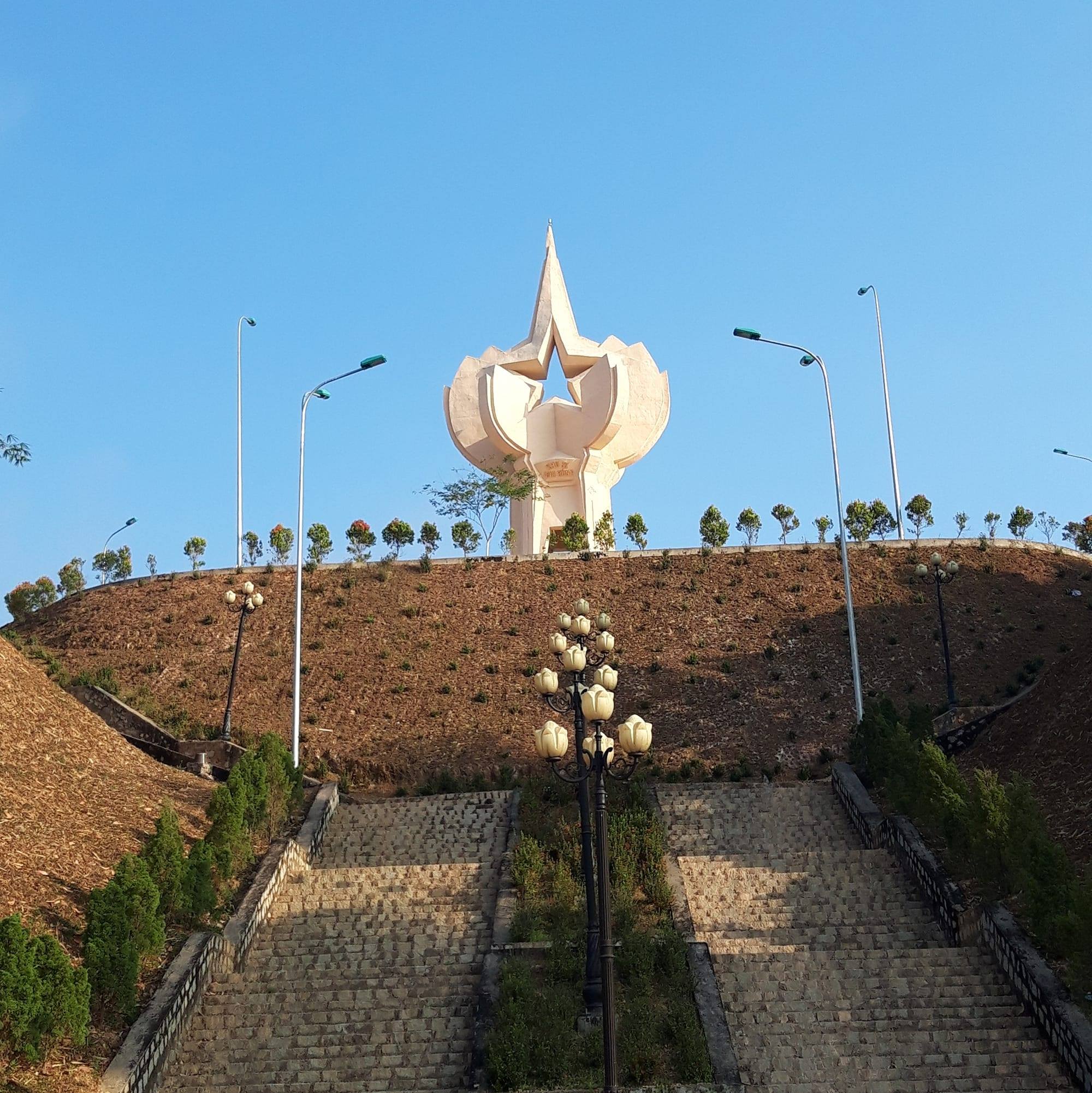
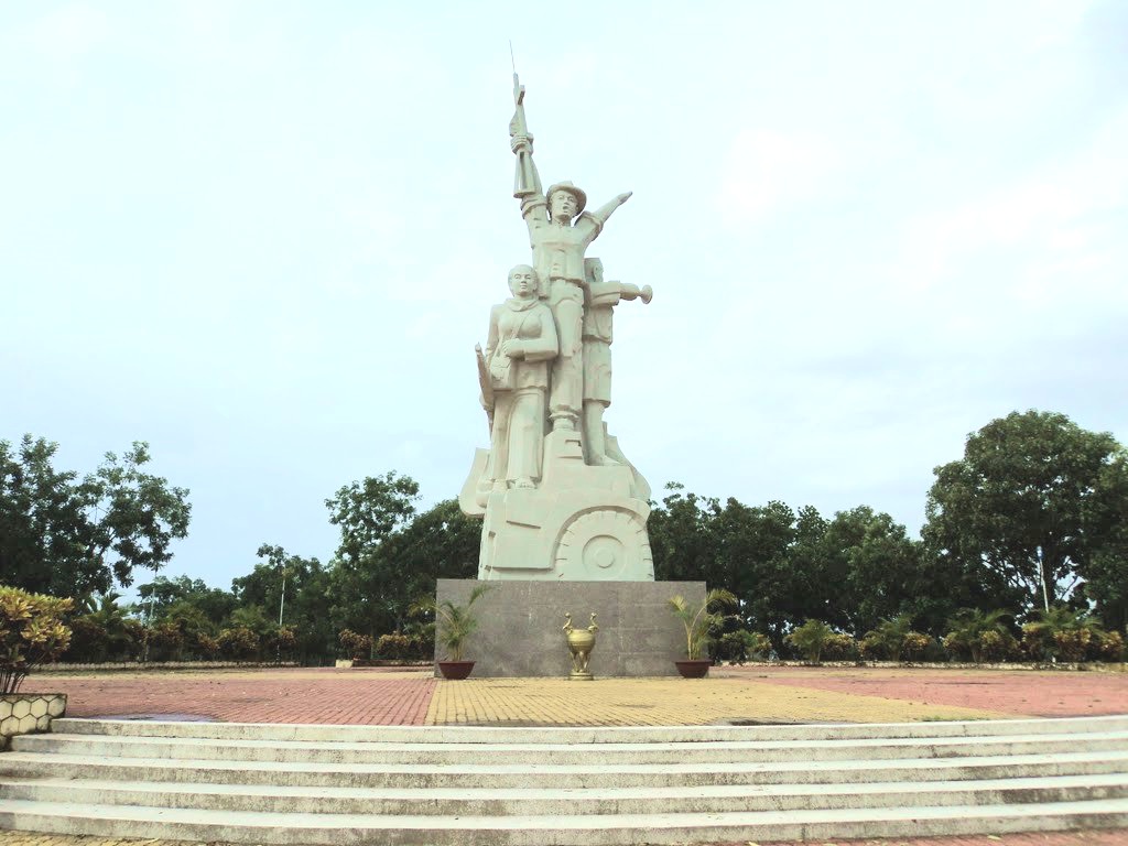
The historical relic site of resistance base in Cat Tien zone VI has a total area of nearly 50 hectares, located in village 5, Duc Pho commune, Cat Tien district, Lam Dong province. This is an ideal address to attract people and tourists who love nature, explore and learn about history and national revolutionary traditions. Area VI relic, Cat Tien is a work of important historical significance, recording the merits and achievements of generations of ancestors in the struggle against the American invaders, period 1963 - 1966. Mold The relic site of Area VI, Cat Tien is designed harmoniously, scientifically and beautifully, suitable for the landscape space, with a system of clean, beautiful concrete-paved internal roads winding around cool, green ponds and lakes; The majestic monument located on the top of the central hill has created a highlight that attracts the attention of people and tourists when visiting the relics of Area VI, Cat Tien. Not far from Monument Hill is a display house with 108 collected artifacts and a number of primitive weapons restored for display and explanation. Scattered on the green hillsides shaded by forest trees are buildings of camps and shelters recreating the working and living spaces of "Region and Military Region Party Committee agencies" with a total of 23 categories. categories, in which, the Regional Party Committee agency has 12 categories and the Military Region agency has 11 categories. According to historical documents, in the period from 1963 - 1966, Cat Tien Party Committee and Zone VI made important contributions marking the continuous growth of our country's revolutionary forces. In the beginning, Area VI was the place to focus on consolidating and preparing the necessary conditions to coordinate with the entire South to attack the enemy, destroy strategic hamlets, expand the controlled and liberated areas, and create position and force. for the Vietnamese revolutionary movement to win great victories. Especially in the Winter - Spring of 1964 - 1965, the revolutionary movement in Area VI had a leap forward in both width and depth; The army and people of Zone VI proactively coordinated with the entire South to attack the enemy in the Dong Xoai campaign in the summer of 1965, contributing to the bankruptcy of the US imperialism's "special war" strategy. In the dry season of 1965 - 1966, the army and people of Zone VI defeated the enemy's first counterattack in the Zone VI battlefield. From here, the army and people of Zone VI continuously failed the enemy's pacification and search-and-destroy plan in the second strategic dry season counterattack (1966 - 1967). By the dry season of 1967 - 1968, the army and people of the Zone VI stepped up its attacks and won great victories. From mid-1965 to the end of 1968, the Party Committee, army and people of Region VI coordinated with the entire region to defeat the "Local War" strategy of the US imperialists. The victories of the army and people of Zone VI - Cat Tien demonstrate the Party's ingenious and wise leadership. Among them, the ethnic community of Zone VI was united, heroic, and indomitable, achieving resounding victories, demonstrating the brilliance of revolutionary heroism, and with passionate patriotism helping the army. and the people of Area VI overcame countless difficulties and challenges, winning victory after victory in the resistance war against the US to save the country, contributing to completely liberating the South and reunifying the country. The construction and embellishment of the historical relics of the resistance base of Zone VI, Cat Tien has shown the spirit of drinking water, remembering the source, honoring and promoting the great historical values of the army and people of Zone VI, and the community. This is the place to educate, train and foster revolutionary traditions for future generations. Source: Cat Tien District Electronic Information Page
Lam Dong 5011 view
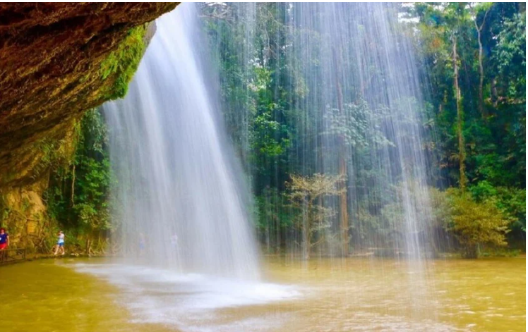
National historical and cultural relic tourist area Da tang la waterfall, also known as Da tan la, is a famous waterfall in Da Lat city, Lam Dong province, Vietnam. Located in the Da Tan La tourist area, the waterfall is 8 km from Prenn waterfall and about 10 km from Da Lat city center. Da Tang La Waterfall is considered one of the ideal destinations for tourists who want to visit and experience adventure. The name "Da tang la" or "Da tang la" is taken from the K'Ho language, made up of the word "Da-Tam-N'ha", meaning "there is water under the leaves". This name originates from the historical conflict between the Cham - Lach - Chil peoples in the 15th century. to the 17th century. Da Tang La Waterfall has abundant water thanks to a stable water source from upstream. Not as noisy as some other waterfalls, Da Tang La flows through many stone shelves and falls from rapids about 20m high. The lower part of the waterfall forms a very clear water area, called Suoi Tien, while the upper part has a deep pool called the Death Abyss. According to legend, because this abyss is located in the middle of a mountainous area, it was once a refuge for an army of the indigenous people during the war with the Cham people hundreds of years ago. There are many legends about the origin and meaning of Da Tang La waterfall. One of them tells about the meeting of the brave warrior K'Lang and the mountain girl Hobilang here. Some other legends about Da Tang La waterfall say that the waterfall is the place where fairies often bathe, or the story about the war between the Lat and Cham people, in which the waterfall played an important role in the fighting strategy of the people. Surname. With those cultural values, in 1998, Da Tang La Waterfall was recognized by our state as one of the famous landscapes and historical relics in Da Lat, ranked as a national monument. . Source: Da Lat tourism information portal
Lam Dong 2991 view
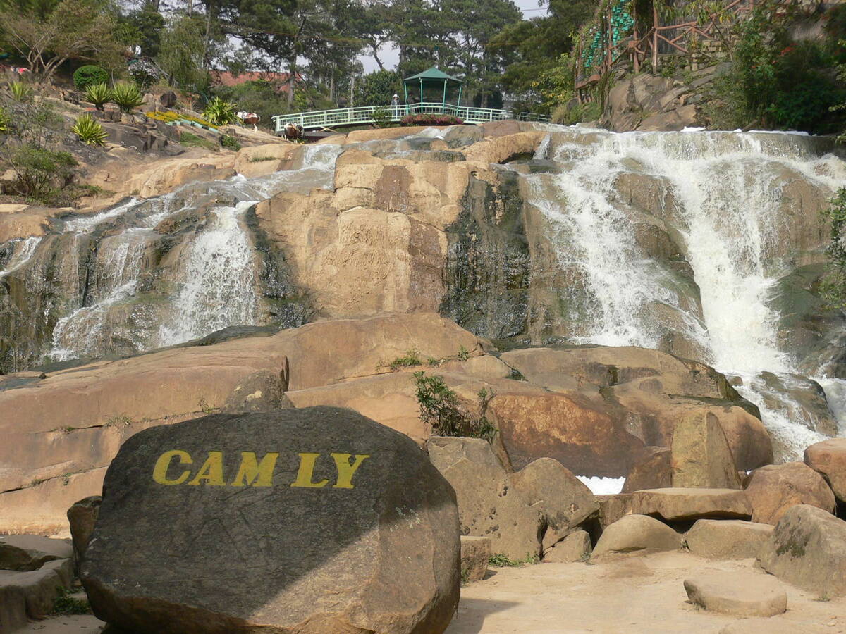
Cam Ly Waterfall is located 2km west of Da Lat city. This is considered the waterfall located closest to the city center. Cam Ly waterfall is located next to Cam Le stream, the waterfall is formed from part of the water flowing in from Xuan Huong lake and another stream, Cam Ly stream, also flows here. Cam Ly Waterfall is one of the waterfalls that talks about the remembrance, gratitude, and respect of the people here for people with meritorious services during that period. Legend has it that Cam Ly waterfall originated from the K'Ho language. People in the Lach (Lat) tribe call Cam Ly waterfall Lieng To Sra - the boundary of Cam Le stream to Da Dong river. People in the new village took the name of the chief of the Lach (Lat) tribe at that time, K'Mly, to commemorate and show the villagers' gratitude to this chief. This chief took care of the meals and sleep of the entire tribe, lived in harmony with the people, and took care that the lives of the people in the village became prosperous, prosperous, and complete. So the name of this chief given to the waterfall was K'MLy, later pronounced Cam Ly. According to the Sino-Vietnamese origin, Cam Ly means stream with fresh water (Cam means sweet, Ly means permeable). Cam Ly Waterfall possesses poetic beauty, especially in the rainy season when the water flows rapidly, creating huge blocks of water pouring down violently. With a convenient location near the city center, Cam Ly waterfall attracts a large number of tourists every year. At the foot of Cam Ly waterfall is a small flower garden, contributing to creating a harmonious and beautiful landscape. In addition, in the waterfall area there is also Nguyen Huu Hao mausoleum, built with many unique architecture. In 1998, Cam Ly Waterfall was ranked by our state as a scenic spot and historical relic in Da Lat, recognized as a national monument. Source: Da Lat tourism information portal
Lam Dong 3005 view
When mentioning Da Lat, no one knows about Xuan Huong Lake, a beautiful lake located right in the center of Da Lat city. Xuan Huong Lake is an artificial lake, with a circumference of about 5km and 25ha wide. The lake has the shape of a crescent moon, stretching more than 2 km and passing through many famous tourist attractions of Da Lat such as the City Flower Garden, Yersin Park, Cu Hill and Lam Vien Square. According to people here, the origin of the name Ho Xuan Huong comes from two different legends. The first legend says that every spring, there is a faint, fragrant scent around the lake, ecstatic. That's why people gave the lake the name Xuan Huong Lake. However, the second legend says that Ho Xuan Huong was named after a 19th century Vietnamese female poet named Ho Xuan Huong. Ho Xuan Huong is the author of a number of famous poems such as Floating Water Cake, Life as a Monk, Debt to Husband and Children,... Xuan Huong Lake was originally a large valley, and Cam Ly stream flowed through. In 1919, engineer Labbe blocked this stream so that water could accumulate and form a lake. Then, in 1923, French engineers built a dam at the bottom of the lake, but it broke after a storm in 1932. Engineer Tran Dang Khoa then rebuilt a new dam. made of stone. In 1989, Xuan Huong Lake was recognized by our state as one of the famous landscapes and historical relics in Da Lat, ranked as a national monument. Source: Da Lat tourism information portal
Lam Dong 3624 view

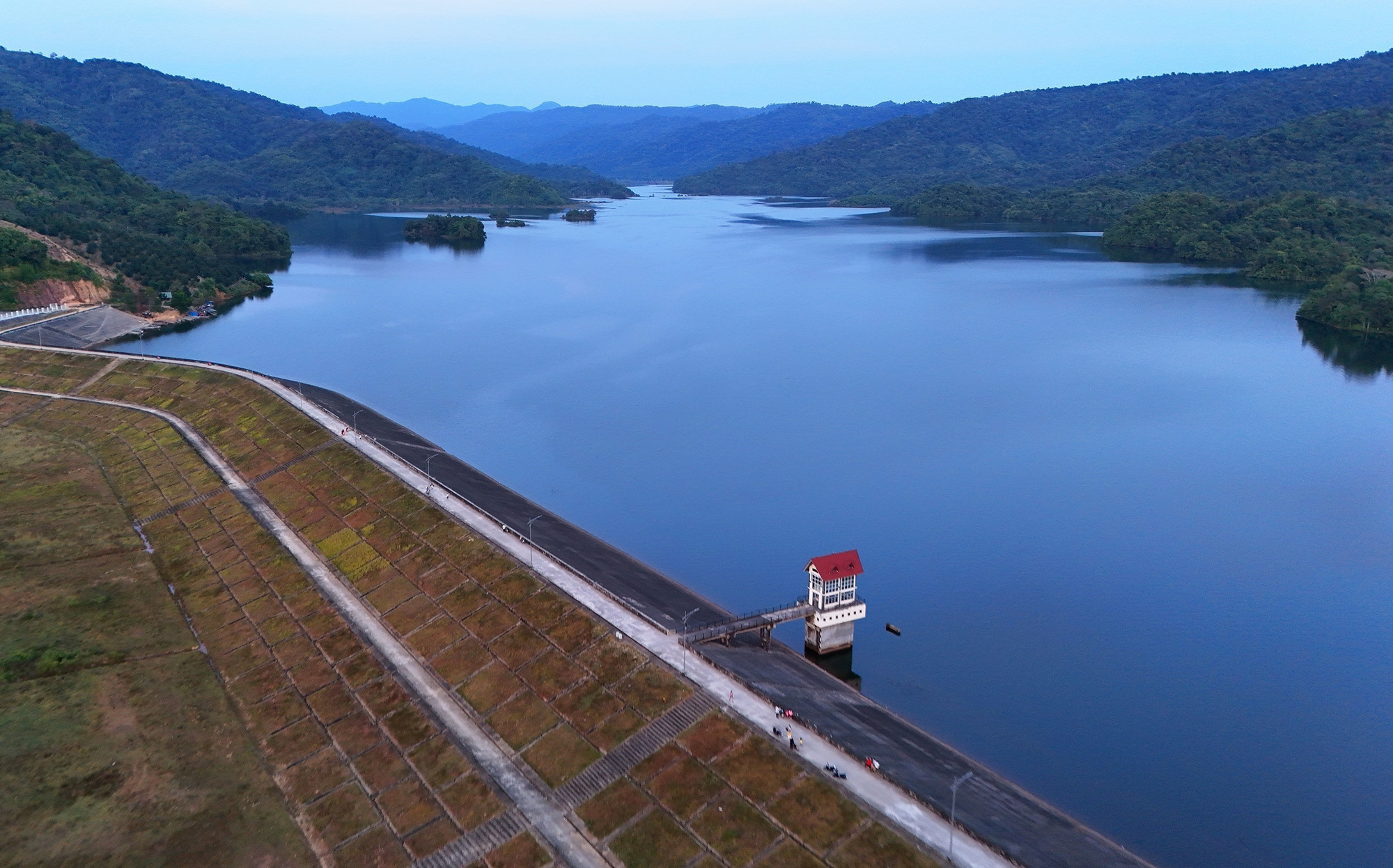
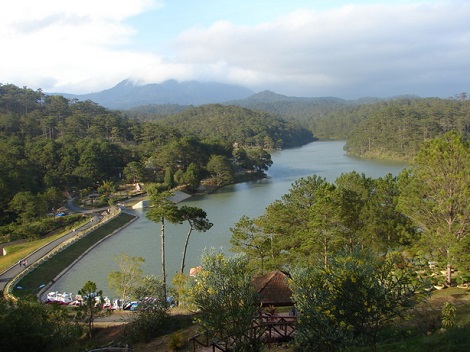
Tuyen Lam Lake was formed in 1985 - 1986. At that time, the People's Committee of Lam Dong province and Duc Trong district deployed troops to build dams to retain water in the Suoi Tia area. Surrounding the Suoi Tia flow area are surrounding mountain ranges that form a basin. When the dam is built to retain the water, it forms Tuyen Lam Lake as it is today. Initially, the main purpose of Tuyen Lam Lake was to store water for main use for irrigation in agricultural production in the downstream area - Hiep An and Dinh An communes in Duc Trong district of Lam Dong province. By 1998, when Tuyen Lam Lake was recognized by the Ministry of Culture, Sports and Tourism as a national historical and scenic site on August 31, 1998, the Tuyen Lam Lake area received even more attention and attention. Not only does it serve irrigation purposes in agricultural production, but it is also used by agencies from central to local levels to guide tourism development planning. Tuyen Lam Lake has an area of 350 hectares; More than 6km south of Da Lat city center. Tuyen Lam Lake area has a fresh climate, quiet space, natural landscapes (forests, mountains, lakes, streams, waterfalls,...) that are diverse, attractive and have many attractive and promising humanistic elements. become a large-scale tourist area with many unique types of tourism such as: sightseeing, camping, relaxation, medical treatment, walking, climbing, fishing, festivals - beliefs, entertainment entertainment, sports,...especially eco-tourism. During the two resistance wars against the French and American invaders, with the location and topography of the Suoi Tia area (now Tuyen Lam Lake) and Elephant Mountain, it was the most important base of the revolutionary movement in Da Lat city and Da Lat city. Tuyen Duc province. This base area serves as a place to direct political and armed struggle movements of the army and people of Da Lat town and Tuyen Duc province, and a place to gather and train the armed forces. , the working teams of the Province and the military region, are the springboard for forces to attack Da Lat and maneuver to fight the enemy on fronts in Tuyen Duc province. During the resistance war against the Americans, in addition to the City Party Committee, there were also military units stationed such as the Financial Department, the clinic, the Women's Work Team, the Youth and Students, the Urban Work Team, and the City Special Forces 850 and 852. , 860... and leading agencies and front units of the province such as the Provincial Party Committee, Provincial Team, logistics, Corridor Station, Company 810 (later to become Battalion 810), Provincial Security Team and forces of the Region 6 as Battalions 186, 145, 200C. From 1982 to 1987, Lam Dong Irrigation Company, invested by the Ministry of Irrigation, built a 235m long dam across Tia stream to create Quang Trung lake, later renamed Tuyen Lam lake. By 2017, the Prime Minister recognized Tuyen Lam Lake National Tourist Area, Da Lat City, Lam Dong Province as a National Tourist Area. Tuyen Lam Lake National Tourist Area was honored by UNESCO as "Typical Asia-Pacific Tourist Area" in the Forum Program "Vietnam - India Cultural and Economic Exchange". Tuyen Lam Lake National Tourist Area has rich tourism resources including natural landscapes, forest resources, climate, cultural and architectural values; Invested and renovated infrastructure along with ongoing investment projects have been promoting value, contributing to affirming the position of Tuyen Lam Lake National Tourist Area on Vietnam's tourism map. South with diverse types of tourism. Source: Management Board of Tuyen Lam Lake National Tourist Area
Lam Dong 3281 view
Than Tho Lake is located about 6 km east of Da Lat city center, near Da Lat National Martial Arts School (currently the Army Academy). The lake is located on a high hill in the middle of a pine forest, providing a peaceful and quiet space. On the north side of the lake there is a pair of pine trees that evoke the image of a couple, near the scenic Pine Hill Two Tombs with the legend of a broken love. Initially, the Than Tho lake area was just a small pond, and was called Tono Pang Dong. However, in 1917, the French built a lake here to provide daily water for Da Lat. The French named the lake Lac Des Soupirs (meaning "murmuring lake" in French). However, later, the lake was renamed Than Tho Lake by Mr. Nguyen Vy, Chairman of Da Lat Town Council, to express sympathy for the legend of the romantic love story between Hoang Tung and Mai relying on the year of the 18th century here. Than Tho Lake has experienced many ups and downs in history. From the reclamation of mountains and forests in the 1980s - 1990s, to the process of conservation and restoration at the end of 1990. In 1999, Than Tho Lake was recognized and ranked by our state as a scenic spot, national historical relics. Source: Da Lat tourism information portal
Lam Dong 3121 view
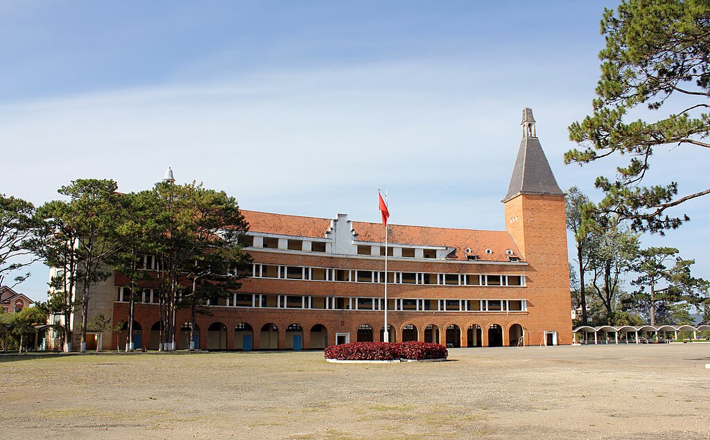
Da Lat Pedagogical College was established on September 3, 1976 by decision of the Ministry of Education. The school was assigned by the Ministry of Education to become a secondary school teacher training center for Lam Dong province as well as some neighboring provinces. Initially, the school was called Grand Lycée Yersin, built by the French in 1927 for French citizens and some wealthy families to study. The school's main building is designed and built in a unique style and has been recognized by the World Association of Architects. After the victory of the Ho Chi Minh campaign on April 30, 1975, the school was reclaimed by the Vietnamese government and converted into Da Lat Pedagogical College. Currently, the school's buildings have been repaired and upgraded, with new roofing tiles being replaced. The school's special features lie in its 54-meter high bell tower and unique arc-shaped buildings. In 2001, Da Lat Pedagogical College was recognized by our state as one of the historical relics in Da Lat recognized as a national relic. In August 2022, Da Lat Pedagogical College was merged with Lam Dong Economic and Technical College and Da Lat Vocational College, then renamed Da Lat College according to the decision of the Ministry of Labor Movement, War Invalids and Society. Source: Da Lat tourism information portal
Lam Dong 2886 view
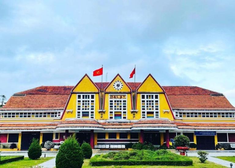
Da Lat Station is not only a unique architectural work of Da Lat city, but also a place that makes a special mark in the history of Vietnam Railways. Da Lat Station is located on Quang Trung Street (Ward 10, Da Lat City, Lam Dong Province), also the only train station in the Central Highlands region. Da Lat Station is associated with the history of formation and development of the "land of thousands of pines" urban area, considered the most beautiful ancient train station in Vietnam and Indochina. Da Lat Station was built from 1932 to 1938, located on the Thap Cham - Da Lat railway, connecting the plateau city with Phan Rang (Ninh Thuan). This railway line is 84km long, with an elevation difference of 1,500m, and was started in 1908 by order of Governor General of Indochina Paul Doumer. In 1932, the route was completed, which was also the time to build Da Lat station. The entire route has 12 stations and 5 underground tunnels. It is a special railway because it has 16km of cog railway climbing steeply, with an average slope of 12%. At that time, railways and locomotives with cog wheels only existed in Switzerland and Vietnam. In 1972, this railway line was destroyed by war. In 1975, the country was unified, this line was restored but only operated for a short time due to poor economic efficiency. The rail system and cog railway tracks were removed. The stations were abandoned. Dalat Railway Station was designed by two French architects, Moncet and Revéron, with bold indigenous architecture. The structure of the project is coherent and scientific, but the form is very sophisticated. The building has a symmetrical layout, with the architectural block in the middle simulating the three peaks of Langbiang Mountain and the roofs of the Central Highlands' communal houses; On both sides are two sprawling architectural blocks. In the middle of the building, outside, under the roof, there is a large clock face recording the time Dr. Alexan Dray Yersin discovered Da Lat. In the middle block, there are two front halls, one for passengers and one for cargo. Between these two paths is the train waiting area. This middle architectural block has only 1 floor with large space and a height up to the roof. Overall, the building's architecture is in harmony with nature and is a unique urban highlight. Da Lat Station was recognized as a national historical and cultural relic in 2001. Currently, Da Lat station has been separated from the Vietnam national railway system, but is still an attractive tourist destination. The station maintains a tourist train consisting of 1 locomotive and 4 carriages going back and forth to Trai Mat station (ward 11, Da Lat city), located in the east, 7km from Da Lat, about 25 minutes away. On this road, visitors can admire the romantic suburban landscape of the city. At the last stop is Trai Mat station, visitors can visit Linh Phuoc Pagoda (also known as Ve Chai Pagoda) - a famous and unique pagoda. In addition, Da Lat station still sells intermodal tickets on the Thong Nhat railway, departing from Nha Trang station (Khanh Hoa) and serving Da Lat - Nha Trang transit cars. Along with famous works of Da Lat such as: Cathedral, Bao Dai Palace, Da Lat Pedagogical College..., Da Lat Station is a destination not to be missed for tourists coming to the city. Da Lat. There is also an antique steam locomotive on display and a cafe located in a train car. The station's romantic scenery and ancient architecture is a place where many people come to "hunt" for beautiful photos Source: Vietnam National Tourism Administration
Lam Dong 3447 view
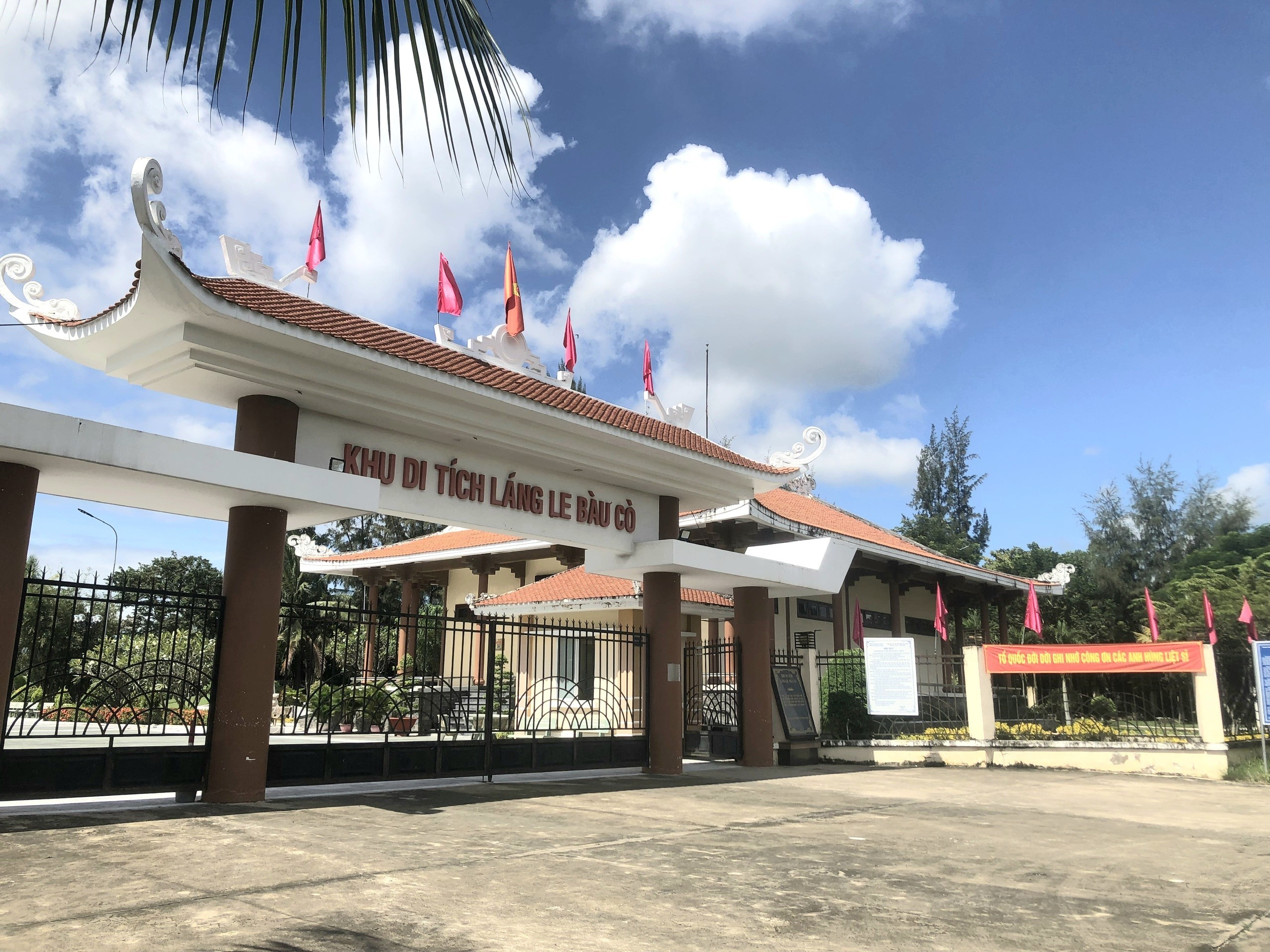
Lang Le Bau Co relic site is located in Tan Nhut commune, Binh Chanh district, Ho Chi Minh City. Lang Le Bau Co is associated with the resistance war against the French invasion in 1948 with major battles that went down in history. Lang Le Bau Co relic was recognized as a city-level historical relic in 2003. The reason it is called Lang Le Bau Co relic area is because the name of Lang Le Bau Co relic area was given by local people. The hamlet was established next to the interlaced canals and rivers. Lang Le Bau Co is located inside a large field with many shrimp, crabs, and fish. Along with many species of birds such as mallards, storks, teal, nuthatches, gongs, partridges, herons, and red armpits come to feed here. Therefore, Tan Nhut people call it by the familiar and rustic name Lang Le Bau Co. Lang Le Bau Co relic is considered the gateway to move to the center of Vuon Thom base and attack the enemy headquarters in Saigon. Previously, Lang Le Bau Co relic area was originally a field of overgrown reeds. On April 15, 1948, the French colonialists sent 3 thousand soldiers and many modern weapons to simultaneously attack the Lang Le Bau Co area to destroy the Vuon Thom base. At that time, the revolutionary armed forces in Lang Le - Bau, because of their small force and rudimentary weapons, had the help of local people along with the advantage of terrain. After just over half a day of fighting, it turned to attack, causing the French army to suffer a large number of casualties. The victory at Lang Le Bau Co killed 300 enemies, captured 30 mercenaries, and destroyed many machines, military vehicles, and guns of all kinds of the enemy. However, on our side, there are many officers and soldiers who heroically sacrificed their lives at a very young age. On October 14, 1966, in Lang Le, the Republic of Vietnam Army Ranger Battalion was destroyed by tourist militia. Lang Le Bau Co relic site has great historical significance for the people of Saigon in particular and the whole country in general. Faced with hatred for the French colonialists, Lang Le Bau Co's army and people fought a war of great historical significance that opened the door for our side and the enemy. For our side, the battle opened the door to heroism in a strong resistance position. As for the enemy, they had to retreat into a strategic position and were destroyed. The French colonialists could no longer form a strategy to defeat the Viet Minh. Moreover, at Vuon Thom base, Lang Le Bau Co also took place a determined battle to protect our base and destroy all sabotage plans of the enemy. Lang Le Bau Co relic area, after the Dong Khoi movement in 1960, was also a logistics and springboard for the armed forces to liberate Long An - Saigon - Gia Dinh. To commemorate the sacrifices of our compatriots and soldiers, in 1988 Binh Chanh district built a historical building in Lang Le Bau Co land with an area of 1000m2. Source: Ho Chi Minh City Electronic Information Newspaper
Ho Chi Minh City 10690 view
Tan Hiep Prison, also known as "Tan Hiep Correctional Center", is located in Quarter 6, Tan Tien Ward, Bien Hoa City. Tan Hiep Prison Relic was ranked as a national relic by the Ministry of Culture and Sports on January 15, 1994. Tan Hiep Prison is one of the six largest prisons in South Vietnam and the largest prison in the Southeast region, built in an important military position, northeast of Bien Hoa town. Ahead is National Highway 1; Behind is the North - South railway line. This is an isolated location, convenient for transportation, easy for protecting, guarding, receiving prisoners from other places and transferring prisoners to Con Dao, Phu Quoc... Tan Hiep Prison has an area of 46,520 square meters with 8 prisons, including 5 prisons for communist prisoners and patriots. The prison is surrounded by 4 layers of barbed wire with 9 bunkers, 3 watchtowers with a team of guards and a modern alarm system. It's called "Correctional Center" but inside is actually a gun warehouse, an interrogation and torture room with the most modern tools. Each prison only has an area of nearly 200 square meters but holds 300-400 people, sometimes up to a thousand people. In particular, there are "repentance" rooms and "tiger cages" that are very small and narrow and living conditions are extremely harsh, prisoners live like in a crematorium. The diet was extremely unhygienic. The prison guards bought rotten rice and rotten fish to fertilize the fields, and fried them in oil to feed the prisoners, leading to many people being poisoned. With the determination to escape the imperial prison, return to the Party and the people to continue fighting and liberating the nation, on December 2, 1956, with the agreement of the Eastern Inter-Provincial Party Committee, the soldiers Communists were "detained" in Tan Hiep prison under the direct direction of comrade Nguyen Trong Tam (Bat Tam) - in charge of the prison Party Committee and a number of other comrades who suddenly broke the shackles. was able to free nearly 500 comrades and patriots. This event caused a stir in the Pentagon. America - Diem hastily mobilized both main forces and security forces, civil guards defending the three provinces of Bien Hoa, Ba Ria, Thu Dau Mot and two special forces to encircle and capture the prisoners, but all were defeated. failure. Our comrades and compatriots who escaped from Tan Hiep prison received help and protection from local facilities and returned safely to base. Among the escaped prisoners were comrades: Bay Tam, Hai Thong, Ly Van Sam... who became the core nucleus of the Dong Khoi movement later. In 2001, to partly recreate the crimes of the US - Diem against our comrades and compatriots imprisoned at Tan Hiep prison and describe the entire Tan Hiep uprising on December 2, 1956. , Dong Nai Museum has collected images, documents, and artifacts displayed at the relic and made a model to serve the research and sightseeing needs of all classes of people. Every day, the monument is open to visitors. Source: Dong Nai Electronic Newspaper
Dong Nai 9618 view
Nguyen Huu Canh temple, also known as Binh Kinh communal house, is located on the left bank of Dong Nai river, formerly belonging to Binh Kinh hamlet, Binh Hoanh village, Tran Bien canton, now Nhi Hoa hamlet, Hiep Hoa commune, Bien Hoa city. It was ranked as a national historical relic by the Ministry of Culture, Information, Sports and Tourism on March 25, 1991. Nguyen Huu Canh Temple was built around the end of the 18th century. Initially, the temple was small in scale, with walls made of boards and a yin-yang tile roof, about 400m south of the current temple. Documents say: the temple was first rebuilt in the fourth year of Tu Duc (1851); By 1923, the temple was rebuilt at its current location. Nguyen Huu Canh was born in 1650 in Gia Mieu, Tong Son district, Thanh Hoa province in a family with many famous generals in the dynasty. He was a man of both literature and martial arts, accomplished many great victories and was trusted, loved and respected by Lord Nguyen. In the spring of the year Mau Dan (1698), he obeyed Lord Nguyen's order to invade Dang Trong while it was still very desolate. Arriving in Dong Nai, he set up his headquarters at Cu Lao Pho (now Hiep Hoa commune); took Dong Nai land as Phuoc Long district, built Tran Bien palace, took Saigon land as Tan Binh district, built Phien Tran palace, the land expanded thousands of miles. He recruited immigrants to settle down, organized the administrative apparatus gradually and systematically, encouraged land reclamation, and promoted Cu Lao Pho to develop into one of the busiest and most dynamic port towns throughout the century. 18 and officially annexed the new land of the South into the Dai Viet map. After returning from the invasion of the South, the following year he again served Lord Nguyen Phuc Chu's command to lead an army to suppress King Chan Lap and maintain the southern border region. In April of the year Canh Thin (1700), after completing his mission, on the way back to Rach Gam (Tien Giang), he fell ill and passed away on the 16th day of the 5th lunar month, at the age of 51 years old. On the way to his hometown for burial, his coffin was stopped at the land where he once had his headquarters on Cu Lao Pho so that local people could have the opportunity to say goodbye to him one last time. At the mandarin's communal house, local people built a tomb to remember this event. When hearing the news of Nguyen Huu Canh's death, Lord Nguyen was extremely sorry and conferred on him the title of High-ranking official of the Town Chancellor with the title: Thanh Marquis Ceremony and had his tablet enshrined at the Thai temple. Source: Dong Nai Electronic Newspaper
Dong Nai 7640 view
La Nga Victory Relic (at km 104-112 on Highway 20 to Da Lat, in Phu Ngoc commune, Dinh Quan district) was ranked a national historical relic by the Ministry of Culture on December 12, 1986. To cheer for the Viet Bac victory in the fall-winter of 1947 and also to deal a fatal blow to the enemy, the command board of squad 10 decided to organize a big battle, to show the enemy that the Vietnamese people were , Vietnamese people do not easily submit to any enemy; With a spirit of courage and ingenuity after nearly half a year of preparation, studying the terrain, and choosing a location: at 15:12 on March 1, 1948, the La Nga ambush battle began and ended at 15:12 on March 1, 1948. 15:57 on the same day, in just 45 minutes. The victory of La Nga delighted the people of Dinh Quan in particular and the people of Dong Nai in general. This is a victory that demonstrates the cunning and courage of our army and people, causing the enemy to be stunned and defeated. From this victory, our force grew stronger and stronger, contributing to defeating the enemy's plan to attack quickly and win quickly, forcing them into a passive position. The scenic complex of Chong Rock, Mai Waterfall, La Nga River and La Nga Victory Monument is an interesting tourist complex of Dinh Quan. The amazing beauty of Hon Ba Chong, Da Voi Mountain, Hon Dia, along with the natural pagoda at the foot of the rocky mountain are typical clusters that create a harmonious beauty for the Da Chong scenic area. Dinh Quan Da Chong Complex is also a place that retains traces of prehistoric life. Here, under the stone roofs, along the streams and on the slopes along the valley, many production and daily life tools of the ancients made of stone, bronze and terracotta were discovered. During the 30-year resistance war. Dinh Quan is an important part of War Zone D. Da Chong witnessed the formation, development, stationing, and combat deployment of revolutionary forces. Today, a part of the land of Da Chong Dinh Quan scenic area has been used and built into the Dinh Quan District Cultural and Sports Center. In the near future, Da Chong Dinh Quan scenic area will be invested in and renovated, contributing to making the natural landscape more beautiful and becoming an attractive eco-tourism destination. Source: Dinh Quan District People's Committee
Dong Nai 7639 view
Chot Mat Tower Historical-Cultural Relic, located in Xom Thap hamlet, Tan Phong commune, Tan Bien district, Tay Ninh province, was recognized by the Ministry of Culture and Information (now the Ministry of Culture, Sports and Tourism) as historical - cultural relic on July 23, 1993. Also one of the last three ancient towers remaining in the South of our country. Having undergone many restorations in 1938, 2003 and most recently in 2013. Despite undergoing restorations, the Chot Mat ancient tower relic site has given itself a new look but still remains retains the spirit of ancient architecture. The entire Tower is built of brick and slate with the top of the tower tapering upward, from the ground to the highest point of the tower is estimated to be 10m. In addition, this ancient tower is located on a high mound in the middle of the field, so from a distance it looks like a pen rising gradually. In 2003, the People's Committee of Tay Ninh province decided to approve the investment project to restore, embellish and preserve Chot Mat tower relics and carried out the restoration, restoration, display and opening of the excavation pit in 2003. into use. On November 27, 2019, the Provincial People's Committee issued a Decision regulating the decentralization of management, protection and promotion of the value of historical and cultural relics and scenic spots in Tay Ninh province. Decision to assign the People's Committee of Tan Bien district to directly manage 4 relics, including the National Historical-Cultural relic Thap Chot Mat. In particular, the Chot Mat Tower Historical-Cultural Relic in Tan Phong commune, Tan Bien district was chosen to be part of the tourism development link of Tay Ninh Province. This is a tourist destination worth exploring, contributing to tourism development in Tan Phong commune in particular and Tan Bien district in general. Source: Tay Ninh province electronic information portal
Tay Ninh 6994 view
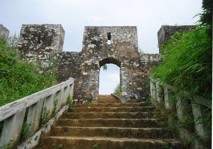
During the period when the Mac dynasty had its capital in Cao Bang, in order to prevent the Le dynasty from attacking, the Mac dynasty restored and repaired Na Lu citadel (now in Hoang Tung commune, Hoa An) and Ban Phu citadel (now in Hung Dao commune). ), Phuc Hoa citadel, in addition to building many other citadels in Cao Bang, making Cao Bang a political and military center in the far Northeast border region at that time. Na Lu citadel and Phuc Hoa citadel are two citadels built before. According to the records of Be Huu Cung in Cao Bang Thuc Luc, Na Lu citadel and Phuc Hoa citadel began in the reign of Tang Y Tong in the year Giap Than, the 5th Ham Thong era (874). Based on the presence of many ancient tombs with stone inscriptions containing the names, addresses, and hometowns of the citadel builders who died here during the Ham Thong Dynasty, it can be confirmed that these two citadels were built during the Tang Dynasty. Na Lu Citadel was built over many different dynasties. When the Mac dynasty came to Cao Bang, it was rebuilt with bricks. Na Lu citadel has a nearly rectangular shape, has a total area of about 37.5 hectares, a length of about 800 m, a width of about 600 m, the citadel has 4 gates. Ban Phu citadel in the capital of Nam Binh, Nam Cuong country of Thuc Phan in the past in Cao Binh (Cao Bang), the Mac dynasty renovated the royal palace in the inner circle of the old capital of Nam Binh and called it Ban Phu citadel or Royal Palace. In the ancient capital of Nam Binh of the Nam Cuong country and the Mac dynasty, Ban Phu citadel still has clear traces. The capital city of Nam Binh consists of two citadels, to protect the citadel, the outer ring has a circumference of about 5 km, including a low hillock area, around the foot of the hill is covered with vertical canvas like a wall, convenient for navigation. Build defense lines. The western wall of the citadel runs parallel to the bank of the Bang River to the beginning of Bo Ma village, connecting the southeast wall of the citadel, flowing in front of Ban Phu, following the foot of the hill to meet National Highway 4, the northeastern side running along the foot of the hill close to the outside of National Highway 4. , up to the top of the mound is the northwest side, continue running along the foot of the hill, out to the river bank and meet the west wall, forming a closed citadel. When the Mac Dynasty established the capital, it repaired and built a number of additional works, in which Ban Phu Citadel (inner citadel - the king's working place) was built higher on the old citadel walls from the Thuc Phan period. The citadel is located on a flat land. Along with rebuilding the capital, the Mac dynasty also built a system of posts and ramparts quite thick around the capital and a number of important border points, forming a system of protecting the capital and protecting the border. gender. Phuc Hoa citadel (Phuc Hoa district) was built in a square style, about 400 m in each direction, including two citadel rings, the distance between the two rings is 80 m. Currently, the southern wall has been completely destroyed. Phuc Hoa Citadel has 2 main gates: The North Gate is open to the national highway to Ta Lung Border Gate today, people often call it Pac Gate, this gate is built in a rectangular style, 8 m wide, 5 m high. , including two gates made of thick, very sturdy wood; The second gate is in the south, opening to the river bank. Both gates were flattened long ago, and now there are no traces left. Near the citadel, in the northwest suburbs along the riverbank, there are many traces of brick kilns. People said that during the process of labor and exploration, many intact brick kilns were found in this area. Through research and surveys, it has been shown that in Cao Bang, the Mac dynasty renovated, embellished and built many citadels and fortresses, including repairing, embellishing and rebuilding Ban Phu citadel, Na Lu citadel, and Phuc citadel. Hoa. These fortifications have formed a quite solid system of protecting the capital. Up to now, of the ancient citadels built by the Mac Dynasty during the capital period in Cao Bang, some of the citadels built of earth only have traces left, but the citadels built of stone are still very clear. Source: Cao Bang Electronic Newspaper
Cao Bang 6451 view
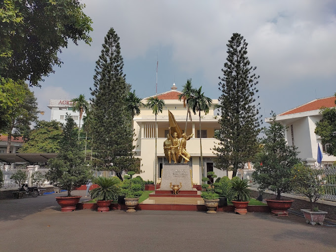
Hoc Mon District Palace is located at No. 1, Ly Nam De Street, Hoc Mon Town, (next to the District People's Committee headquarters) and is the place where many outstanding fighting events have been recorded throughout the long history from 1885 to the Southern days. Complete liberation of the People of 18 Betel Garden Villages. After defeating Chi Hoa Fort, the French colonialists built a 3-storey wooden house here to use as a military post. When Tran Tu Ca took office as Governor of the Palace, he used the Station as the Palace of Binh Long district. Originally a cunning drunkard of the French colonialists, Tran Tu Ca was led by a group led by Mr. Phan Van Hon (Quan Hon) and Nguyen Van Qua (Chanh Lanh Binh) of nearly 1,000 insurgents who came to burn the District Palace, captured and head cut off in the middle of the market. That was February 8, 1885, At Dau Tet. Afterwards, Hoc Mon District Palace was rebuilt with a blue stone foundation, brick walls, and a defense system from the upper floors to the fence. The architecture is similar to the Military Fort, so the locals call it Hoc Mon Fort. Tran took over from Tran Tu Ca as Governor of Ngon district, moving to Tra District and then Tho District. This was a long period of time when the people of the Hoc Mon region suffered from many cruel and despicable scenes from the French colonialists and their oligarchic henchmen mentioned above. With the indomitable tradition of Hoc Mon people. On June 4, 1930, around 6 a.m. in front of the District Palace, hundreds of Hoc Mon people protested demanding "abolition of poll tax, reduction of license and market taxes, and granting land to poor farmers." Tra District invited the leaders into the Palace to negotiate, but they cunningly arrested them, including Mr. Le Van Uoi (Secretary of Tan Thoi Nhi Commune), who was the leader of the protest. People were undaunted and fiercely demanded that Tea District release those detained. The protest group became more and more crowded, the fighting spirit spread somewhat, causing Tra District to give in. On the one hand, they released the detained people, on the other hand, they called the officials in Saigon for help. 2 hours later, the struggle was led by two men, Blachole and Nobbot, who opened fire on the protest group, causing many casualties. But the most impressive historical event at Hoc Mon District Palace was the Southern Uprising on November 23, 1940. Hoc Mon Fort is very solid, built of green stone like a fortress, about 15 meters high, has a gun emplacement and a defense system with battlements guarded by a platoon of green soldiers. On November 22, 1940, France reinforced one more platoon to deal with the situation. On the afternoon of November 22, 1940, Mr. Do Van Coi's army broke into the town, disguised as civilians, ambushed behind the Station waiting for orders to rob the Station. Another army wing has the task of destroying bridges, cutting down trees blocking roads, and occupying offices and houses... The army wing from Phuoc Vinh An, Tan Thong, Tan An Hoi, Tan Phu Trung is led by Mr. Pham Van Sang and Dang Cong Binh commanded, started from Ben Do hamlet, attacked the house, killed 1 person, collected 4 guns, and took control of the situation here (Tan Phu Trung). Immediately this army was ordered to pull back to Hoc Mon. The Long Tuy Thuong army was commanded by Mr. Bui Van Hoat. The army of General Long Tuy Trung was commanded by Mr. Do Van Day and Le Binh Dang. At around 24:00 on the night of November 22, 1940, the sound of artillery fire had not yet been heard in Saigon. After consulting, the army commanders united to attack the enemy's post. Immediately the troops headed straight to Fort Hoc Mon, where District Chief Bui Ngoc Tho resided. Two insurgents named Nghe and Kinh volunteered to enter the front gate and sacrificed their lives. Insurgents from all directions rushed into the Fort like water bursting its banks. Faced with the power of the insurgents and the masses, the soldiers in the Station no longer had the spirit to resist and fled in disarray. The insurgents completely occupied the inside of the station, but upstairs, the enemy still stubbornly used guns to shoot sporadically, at the same time calling Saigon and Thu Dau Mot for emergency help. Because he was eager to capture the name of Tho District, comrade Do Van Day climbed up to the upper floor of the Station by clinging to the gutter. Halfway up, he was hit by bullets, the comrade fell and died later. The battle was at a standstill when enemy reinforcements arrived. Unable to hold out, the insurgents withdrew from the town, dispersed to the villages, the armed forces withdrew to Ben Do hamlet (Tan Phu Trung) and then moved to My Hanh hamlet (Duc Hoa). Although the attack on Hoc Mon Fort (later called Hoc Mon District Palace) failed, it left a deep impression in the hearts of all civilians admiring the courage of revolutionary soldiers in the fight against colonialism. steal the country. During the historic Ho Chi Minh campaign, at 7:00 a.m. on April 30, 1975, Hoc Mon town was completely liberated, the National flag fluttered above the District Palace, where District Chief Nguyen Nhu Sang and his gang sai has been running away since last night. Today, Hoc Mon District Palace is chosen as the District Museum, where many documents are displayed, illustrating the ups and downs of historical periods as well as the revolutionary fighting spirit of the army and people in Hoc Mon district over the past two years. resistance war against French colonialism and American imperialism. A monument placed in front of the Hoc Mon District Palace relic represents the indomitable sacrifice of the army and people of 18 Betel Garden Villages, recognized as a national historical and cultural relic. Source: Hoc Mon District People's Committee
Ho Chi Minh City 6404 view
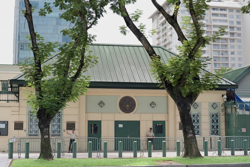
The US Embassy relics, also known as the "White House of the East", are the origin of sinister military and political plots aimed at long-term annexation of Vietnam. The relic site is a 5-storey building built Built in modern architecture, located at the corner of Mac Dinh Chi - Le Duan Street, Ben Nghe Ward, District 1, Ho Chi Minh City, on a plot of land nearly 5,000 square meters. Previously, the US embassy was located at 39 Ham Nghi Street. At around 10:00 a.m. on March 30, 1963, the US embassy on Ham Nghi Street was hit with explosives by the F21 Commando team, collapsing three floors: 1, 2, 3, so the US decided to rebuild it. Construction began on the building in 1965, most of the materials and construction machinery were transported from the US, under the control of American engineers. According to the design, the building is surrounded by 7,800 Taredo stones that can withstand mines and artillery shells. The main door is equipped with thick steel, the other doors are blocked by a special thick bulletproof layer. All doors use automatic systems, including iron doors blocking the way to the upper floors. Inside the building there are 140 rooms with 200 staff serving day and night. In addition, next to the building is also built an additional row of houses called the "Norodom" area exclusively for C.I.A. employees. When inaugurated, the building had only 3 floors. At the end of 1966, two more floors and a terrace were built to serve as a landing place for helicopters. Surrounding the building is a 3m high wall, at both ends of the wall close to Le Duan Street, 2 high blockhouses are built, guarded day and night. The Embassy was completed in September 1967 with a defense system such as a fortress with 60 guards, a bomb shelter, and a radar screen system to control the facade. Immediately after the building was completed, on September 24, 1967, thousands of students flocked to the gate of the US Embassy to fight for "America to stop bombing the North", "America to go home" and issued a notice denouncing the US for "trampling and seriously violating the right to self-determination of the Southern people". But the outstanding event that happened at the US Embassy was the battle of the City Rangers during the General Offensive and Uprising in the Spring of 1968. The target of attacking the US Embassy was added on January 24, 1968 by Ngo Thanh. Van is in charge of general affairs. Ranger Team 11 took on this important mission, including captain Ut Nho (military region reconnaissance captain) and soldiers: Bay Truyen, Tuoc, Thanh, Chuc, Tran The Ninh, Chinh, Tai, Van, Duc, Cao Hoai Vinh, Mang, Sau and 2 drivers: Tran Si Hung and Ngo Van Thuan. Another equally humiliating event for the US Embassy was the chaotic escape that occurred on April 29 and 30, 1975 by the US and its accomplices. Faced with the rapid attack of the Vietnamese army and people in the historic Ho Chi Minh campaign, over 1,000 Americans and more than 5,000 pro-American Vietnamese jostled, pushed, and kicked each other to compete for a place on the terrace of the building. building to be rescued by helicopter. This relic was granted a certificate of recognition by the Ministry of Culture on June 25, 1976. Currently, the US Embassy building has been demolished and a new consulate in Ho Chi Minh City has been built, but next to it is a memorial stele forever remembering the achievements of the special forces soldiers who died in the battle. . Source: Ho Chi Minh City Youth Union
Ho Chi Minh City 6338 view
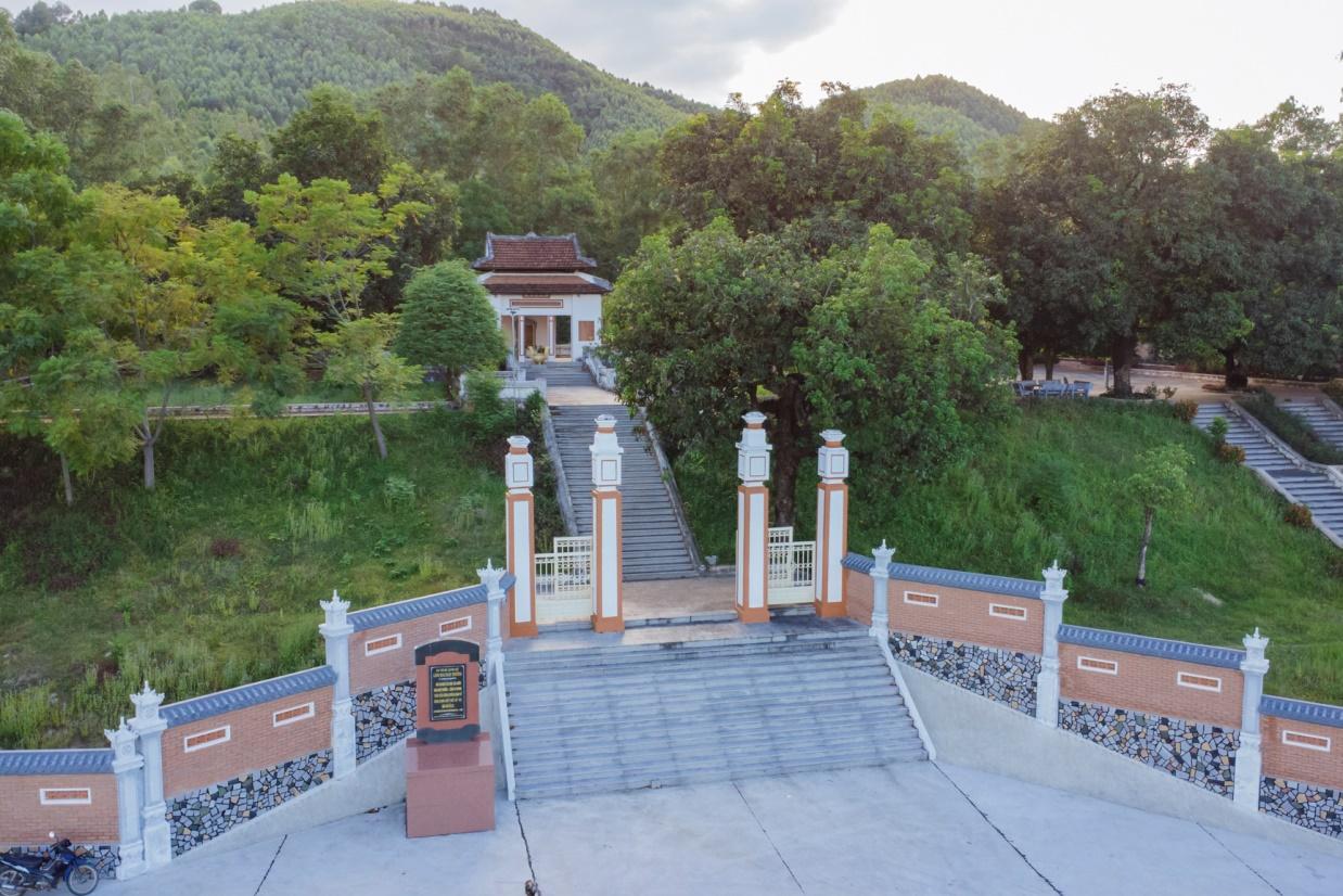
Mai Xuan Thuong was the leader of the Can Vuong movement against the French at the end of the 19th century in Binh Dinh. Mai Xuan Thuong was born in the year of Canh Than, 1860, died in the year of the Pig, 1887, from Phu Lac village, Phu Phong district, Tuy Vien district, Binh Dinh province (now Phu Lac village, Binh Thanh commune, Tay Son district, Binh Dinh province). His father, Mai Xuan Tin, was the chief father in Cao Bang. His mother, Huynh Thi Nguyet, was the daughter of a noble family in the village. Mai Xuan Thuong is inherently intelligent and eager to learn. At the age of 18 (1878), he passed the Baccalaureate at Binh Dinh Examination School. At the age of 25 (1885), he passed the bachelor's exam. Responding to King Ham Nghi's Can Vuong edict, Mai Xuan Thuong returned to his hometown of Phu Lac, recruited insurgents, set up a base on Sung island to raise the Can Vuong flag against the French, then Mai Xuan Thuong brought his forces to join the army. The insurgent army was led by Dao Doan Dich and was appointed by Dao Doan Dich to the position of Military Salary Officer (in charge of food for the insurgent army). From then until 1887, the Can Vuong movement in Binh Dinh developed strongly and spread to Quang Ngai, Phu Yen... attracting tens of thousands of people from all walks of life to participate. On September 20, 1885, Dao Doan Dich died and assigned all his forces to Mai Xuan Thuong. He chose the Loc Dong mountain area (now in Binh Tuong commune, Tay Son district) as his headquarters and organized a flag worshiping ceremony, calling on scholars, literati, and people to join the movement to fight against the French. During that ceremony, insurgents from many regions in Binh Dinh province agreed to honor him as the Marshal leading the uprising and raised the slogan: "First to kill the left, later to attack the West". In early 1887, the French army under the command of Lieutenant Colonel Cherrean and the royal army led by Tran Ba Loc along with Minister Trira launched a major attack on the headquarters of the Can Vuong movement in Binh Dinh, the battle The fighting between the insurgent forces and the French enemy was extremely fierce, the fight was unequal, and in the end the insurgent force was pushed back. In March 1887, after a fierce battle in Bau Sau (An Nhon town, Binh Dinh province), Mai Xuan Thuong was seriously injured, the insurgents withdrew to Linh Dong secret area. On April 21, 1887, Tran Ba Loc surrounded and captured the Linh Dong secret base and captured a number of insurgents, including Mai Nguyen Soai's mother. On the night of April 30, 1887, Mai Xuan Thuong sent a suicide squad to break into Tran Ba Loc barracks, relieve the captured people, and he and a group of 50 subordinates crossed the mountain into Phu Yen and continued to resist. battle, but when she reached Phu Quy Pass (boundary between Binh Dinh and Phu Yen), she was captured by Tran Ba Loc's ambush and taken to be beheaded at Go Cham (East of Binh Dinh Citadel). The mausoleum of patriot Mai Xuan Thuong is located on a high hill of the Ngang mountain range (in Hoa Son village, Binh Tuong commune, Tay Son district, Binh Dinh province) about 50km northwest of Quy Nhon city; The mausoleum was built on a land area of 1988m2, inaugurated on January 22, 1961. Overall, the mausoleum is designed in the style of an ancient mausoleum, surrounded by low walls. The Lang gate (three gates) is made up of 4 square pillars, the top is tied in the style of a gourd and a vase, bearing the architectural appearance of a communal house or temple gate of the late 19th century. In the middle of the Mausoleum is Mai Xuan Thuong's tomb, rectangular in shape in the East - West direction; At the head of the grave is a stone stele engraved with an inscription recording the biography and career of Mai Xuan Thuong: The relic was ranked at the National level by the Ministry of Culture and Information on April 20, 1995. Source: People's Committee of Tay Son District, Binh Dinh Province
Gia Lai 6201 view
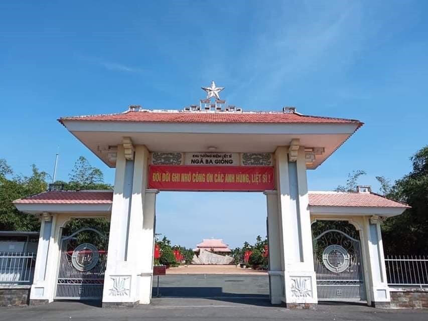
Nga Ba Giong relic is a revolutionary historical relic located in Hamlet 5, Xuan Thoi Thuong commune, Hoc Mon district. Surrounded by three roads: Phan Van Hon, Nguyen Van Bua and Provincial Road 19. Nga Ba Giong relic site is a memorial site for historical events in two wars against foreign invaders. Recognized as a national historical site in 2002. Giong Junction (also fully known as Giong Bang Lang Junction) is located in Xuan Thoi Tay village, part of 18 old betel garden villages formed from 1698 to 1731. For a long time, Giong Junction is a place with a folk name that has entered the history of the hometown of 18 betel garden villages of Hoc Mon - Ba Diem. Legend has it that in the past, this place was a relatively high land and a place where many linden trees grew, so this place got its name from there. After the Southern Uprising (November 23, 1940) failed, the French colonialists increased their repression and fierce terror against the revolutionary movement in the Hoc Mon - Ba Diem region. They set up three shooting ranges in Hoc Mon to kill Party leaders and patriotic comrades from their hometown of Hoc Mon and surrounding areas. Giong intersection is the third shooting range to record the heinous crimes of the French enemy and his henchmen against the people of Hoc Mon. Learning from the experience of 2 previous shooting ranges (1 at the old theater in the center of Hoc Mon District, 1 next to the well behind Hoc Mon Hospital today), they executed public shootings, forcing people to come and watch for the purpose of intimidation. revolutionary spirit of Hoc Mon people. But that firing squad backfired. The Hoc Mon people witnessed with their own eyes the cruelty of the French colonialists and the noble sacrifices of the communist soldiers, so their patriotic fire flared up even more fiercely. . For this third shooting range, they did not dare to build it near the center of the District anymore, but moved it to the Giong Junction area as a desolate, sparsely populated area to avoid people's resistance. Here, they built a shooting range with a solid mound of land 12m long, 2.2m high, in front of which were planted 6 shooting posts, each 1.7m high, the shooting direction facing the field (Ba Tram Lac). In 1941, here they secretly executed many times without letting the people see, hundreds of communist soldiers and patriots were killed by them. With the extremely sacred historical significance of Giong Junction, the place that marked the barbaric crimes of the French invaders, the place that demonstrated the indomitable fighting will and noble sacrifices of our comrades and compatriots later on. the Southern Uprising (November 23, 1940); After the complete liberation of the South (April 30, 1975), Hoc Mon district quickly restored and embellished the Nga Giong Junction revolutionary historical relic site to educate traditional generations of youth. This place has become a tourist attraction and a place to organize traditional festivals during major annual holidays of Hoc Mon district and the city, especially the anniversary of Southern Uprising Day (November 23). Currently, with the consent of the city, the district is renovating and building Giong Junction into "Giong Junction Martyrs' Memorial Area". Source: Hoc Mon electronic information portal
Ho Chi Minh City 6096 view
 vn
vn en
en ja
ja ko
ko zh
zh