
 vn
vn en
en ja
ja ko
ko zh
zh


















List of tourist attractions (1624)
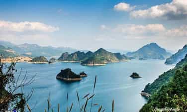
Thung Nai – Ha Long on land
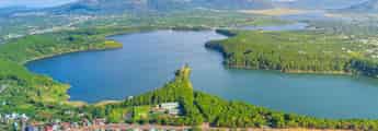
Thung Nai in recent years has been a familiar destination every weekend for those who love peace, avoiding noise and dust. As a commune in Cao Phong district, Hoa Binh province, Thung Nai is located in the bed of Da river lake, 25 km from the city center and about 110 km from Hanoi. With the perfect combination of mountains, islands and clear blue lakes, Thung Nai brings poetic beauty and relaxing moments. Thung Nai in recent years has been a familiar destination every weekend for those who love peace, avoiding noise and dust. As a commune in Cao Phong district, Hoa Binh province, Thung Nai is located in the bed of Da river lake, 25 km from the city center and about 110 km from Hanoi. The name Thung Nai makes many people think of a valley with deer roaming around. According to local people, this place was once home to many species of wild deer. The poetic image of golden deer bewildered in the afternoon sunlight on the slopes, reflecting on the Da River, was used by people to name this land. Nowadays, coming to Thung Nai, although there are no longer wild deer, the poetic and romantic beauty of the mountains and rivers here seems to still be intact. To explore this "golden deer valley", you can only use a boat or walk. Leave the car on the shore, the motorboat will take tourists for a tour on the hydroelectric lake. In the strong wind blowing from the lake, the picturesque scene of Thung Nai appears before your eyes. A large lake surrounded by rolling mountains. In the lake, hundreds of large and small "islands" undulate like magnificent natural masterpieces. Floating on the water, the motorboat weaves through the rocky outcroppings, creating the feeling of enjoying "Ha Long on land". A perfect combination of rivers, lakes and mountain rocks, Thac Bo cave is a destination not to be missed when coming to Thung Nai. The cave is located deep inside the mountain and is quite wild, but the scenery inside is beautiful. The whole forest of stalactites grows up and down, with strange shapes. After the high water season, visitors entering the cave can enjoy schools of fish swimming freely in the shallow, clear water. Right near the cave is Ba Chua Thac Bo temple. Although the temple is quite small and located on a steep mountain slope, this place attracts many tourists from all over to worship. For many people, stopping at the temple is an opportunity to enjoy the beauty of Thung Nai from a high perspective with floating white clouds and glimpses of ethnic villages. An interesting thing here is that when the Da River water dries up, visitors to the temple have to climb up steep stone steps, sometimes stumbling. But during the high water season, the steps flood, visitors to the temple just need to step down from the boat. If you go on Sunday, don't forget to visit Thac Bo floating market. Not too noisy and crowded, but a very typical cultural feature of the Muong people in Thung Nai. Thung Nai in recent years has been a familiar destination every weekend for those who love peace, avoiding noise and dust. As a commune in Cao Phong district, Hoa Binh province, Thung Nai is located in the bed of Da river lake, 25 km from the city center and about 110 km from Hanoi. The name Thung Nai makes many people think of a valley with deer roaming around. According to local people, this place was once home to many species of wild deer. The poetic image of golden deer bewildered in the afternoon sunlight on the slopes, reflecting on the Da River, was used by people to name this land. Nowadays, coming to Thung Nai, although there are no longer wild deer, the poetic and romantic beauty of the mountains and rivers here seems to still be intact. To explore this "golden deer valley", you can only use a boat or walk. Leave the car on the shore, the motorboat will take tourists for a tour on the hydroelectric lake. In the strong wind blowing from the lake, the picturesque scene of Thung Nai appears before your eyes. A large lake surrounded by rolling mountains. In the lake, hundreds of large and small "islands" undulate like magnificent natural masterpieces. Floating on the water, the motorboat weaves through the rocky outcroppings, creating the feeling of enjoying "Ha Long on land". A perfect combination of rivers, lakes and mountain rocks, Thac Bo cave is a destination not to be missed when coming to Thung Nai. The cave is located deep inside the mountain and is quite wild, but the scenery inside is beautiful. The whole forest of stalactites grows up and down, with strange shapes. After the high water season, visitors entering the cave can enjoy schools of fish swimming freely in the shallow, clear water. Right near the cave is Ba Chua Thac Bo temple. Although the temple is quite small and located on a steep mountain slope, this place attracts many tourists from all over to worship. For many people, stopping at the temple is an opportunity to enjoy the beauty of Thung Nai from a high perspective with floating white clouds and glimpses of ethnic villages. An interesting thing here is that when the Da River water dries up, visitors to the temple have to climb up steep stone steps, sometimes stumbling. But during the high water season, the steps flood, visitors to the temple just need to step down from the boat. If you go on Sunday, don't forget to visit Thac Bo floating market. Not too noisy and crowded, but a very typical cultural feature of the Muong people in Thung Nai. As the boat slowly moves through the water, the windmill stands tall on the small island, attracting the attention of anyone passing by. This is like the invitation of a vacation home in the middle of the lake. Therefore, whether they come back during the day or stay overnight, most tourists coming to Thung Nai want to stop by this small island to see with their own eyes the seemingly unique windmill. in the Netherlands, or in the famous novel "Don Kihote - the talented nobleman of Manta". Not only is it unique, the windmill here also has a beautiful viewing spot. From here, you can zoom out into the distance, taking in the entire ink painting of Thung Nai in your sight. If you go up the "mill" early in the morning, you will see Thung Nai engulfed in mist, while when the sun rises, the clear blue lake surface sparkles yellow. In addition to the pristine natural landscape, the specialty parties of the Muong people have become a highlight in Thung Nai. It was a meal with stream fish, hill chicken and exotic wild vegetables.
Phu Tho
5857 view


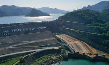
Hoa Binh hydroelectric plant
Hoa Binh Hydropower Plant was built at Hoa Binh Lake, Hoa Binh province, on the Da River in Northern Vietnam. Before Son La hydroelectric plant was inaugurated, this was the largest hydroelectric plant in Vietnam and Southeast Asia. Hoa Binh Hydropower Plant - a century project built with help from the Soviet Union in 1979 in Hoa Binh City. Where Soviet experts and tens of thousands of engineers and workers, many of whom were teachers and students from the Faculty of Civil Engineering - Water Resources University, had unforgettable years, with determination and thirst. A burning desire to create miracles in conquering the Da River. On the largest scale construction site in Southeast Asia at that time, at peak there were up to 40,000 workers working. Although there are still many difficulties, lack of electricity, lack of water, hard and dangerous work, the enthusiasm of working youth has urged the hands and minds of engineers and workers to turn the river into a source of doll. Everyone did not care about difficulties and hardships, enthusiastically working up to 3 shifts, 4 shifts, all night long "for the tomorrow's electricity of the Fatherland". Labor slogans have now become legendary such as "High altitude". 81 or die" has shown the spirit of working urgently, enthusiastically, and overcoming difficulties of the young generation on the construction site. People's efforts and efforts to overcome all time and all dangerous terrain have been rewarded. On December 31, 1988, the first generating unit of Hoa Binh Hydropower Plant generated electricity to the system, signaling a historic moment for the country and the Vietnamese Electricity industry. On April 4, 1994, the eighth and last power unit of the plant was officially completed, with a total installed capacity of 1,920 MW. On December 24, 1994, our country excitedly celebrated the important event of the inauguration of the Hoa Binh Hydropower Plant on the Da River, marking the result of 15 years of selfless labor for the electricity of tomorrow for the Fatherland. Tens of thousands of officials, employees and experts on the construction site were constructing for the first time a great project of the twentieth century. After more than 30 years of operation, by 2021, the plant has provided the country with a total output of over 250 billion kWh, annually contributing more than 1,000 billion VND to the province's State budget. In addition, TDHB actively and effectively participates in flood control, ensuring safety for the Northern Delta and Hanoi Capital. With a large reservoir capacity of up to 10 billion cubic meters of water, the flood prevention capacity Flood estimated at 5.6 billion cubic meters, Hoa Binh hydropower plant has made a great contribution to flood prevention, ensuring safety for the entire Northern Delta region, especially Hanoi capital. Since the Hoa Binh Hydropower Plant was put into operation until now, the Northern Delta region has no longer had flooding. TDHB has controlled dozens of major floods of over 10,000 m3/sec; Typically, the historic flood in August 1996 had a flow of more than 22,650 m3/sec; The late flood that appeared in October 2017 (when the reservoir was full) had a flow of nearly 16,000 m3/sec with very complicated and unpredictable developments. At the same time, maintain the safety of the project and the downstream area of the Northern Delta.
Phu Tho
7034 view


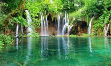
Nine waterfalls Tu Son
Nine waterfalls Tu Son includes 9 waterfalls, each waterfall possesses its own unique beauty, both unique and blending together to create a beautiful landscape that makes many people ecstatic and fascinated. These include Au Co love waterfall, Tien Tam waterfall, Trai Chieu Quan Lang waterfall, Ut Lot waterfall, Silver waterfall, Truong Phu waterfall, Thuong Ngan month, Mau waterfall and Thien Ngoc Thach waterfall. Nine waterfalls are located in Kim Boi nature reserve, Cu hamlet, Tu Son commune, Kim Boi district, Hoa Binh province and about 60 km from the center of Hanoi capital. Therefore, this is an ideal rendezvous for people in Hanoi and neighboring provinces to have the opportunity to leave the hustle and bustle of the city and wander to pristine nature on short holidays or weekends. . Walking on the trail around those waterfalls, you will feel like you are going on an exciting trekking trip in a primeval forest with a poetic space and fresh, airy atmosphere. Somewhere you will also see a few wildflowers blooming, a few small squirrels on the rows of green trees. You will also listen to the roaring sound of the waterfall and the chirping of birds. The beautiful scenery will make you more excited, and the long journey will no longer be tiring. Continuing your journey to explore different waterfalls one by one, you will encounter enchanting waterfalls, containing the magical beauty of nature. These waterfalls have beautified the wild space, making it more poetic, sparkling, and charming. That scene not only makes you more excited and eager to explore nature, but also connects you and nature, making you even more connected and familiar. In the early mornings, the scenery around the waterfalls becomes dim and magical, making travelers from far away admire it in amazement. When the sun comes out to give bright yellow rays of sunlight, the water color of the waterfalls has a slight yellow tint, then at sunset it changes to a shimmering pink color. Perhaps the most beautiful time the waterfall is when a colorful rainbow spans across the "silver silk ribbons", illuminating the entire sky. Au Co Waterfall is located in the upper reaches of Tu Son peak at an altitude of about 1300 m above sea level. With this waterfall, travelers from far away will feel like they are admiring a shimmering silver silk strip in the middle of the ocean, like the long, silky hair of a young girl. Tiny sparkling water sprays illuminate a corner of the forest and vague, dreamy images flicker behind the waterfalls. Au Co Love Waterfall flows into Lac Long Quan Lake, next to it there is a giant round stone block, associated with the legend of the eternal love story between Au Co and Lac Long Quan and their 100 children, sharing the forest and the sea. If you have the opportunity to set foot in the royal garden at an altitude of more than 1,000 m in the nine waterfalls of Tu Son, visitors will also have the opportunity to freely admire the charming natural picture, letting their soul be blown away by the wind. At that time, you will surely feel fresh, gentle emotions and feel peaceful even in the middle of the wild mountains and forests. Visitors can also stop, enter small huts to rest, enjoy lunch and take a relaxing nap for a few minutes to get ready for the next journey of discovery. Just like that, it won't be too difficult for you to conquer these 9 beautiful waterfalls of Muong country!
Phu Tho
6666 view


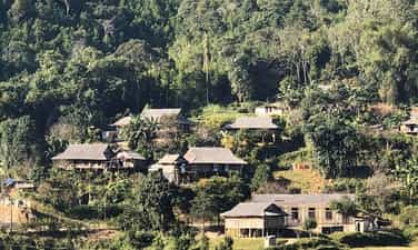
Lung Van - The roof of Muong parish
Lung Van is located at the highest peak of Muong Bi. That's why this place is known as "the roof of Muong". Isolated by traffic, perhaps that is why Lung Van retains its pristine beauty from ancient times. Visitors coming here not only have the opportunity to admire the nature of the mountains and forests, but also enjoy the fresh, pleasant space, helping you feel extremely relaxed and comfortable. The road to explore Lung Van, although difficult, always creates a strange attraction for any traveler. Perhaps because of the clouds of sky hovering around the traveler, mixed with the natural scenery of mountains and forests. All create a beautiful, unreal picture. In particular, visitors can go to the highest position in Lung Van to admire the clouds flying in the early morning, when the sun has not yet risen. In the morning in Lung Van, the wind is cool and the sunlight is gentle, white clouds hover around the mountain tops and villages... When the sun appears, its rays penetrate straight through the dense layers of clouds and spill into the valley. The morning dew drops on a winter day settle on the green leaves of the terraced fields like sparkling jade. The white of the clouds, the yellow of the sunlight and the green of thousands of trees blend into one. All create a wonderful poetic picture in the middle of a mountainous region that can only be found in Lung Van. Besides the "cloud hunting" experience, visitors also enjoy other discovery activities such as climbing Co Tien mountain, trekking U Bo hill, enjoying the feeling of bathing in Mo stream or immersing yourself in fresh nature. Not only that, tourists also have the opportunity to participate in community cultural activities, or even experience the daily work of Muong people such as rice planting, rice harvesting, and fruit harvesting. This is also an opportunity to gain a deeper understanding of the cultural identity and life of the region here. Lung Van is known as the ideal "Rattan Hunting" spot. So which season of the year is best to travel to Lung Van? This is the question of many tourists. Lung Van is known as the "roof of Muong" and is most beautiful from after Tet to April every year because this is the time with the most clouds. The clouds drifted slowly from evening until the next morning. And it's not until noon that you see the clouds completely clear. Moreover, this is also the time when Muong people begin the planting season across the long terraced fields. So according to the experience of many backpackers, traveling to Lung Van Hoa Binh in April is the best time for cloud hunting. Or if you don't need to hunt clouds, choose the golden rice season in Lung Van in August, it will definitely not disappoint you.
Phu Tho
6894 view


Moc Chau
Moc Chau has four seasons: spring, summer, autumn, winter with mild weather and flowers and fruits all year round. In January, the plateau is green with budding tea hills, peach blossoms, plum blossoms, apricot blossoms, cherry blossoms... From mid-May, plums begin to ripen, people harvest plums and sell them to lowland traders. There are no flowers in summer, nor is it strawberry season, but this place is very suitable for picnics because of the fresh air and many outdoor activities. The persimmon season in Moc Chau starts from August to December every year. In particular, the crispy persimmon season usually comes earlier, from August to October, while from October to the end of the year is the season for astringent persimmons. The white mustard season in Moc Chau begins in November. In December, bright yellow wild sunflowers decorate the plateau. Moc Chau is nearly 200 km from Hanoi. If traveling by motorbike, you should follow the old Highway 6 because there are many beautiful scenery along the way, but you should pay attention to the steering wheel because the road is quite degraded. The journey takes about 4-5 hours. On the way, you will pass the S-shaped road in Van Ho district. Most travelers stop to admire the scenery and check-in at this soft S-shaped curve. If you take a bus, you can choose routes to Son La from My Dinh or Yen Nghia bus station, then get off at Moc Chau with a high-quality bus ticket price of about 200,000 VND. If you drive your own car, you don't need to worry too much because the road is big and easy to go despite many steep passes. Be careful, drive at the right speed and pay attention to the lane when passing. In the summer, the roads are less foggy but visibility is limited when it rains. The section that may be cloudy is the road from Thung Khe section. Moc Chau has many motels. However, to get quality accommodation during peak season, you should still call to book in advance. There are eco-lodges (with mountains, lakes, stilt houses) or homestay-style community motels. The price of a room is about 200,000 - 300,000 VND per night but there are also many motels with lower prices. Some suggested "chill" homestays are MAMA's House, Le Chalet du Lac, Fairy House Moc Chau, House By Lake, The Nordic Village, Moc Chau Retreat... Room prices range from 300,000 to 1,000,000 VND per night. To fully explore Moc Chau, you can go quickly in 2 days. If you have more time, about 3-4 days is best, you will have plenty of time to find beautiful camera angles to take photos or go to nearby famous tourist areas such as Thung Nai, Mai Chau, Hoa Binh hydroelectric power station... Places you can visit: Ban Ang pine forest, Mu Nau plum valley, Sunflower garden, Moc Chau tea exchange, Chieng Khoa waterfall, Nang Tien waterfall, Dai Yem waterfall, Grassland 68, Nguyen Thuy village, Pha Luong peak. Eateries and restaurants are located along the town center passing through Highway 6. In addition to specialties such as plums, tea or milk, Moc Chau is also famous as a delicious place to eat. The dishes not to be missed when coming here are fried veal, fried stream fish, multi-dish lentil fish, salmon hot pot, pork blood pudding, buffalo meat on the stove, vegetables dipped in fish intestine sauce or five-color rice. If you want to eat dairy veal, you can find restaurants Dong Hai, Xuan Bac 181, Nam Hung 70, or Lan Hong 64, Ve Quan Moc Chau... A strange dish to try is Moc Chau fresh milk hot pot. The broth is simmered from bones and vegetables, a moderate amount of milk is added to give it a milky white color and mild flavor, and corn is added for sweetness. When the hot pot begins to boil, the layer of milk on top begins to thicken, giving it a fatty and fragrant taste. This is also the time when the hot pot broth is at its most delicious. In the past two years, Moc Chau has also been famous for producing strawberries with quality not inferior to those of Japan or Korea because they are grown using Japanese technology. Winter will be the strawberry harvest season on farms with gardens filled with ripe red strawberries, sweet and sour taste, and if eaten with Moc Chau yogurt, it is very easy to become "addictive". In the summer, after plum season, there will be melon season with sweet fragrant fruits. You can buy tea, milk, cat apples, corn, corn wine... as gifts from locations: intersection 73 near the town, sub-areas 32 and Bo Bun, intersection 70, peach garden intersection, Chieng Bi sub-area. Moc Chau usually has warm sunshine during the day, but the night temperature is quite low and foggy. You need to bring enough warm clothes to ensure your health, and check your vehicle's lights before departing. Do not litter, step on people's mustard beds or climb on trees, break wild peach branches, plum branches, flowers...
Son La
7015 view


Son Moc Huong Cave
With an area of 6,915 square meters, Bat Cave contains an underground water source that never dries up. The name Bat Cave originates from the fact that in the past, there were large colonies of bats living and nesting here, but now they have left elsewhere. However, the name Bat Cave is still called by people here to this day as a familiar name from a long time ago. Above the ceiling of the cave are high stone arches hanging down to form magical shimmering stalactites. These stalactites form many interesting shapes such as fairies, fairies, animals... All create a scene that is both sparkling and majestic. This is a place that when traveling to Moc Chau you should not miss! Legend has it that once upon a time, there was a sacred dragon who, when flying over this land, saw the majestic mountains and cool climate, so he humbled himself and hid in Bat Cave and resided here. That's why this mountain range has many mysterious colors such as: white in the morning, blue at noon, then pink in the afternoon, and finally purple at sunset. People here often tell each other that it is because the dragon's body is surrounding the mountain. Later, when the dragon died, it released 7 pearls to repay the favor. The 7 pearls are the 7 mountains that later created Bat Cave. Thanks to the legendary stories that have been passed down from generation to generation, this place becomes even more attractive and makes many curious tourists want to come here to verify. From the moment you enter from the cave entrance, the light shining into the cave will make you feel like you are lost in a fairyland with different dark and light shades. Visitors will admire the beauty of the limestone stalactites hanging down, creating an amazing natural picture. Furthermore, these rocks also have many different shapes, making them interesting for visitors. The most special is the stone block shaped like a man and woman in love in the shallow lake in the middle of the cave, a highlight that makes everyone admire. In the cave, in addition to the shapes created from limestone blocks, there are also many banyan trees whose roots form shapes on the ground such as elephants, tigers... Another special thing about Son Moc Huong Cave is that the middle of the cave is arched higher than other places in the cave, with a stone curtain at the entrance. This is called the "princess" chamber, which is also an attraction in this place. This. Bat Cave is both a place to visit and a place to explore with forests and trees growing around, so visitors need to pay attention to the following things: Because the cave is located in a dense forest, visitors should wear comfortable and covered clothes to both climb the mountain and avoid being bitten by insects or mosquitoes. You should also bring mosquito spray to ensure safety. , especially with children. When visiting Son Moc Huong Cave, parents need to pay attention to their children's health when climbing the mountain and visiting the cave, then provide timely solutions if the child is too tired or too hyperactive to run around. toss.
Son La
10575 view


Son La Prison and Son La Museum
In the heart of the city, there is a hill named Khau Ca lying beside the Nam La stream. This place also preserves historical evidence of Son La Prison - evidence of a historical period of revolutionary struggle and the spirit of injustice. The remains of resilient communists who were imprisoned by the French colonialists, and the Son La museum, which displays many precious artifacts, introducing the historical and cultural traditions of a community of 12 ethnic groups united together. together to build Son La into a rich province of Vietnam. Son La Prison was built by the French colonialists in 1908 with an initial area of 500 m2. The prison is built quite solidly: the walls are built of stone and brick, the roof is covered with corrugated iron, there is no ceiling, the beds for prisoners are also built of stone, the surface is cemented, the outside edge is attached with a system of vertical leg shackles. along the length of the floor. In each cell there is a floating toilet built higher than the floor, without a lid, without flushing water, and not cleaned regularly. With such a design, in the summer, the Lao wind of the Northwest region causes scorching heat, the frost creates cold, bone-chilling cold in the winter, combined with the polluted environment in the area. Each cell has caused diseases to arise and spread very quickly among prisoners. In 1930, the Communist Party of Vietnam was born and led the people to fight against the brutal regime of feudal colonialism. The struggle movement surprised the enemy, who frantically sought every way to suppress and arrest patriotic Vietnamese people in an attempt to quell the revolutionary movement. On the other hand, strengthen the construction and expansion of the prison system throughout the country, paying special attention to Son La prison. In 1940, Son La Prison was expanded to add a large prison to hold more prisoners and send a number of female prisoners to Son La, but that plot failed to materialize. Thus, through 3 times of construction and expansion, Son La prison has a total area of: 2,170m2. The French colonialists turned this place into a living hell to imprison, deport and destroy the will of the Communists to fight. With an extremely harsh prison regime and extremely cruel torture methods, the enemy thought they could destroy the spirit and body of the revolutionary soldiers, but this place became a revolutionary school. network, train the will and supplement the Party and the revolution with loyal communist soldiers and party members, most notably the role of comrade To Hieu and many other loyal comrades. After being devastated twice by the enemy's bombs, the old relics are now dilapidated, remaining almost nothing more than a pile of destroyed bricks, and the ruined prison walls are a testament to the brutal crimes of the enemy. What remains intact is the To Hieu peach tree, a symbol associated with the name of the steadfast Party Secretary of the prison, which still blooms brilliantly when spring comes... In 1952, when the French colonialists withdrew from Son La, they bombed to erase traces of their crimes. The second time in 1965, the American imperialists raided Son La Town and destroyed part of the prison. In 1980, Son La Museum carried out the first restoration: Leveling bomb craters, rebuilding some surrounding fence sections; The second time, in 1994, restored the two watchtowers, the kitchen, the large prison, reinforced the underground bunker, and built the walls of the cells according to the traces of the old foundations. In 1994, Son La Museum intended to restore the entire relic site to its original form, but could not find complete records, so there was not enough scientific basis to restore the entire site. Just build the walls a little higher so visitors can visualize the structure of the Son La prison complex. Every year, the historical site of Son La prison welcomes hundreds of thousands of tourists to visit, research, study... Surely, at some point, tourists come to Son La, return to the mountains and forests. Northwest to experience and reminisce about the war that took place more than a century ago; With the skillful leadership of the party, the passionate patriotic spirit willing to sacrifice for national independence, the strong solidarity between peoples... We have left behind a peaceful country for today's posterity.
Son La
8564 view


Pha Luong Mountain
Possessing an impressive height above sea level of 2,000 m, the mountain peak is located in the Vietnam - Laos border area and has received the love of many tourists in recent years. After arriving at the center of Moc Chau district, you need to travel another 40 km to reach the foot of the mountain. In addition to the name Pha Luong peak, visitors can also use the name Bo Lung to talk about this tourist destination. When you come here, you will experience the feeling of conquering the mountain peak with impressive heights. In particular, it is the feeling of seeing the majestic and wild scenery from above that is not available everywhere. For those who love to explore and are passionate about adventure sports, this will be a great destination. You can also enjoy the fresh, cool atmosphere of the Northern highlands and relax after the stress and fatigue of life here. For young people, this is an ideal check-in point and great "cloud hunting" in the early morning. Featuring the climate of the North with four distinctly changing seasons, visitors can reach Pha Luong peak at any time of the year. Because this place at each time will bring its own unique beauty and impression to tourists. However, because the road to the top of the mountain is up to 2000m high and difficult, visitors should choose a travel time from March to April. This is the time with warm sunshine and no rain, convenient for climbing. The mountain is safer as well as helps the sightseeing process. One of the famous check-in points when conquering Pha Luong peak is the uniquely shaped rock outcrop. The breadth of space and scenery, along with the rocky outcrop that juts out, make your photo even more impressive. Visitors do not need to worry because the stones are quite large and thick. Be careful when checking in in the rain because they are easily slippery. In addition to experiencing the scenery and atmosphere at the top of the mountain, visitors also have the opportunity to discover more about the typical Lao market. You can find handicraft products, specialty dishes in Moc Chau, dried meat,... as gifts for relatives or friends after the trip. Although it is an attractive tourist destination and brings wild and impressive beauty to tourists. But Pha Luong peak is quite difficult to conquer, so in addition to experience, you also need to know the following notes: With an altitude of 2000m, when you reach the top of the mountain you will see the temperature drop quickly. Especially, if you come in the winter, the temperature is lower, so you need to bring warm clothes, towels, wool hats, gloves, etc. To avoid sudden changes in temperature that affect your body. During climbing, you should use specialized shoes for climbing. Do not wear flat shoes or sandals because they can cause slipping and danger during movement. Visitors should carefully consider their health and mobility before deciding to climb Mount Pha Luong. People with cardiovascular diseases should not move to the mountains. Before conquering the mountain peak, you should have a light snack and drink water to give yourself more energy. Absolutely do not arbitrarily throw trash indiscriminately while moving or visiting the mountain top. Always bring identification documents to present for check-in procedures at the border station.
Son La
9656 view


Tien Phong Lake
Tien Phong Lake in Son La is a typical place of wild and majestic beauty, but extremely romantic in the Northwest mountains and forests. Visiting this land, visitors will admire the charming feng shui and enjoy the fresh air of nature, and have many interesting experiences when yachting on the lake. Located in the middle of the vast steppe, Tien Phong Lake has thousands of winds and warm sunshine, captivating many tourists. Tien Phong Lake in Son La is located in Muong Bom commune, Mai Son district. The place is located right next to National Highway 6, 23km from Son La town, 7km from Hat Lot town and 2km from Na San airport. This is a prime location surrounded by majestic mountains. It is a place surrounded by beautiful nature - in the middle of the immense steppe. To the East and North are two majestic mountain ranges, one after another. To the East is the Na San plateau full of fruits and thousands of green tea hills. All have created a charming landscape, attractive nature, bringing moments of relaxation and peace, holding the traveler's feet. The scenery of Tien Phong Lake is created from Tien Phong dam made of earth and solidified by solid concrete panels. Tien Phong Dam is 23m high, 120m2 wide and 120m long. Coming here, visitors can witness with their own eyes the beautiful natural scenery with a stretching blue color. The vast lake surface is jade green, in the distance there are deep green tropical forests and deep clouds and sky. Nature guides us, people do not want to leave the majestic landscape of Tien Phong. Cruising is an attractive experience for tourists when visiting Tien Phong Lake in Son La. There's nothing more wonderful than floating on the water and taking in the wonderful view of nature. You can choose to row a manual boat, a pedal boat or a motor boat depending on your preference. Many tourists also choose to fish to preserve the beautiful nature. Just do it the way you like, immerse yourself in nature to feel the slow passage of time, preserving the most wonderful emotions. From a distance, the floating island looks like a turtle's shell floating in the middle of the lake. The landscape here is always green and fresh from the young grass and the wind. The wind brings cool and refreshing steam to the small island. Exploring the floating island, visitors will be immersed in the fresh nature here, enjoying the freshest and most peaceful air of their lives.
Son La
9306 view


Dai Yem Waterfall
In addition to the name Dai Yem, this waterfall is also called "Nang waterfall" or "Ban Vat waterfall". The waterfall originates from two streams of Bo Co Lam and Bo Ta Chau, located at the confluence of Vat stream and Bo Sap stream, in Muong Sang commune, Moc Chau district. Legend has it that more than 700 years ago, there was a couple who loved each other dearly. But because of the war, both had to separate. The boy went to war, and the girl went to the waterfall every day to wait for her lover to return. One day, it rained and stormed, the water flooded the entire waterfall. The girl was swept away, leaving only the token of love, an embroidered scarf, scattered near the waterfall. The villagers mourned so they named the waterfall "Dai Yem", which in ancient Thai means "Love Thread". Because of this touching legend, the waterfall has become a place to "prove love" and an ideal destination for many couples. Currently, the waterfall is being preserved and managed by Dai Yem Waterfall Tourist Area. Like a girl in the age of love, Dai Yem waterfall is sometimes gentle and peaceful but also sometimes fierce and passionate. To fully feel the wild beauty mixed with a bit of dreaminess of the waterfall, you should come here during the pouring water season. The period from April to September is the best time to see the falls. At this time, the stream flows rapidly, the amount of water pouring in is huge, creating a white, mesmerizing curtain, making viewers overwhelmed and excited. But if you want to see something gentler and quieter, you can also visit the waterfall in the dry season. At that time, the waterfall will become gentle and full of dreams. The sound of the gurgling stream mixed with the chirping of birds from the deep forest, all blend together, creating a poetic scene. But if you want to see something gentler and quieter, you can also visit the waterfall in the dry season. At that time, the waterfall will become gentle and full of dreams. The sound of the gurgling stream mixed with the chirping of birds from the deep forest, all blend together, creating a poetic scene. The first experience that any tourist cannot miss is admiring the majestic beauty of Dai Yem waterfall. The waterfall is more than 100m high, divided into two distinct branches: the upper waterfall is about 4,000 m2 wide with 9 floors symbolizing 9 levels of love, while the lower waterfall is smaller (area of about 300 m2) and has 3 floors. The two clusters of waterfalls are about 200m apart, flowing day and night. From a distance, they look like a soft peach band winding around the cliff. With its poetic and magical beauty, this waterfall has become a place to visit, picnic, check in and take photos for many tourists, especially young people.
Son La
9312 view


Muong Lo fields
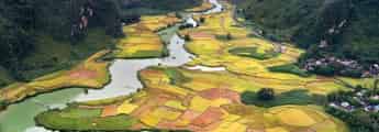
Muong Lo field is located in Nghia Lo town, located on Highway 32, about 80km west of Yen Bai city center. The vast, straight fields are the source of life for the Thai ethnic people, and are also the cradle of culinary culture and traditional traditional dances typical of this land. If Tu Le and Mu Cang Chai are extremely famous with tourists, Muong Lo is still not known to many people. However, this place possesses a very unique beauty that MIA.vn would like to suggest you visit and conquer. You can conveniently go to Mu Cang Chai by Highway 32, then you will pass through Muong Lo Field to explore. Coming to Muong Lo, visitors will be surprised by its extremely peaceful and quiet beauty. The simple small houses, the tall trees, the people who work hard every day, all create a beautiful land. Muong Lo has a terrain like a giant basin, located in Nghia Lo town and a few other communes in Van Chan district. Looking down from above, this place is surrounded by the majestic Hoang Lien Son range, the yellow color of ripe rice and the green color of trees and mountains interwoven together spreading to the horizon. The Muong Lo basin is home to more than 10 ethnic groups including Thai, Muong, Kinh, Tay, Nung, Mong... Therefore, it creates a unique cultural region with unique interwoven features. no two. For a long time, people have called Muong Lo field the land of white rice with clear water and the fragrant flavor of Tu Le sticky rice. Muong Lo rice valley is currently the second largest rice granary in the Northwest region, only after Muong Thanh in Dien Bien province, providing a huge source of food for people here. With a limited economy, mainly dependent on agriculture, Muong Lo plays a huge role in people's lives. Famous as the land of "white rice, clear water", Muong Lo has become the inspiration for many poetic works. With ecstatic beauty, each season appears before visitors' eyes with its own colors and beauty. Because the area of Muong Lo Field is very large and belongs to many localities, it creates a very special scene. At the same time, each commune will have a different farming schedule. On this side, in Nghia Lo, the rice has turned golden, while in Van Chan, the fields are still green. Therefore, creating a very unique landscape of interwoven fields. Every morning when dawn rises, the first rays of light shine down on the vast field. Images of farmers carrying hoes and sickles to the fields to weed and harvest rice, the sound of laughter and talking echoing throughout the sky. As the sky gradually deepened into the afternoon, the boys and girls drove the buffalo back to the barn, the rice flowers sparkled in the sunset, a beauty that was both peaceful and magical that made people's hearts flutter. When harvest season comes, carts laden with rice are returning home. Left behind are fields filled with straw. The smell of straw is strong, dry and yellow under the sun. Coming here this season, you also have the opportunity to participate in local people's new rice festivals, enjoy many delicious dishes and fragrant jars of wine.
Lao Cai
5816 view


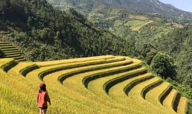
Lim Mong village
Lim Mong village is located in Mu Cang Chai district, Yen Bai, with a beauty that has captivated the hearts of many people. Lim Mong village is located at the end of Yen Bai, blessed by nature with breathtaking beauty and stretching rice fields, interspersed with roofs that appear hidden in the clouds, as beautiful as paradise. . It is no exaggeration to say that Ban Lim Mong is one of the extremely challenging attractions and discoveries for those who are passionate about backpacking. With an extremely dangerous road full of hardships and challenges, Ban Lim Mong responds to everyone's patience with a breathtakingly beautiful natural scenery, not inferior to Tu Le Town in Yen Bai. Between September and October is the best time for you to explore Ban Lim Mong. This is also the time when Mu Cang Chai terraced fields are at their most beautiful season. Coming here at this time, you will admire the natural scenery of Yen Bai dressed in shiny golden colors, as beautiful as a picture painted by the hands of Mother Nature. If you missed Yen Bai's golden season, you can also visit Ban Lim Mong around May to June. At this time, Yen Bai is in the flood season, so the natural scenery is extremely beautiful and poetic. At this time, Ban Lim Mong is also much more cheerful and bustling because people begin to invite each other to go to the fields to plow for a new, bountiful crop. Coming to Yen Bai and missing out on the beautiful natural scenery of Ban Lim Mong is an extremely big mistake. Located at the end of the land of clouds, the road to Ban Lim Mong is also extremely dangerous, making many backpackers restless, wanting to pick up their backpacks to come here to explore one of the most dangerous roads in Vietnam. To get to Ban Lim Mong, from Hanoi you move in the direction of Trung Ha bridge. Coming to Thanh Son (Phu Tho), continue moving straight through Highway 32 towards Yen Bai province. After arriving at the foot of Khau Pha pass, you have to pass through the Thai village at Nam stream to reach Lim Mong village located on the other side of the stream. Right from the time you are on the road to Lim Mong village, you can admire the impressive beauty of Khau Pha pass. With an altitude of up to 1200m above sea level, the spectacularly beautiful Khau Pha Pass brings a significant challenge for those who are planning to explore Ban Lim Mong. Standing from the top of the pass, you will easily admire the natural scenery of Ban Lim Mong. The beauty of Yen Bai's mountains and forests is captured in full view. Especially when Ban Lim Mong is in the ripe rice season, the rice fields stretch out in an extremely bright yellow color, adding to the enchantingly beautiful landscape. Young people often choose the top of this pass as a place to watch Ban Lim Mong, live virtual lives and especially catch the moment of sunset or sunrise. If you intend to explore Ban Lim Mong, one of the first things you need to do is to thoroughly check your vehicle and have it serviced if possible. The road to the village is extremely difficult and dangerous with many steep passes and bends, so if you are not careful, you can easily encounter mishaps in the middle of the road. Make sure you are in good health before leaving because the road to get here is not only long but also full of hardships and challenges. If you are not confident enough to drive, you should go with someone who has a strong handlebar, has experience driving long distances and is as familiar with the roads in Yen Bai as possible. You should check the weather forecast before leaving. If the weather is bad, you should consider changing your itinerary to other destinations before going to Ban Lim Mong. Especially, you should not go down a steep mountain pass at night because the road is very dark, deserted and extremely dangerous for those who are not familiar with the roads of Ban Lim Mong. Prioritize comfortable clothes and sports shoes for ease of movement because most people come to Ban Lim Mong with the desire to explore as much as possible. The terrain here is not suitable for wearing too elaborate dresses and skirts for virtual living.
Lao Cai
6123 view


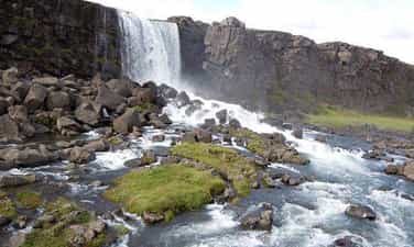
Pu Nhu Waterfall
Yen Bai province is known to many people thanks to the impressive beauty of its charming natural scenery, the most famous is probably Mu Cang Chai. But few people know that this is also the place where the endless echo of the majestic and beautiful Pu Nhu waterfall is heard. Pu Nhu Waterfall is located in Pu Nhu village, La Pan Tan commune, Mu Cang Chai with the waterfall creating melodious sounds like a proud story about the honest, simple people of the majestic high mountains of the West. North. The waterfall is located about 10km west of the center of Mu Cang Chai district, originating from streams in the upstream forests of Lao Cai and Son La. The extremely impressive high mountain terrain here has turned that stream into the majestic, impressive waterfall it is today. The most special thing to mention is that during the flood seasons, the water here is compensated with a layer of fertile silt to help the plants grow, bringing fresh flavors and full of vitality. Nature is very clever in delicately surrounding this beautiful waterfall, only "revealing" the majestic echo of the waterfall to those from afar. That's why Pu Nhu waterfall becomes more mysterious, making everyone curious to discover it just by hearing those sounds. Before you can see Pu Nhu waterfall, you will already be ecstatic about the poetic beauty of the path leading there. The road is quite easy, just passing through the stream and cornfield, you can enjoy the cool feeling of the cool water here. If you choose to travel along the main road, it will be difficult to admire this waterfall. Do you know why? Because nature has embraced this waterfall with tall forest trees, creating a delicate hiding place for the waterfall. With a height of about 200m, the waterfall is divided into many different levels. The most beautiful is on sunny days, the Pu Nhu waterfall flows down like a white silk cloth fluttering to the joyful melodies of the whispering wind and the singing of birds in the surrounding pristine forest. If you have the opportunity to explore Mu Cang Chai on days with such great weather, you will surely admire the pristine beauty, majestic sounds and the most memorable moment is the moment of immersing yourself in the fresh air. that heaven and earth bestowed on this place. Standing proudly between two high vertical cliffs, Pu Nhu waterfall appears like a watercolor painting. The image of the majestic high mountain is like a mighty man surrounding and protecting the beautiful young woman named Pu Nhu waterfall through many ups and downs of life. Around the waterfall, there are also large rocks covered with moss that are somewhat scary, but that is also a special highlight that makes you unable to take your eyes off the strangeness. If you are struggling to find a place to let go of all your worries and relax in the fresh nature, this is truly the ideal place for you. With what Pu Nhu waterfall possesses, you will surely have a memorable trip with wonderful and impressive scenery here. Beneath the continuously flowing water of the waterfall there is also a mysterious lake called Dragon Lake. According to the people here, this lake is extremely sacred because there is a dragon sleeping at the bottom of the lake, and it is said that the Pu Nhu waterfall is the beautiful result gushed out from that dragon. Although it is only a story that has been passed down orally to this day, it has made people not dare to immerse themselves in this water, because no one dares to wake up the dragon's sleep. However, this is just a legendary story. Nowadays, tourism services here have become much more developed, you can be completely guaranteed safety during your visit. Therefore, you can still enjoy the cool water here without having to worry too much.
Lao Cai
5904 view


Thac Ba Lake
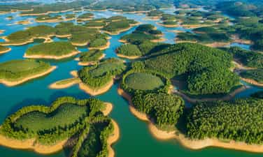
Located in the Northwest of the country, Thac Ba Lake of Yen Bai province, a place called "Ha Long on the mountain", is one of the three largest artificial lakes in Vietnam formed when the Thac Ba Hydroelectric Plant was built. The lake is located in two districts of Yen Binh and Luc Yen. The lake has nearly 20 thousand hectares of water surface, including more than 1,300 large and small green islands, along with a beautiful cave system hidden deep within the limestone mountains. Coming to Thac Ba Lake, visitors can enjoy watching the vast sea of water and the immense islands of trees reflecting on the blue lake surface. The people here are also very friendly and hospitable. Anyone who has once visited Thac Ba Lake will surely be surprised and will never forget the clear, poetic and majestic Thac Lake. Not only does it provide water to generate electricity from the national grid, Thac Ba Lake is also a place for fresh air conditioning and a stopping point for tours. Visiting Thac Ba Lake, when traveling by boat, visitors will enjoy the fresh air amidst the vast, shimmering water surface reflecting the seemingly endless overlapping islands, forgetting all the tiredness and worries. troubles of life. The first place visitors can visit is the Thac Ba Hydroelectric Plant area, where Thac Ba Temple is located, this is Vietnam's first hydroelectric project standing tall on the lake. Having the chance to visit the country's historical works with their own eyes and hear the story of the people who devoted their lives day and night to building the factory, each visitor will be moved and more proud of the glorious national tradition. , the sacrifice of his father's generation. At the end of the trip to visit Thac Ba Hydroelectric Plant, visitors can also visit Thac Ba Mau Temple - a spiritual tourist destination not far away. The temple is located on Hoang Thi mountain, with its back against the mountain, overlooking the Chay River in the East Northeast direction, far away is Cao Bien Mountain. For a long time, Thac Ba Mau Temple has been famous as a sacred place, recognized as a Provincial Cultural and Historical Relic in 2004. Tourists visiting Mau Temple light a stick of incense, letting go of the chaos of life. , praying for peace of mind at the door of compassionate Buddha to continue the journey that takes visitors to discover the magical beauty of stalactites, of strange natural stone statues that hide many human desires and ambitions in the world. Limestone cave complexes on the lake such as: Thuy Tien cave, Xuan Long cave, Bach Xa cave, Thac Ba, Thac Ong... Thuy Tien cave, located in the heart of the rocky mountain is about 100m long with sparkling, clear stalactites. It has a picture of nine fairies, each with a unique look associated with a thrilling and attractive love legend. Visit Xuan Long cave hidden in the rocky mountains, with natural stone statues and stalactites associated with colorful legends. Along with the cave system, visitors can go up Cao Bien Mountain, the largest and longest mountain range of Thac Ba Lake. Standing on the top of the mountain, you can see the lake engulfed in mist with its shimmering and magical beauty. , feel the majestic beauty of nature, to find the ancient mark of Ngoc market, the famous Thac Ba Ivory market, once a bustling market... Sitting on a canoe up the Chay River, not far away, visitors will Visit the land of Ngoc Luc Yen with famous landscapes such as Sao Pagoda cave, Dai Cai temple... and admire the magic of natural gemstone paintings under the talented hands of craftsmen. Charming scenery, rich in aquatic resources, the lakeside is also home to many ethnic groups such as: Kinh, Tay, Nung, Mong, Dao, Phu La, Cao Lan... People here still keep local cultural identity, in which many special festivals often take place such as the New Rice Festival of the Tay people, Tet dancing of the Dao people... Coming to Ngoi Tu Cultural Village - Vu Linh commune, Yen Binh district, where 5 ethnic groups gather (mainly White Dao people), visitors will experience a relaxing life under low stilt houses. Wander among the palm forests, learn about the traditional craft of weaving shrimp baskets, and watch red-cheeked Dao girls in brilliant national costumes. In particular, every time night falls, by the flickering campfire, visitors will hear captivating folk songs and enjoy the delicate flavors of dishes such as: bamboo-tube rice, banana flower salad. forests, chicken cooked with sour bamboo shoots or fish salad, shrimp salad... Most of the villages along Thac Lake still retain their wild features, along with the cultural identities of the Tay, Nung, Dao, and Cao ethnic groups. Lan... with many unique festivals. Currently, Ngoi Tu village has many fully invested households qualified to welcome foreign guests. Every year, the village welcomes hundreds of groups of visitors, mainly from Germany, France, Italy, Sweden, Australia and overseas Vietnamese. In addition, visitors can also attend the unique boat racing festival called "Echoes of Thac Ba Lake" or visit the famous Kha Linh grapefruit village. And on that journey of discovery, visitors can also spend a little more time to visit the adjacent land of Luc Yen, a famous gemstone area in the country, visit the historical relics of Dai Cai temple, Ma Mut cave, and Sao pagoda. , Black King Mountain... where archaeologists have discovered traces of ancient Vietnamese people. Compared to Ha Long Bay on the mountain - Thac Ba Lake promises to bring tourists wonderful, unforgettable experiences.
Lao Cai
7465 view


Suoi Giang
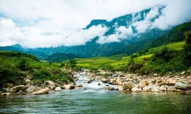
Yen Bai Giang Stream is located at an altitude of about 1,300 - 1,400 m above sea level, covered by layers of clouds all year round, plus the air is always extremely fresh and cool, making this place a hot spot. The spot is very popular with tourists, choosing it as a place to stop. Besides, this place also has a unique feature that MIA.vn believes that when you hear it, you will want to pack your things and go to Suoi Giang immediately, that is, you can feel all four seasons of the year in just one breath. in... a day in Suoi Giang. When mentioning Yen Bai, it is impossible not to mention Suoi Giang, and when mentioning Suoi Giang, it is impossible not to mention Shan tea. Stop here for a moment to let MIA.vn tell you a fairy tale about this type of tea associated with Suoi Giang. Legend has it that, once upon a time, a fairy sowed seeds in Suoi Giang and this divine seed germinated into a lush green tree. When the tree grows, it spreads its leaves and buds as white as snow. At this time, the Mong people living here were suffering from hunger and cold. They used this leaf to eat. After eating, their bodies felt healthier. It was that miracle that they believed that God had helped them, so they decided to establish a village here to live and call this place Suoi Giang. It must be said that the ancient tea trees in Suoi Giang are also very magical, they live at an altitude of 1,400 meters above sea level, the "young" trees are over a hundred years old, the older trees are over 300 years old. Yet young buds still grow green on rough, moldy white tea stems, firmly clinging to the roots on the craggy mountainside, creating a unique ancient tea garden landscape. In addition, those fat tea buds are covered with a translucent white layer, so they are called snow tea. Tea is picked and prepared with the experience and skillful hands of the Mong people. Shan Tuyet Suoi Giang tea is very unique. Although it lives in a pristine mountain area, the green tea contains all the top flavors of world-class teas in the bowl. When traveling here, there are many activities for you to enjoy this green, clean, and beautiful living space, such as closing your eyes and thinking about a bowl of fragrant tea, or carelessly drinking a cup of tea. Sleep soundly under the canopy of a huge tea tree, or immerse yourself in the lives of the people here through tea picking and tea making activities, and finally enjoy the tea that is a finished product that you have made with your own hands. It is truly an ideal destination for us to "detox" the fatigue and worries from life in the city, isn't it! Traveling to Suoi Giang, in addition to enjoying Shan tea, there are also many specialties of the Mong people waiting for you to enjoy such as: men men, Yen Bai kitchen buffalo meat, armpit pig, wild vegetables, cassava wine, corn wine,... and extremely unique dishes, blended with the flavor of ancient sweet soup such as meat rolled in grilled tea leaves, young sweet soup leaves eaten raw with herbs. The cuisine is simple and rustic but has an unforgettable flavor. Imagine sitting comfortably at the wooden dining table, in the cold weather of a quiet night, enjoying hot grilled meat skewers, accompanied by the strong aroma of wild vegetables, the heat of a bowl of wine and wine. Occasionally "coating" your mouth with the sweet taste of men men made from corn, it will definitely make you want to take a once-in-a-lifetime trip with your best friends.
Lao Cai
5667 view


La Pan Tan commune
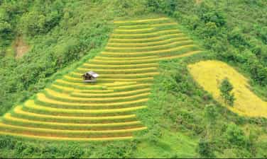
La Pan Tan is a highland commune in Mu Cang Chai district, Yen Bai province. With its location on the top of Khau Pha, nearly 2000 meters above sea level, La Pan Tan commune possesses an extremely beautiful natural picture with terraced fields, towering mountains and indigenous culture. H'mong people. From Mu Cang Chai town to La Pan Tan commune, about 15km, visitors can easily reach the destination by going in the Northeast direction. After the journey through the mountain passes, you will come to a beautiful land with up to 2,200 hectares of terraced fields arranged in layers. In the past, La Pan Tan commune used to be a poor commune, the "capital" of opium when up to 80% of the population was addicted. However, that "dark" period has gradually passed when the commune received adequate investment to develop tourism. The lives of local residents have gotten better. In 2007, La Pan Tan was recognized by the Ministry of Culture, Sports and Tourism as a National Scenic Monument. With a prime location in the high mountains, cool climate and average temperature of about 19 degrees Celsius, this place has become a favorite destination in Mu Cang Chai for many tourists. The journey to explore La Pan Tan commune brings you countless memorable experiences in both the beautiful scenery, culture and people here. If you discover La Pan Tan commune for the first time, you will probably be immediately overwhelmed by the beautiful scenery here. On the journey to visit this Northwest highland commune, visitors will enjoy the beautiful scenery of terraced fields surrounded on all sides. As one of the communes with the most terraced fields in Mu Cang Chai, everywhere you look you will see rice fields overlapping. It is truly admirable for the farmers here, with their human strength and rudimentary agricultural tools, they can turn the mountains and hills into beautiful fields, curving beneath the mountain slopes. Terraced fields lie gently along the hillsides, extending to the stream banks, weaving into the villages. Everywhere are rice fields. Exploring La Pan Tan commune, visitors can check in many beautiful places here. Among them, Mam Xoi hill is the hottest coordinates of each ripe rice season. This hill is supported by terraced fields below, and above has a round shape like a tray rising to the sky. Every golden rice season, Mam Xoi Hill attracts many tourists to check in and take photos. According to the experience of many tourists going to Mu Cang Chai, Mam Xoi Hill is most beautiful in the early morning at dawn when the golden sunlight has just gently crept onto the fields, surrounded by white mist covering it, painting a picture. beautiful like a fairyland. Near Mam Xoi hill, there is a small wooden shack owned by local people, where visitors can sit and admire the scenery and enjoy taking photos. Visiting La Pan Tan during the ripe rice season in September - October, visitors can both admire the beautiful terraced fields and have the opportunity to watch people harvest rice manually. The image of Hmong women with small sickles quickly harvesting each clump of rice in the field is so beautiful and simple. Coming to La Pan Tan, Mu Cang Chai district, in addition to terraced fields, visitors can also explore the beautiful waterfall here. That is Pu Nhu waterfall with a height of more than 20 meters, pouring loudly into Dragon Lake and creating a very majestic and mysterious scene. Around Pu Nhu waterfall are large and small rocks covered with moss, leading to a peaceful, poetic forest of ancient trees. Coming to Pu Nhu waterfall, you can spend time admiring the beautiful scenery, taking photos or camping around the lake shore. Indigenous people believe that Dragon Lake is a sacred place so no one goes to bathe. However, later when local tourism activities are promoted, visitors can experience bathing in the waterfall to feel the cool water here.
Lao Cai
6095 view


Mu Cang Chai
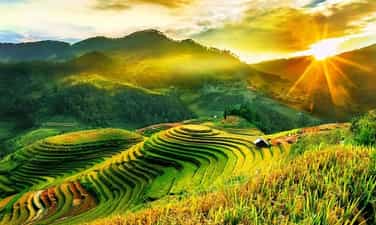
In recent years, every year, around the end of September and early October every year, tourists from all over the country flock to Mu Cang Chai to admire the wonderful scenery of this highland land. Coming here, visitors can not only enjoy the beauty of terraced fields and the sea of white clouds on top of Cao Pha pass but also immerse themselves in the unique cultural festivals of the Mong people. Mu Cang Chai is a western highland district of Yen Bai province, 180km from Yen Bai city center, more than 300km northwest of Hanoi capital. This land is located at the foot of the Hoang Lien Son mountain range, at an altitude of over 2,000m above sea level. Coming to Mu Cang Chai, visitors can take Highway 32 in two directions. If from Hanoi, you will go to Yen Bai, from Yen Bai to Muong Lo 70km, sleep here so that you can drive from Muong Lo early in the morning and arrive at Muong Chai in the afternoon. This section is nearly 100km long, but more than 80km is a steep mountain pass that continuously advances. Once it reaches an altitude of 1,750m, covered with mist and clouds, it will soon reach Mu Cang Chai town. In the middle of the pass, there is a flat land, stop here to enjoy the fragrant Tu Le sticky rice that is famous throughout the region. In the second direction, tourists go all the way to Noi Bai - Lao Cai highway, go to Sa Pa and pass O Quy Ho pass, then go through Tan Uyen and Than Uyen of Lai Chau to reach Mu Cang Chai. Coming to Mu Cang Chai even once, visitors will feel the richness of nature, the uniqueness of culture, and the warmth of human love. The road to Mu Cang Chai is far and difficult, but very interesting. The scenery changes constantly on the road. Tourists have not yet had time to see all the Thai stilt houses on the vast Muong Lo field with countless white daylilies before they have reached the winding roads, meandering on the steep hillsides. Geological movements have created high mountain peaks in Mu Cang Chai such as: Pung Luong (2,985m), Phu Ba (2,512m), Mo De (2,100m)... Through Khau Pha Pass (2,100m high), this is the highest mountain among the "four great passes" in the Northwest covered in a sea of floating clouds, with a cool climate all year round. The top of Cao Pha Pass is also the 4th most beautiful place in the world for pilots to paraglide, for those who love thrills and adventure games to conquer the sky and freely admire and explore the majestic natural beauty of heaven and earth from the air through paragliding games. From here, from pass to pass, mountain to mountain, visitors will clearly feel the change in altitude. On both sides of the road are beautiful terraced fields that make each of us feel overwhelmed. The beautiful small town of Mu Cang Chai is nestled between two mountain slopes with peaceful villages in the green valley or on Khau Pha pass. Accounting for 90% of the district's population, the Mong people in Mu Cang Chai have 4 groups: Mong Do (White Mong); Butt Swing (Black Butt); Mong Linh (Mong Hoa); Mong Si (Red Mong), they reside on mountain slopes from 800 to 1,700m high with rich traditional and unique cultural features that always attract many researchers. Coming here, visitors can visit Mong ethnic villages, explore the culture and customs of the Northwest highlands with many unique folk cultural and artistic values and famous products. Watch the Khen dance, go with Mong boys and girls to the Sai San festival, experience some traditional crafts such as blacksmithing, flax weaving, jewelry making and enjoy traditional dishes of the Mong people. In particular, tourists cannot miss and visit Thai village, just cross the bridge in the center of the district (towards Che Tao commune where there is a conservation area for ornamental species) then turn left about 1km to reach Thai village. A small peaceful village located in the middle of the valley, its back leaning against the mountain. Here, visitors will enjoy Thai specialties, take a herbal bath in the traditional Thai way, rest in a stilt house and organize exchanges, light a campfire, and dance. Coming to Mu Cang Chai, visitors can enjoy the beauty of the Mu Cang Chai Rice Terraces National Scenic Landscape complex with a total area of 330 hectares distributed mainly in 3 communes Che Cu Nha, La Pan Tan and De Su Phinh, which has been recognized as a National Landscape by the Ministry of Culture, Sports and Tourism since 2007. The terraced fields here are as beautiful as fingerprints of the sky, an artistic architectural work full of brilliance. Created by the skillful hands of the Mong people. Not just now but for a long time, the harsh land of Mu Cang Chai with the meaning of "dry tree village" in the Mong language has become a symbol of human diligence and persistent creativity. From a deserted, arid land, the Mong people who are good at climbing passes and crossing mountains have cleverly turned each bed of land and each hill into beautiful terraced fields, not only providing a source of food to feed the community but also adding highlights to nature, turning the wild mountains and hills into unique masterpieces imbued with the traditional cultural values and creative feats of the Mong people. The fields are level by level, each level hugs the mountain slopes. Throughout the 13 communes and towns of Mu Cang Chai, there are terraced fields. The terraced fields are most beautiful in May-June when the fields are in the flood season and September-October when the sticky rice is ripe and shiny golden spreading across the hillsides. Tourists come to Mu Cang Chai at these two times to witness firsthand the green and yellow raspberries appearing among the vast hills and mountains. Stopping at the three communes of La Pan Tan, Che Cu Nha and De Su Phinh, everywhere visitors can see terraced fields spread across the hills. Visitors will not be able to help but admire, admire, and appreciate the glorious brocade painting between heaven and earth woven by the "peasant artists" of the Northwest. This entire mountainous area is a beautiful picture of the Northwest highlands painted by blue sky, white clouds, high fields and a simple, simple life that is true to every look and smile.
Lao Cai
6410 view


The westernmost point of A Pa Chai
A Pa Chai is located in Sin Thau commune, Muong Nhe district, 250 km from Dien Bien Phu city, is the westernmost point of the country, where there is a landmark dividing the boundary between the three countries Vietnam - Laos - China. This is called the border junction located on the top of Khoang La San mountain, 1,864m above sea level, welcoming many tourists every year, especially young people from all over the country to visit. , conquer. Previously, A Pa Chai was considered a difficult landmark to conquer because the road to the landmark was difficult, having to cross three head-high thatched grass hills, cross forests, wade streams, and climb high mountains, which took four to five hours from The border guard station has just arrived. It's different now. In 2018, Dien Bien province completed the concrete road along the cliffs and built steps, making it easier for visitors to conquer the milestone even though they still have to walk a few kilometers of small, steep and climbing concrete roads. 500 steps to reach the landmark. The border junction marker placed on the top of the mountain is triangular in shape, with three sides facing three directions, each side has the country's name engraved in its own national language and the national emblems of the three countries of Vietnam, Laos and China. From the high point of the westernmost point of the country, looking into the distance is a vast space, majestic mountains and forests. The three-sided landmark dividing the boundary of the three countries Vietnam - Laos - China shimmers in the sunlight. Emotion and national pride surged.
Dien Bien
9317 view


