Tourist destination
La Pan Tan commune
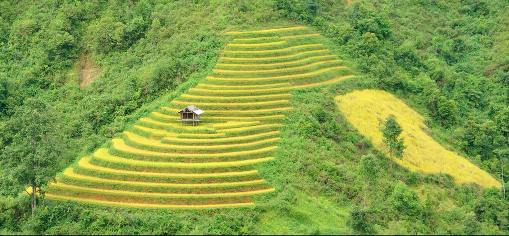
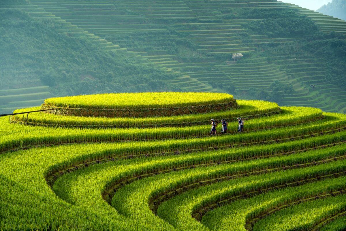
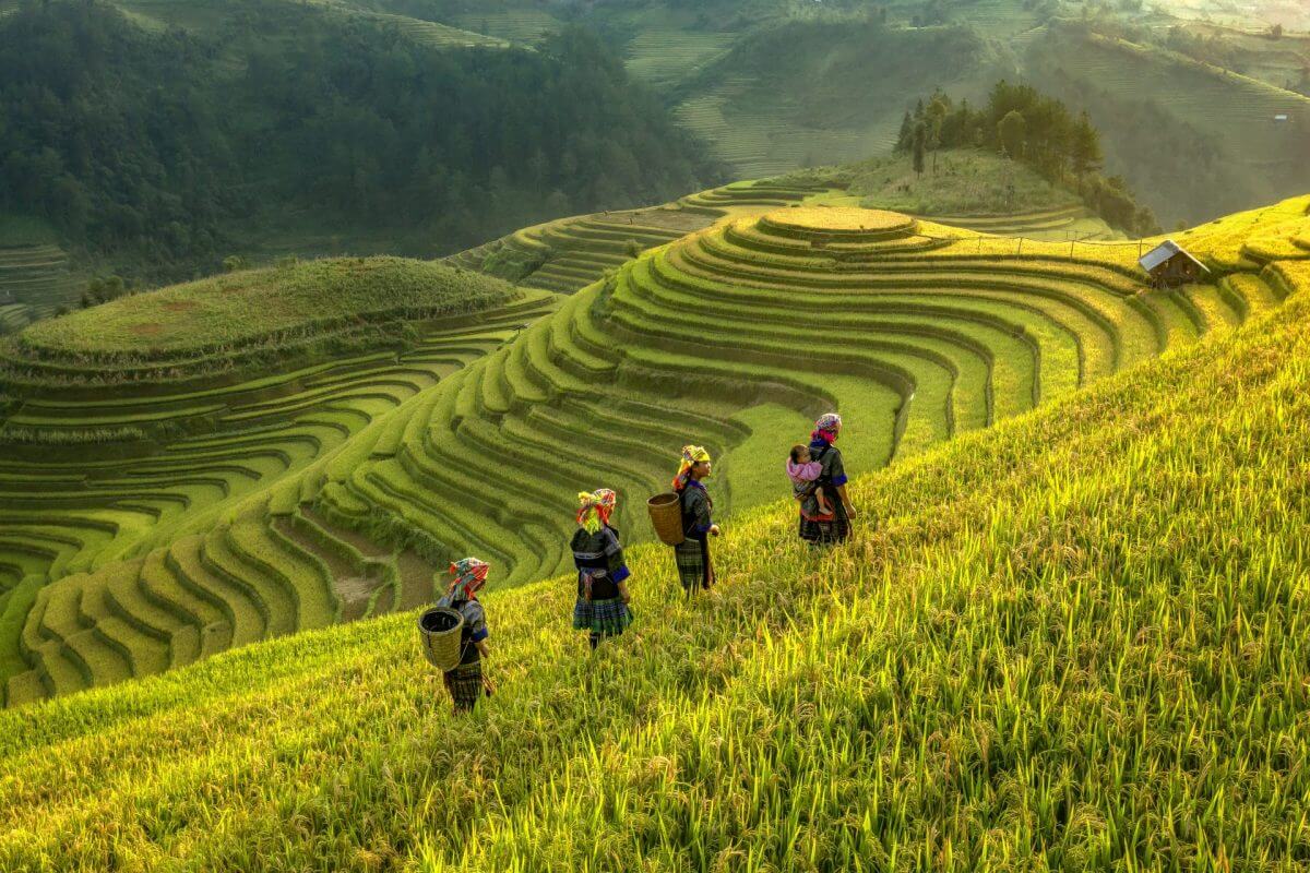
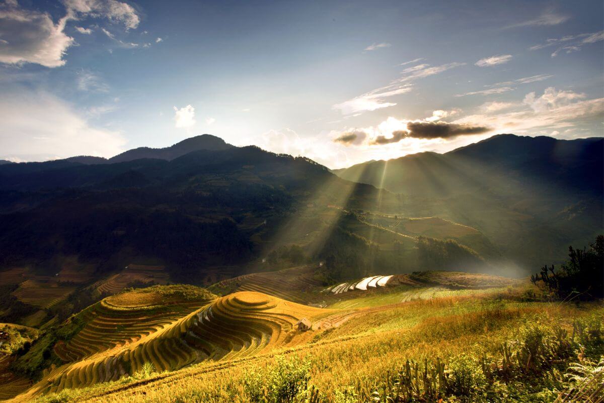
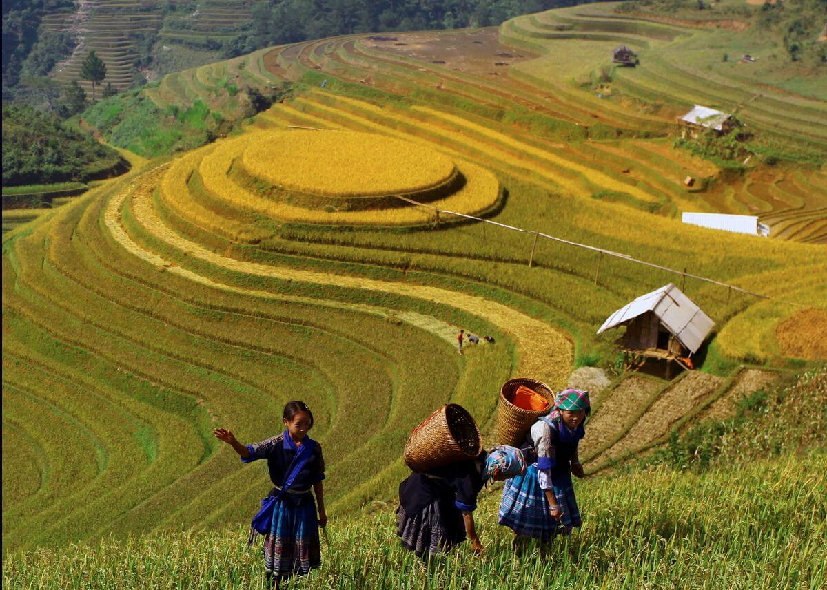
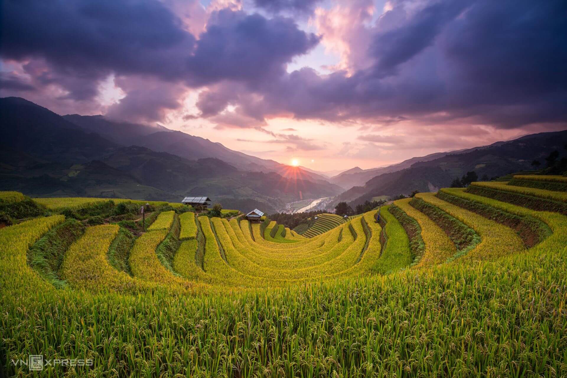
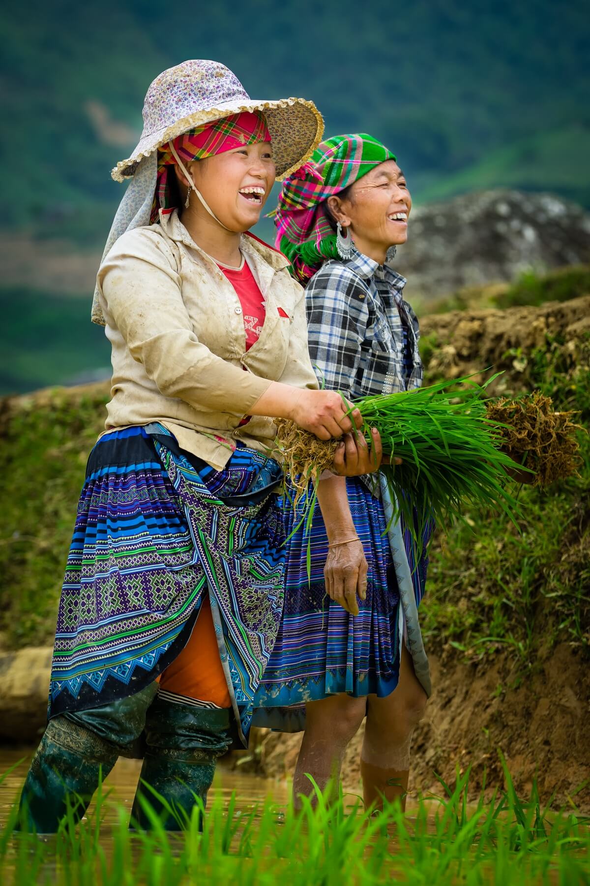
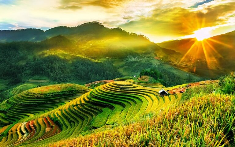
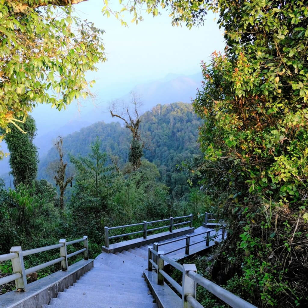
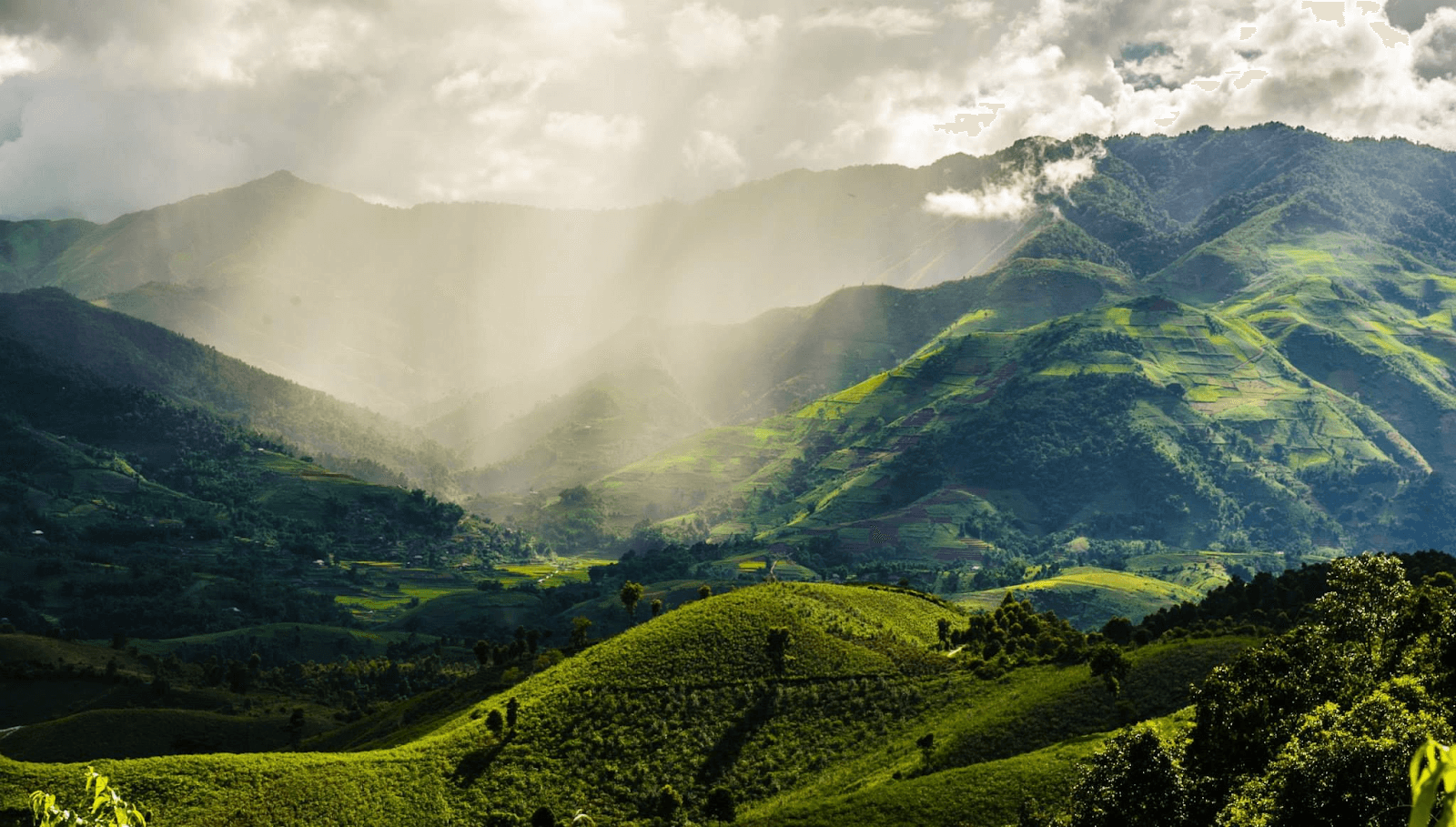
La Pan Tan is a highland commune in Mu Cang Chai district, Yen Bai province. With its location on the top of Khau Pha, nearly 2000 meters above sea level, La Pan Tan commune possesses an extremely beautiful natural picture with terraced fields, towering mountains and indigenous culture. H'mong people. From Mu Cang Chai town to La Pan Tan commune, about 15km, visitors can easily reach the destination by going in the Northeast direction. After the journey through the mountain passes, you will come to a beautiful land with up to 2,200 hectares of terraced fields arranged in layers. In the past, La Pan Tan commune used to be a poor commune, the "capital" of opium when up to 80% of the population was addicted. However, that "dark" period has gradually passed when the commune received adequate investment to develop tourism. The lives of local residents have gotten better. In 2007, La Pan Tan was recognized by the Ministry of Culture, Sports and Tourism as a National Scenic Monument. With a prime location in the high mountains, cool climate and average temperature of about 19 degrees Celsius, this place has become a favorite destination in Mu Cang Chai for many tourists. The journey to explore La Pan Tan commune brings you countless memorable experiences in both the beautiful scenery, culture and people here. If you discover La Pan Tan commune for the first time, you will probably be immediately overwhelmed by the beautiful scenery here. On the journey to visit this Northwest highland commune, visitors will enjoy the beautiful scenery of terraced fields surrounded on all sides. As one of the communes with the most terraced fields in Mu Cang Chai, everywhere you look you will see rice fields overlapping. It is truly admirable for the farmers here, with their human strength and rudimentary agricultural tools, they can turn the mountains and hills into beautiful fields, curving beneath the mountain slopes. Terraced fields lie gently along the hillsides, extending to the stream banks, weaving into the villages. Everywhere are rice fields. Exploring La Pan Tan commune, visitors can check in many beautiful places here. Among them, Mam Xoi hill is the hottest coordinates of each ripe rice season. This hill is supported by terraced fields below, and above has a round shape like a tray rising to the sky. Every golden rice season, Mam Xoi Hill attracts many tourists to check in and take photos. According to the experience of many tourists going to Mu Cang Chai, Mam Xoi Hill is most beautiful in the early morning at dawn when the golden sunlight has just gently crept onto the fields, surrounded by white mist covering it, painting a picture. beautiful like a fairyland. Near Mam Xoi hill, there is a small wooden shack owned by local people, where visitors can sit and admire the scenery and enjoy taking photos. Visiting La Pan Tan during the ripe rice season in September - October, visitors can both admire the beautiful terraced fields and have the opportunity to watch people harvest rice manually. The image of Hmong women with small sickles quickly harvesting each clump of rice in the field is so beautiful and simple. Coming to La Pan Tan, Mu Cang Chai district, in addition to terraced fields, visitors can also explore the beautiful waterfall here. That is Pu Nhu waterfall with a height of more than 20 meters, pouring loudly into Dragon Lake and creating a very majestic and mysterious scene. Around Pu Nhu waterfall are large and small rocks covered with moss, leading to a peaceful, poetic forest of ancient trees. Coming to Pu Nhu waterfall, you can spend time admiring the beautiful scenery, taking photos or camping around the lake shore. Indigenous people believe that Dragon Lake is a sacred place so no one goes to bathe. However, later when local tourism activities are promoted, visitors can experience bathing in the waterfall to feel the cool water here.
Lao Cai
September to October
4894 view


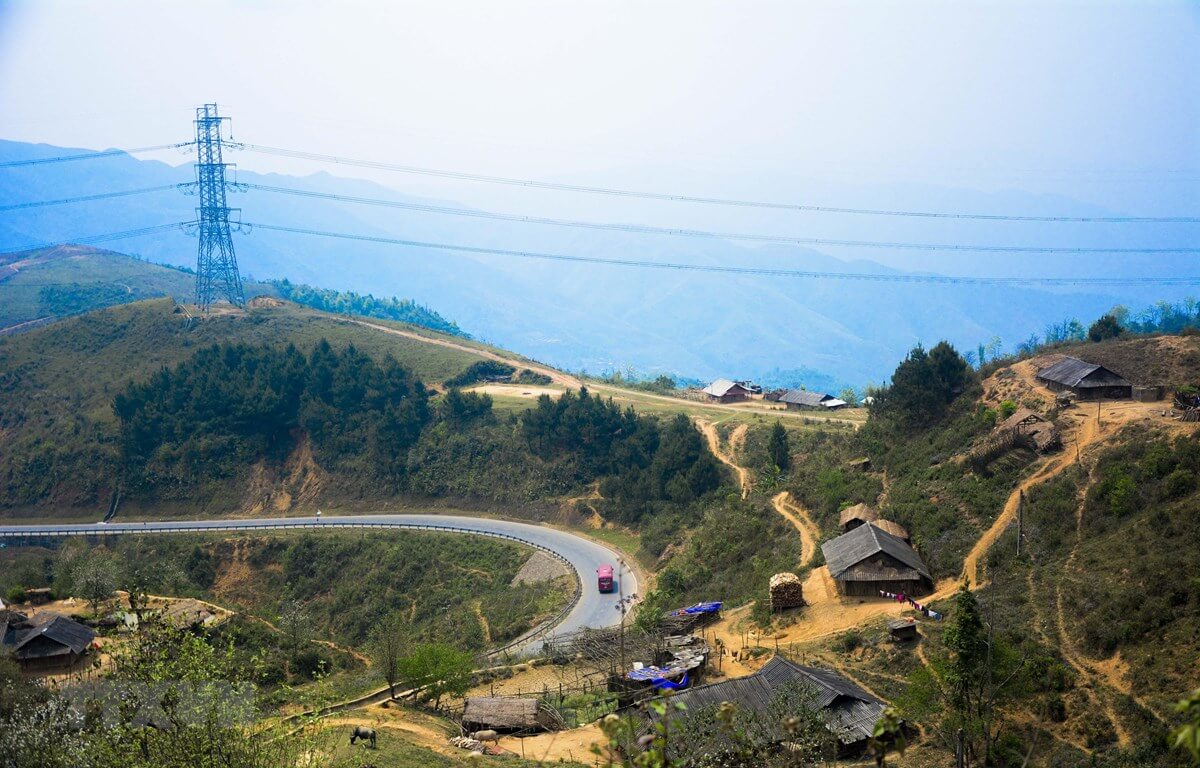
Mu Cang Chai
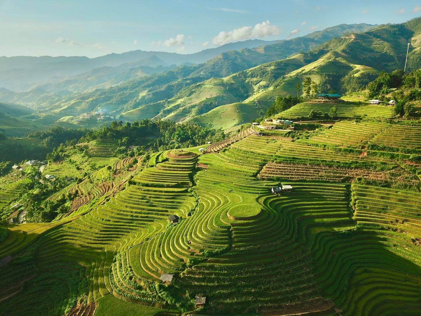
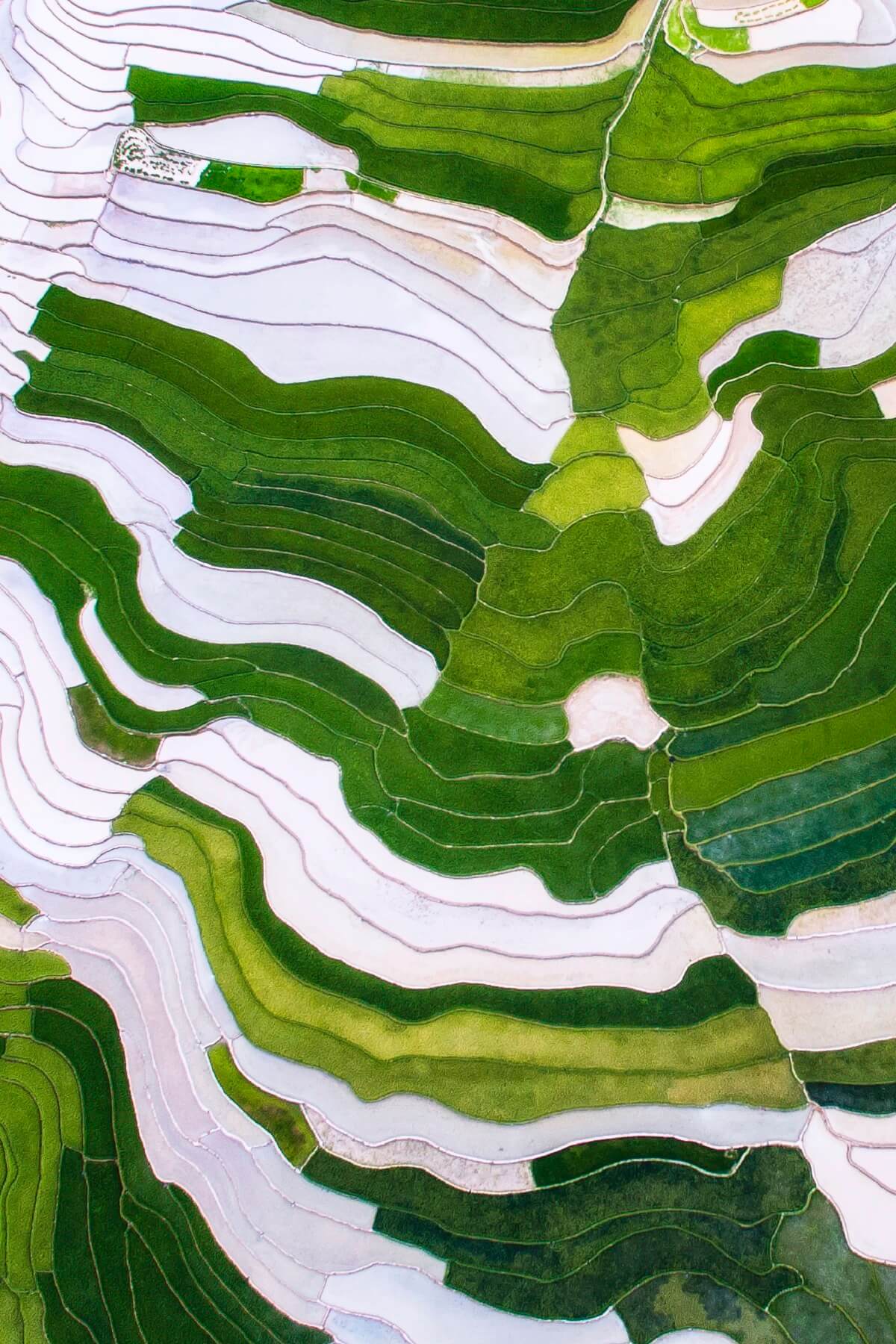
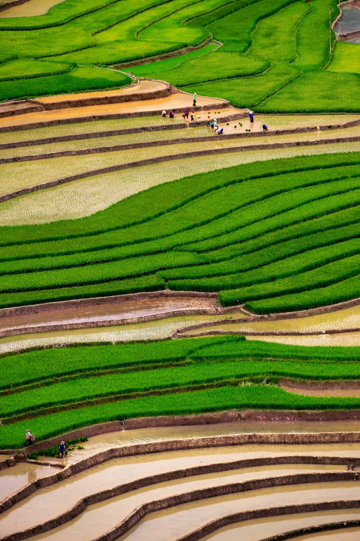
In recent years, every year, around the end of September and early October every year, tourists from all over the country flock to Mu Cang Chai to admire the wonderful scenery of this highland land. Coming here, visitors can not only enjoy the beauty of terraced fields and the sea of white clouds on top of Cao Pha pass but also immerse themselves in the unique cultural festivals of the Mong people. Mu Cang Chai is a western highland district of Yen Bai province, 180km from Yen Bai city center, more than 300km northwest of Hanoi capital. This land is located at the foot of the Hoang Lien Son mountain range, at an altitude of over 2,000m above sea level. Coming to Mu Cang Chai, visitors can take Highway 32 in two directions. If from Hanoi, you will go to Yen Bai, from Yen Bai to Muong Lo 70km, sleep here so that you can drive from Muong Lo early in the morning and arrive at Muong Chai in the afternoon. This section is nearly 100km long, but more than 80km is a steep mountain pass that continuously advances. Once it reaches an altitude of 1,750m, covered with mist and clouds, it will soon reach Mu Cang Chai town. In the middle of the pass, there is a flat land, stop here to enjoy the fragrant Tu Le sticky rice that is famous throughout the region. In the second direction, tourists go all the way to Noi Bai - Lao Cai highway, go to Sa Pa and pass O Quy Ho pass, then go through Tan Uyen and Than Uyen of Lai Chau to reach Mu Cang Chai. Coming to Mu Cang Chai even once, visitors will feel the richness of nature, the uniqueness of culture, and the warmth of human love. The road to Mu Cang Chai is far and difficult, but very interesting. The scenery changes constantly on the road. Tourists have not yet had time to see all the Thai stilt houses on the vast Muong Lo field with countless white daylilies before they have reached the winding roads, meandering on the steep hillsides. Geological movements have created high mountain peaks in Mu Cang Chai such as: Pung Luong (2,985m), Phu Ba (2,512m), Mo De (2,100m)... Through Khau Pha Pass (2,100m high), this is the highest mountain among the "four great passes" in the Northwest covered in a sea of floating clouds, with a cool climate all year round. The top of Cao Pha Pass is also the 4th most beautiful place in the world for pilots to paraglide, for those who love thrills and adventure games to conquer the sky and freely admire and explore the majestic natural beauty of heaven and earth from the air through paragliding games. From here, from pass to pass, mountain to mountain, visitors will clearly feel the change in altitude. On both sides of the road are beautiful terraced fields that make each of us feel overwhelmed. The beautiful small town of Mu Cang Chai is nestled between two mountain slopes with peaceful villages in the green valley or on Khau Pha pass. Accounting for 90% of the district's population, the Mong people in Mu Cang Chai have 4 groups: Mong Do (White Mong); Butt Swing (Black Butt); Mong Linh (Mong Hoa); Mong Si (Red Mong), they reside on mountain slopes from 800 to 1,700m high with rich traditional and unique cultural features that always attract many researchers. Coming here, visitors can visit Mong ethnic villages, explore the culture and customs of the Northwest highlands with many unique folk cultural and artistic values and famous products. Watch the Khen dance, go with Mong boys and girls to the Sai San festival, experience some traditional crafts such as blacksmithing, flax weaving, jewelry making and enjoy traditional dishes of the Mong people. In particular, tourists cannot miss and visit Thai village, just cross the bridge in the center of the district (towards Che Tao commune where there is a conservation area for ornamental species) then turn left about 1km to reach Thai village. A small peaceful village located in the middle of the valley, its back leaning against the mountain. Here, visitors will enjoy Thai specialties, take a herbal bath in the traditional Thai way, rest in a stilt house and organize exchanges, light a campfire, and dance. Coming to Mu Cang Chai, visitors can enjoy the beauty of the Mu Cang Chai Rice Terraces National Scenic Landscape complex with a total area of 330 hectares distributed mainly in 3 communes Che Cu Nha, La Pan Tan and De Su Phinh, which has been recognized as a National Landscape by the Ministry of Culture, Sports and Tourism since 2007. The terraced fields here are as beautiful as fingerprints of the sky, an artistic architectural work full of brilliance. Created by the skillful hands of the Mong people. Not just now but for a long time, the harsh land of Mu Cang Chai with the meaning of "dry tree village" in the Mong language has become a symbol of human diligence and persistent creativity. From a deserted, arid land, the Mong people who are good at climbing passes and crossing mountains have cleverly turned each bed of land and each hill into beautiful terraced fields, not only providing a source of food to feed the community but also adding highlights to nature, turning the wild mountains and hills into unique masterpieces imbued with the traditional cultural values and creative feats of the Mong people. The fields are level by level, each level hugs the mountain slopes. Throughout the 13 communes and towns of Mu Cang Chai, there are terraced fields. The terraced fields are most beautiful in May-June when the fields are in the flood season and September-October when the sticky rice is ripe and shiny golden spreading across the hillsides. Tourists come to Mu Cang Chai at these two times to witness firsthand the green and yellow raspberries appearing among the vast hills and mountains. Stopping at the three communes of La Pan Tan, Che Cu Nha and De Su Phinh, everywhere visitors can see terraced fields spread across the hills. Visitors will not be able to help but admire, admire, and appreciate the glorious brocade painting between heaven and earth woven by the "peasant artists" of the Northwest. This entire mountainous area is a beautiful picture of the Northwest highlands painted by blue sky, white clouds, high fields and a simple, simple life that is true to every look and smile.
Lao Cai
May to June
5271 view


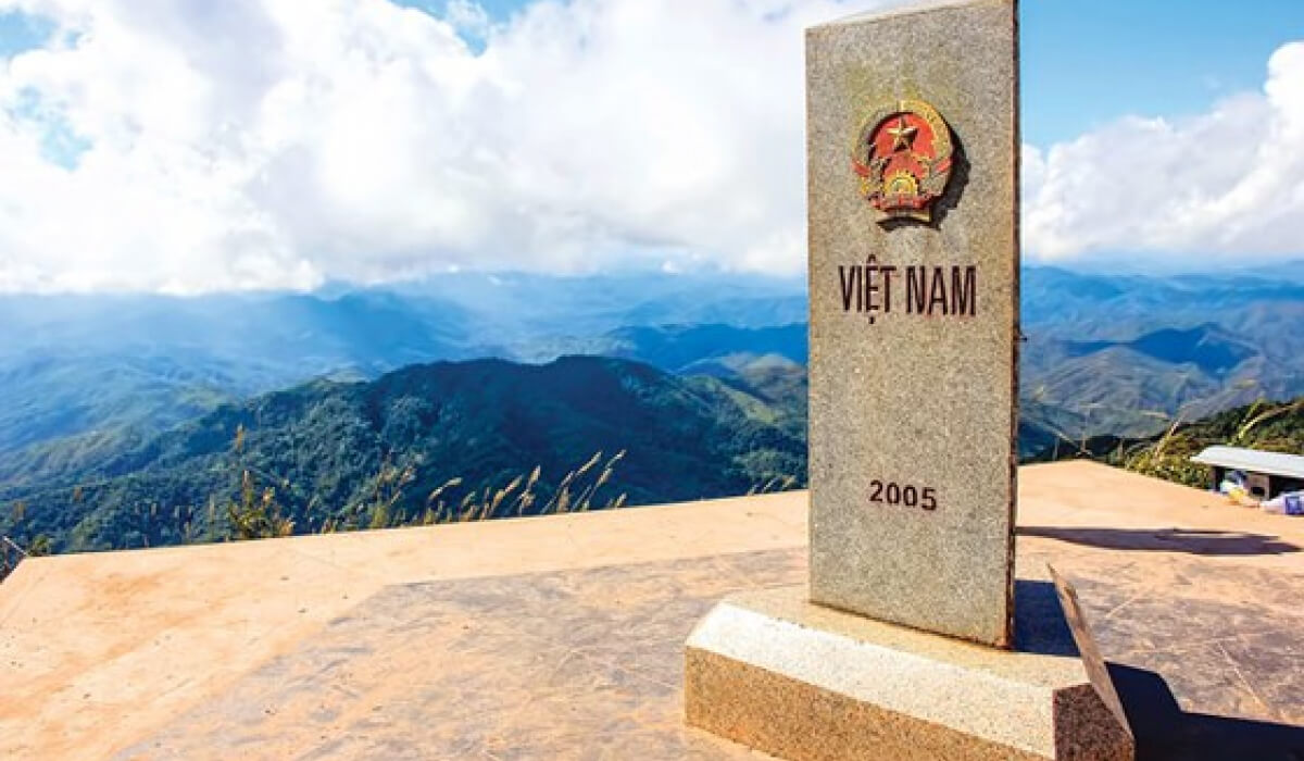
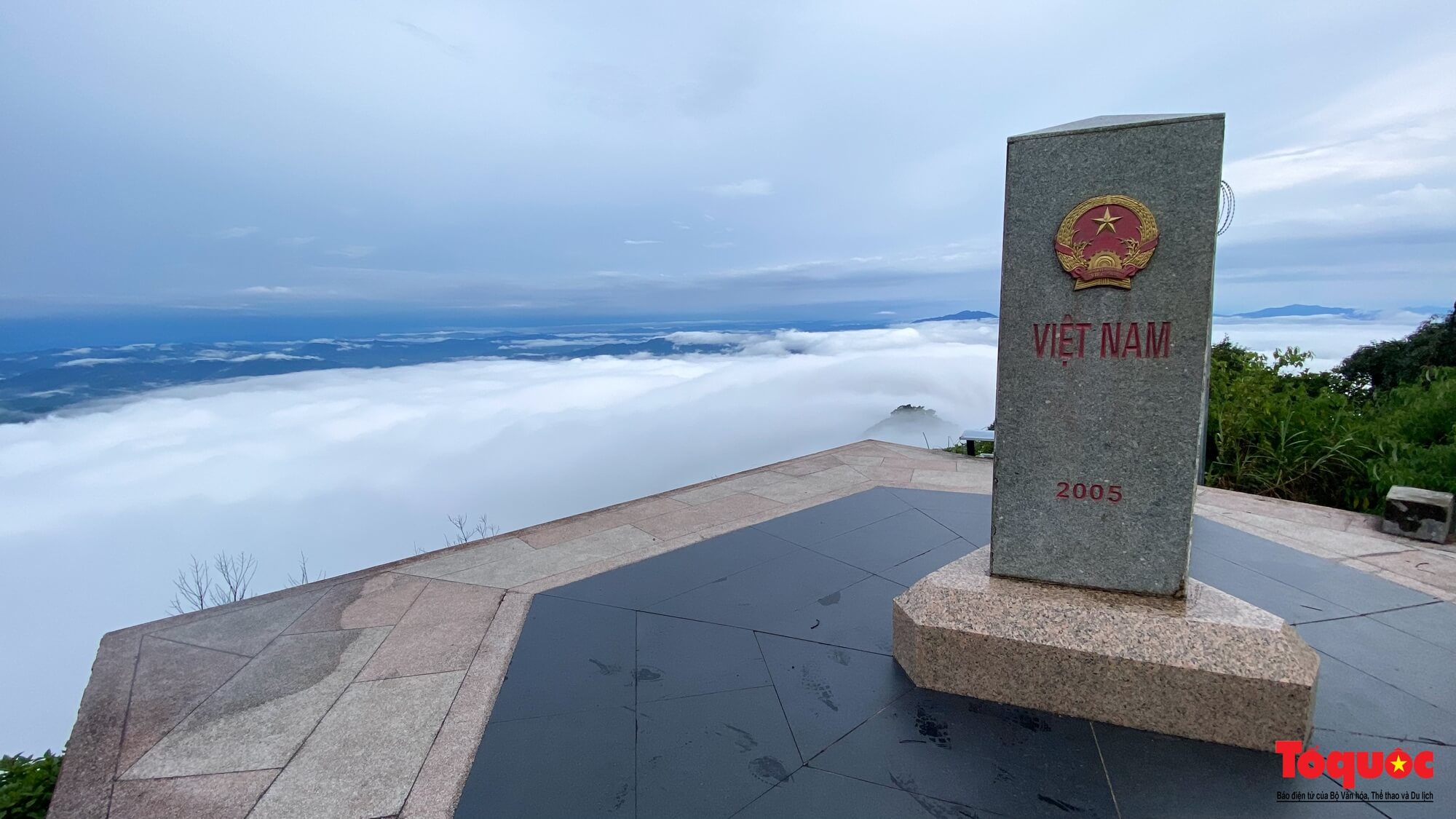
The westernmost point of A Pa Chai
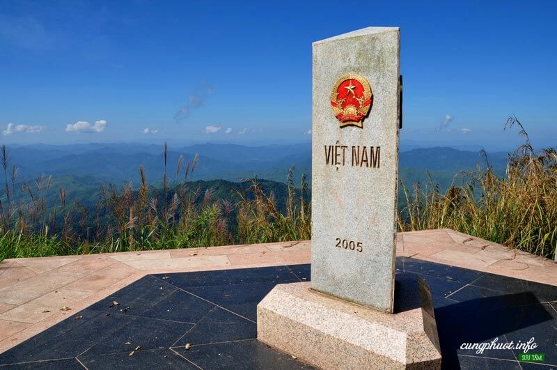
A Pa Chai is located in Sin Thau commune, Muong Nhe district, 250 km from Dien Bien Phu city, is the westernmost point of the country, where there is a landmark dividing the boundary between the three countries Vietnam - Laos - China. This is called the border junction located on the top of Khoang La San mountain, 1,864m above sea level, welcoming many tourists every year, especially young people from all over the country to visit. , conquer. Previously, A Pa Chai was considered a difficult landmark to conquer because the road to the landmark was difficult, having to cross three head-high thatched grass hills, cross forests, wade streams, and climb high mountains, which took four to five hours from The border guard station has just arrived. It's different now. In 2018, Dien Bien province completed the concrete road along the cliffs and built steps, making it easier for visitors to conquer the milestone even though they still have to walk a few kilometers of small, steep and climbing concrete roads. 500 steps to reach the landmark. The border junction marker placed on the top of the mountain is triangular in shape, with three sides facing three directions, each side has the country's name engraved in its own national language and the national emblems of the three countries of Vietnam, Laos and China. From the high point of the westernmost point of the country, looking into the distance is a vast space, majestic mountains and forests. The three-sided landmark dividing the boundary of the three countries Vietnam - Laos - China shimmers in the sunlight. Emotion and national pride surged.
Dien Bien
From January to December
6945 view

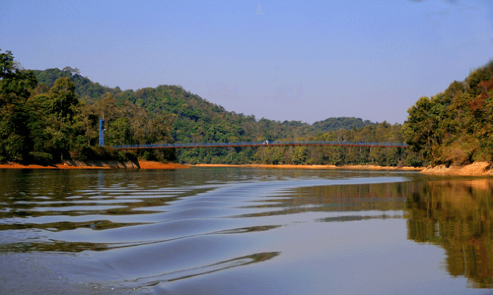
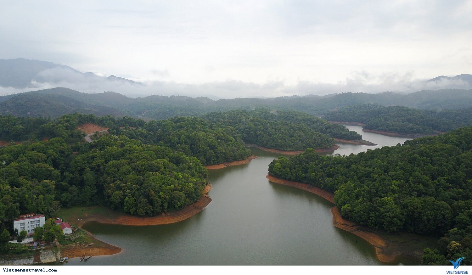
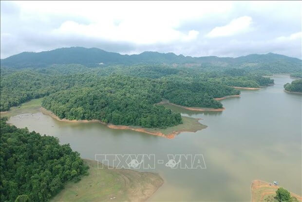
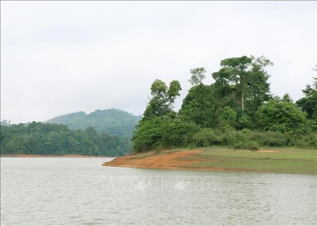
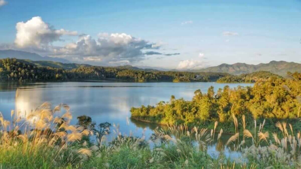
Pa Khoang Lake
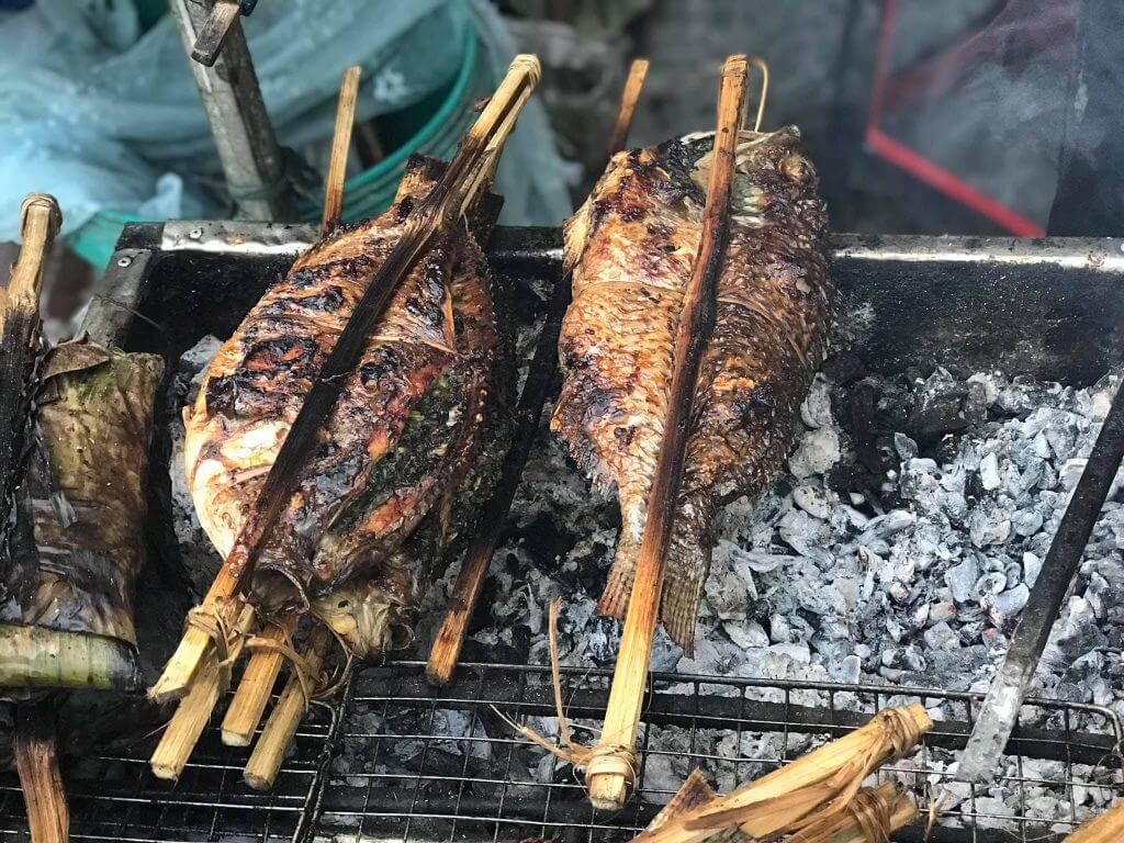
Pa Khoang Lake is located in Pa Khoang commune, City. Dien Bien Phu; About 8km from Highway 279 and from the city center. Dien Bien Phu is nearly 20km to the Northeast. In the language of the Thai people, Pa Khoang means "bamboo forest". Mr. Quang Van Viet, Chairman of the People's Committee of Pa Khoang commune, said: In the past, countless bamboo trees grew around the lake. Thai people here have a funny saying that "look up and see the sky, look down and see bamboo". Local people often use bamboo to make fishing rods and some household items. In addition to ensuring irrigation for 5,000 hectares of Muong Thanh fields with 2 rice crops, Pa Khoang lake also regulates the climate, limits the harmful effects of floods, and stores water for two hydroelectric projects Thac Bay and Na Loi. With the advantage of diverse vegetation, the forests around the lake are rich in all kinds of animals; Many species of plants and animals floating and under the lake bed. In 2004, on the occasion of the 50th anniversary of the Dien Bien Phu victory, the road leading to Pa Khoang Lake was paved. Also at this time, 4 motels, both luxurious and rustic, with nearly 100 rooms were opened; Cultural villages of the Thai and Kho Mu ethnic groups were also deployed with a total area of over 1,000 hectares. To get to Pa Khoang Lake, visitors can move from Highway 279 along Highway 279b into Muong Phang commune. Or you can follow the road southeast of the city. Dien Bien Phu passes through Ta Leng commune. These two routes lead visitors through winding roads along the lake, occasionally appearing behind the forest canopy on the clear blue surface of Pa Khoang Lake... Visiting Pa Khoang Lake, visitors can row a boat on the rolling waves, creep into every corner of the islands, and discover the magic of the natural world. Visitors can also walk through the forest to enjoy the scenery and visit villages of the Thai ethnic group. The people here are very friendly and hospitable; Visitors will be invited to attend cultural exchanges, enjoy art and culinary dishes, such as sticky rice, bamboo-tube rice, grilled fish, smoked meat... In winter, mist covers the lake surface, creating a magical watercolor painting. Summer comes, the lake surface is clear and gentle, reflecting the mountains, clouds, sky and dark green forests. In 2015, the Prime Minister approved the "Master plan for development of Dien Bien Phu - Pa Khoang National Tourist Area, Dien Bien province until 2020, vision to 2030". The general goal of the planning is to develop the Dien Bien Phu - Pa Khoang Tourist Area by 2020 to basically meet the criteria of the National Tourist Area; By 2030, it will truly become a National Tourism Area with a system of synchronous and modern technical facilities; is a highlight and milestone on the tourist route through the Northwest region, creating a driving force to promote tourism and socio-economic development in Dien Bien province.
Dien Bien
From January to December
6264 view

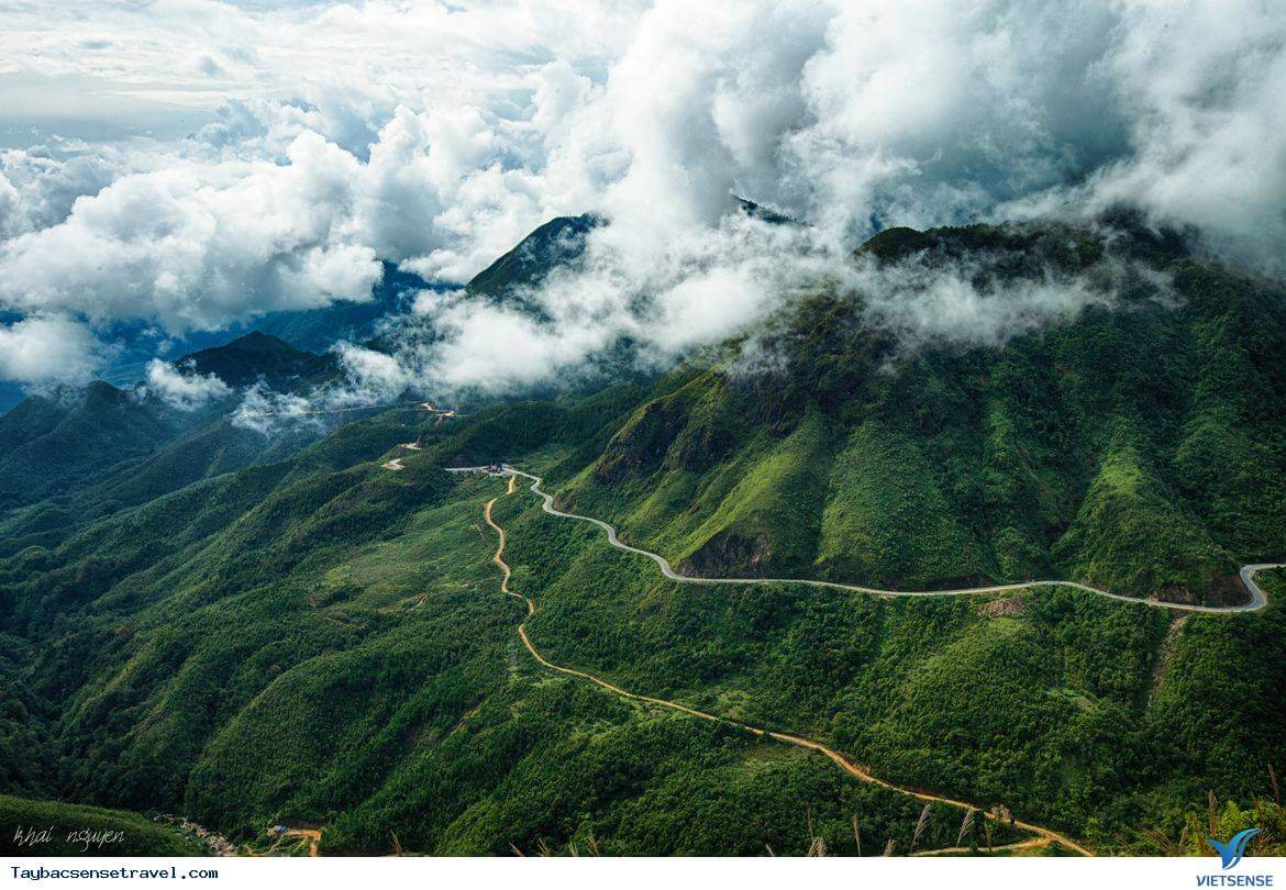
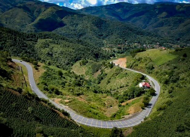
Pha Din Pass
Pha Din in Thai is called "Pha Din", in which "Pha" is heaven, Din is "earth". The name of this pass means the place where earth and sky intersect - the name is enough to help people imagine the remoteness and danger here. Pha Din Pass is about 100km from Dien Bien Phu city. This is considered the boundary between Dien Bien and Son La provinces. Pha Din is located at an altitude of 1000m above sea level, with a total length of about 32km. The starting point of the pass is 66km from Son La City, and the end point is about 84km from Dien Bien Phu City. Pha Din, along with O Quy Ho, Khau Pha, and Ma Pi Leng, make up the four legendary passes of the Northwest highlands. Tourists from far away who want to conquer this great pass need to come to Hanoi by bus, train or it is best to book a plane ticket to Hanoi. From Noi Bai airport, visitors can book an airport shuttle on Traveloka to get to the city center. From Hanoi, to Son La - the starting point of Pha Din Pass by sleeper bus, limousine or motorbike. This pass is located on Highway 6, connecting the two provinces of Son La and Dien Bien. Travelers starting from Hanoi will travel along Highway 6 through Moc Chau - Yen Chau - Mai Son - Thuan Chau plateau to reach the starting point of Pha Din pass. If you depart from Dien Bien Phu City, you will follow Highway 279 towards Tuan Giao district. Each season, Pha Din Pass has a different beauty. But the most beautiful seasons in Pha Din are spring and summer. Spring is the season when wild flowers bloom. There are pink peach blossoms, pure white plum blossoms, and banyan flowers filling the sky. March is the season when ban flowers bloom - a typical flower of Dien Bien province and is also considered the most beautiful season by backpackers. Summer in the delta provinces is scorching hot, but the climate in Pha Din is cool and pleasant. Winter with drizzle, cold weather and more dangerous roads is not the ideal season to conquer Pha Din. In addition, from May to August is the rainy season in Dien Bien. Before starting your journey, you should closely monitor weather developments. Because the Pha Din area is a red soil mountain, not a limestone mountain. When there is a lot of rain, extremely dangerous landslides can occur. Most tourists and backpackers come here to satisfy their adventurous spirit. The rugged mountain pass and majestic nature here seem to have a strange hypnotic power. Looking back from afar, the long pass road curves like a rope suspended between mountains and hills. The terrain here is extremely dangerous with a cliff on one side and a deep abyss on the other. The highest point of Pha Din pass is 1,648m above sea level. The slope of the pass ranges from 10% to 19%. The mountain pass is zigzag with 125 dangerous curves, A-shaped and Z-shaped curves with a curve radius of less than 15m. Going from the starting point to the top of the pass, each natural picture slowly opens, both majestic, breathtaking and poetic. At the foot of the pass are scattered villages. Halfway up the pass, clouds covered it. Looking down from the slope of the pass is the vast Muong Quai valley. Approaching the top of the pass, there is only the deep sky and majestic, vast mountains and forests. When conquering Pha Din, don't forget to stop to admire the scenery at Ang Nua valley or check in at Pha Din Pass - a 50ha tourist area built by Pha Din cooperative. Vitality is present throughout Pha Din pass. On the conquering route, visitors will encounter images of highland markets when passing through Phong Lai commune, Thuan Chau district, Son La province or Toa Tinh commune, Tuan Giao district, Dien Bien province. People gather at the market to buy and sell agricultural products, medicinal herbs, and mountain and forest products. Tourists can also stop to buy some to take home as gifts. What makes Pha Din Pass more special than the other three great Northwest passes is that this pass is associated with the famous Dien Bien Phu campaign in five continents, shaking the earth. During the resistance war against the French, Pha Din was the route to supply and transport artillery to Dien Bien Phu and became a symbol of the brave spirit of 8,000 young volunteers. To block this supply route, the French army sent planes to bomb Route 6 continuously for 48 days and nights. Among them, Pha Din Pass was one of the two places that suffered the most from bombs and bullets. Now, Pha Din Pass has been recognized as a National Monument, a testament to the nation's history.
Dien Bien
From January to December
6285 view
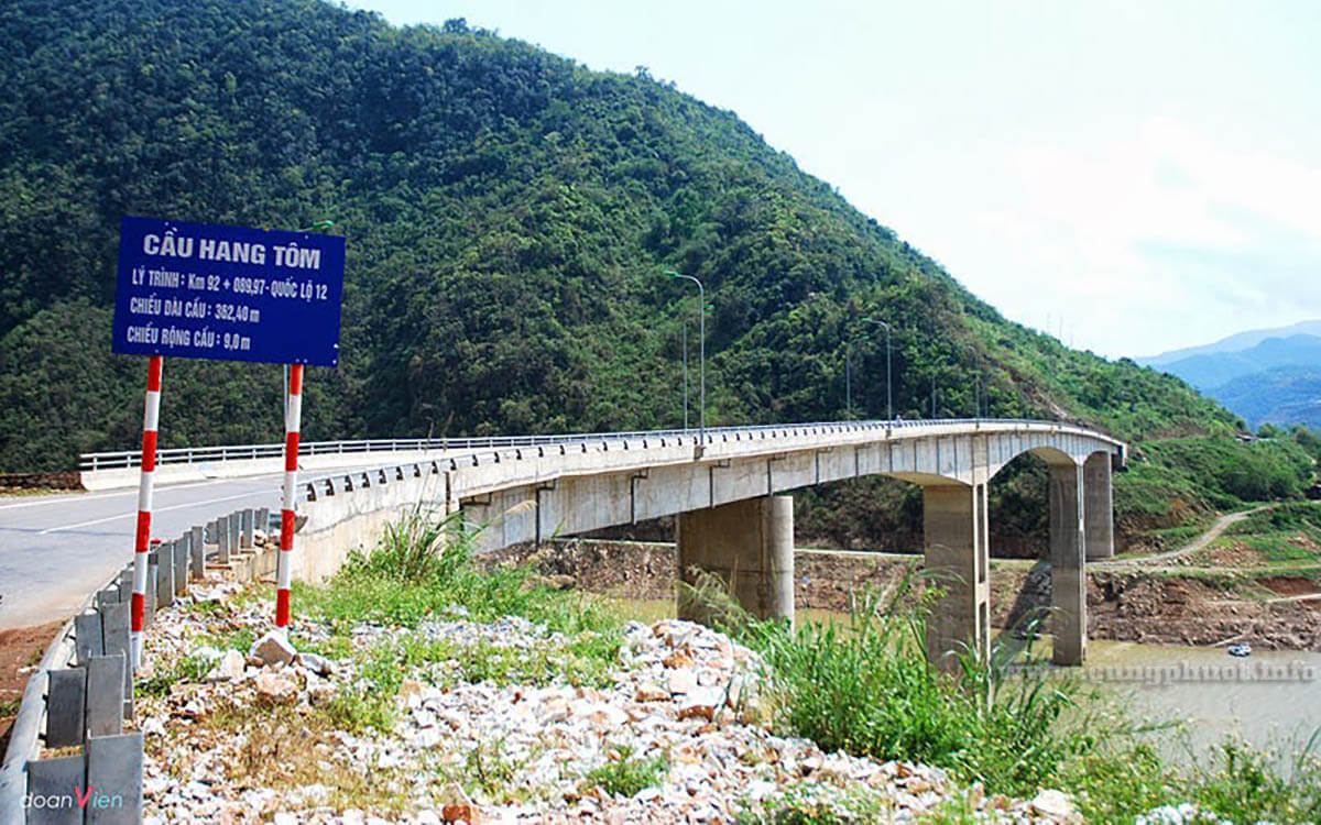
Hang Tom Bridge
The old Hang Tom Bridge was previously famous as the most beautiful cable-stayed bridge in the Northwest, connecting Muong Lay (Dien Bien) and Phong Tho, Sin Ho of Lai Chau. The reason the bridge is called Hang Tom is because this part of the river used to have too many shrimp. About 50m from the bridge, there is a "pool" of very cool water, shrimp from the Da River flock there to lay eggs, the whole stretch of the river is densely packed with shrimp. Every day, people take turns going up there to catch them and eat them. But the people around this area have an unwritten custom: each family can only arrest for about an hour before the other family continues. In the late 1960s, Hang Tom Bridge began to be built. That day, Chinese experts and workers also came to help us build the bridge. However, in 1968, China had a cultural revolution, and all its experts and workers withdrew home. Fortunately, the item considered to be the most difficult, the cable car, had been pulled, leaving only the finishing stages remaining. But it was not until 1973 that Hang Tom Bridge was inaugurated. That day was truly a big festival for tens of thousands of Northwest people. Thousands of people came from all over to eat, eat rice balls, and walk for several days to see with their own eyes and once cross the dream bridge. Tom Cave is a highlight for the Northwest region. Because of the majestic and wild beauty of Hang Tom Bridge, in recent years, tourists, Westerners as well as ours, have flocked here, especially since the emergence of the backpacking tourism movement. In November 2012, Son La hydroelectric power station flooded, the entire old Muong Lay town, including Hang Tom bridge, sank deep under Song Da lake, ending 40 years of operation of the historic bridge. Right near the old Hang Tom bridge location, a new bridge was built to replace the task, 70m higher than the old bridge.
Dien Bien
From January to December
6496 view


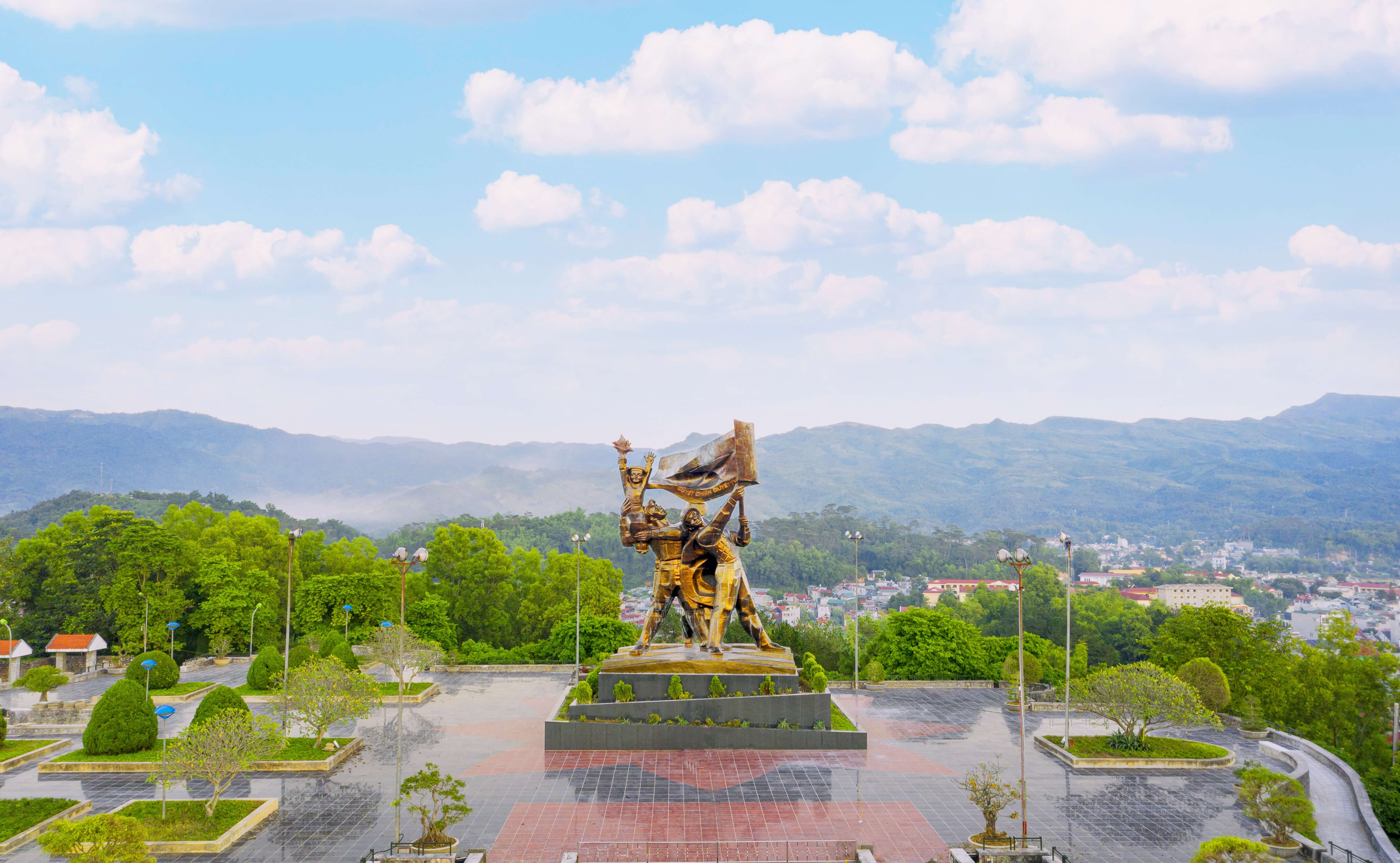
Dien Bien Phu victory relic site
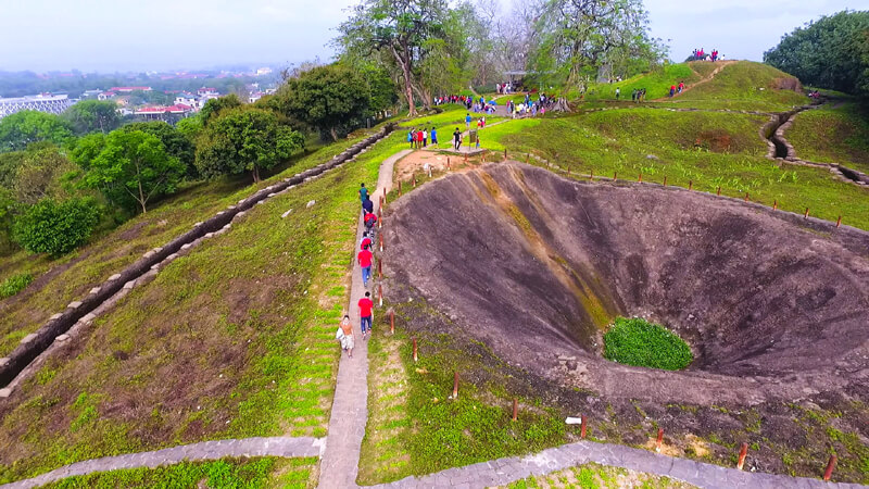
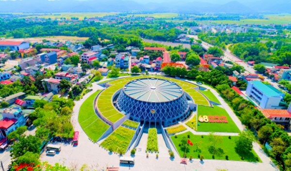
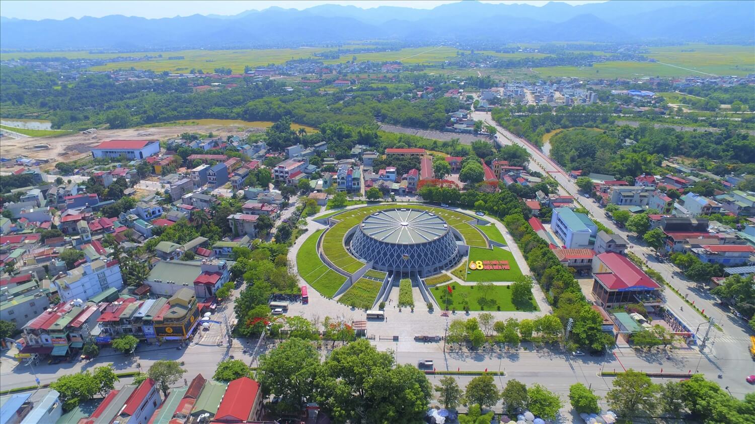
The Dien Bien Phu Battlefield relic site includes 45 component relics. This is a historical space and also an outstanding tourism product, contributing to traditional education for the young generation, reminding Vietnamese people of the heroic memory of the Dien Bien Phu victory "illustrious in five continents, earth-shattering" while bringing economic value to the locality. During these historic days of May, many delegations flocked to Dien Bien Phu city (Dien Bien province) to visit the old battlefield on the occasion of the 65th anniversary of the Dien Bien Phu Victory (May 7, 1954 - May 7, 2019). 2019). There have been a lot of changes in the land that was once a fierce battlefield in the past, with the 56 day and night campaign of "cutting mountains, sleeping in cellars, pouring rain, squeezing rice" by our army and people, successfully ending the battlefield resistance. period against the French colonial invasion. The Dien Bien Phu Battlefield relic complex is now one of more than 100 special national monuments in the country and plays an important role in the tourism development of Dien Bien province. The Dien Bien Battlefield relic complex includes outstanding relics such as: A1 Hill, Doc Lap Hill, Hong Cum base, Him Lam, Muong Thanh bridge, Dien Bien Phu base group command tunnel (or Do tunnel). Sand), Victory Monument, Cannon Monument, Dien Bien Phu Campaign Headquarters... These relics have left a deep impression, attracting many tourists to visit when coming to Dien Bien. Located east of the center of Dien Bien Phu stronghold group, A1 hill has the most important position in the system of 5 hills protecting the center of Muong Thanh. Here, on the night of May 6, 1954, our troops dug a tunnel, placed an explosive weighing nearly 1,000kg and set it on fire. By the morning of May 7, 1954, our troops had complete control of A1 hill, paving the way for the final general attack on the stronghold group headquarters and achieving complete victory. Hill A1 is now a tourist attraction for domestic and international tourists with tunnels, trenches, blockhouses, and tanks preserved almost intact. Here, tourists can experience pushing bicycles, cooking with Hoang Cam stoves, listening to veterans tell stories... General De Cat's command bunker is located in the center of the Dien Bien basin. This is the basement with the working and resting rooms of General De Cat and the Dien Bien Phu base group command. This is also the place that marks the tragic defeat of an expeditionary army with the image of the commanding general and all officers under his command raising their hands to surrender and our soldiers raising the flag of determination to win and ending the war. Translating the history of Dien Bien Phu. Another relic that cannot be ignored along with the epic poems about Dien Bien soldiers is the artillery pulling Duong relic. This legendary route has entered the nation's history and become legendary. Using only human strength and rudimentary tools, but with patriotism and heroic spirit, our army and people opened routes on winding and dangerous mountain slopes to pull artillery into the battlefield. 20km from the center of Dien Bien Phu city is the campaign headquarters located deep in the Muong Phang forest. This was the headquarters of the Dien Bien Phu Campaign Command from January 31 to May 15, 1954. During the days here, General Vo Nguyen Giap made many important and historic decisions. Muong Phang Forest has become a symbol of the strength of the Vietnam People's Army and is called "General's Forest" by the people. In the complex of Dien Bien Phu Battlefield relics, a project that was born in peacetime but plays a very important role is the Dien Bien Phu Historical Victory Museum. This project was completed in 2014, on the occasion of the 60th anniversary of the Dien Bien Phu Victory. The museum has a shape that simulates the helmet of our soldiers in the past. This is where artifacts from the historical Dien Bien Phu campaign are kept, including 2 display areas: Outside, there are 112 artifacts that are weapons used by the Vietnam People's Army and the French army, inside. Displaying 274 artifacts and 202 documentary photos. The museum has contributed to promoting the value of the historical complex of Dien Bien Phu battlefield and is a highlight attracting tourists to Dien Bien.
Dien Bien
From January to December
6358 view

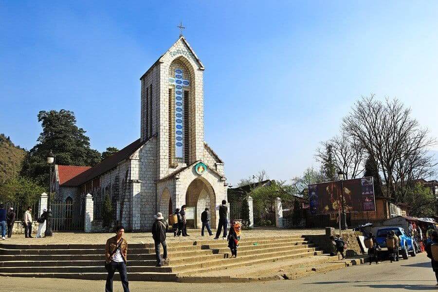
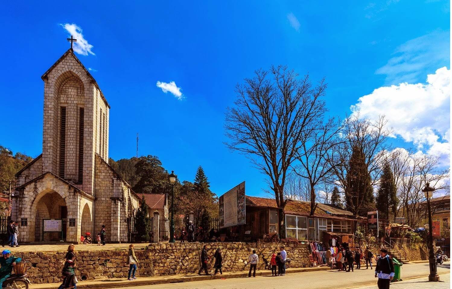
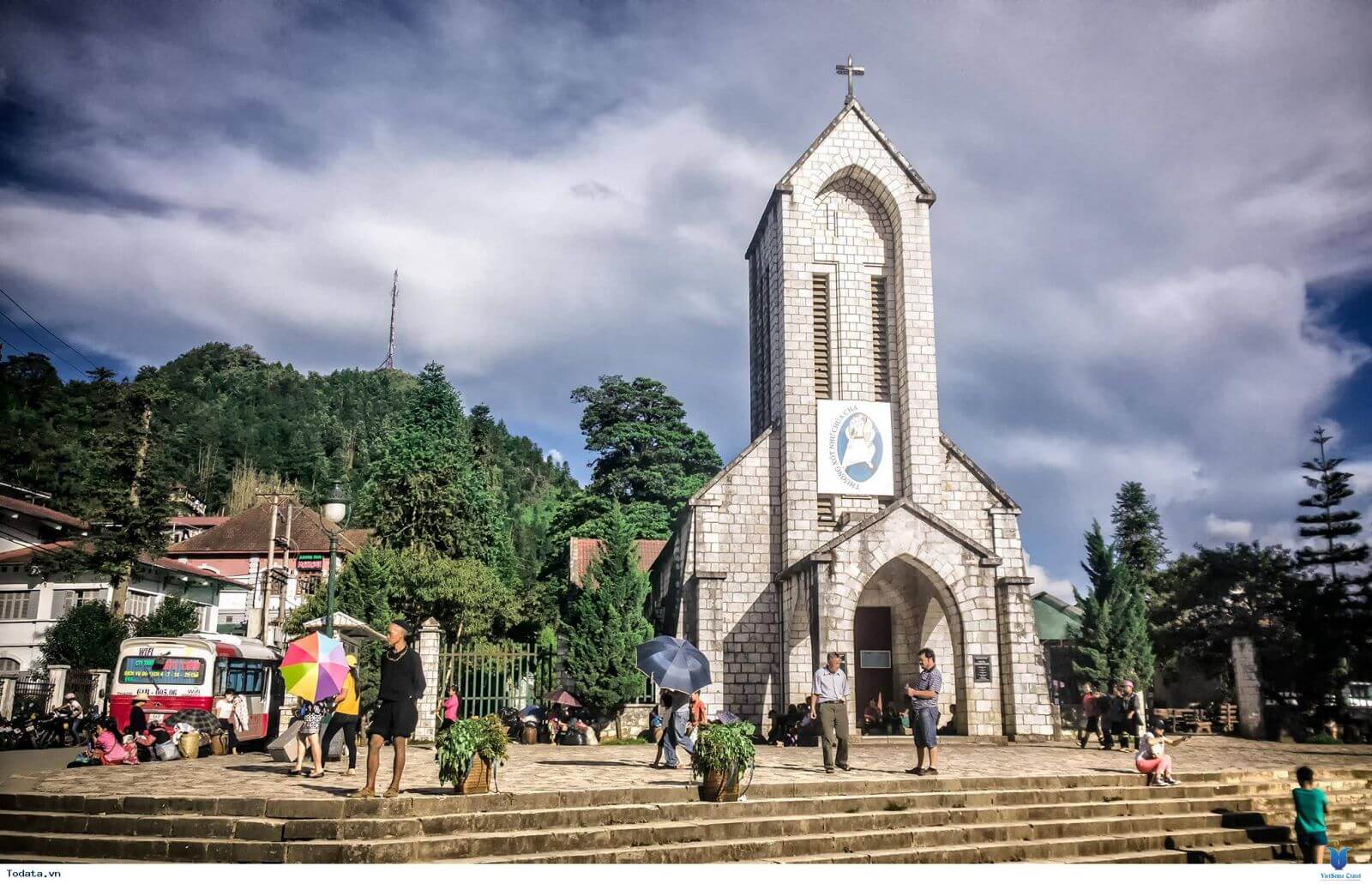
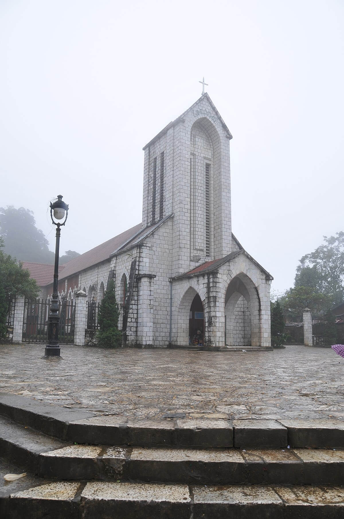
Sapa stone church
Sapa ancient stone church is located near the central square, very convenient for stopping to visit other places. When you come to Sapa Ancient Stone Church, you will feel the sacredness, dignity and respect of this place with its extremely ancient and unique architecture. Coming here, you will have the opportunity to witness the "triangle" of monuments. This triangle includes the stone church, Chu Cau villa (currently Hoang Lien hotel) and finally Bien Xua district (currently Lao Cai Tourism Information center). All of them have unique, French-style architecture. The church is located on quite spacious and flat land. It can be said that this is the place where many cultural activities, meetings and festivals of the village take place. Although the land here was greatly affected by the war, it is still quite flat and does not reduce the quality of the construction. The local government also regularly introduces policies to repair and renew the church, to serve the people here as well as open tourism to tourists. Sapa Stone Church, also known as Our Lady of the Rosary Church. It began construction in 1926 and was inaugurated in 1935, especially people consider this a typical symbol of the foggy town of Sapa. Up to now, Sapa ancient stone church has become one of the tourist attractions attracting a large number of visitors, with interesting religious activities of the people here. This work was built by French architects, who recorded the historical and war marks left on the stone slabs at the church. Sapa ancient stone church was chosen to be located facing the East, where the sun rises. This represents an extremely sacred meaning, which is the act of receiving the bright light and energy given by God. At the end of the church is the west direction, this is where General Kito was born and grew up. The entire house is built mainly of stone, including walls, floors, towers, bells... linked by lime, sand and molasses. With a total area of more than 6000 square meters, Sapa ancient stone church is fully equipped with rooms to accommodate different areas. Moving inside the church, you will be overwhelmed by the beautiful European-style architecture. The La Gothic architectural style is applied at the ancient stone church of Sapa, even in the smallest details. The appearance and architecture here is in the shape of a cross following the very ancient Gothic architecture of Rome. The roof of the church is covered with red tiles and tiled in a triangular shape, the two edges of the tiled roof are made in a simple, straight shape. The ceilings are made of straw, which is continually renewed over generations). However, the bell tower is a combination of a mixture of lime, straw and iron that has remained intact over time and has never been repaired. The white painted interior space enhances the poet's luxurious beauty, creating a more spacious and airy feeling. Both sides of the wall are covered with wood to make cleaning easier. In addition, the upper doorways are designed with a small semicircular size, using colored glass pieces to decorate, this style is characterized by a unique Western style. Most churches are made of carved stone held together by a mixture of sand, lime, and molasses. The wall to the right of the cross is sanded like stalactites slowly flowing down, making the church more unique. The total area of the campus is up to 6,000 square meters, divided into many different small areas: the church area, the monk's living area, the livestock area, the heavenly house, the front yard, the fence and the Holy Garden. The row of houses was built parallel to the church area with 5 different compartments The Angel House has a basement with three upper floors, this place specializes in treating people, welcoming travelers, restrooms, kitchens... The Holy Garden has 2 tombs with 5 long-lasting Khao Vang trees, including 4 trees growing on rocks. The 7-room church area has a large area of 500 square meters, with a bell tower about 20 meters high. Inside the tower is a bell with a height of 1.5 meters weighing 500kg, cast in 1932, its sound can be heard. echoes within a radius of 1km. The bell surface has recorded data related to it, the bell stand is made from Pomu wood and is still quite intact to the present time. In addition, you will be very interested in other areas such as the front yard - where cultural and religious activities take place and is also a place for cultural exchanges and souvenir trading. Every Saturday, exciting activities take place at the famous Love Market in Sapa.
Lao Cai
From January to December
4630 view


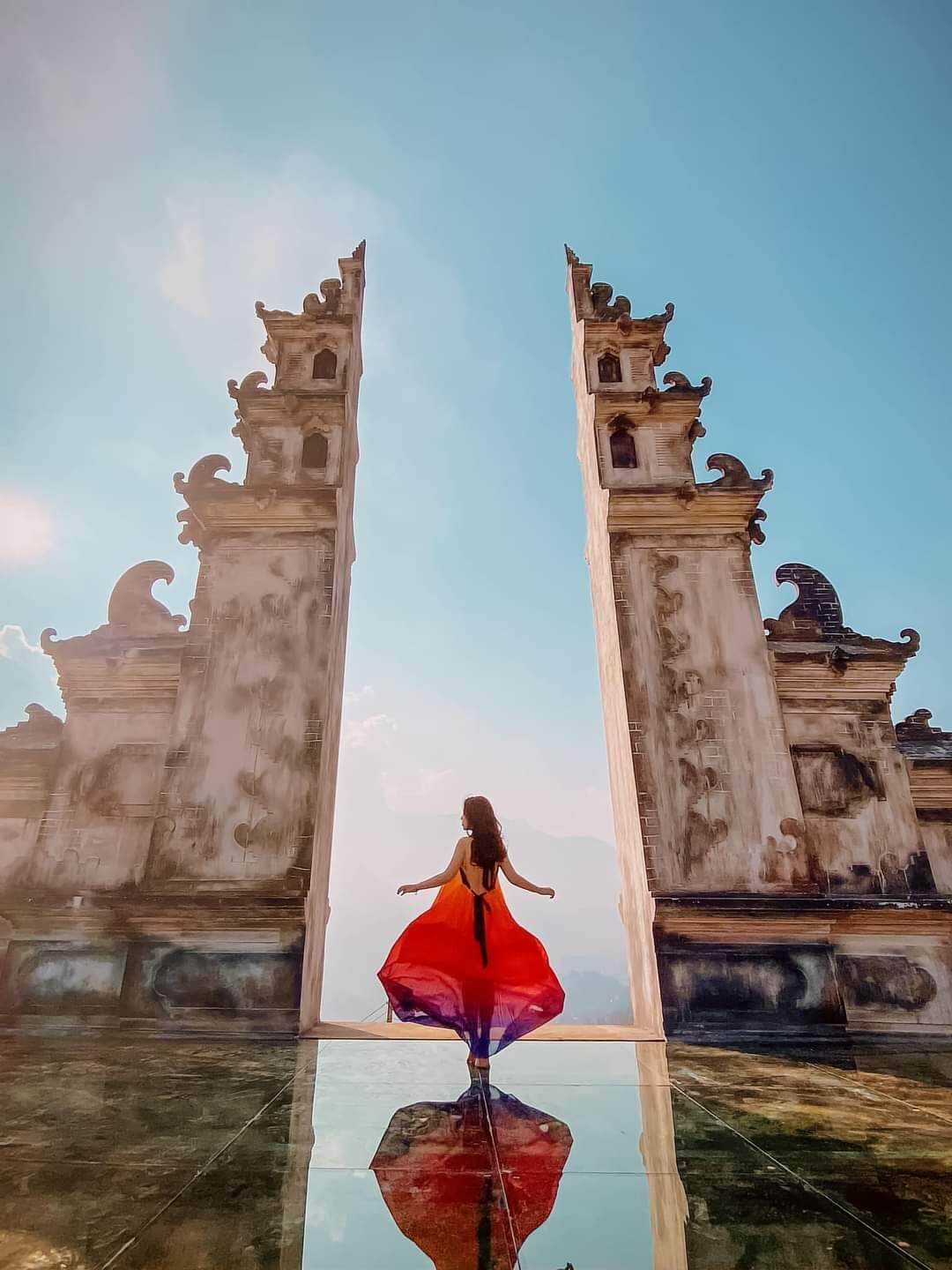
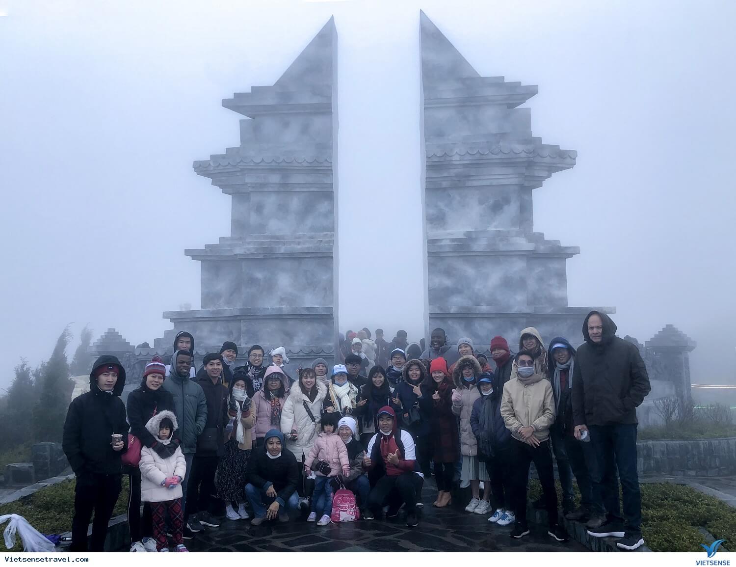
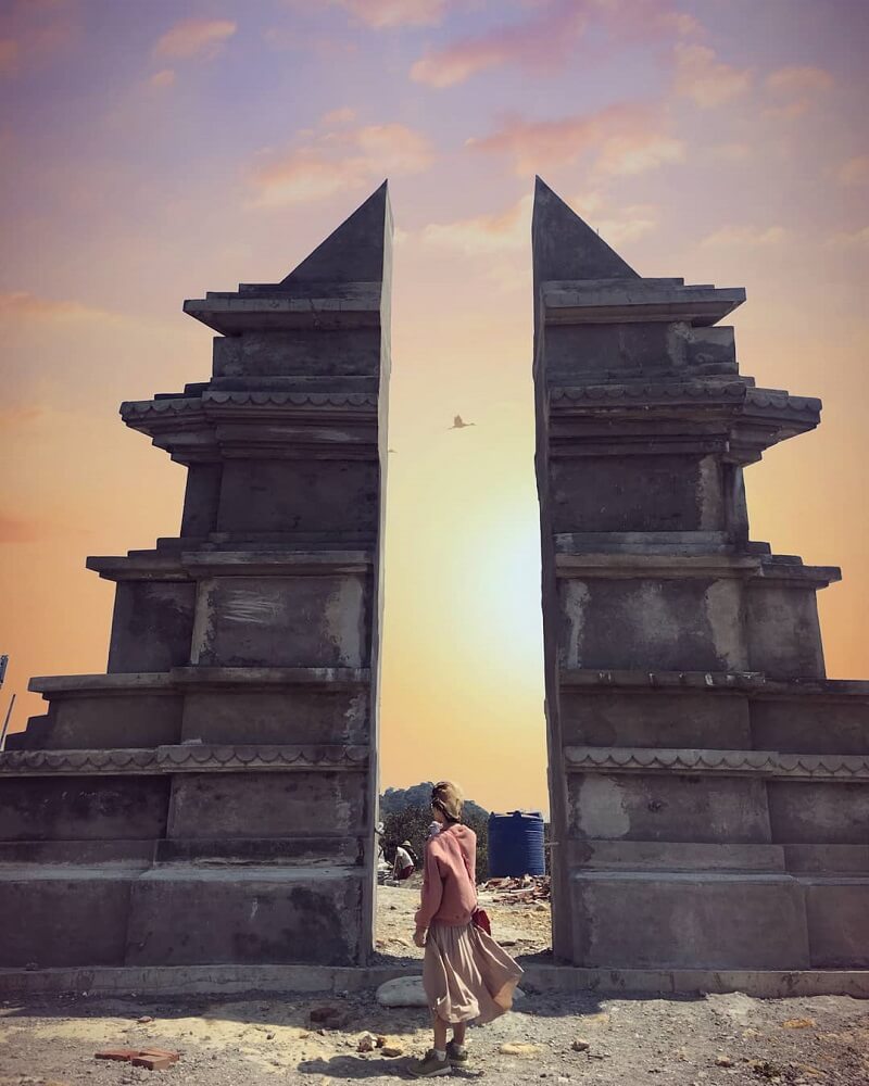
Heaven's Gate
When entering the foggy land of Sapa, people are suddenly attracted by the wild beauty of the Northwest mountains and forests and the changing colors of nature. And in this area, there is a beautiful destination called Sapa Heaven Gate - or O Quy Ho Sapa Heaven Gate. It is a place where people and nature come together, creating a magical gate hidden between floating white clouds and the fresh air of the mountains and forests. Standing at Sapa Heaven Gate, you can admire the entire mountains and forests, the Sapa valley hidden in the mist, is also an ideal place to hunt clouds. For #teamKlook who love trekking, Sapa Heaven Gate is the highest road peak among the four great Northwest passes that you can conquer. Located at the top of O Quy Ho pass, Sapa Heaven Gate, also known as O Quy Ho Heaven Gate, Tram Ton Heaven Gate, is the most wonderful place to view the Northwest mountains and forests in Sapa with an altitude of nearly 2,035m. Sapa Heaven Gate was recommended by the travel blog Global Grasshopper as one of the ten must-visit tourist attractions when coming to Vietnam. In addition, Sapa Heaven Gate is also a place to test your courage because to get here, you have to overcome a winding and dangerous pass. However, all challenges will be rewarded when you arrive, you will immediately be immersed in the endless space of heaven and earth, feeling the wildness of nature in the most honest way. Not just stopping at sightseeing and checking in, the Sapa Heaven Gate area has more interesting activities than you think. Going to Sapa Heaven's Gate is also an opportunity for you to conquer O Quy Ho Pass, which is considered by the backpacking association to be the easiest of the four great Northwest passes. O Quy Ho Pass not only challenges crazy legs, but also captivates many art lovers and professional paparazzi. Because from here, the majestic and charming natural picture of the Northwest mountains and forests appears clearer and more vivid than ever. If you have reached Sapa Heaven Gate, don't hesitate to check-in right away! Most likely, you will have a huge photo archive capable of taking social networks by storm. It can be said that when you set foot at Sapa Heaven Gate, there will be beautiful photos from every corner. However, if you are lucky enough to come here at sunrise and sunset, Klook guarantees that those will be truly the most precious, impressive, and romantic moments you will ever encounter in your life. Along the way to Sapa Heaven Gate, there are many shops selling souvenirs as well as typical grilled dishes of Sapa such as grilled eggs, grilled corn, grilled potatoes, and grilled buffalo meat. Amidst the chilly air, enjoying fragrant grilled meat skewers, rice balls and sipping a cup of sweet tea will cheer up your spirit. Some experiences traveling to Sapa Heaven's Gate you need to know. For a place where heaven and earth harmonize like Sapa Heaven Gate, you can visit any season of the year, especially in September and December. September is the time when you can see Sapa filled with golden ripe rice. ; In December, this place is covered with snow and frost like in Europe. You should not come here in the spring because this season often rains, making the roads slippery and dangerous. In case you still want to go to Sapa Heaven Gate in the spring, choose to travel by cable car as instructed above. Noon and early afternoon are beautiful weather, there is not too much fog at Sapa Heaven Gate, convenient for sightseeing and taking photos. However, if you come here early in the morning or late afternoon, you can watch the sunrise and sunset.
Lao Cai
September to December
4798 view


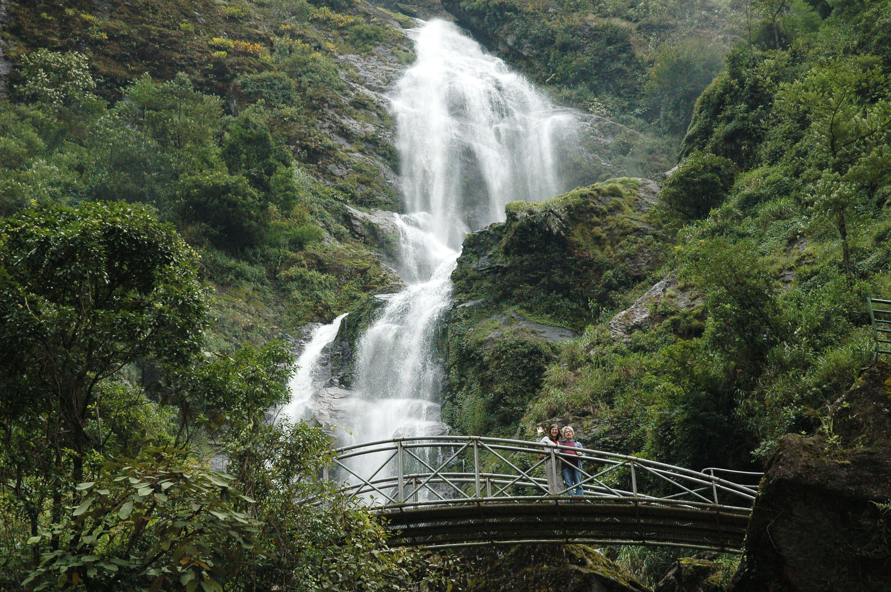
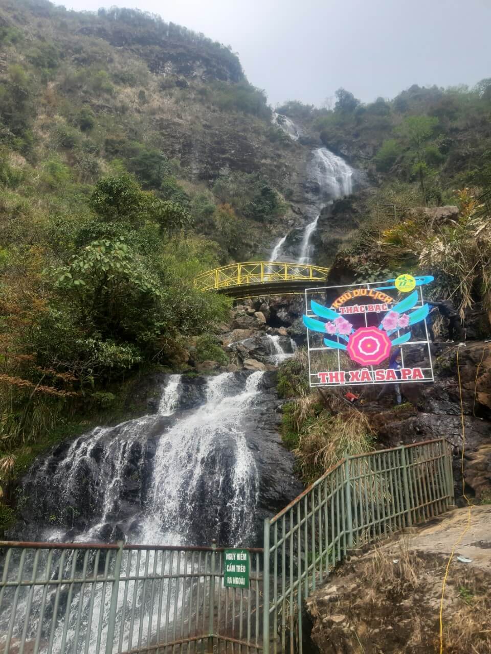
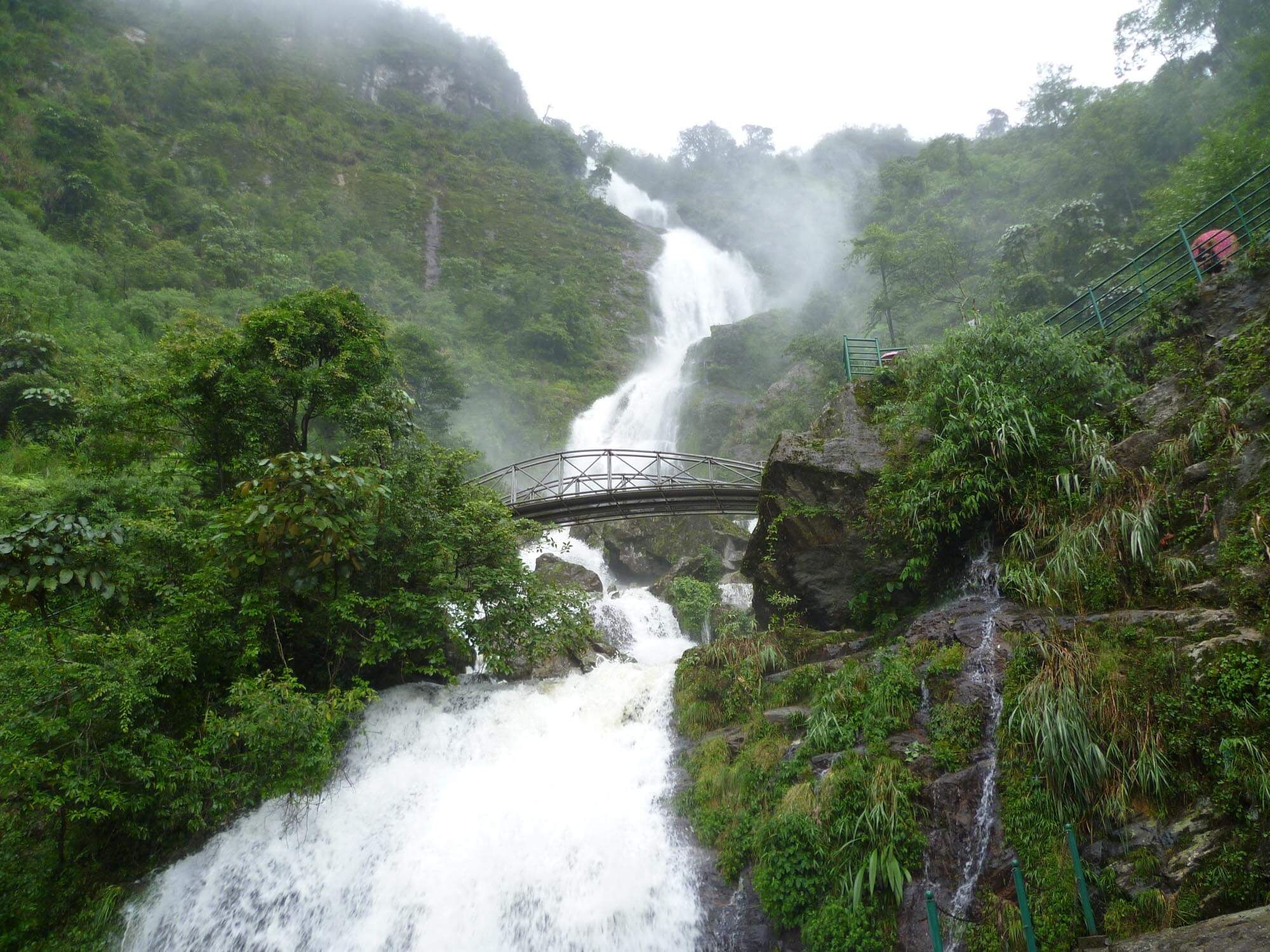
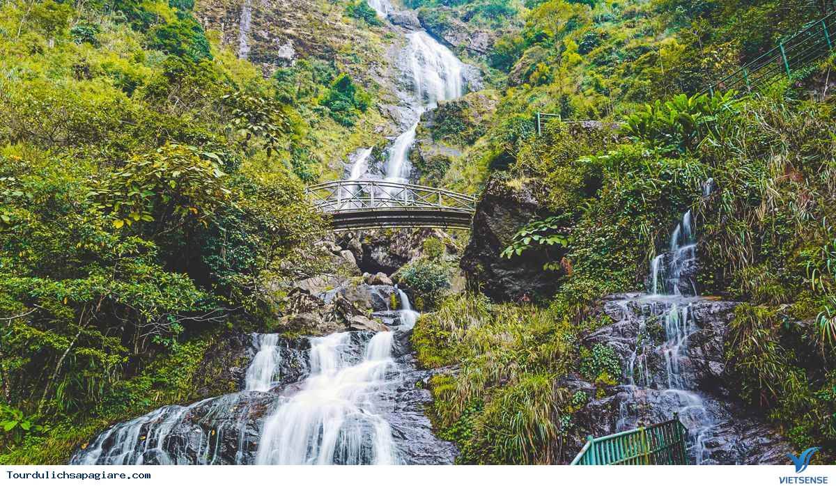
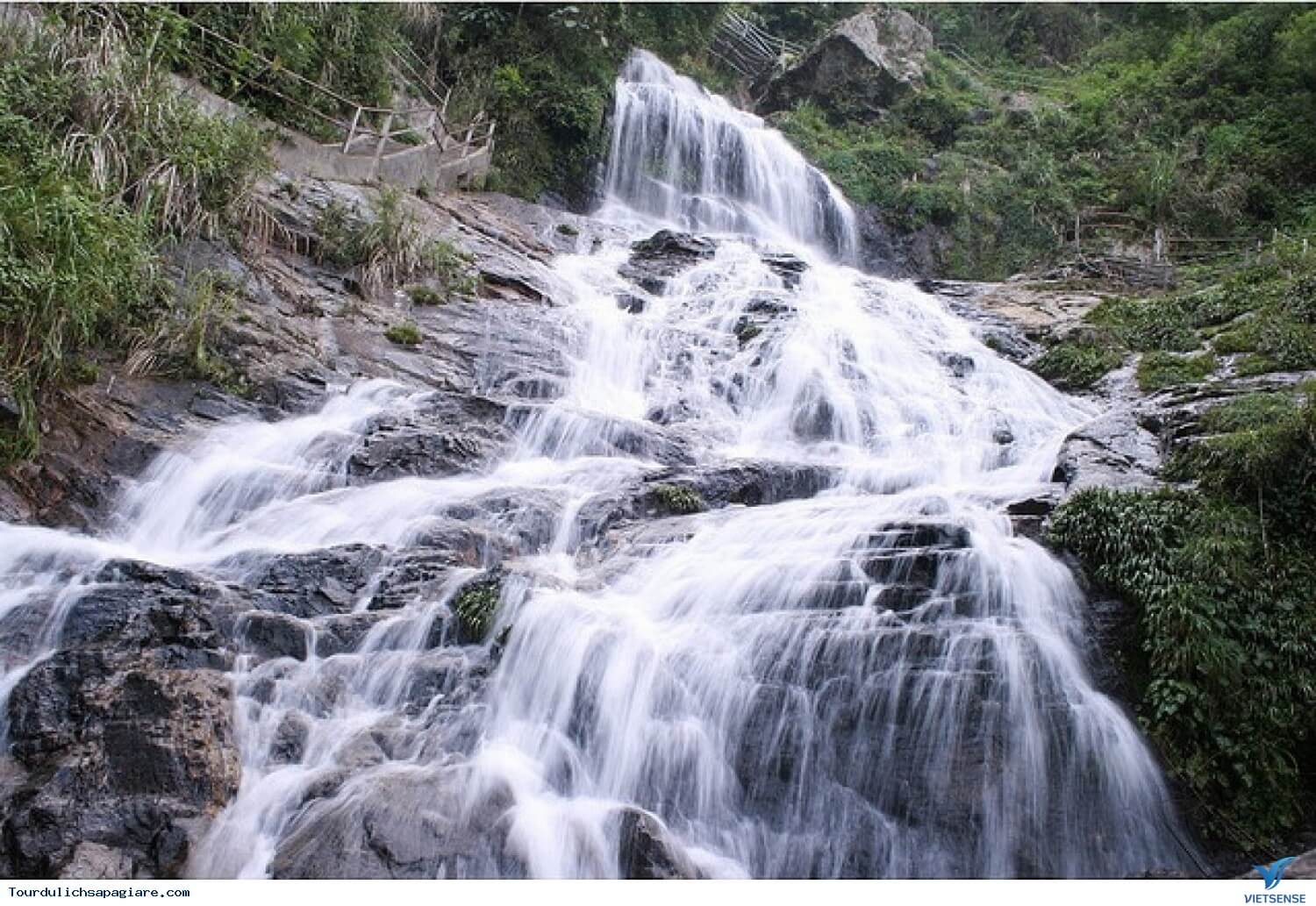
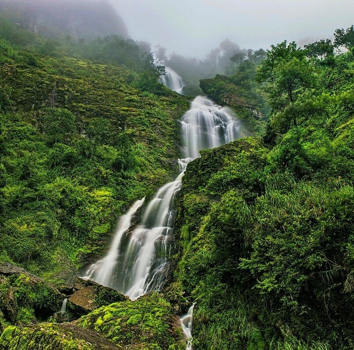
Silver Falls
Silver Waterfall is a poetic name that describes the white waterfall pouring down the stream, looking like a silver strip suspended in the fresh, green mountains and forests of Sapa. With a height of 200m, Silver Waterfall possesses a wonderfully beautiful scenery that is "rare and hard to find", so it is always named in the list of the most beautiful waterfalls in Vietnam. To get to Thac Bac, you will go through roads with towering pine forests, green chayote gardens and most especially beautiful terraced fields, not to mention fields of brightly blooming flowers. makes so many travel addicts fall in love. The road to Silver Waterfall makes you feel like you are lost in a poetic fairy tale world. Romantic appearance with the image of water flowing down from a high ravine, white foam rising up like a strip of fog that suddenly appears and disappears. Each level of the waterfall is like musical notes that sometimes rise and fall in a magical and mysterious violin symphony. From afar, you can hear the mesmerizing sound of the waterfall, motivating your feet to run to find the source of that captivating sound. The atmosphere here can easily dispel the fatigue and sadness of a hustle and bustle life. Currently, stairs have been built on the road up to the waterfall to help you reach Silver Falls. Although quite temporary, it also makes your trip easier. In addition, you can rest at the rest stops to regain strength to continue climbing. No matter the time of year, your trip to explore Silver Falls can be an enjoyable experience. However, the summer from February to June is still the most suitable time frame, because at this time the flow of Thac Bac is quite strong, the forest and mountain scenery is also greener and more beautiful. In the winter, there is most likely no water, snow covers both Silver Waterfall and O Quy Ho Pass, making your experience of watching the waterfall not as expected, but in return is the image of waves of snowflakes fluttering in the winter sky. cold.
Lao Cai
February to June
4766 view