
 vn
vn en
en ja
ja ko
ko zh
zh


Mount Mann – The Legendary Twin of Poetry Mountain

Ha Long – more than just its iconic island wonders, this destination also conceals a host of unique natural and cultural treasures that remain largely off the beaten path.
More Than Just Sea and Sky: Uncovering Ha Long's Hidden Gems
Ha Long City is renowned both nationally and internationally as a stunning semi-mountainous coastal area, encompassing a magnificent 'stone forest' on the water with 1,969 islands of myriad shapes and forms. While the iconic Fighting Cock Islet symbolizes Ha Long Bay, few are aware of the culturally rich twin mountains nestled within Ha Long City itself.
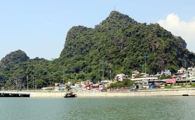

Bai Tho Mountain and Man Son Mountain are traditionally known as twin mountains, displaying strikingly similar geological features. Scientists suggest that both mountains were formed simultaneously during the second geological period.
These are Bai Tho Mountain and Man Son Mountain. Bai Tho Mountain is located across Bach Dang and Hong Gai wards, while Man Son Mountain is in Thong Nhat commune. One mountain stands on the north bank and the other on the south bank of Cua Luc Bay, separated by 12.6km. Both mountains share common characteristics: they are large, tall limestone peaks, isolated from neighboring mountain ranges, and possess quite similar geological features, minerals, and vegetation. According to scientists, these two mountains were formed at the same time during the second geological period.
Legend has it that in primeval times, the Jade Emperor sent a celestial being to patch up the tears between heaven and earth. This celestial being, known to mortals as a giant due to his immense size, carried stones to mend the sky. One day, as the giant shifted his burden, his carrying pole broke. One basket of stones fell to the edge of the sea, now known as Bai Tho Mountain, while the other fell to the edge of the forest at the foot of the Thien Son range – the 'five tigers sitting on the mountain' – in the Northeast region (five mountains over 1,000m high within the Dong Trieu arc), which is now called Man Mountain.
The twin mountains share an inseparable connection with the giant's footprints left on the earth. According to folklore, Cua Luc Bay, with its 17m depth and 18km2 surface area, is believed to be the giant's footprint, located between Bai Tho Mountain and Man Mountain. In Xich Tho village, Thong Nhat commune, bordering the northern shore of Cua Luc Bay, locals still recount stories of two giant footprints on a pine hill, which they refer to as the "giant's mountain" and the "giant's footprint." This depression, shaped like a human foot and about one &sagrave;o (360 sq m) in size, was cultivated by locals during the subsidy period and called the 'giant's field'.
Bai Tho Mountain
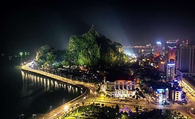
Bai Tho Mountain stands in the heart of Ha Long City. In 1992, it was recognized as a National Historical and Scenic Site.
Bai Tho Mountain, standing at 198.2m high with a base area of 22.9ha, was formerly known as Truyen Dang Mountain. In the past, fishermen and merchants referred to lighthouses as 'Truyen Dang,' now 'Hai Dang,' signifying beacons for vessels navigating the Northeast Sea. In 1468, King Le Thanh Tong, on a naval tour of the An Bang sea, arrived at the foot of Truyen Dang Mountain. There, amidst calm, clear waters, a grand, isolated mountain emerged with a spectacular landscape. Inspired by the scene, the King composed a poem and had it carved into the mountain face. Subsequently, 11 more poems by high-ranking officials from later feudal dynasties, as well as scholars and literati, were also carved onto the cliffs of Truyen Dang Mountain. Because the mountain bears many poems, with King Le Thanh Tong's being the most significant, locals eventually began calling it 'De Tho Mountain,' which gradually evolved into 'Bai Tho Mountain' (Poem Mountain).
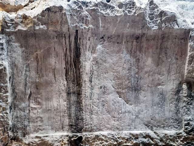
King Le Thanh Tong's poem, comprising 56 Han characters, is carved into the rock face approximately 6m above the tide line.
King Le Thanh Tong's poem is carved into the southern slope of the mountain and is the oldest and most historically significant of all the poems. Comprising 56 Han characters, it is etched into a rectangular hollow on the rock face, about 6m above the high tide mark.
Following King Le Thanh Tong, many other poets also carved their verses into Truyen Dang Mountain. An Do Vuong Trinh Cuong's poem, carved in 1729, echoes King Le Thanh Tong's work. In 1910, Governor Nguyen Can of Quang Yen carved a poem; in the same year, the brothers Vu Tuan and Vu Dai, both magistrates, each carved two poems, and Vu Dai's wife, Mrs. Dao Thi Thoa, contributed one poem in Quoc Ngu (Vietnamese script). In 1929, Hong Lo Tu Khanh, Nguyen Van Ban, carved another poem; and in 1935, Governor Nguyen Van Dao of Quang Yen province carved a poem. There are two more poems carved into the rock on Truyen Dang Mountain from around the 1940s. The prefaces and content of these poems primarily celebrate natural beauty, the heroic spirit of the Tran Dynasty, and the prosperity of the Le Dynasty.
Bai Tho Mountain also serves as a historical site marking significant milestones for the military and people of Ha Long City during the struggles against French colonialism and American imperialism. On the night of April 30, 1930, patriotic miner Dao Van Tuat climbed Bai Tho Mountain and raised the Party flag on Mo Qua peak. On the morning of May 1, 1930, the red flag with a hammer and sickle soared proudly over Bai Tho Mountain in broad daylight, affirming the revolutionary spirit of the coal miners and striking fear into the French colonialists.
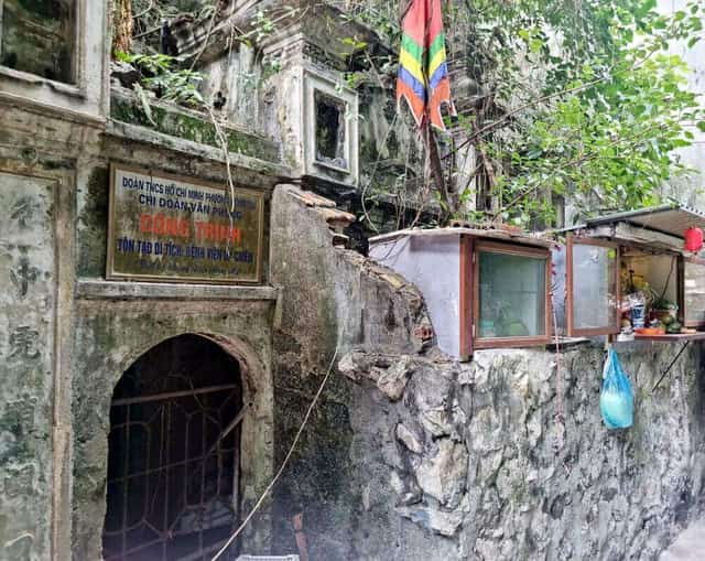
Cave No. 6, a historical relic, is currently managed by the Hong Gai Ward Youth Union.
During the resistance war against America, Bai Tho Mountain also bore many historical imprints. When US forces launched their first airstrike, a loudspeaker, transferred from a powerful cluster of speakers on the north bank of Hien Luong Bridge – the 17th parallel – was placed on Mo Qua peak to broadcast air raid warnings, along with a station to observe enemy aircraft from afar. The caves within the mountain vary in size, designated from Cave No. 1 to Cave No. 6. During wartime, these caves were used as shelters from bombs and bullets, postal communication stations, radio stations, and more. The spacious Cave No. 6 even housed the provincial hospital's emergency department.
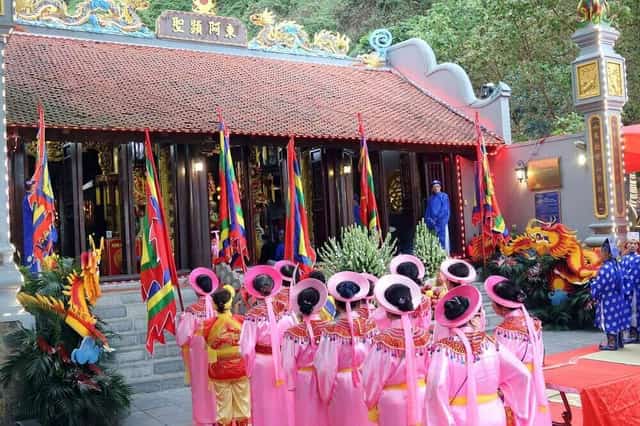
The Duc Ong Tran Quoc Nghien Temple Festival has been restored and is held annually on April 29th and 30th, coinciding with Ha Long Tourism Week.
The mountain is home to numerous plant species, including beautiful flowers like orchids, Ficus microcarpa (rock fig), and bamboo, as well as wild golden monkeys. At the northern foot of Bai Tho Mountain lies Long Tien Pagoda, Ha Long City's largest and most beautiful pagoda; at the western foot stands a sacred temple dedicated to Hung Vuong Tran Quoc Nghien. The Bai Tho Mountain - Long Tien Pagoda relic complex was recognized as a National Historical and Scenic Site by the Ministry of Culture, Sports, and Tourism in 1992.
Man Mountain
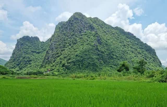
Man Mountain is located in Da Trang village, Thong Nhat commune.
Man Mountain rises 381.8m high with a base area of 383ha, situated between two streams, Da Trang Stream and Luong Ky Stream, which converge before flowing into Cua Luc Bay. Man Mountain was formerly known as Ban Mountain, a beautiful and typical example of Ha Long City's terrestrial limestone mountain system.
Ancient legends and prophecies enshrine the saying, "Man Mountain anchors the sea, a myriad generations of emperors." According to page 406 of the Dong Khanh Du Dia Chi, compiled by the Nguyen Dynasty's National History Office between 1886-1888, the land of Hoanh Bo, now Ha Long City, boasted many beautiful stone mountains at the time, such as Ban Mountain, Truyen Dang Mountain, Hap Mountain, and Phuong Cac Mountain. However, only two mountains were renowned enough to be classified as 'Famous Mountains' then: Man Mountain and Truyen Dang Mountain. Historians state that Man Mountain once served as the main base for the Ly Dynasty army during the 11th-century resistance against the Song Dynasty. During the Tran Dynasty, in both resistance wars against the Yuan-Mongol invaders (1285, 1288), Man Mountain was chosen by Grand Prince Hung Dao Tran Quoc Tuan as the strategic reserve headquarters for the navy. After the victory at the Bach Dang Battle in 1288, King Tran Thanh Tong gathered his troops at Man Mountain, where he established an altar to offer sacrifices and report to the gods. Man Mountain is considered a vital 'mountain-river acupoint' in the Northeast region, a place of flourishing energy.
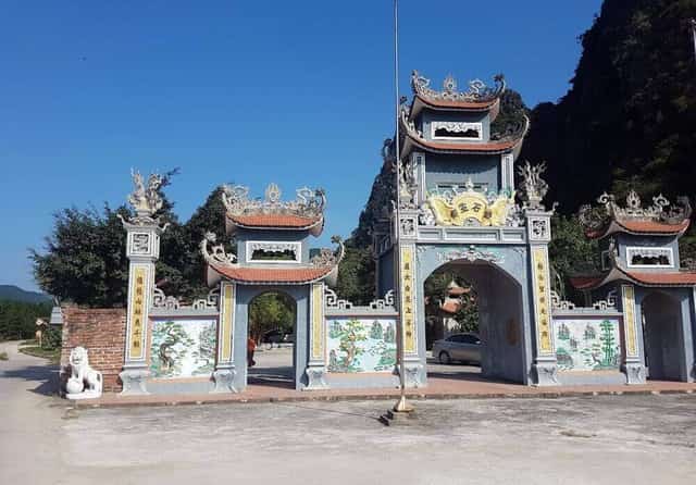
Bach Thach Linh Tu, the only temple in Vietnam dedicated to the Supreme Immortal of Taoism.
At the foot of Man Mountain lies an ancient sacred temple, affectionately known by locals as Da Trang Temple (White Stone Temple), but officially named Bach Thach Linh Tu. This temple is dedicated to the Supreme Immortal of Taoism. While many localities have built shrines or temples to venerate the Supreme Immortal, most are symbolic altars; Bach Thach Temple uniquely serves as the principal shrine, directly worshipping the Supreme Immortal of Taoism, making it a distinctive feature in Vietnam. In its inner sanctum, Bach Thach Linh Tu houses a monolithic white stone goddess statue, weighing over 1 ton, seated on a dragon throne in a serene posture, with a compassionate and peaceful expression. According to legend, this ancient deity guarded the White Jade Capital in heaven and Man Son, earning titles such as Heavenly Palace Supreme Immortal, Man Son Old Mother, and White Jade Lady. Reflecting the syncretism of the three religions (Buddhism, Taoism, Confucianism), Bach Thach Linh Tu also features altars for the Council of Four Palaces, the Jade Emperor, the Three Pure Ones, and a Buddhist shrine.
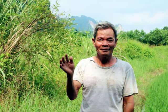
Mr. Trinh Van Khoa, a long-time resident of Da Trang village, shared that on Man Mountain there is a large, peculiar coffin-shaped stone block. The elders say it is a coffin from heaven, and its lid rests on Bai Tho Mountain.
On Man Mountain, at mid-slope, there are various strangely shaped natural rock formations. Some resemble large mushrooms, wider at the top and narrower at the bottom, locally called 'Hon Vanh Mu' (Hat Brim Islet). Others are box-shaped, with clean-cut edges and hollow interiors, which the elders claim are coffins, with their lids resting on Bai Tho Mountain (and indeed, Bai Tho Mountain also features such a rectangular stone slab, as the legend suggests). This peculiarity is linked to the proverb "an old snake sheds its skin, an old person slips into a coffin." To the east of the mountain lies a large rock cave called Dau But Cave (Buddha's Head Cave). Inside the cave are remnants of an ancient shrine; under a layer of faded moss on the cave ceiling, ancient Han characters, tentatively translated as 'Son Than Tu' (Mountain God Temple), are still visible, alongside fragments of ancient ritual artifacts. Deep within the cave, pristine stalactites shimmer when illuminated.
At the saddle-points halfway up the mountain, numerous depressions collect water, and crystal-clear water seeps from rock crevices. Locals call these 'Thien Be' (Heavenly Ponds) or 'Gieng Troi' (Heaven's Well). Thien Be holds water all four seasons; the water is icy cold in summer and warm in winter, with steam rising from the surface on early mornings, resembling boiling pots of water. This rising steam mingles with the night mist, gracefully swirling around the cat-eared rock formations, appearing like waves caressing an offshore sand dune. The water teems with freshwater shrimp, and many mountain crabs and forest snails thrive there. When disturbed, crabs as large as sea crabs raise their claws in defense, a charming sight that attests to the excellent living environment on Man Son Mountain.
It is highly probable that people once lived on Man Mountain. Some historical scholars suggest it was a site of Son Vi - Dong Son cultural sedimentation, with fossilized marine flora found in its caves. Folklore recounts that Man Mountain was once a refuge from invaders and the purges that often accompanied royal successions during feudal dynasties. This is evidenced by ancient Han characters on cave ceilings, fragments of ancient terracotta utensils, snail and clam shells, and groves of what appear to be cultivated mandarin orange trees. The mandarin trees of Man Mountain, growing vigorously amidst the rocks, yield abundant fruit. During the ripening season, many forest patches glow golden. In the past, shepherd children would climb to pick them, but today, the ripe mandarins fall to the ground, serving only as food for wild animals.
Man Mountain boasts a rich and diverse flora, very similar to Bai Tho Mountain, but being farther from urban areas, it has denser vegetation and more wildlife. The patches of soil interspersed among the rocks are home to many precious medicinal plants, terrestrial orchids, and wild animals such as antelopes, golden monkeys, monitor lizards, geckos, pheasants, and green peafowl. The Man Mountain relic complex was designated a National Historical and Scenic Site by the Ministry of Culture, Sports, and Tourism in 2014.
Cua Luc Bay
Cua Luc Bay, with its 18km2 water surface area and 17m depth, serves as the central connector between Ha Long City and Hoanh Bo district, following their merger into the unified Ha Long City. Cua Luc Bay shares a 'three-blessings' relationship with Man Mountain and Bai Tho Mountain. According to legend, Cua Luc Bay is the footprint of the giant who carried stones to mend the sky. When he shifted his burden, his pole broke; one basket of stones fell into the sea, becoming Bai Tho Mountain, and the other fell into the forest, becoming Man Mountain.
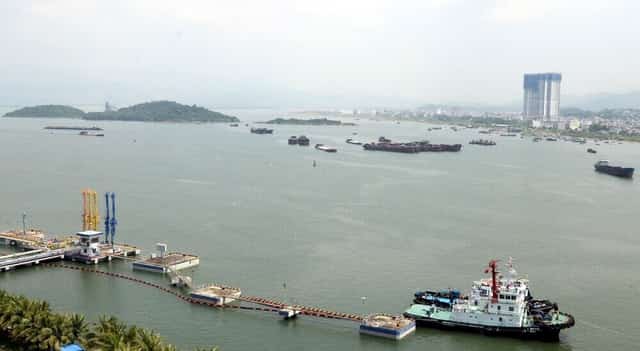
Cua Luc Bay was once an ancient port cluster, featuring Gạo Rang wharf and Dong wharf, with the Mac Dynasty Citadel situated on the shore.
There are differing opinions regarding Cua Luc Bay; some say it is the confluence of six rivers, while others assert it is entirely distinct from Luc Dau Giang in Hai Duong province. Cua Luc Bay, with mountain streams flowing directly into it, is free of alluvial deposits, resulting in crystal-clear forest water blending seamlessly with equally clear blue seawater. This is why a sea gate with clear blue water is called 'Cua Luc' (Luc meaning 'clear blue'). Today, Cua Luc Bay is an inlet with three water passages. The main passage is Cua Luc, flanked by two secondary passages: Hon Hai gate and Kenh Dong gate. Inside the bay lies an ancient port cluster, including Gạo Rang wharf and Dong wharf, located within the Van Yen, Tri Xuyen, and Bang Troi communes.
On July 26, 1884, Grand Mandarin Pham Than Duat, representing the Hue imperial court, signed an agreement leasing a coal mine to French capitalists for 100 years. When the French colonialists created their concession maps, the Bai Chay - Hon Gai area was an island, and boats would navigate from Hon Hai (Hong Hai ward) into Cua Luc Bay and out through Kenh Dong (Gieng Day ward). At that time, Bai Tho Mountain and Ba Deo Mountain were also islands. Hung Thang Island and Sa To Island only recently became connected to the mainland.
Cua Luc is mentioned in historical records concerning the classic naval battle of Van Don - Luc Thuy, where General Tran Khanh Du of the Tran Dynasty sank 600 Yuan-Mongol supply ships in the Northeast Sea in 1288. Furthermore, inscriptions from two poems carved on Bai Tho Mountain—one by Hong Lo Tu Khanh Nguyen Van Ban in 1929 titled “Boating on Luc Hai…” and another by Quang Yen Governor Nguyen Van Dao in 1935 titled “Arriving at Luc Hai for a Boat Ride…”—further reinforce the description of Cua Luc as a sea gate with clear blue waters.
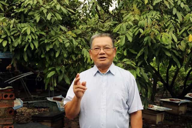
Mr. Tran Van Nghi, a native of Xich Tho village, stated that a person with a body capable of carrying Bai Tho Mountain and Man Mountain would need feet as large as the entire Cua Luc Bay, though folklore suggests this is merely a myth.
Another legend states that Cua Luc Bay is the giant's footprint. It tells that as the giant, carrying stones to mend the sky, stepped across Cua Luc Bay and shifted his burden, his pole broke. One basket of stones fell into the sea, forming Bai Tho Mountain, and the other landed in the forest, becoming Man Mountain. The giant also left two footprints on a hill in Xich Tho village, each depression about one &sào; (360 sq m) in size. Locals who cultivated these low-lying areas called them the 'giant's field' and 'giant's hill.' However, Mr. Tran Van Nghi, a native of Xich Tho village who served as the head of the communal Culture Board for 10 years, commented that while the legend is interesting, a person with a body capable of carrying Bai Tho Mountain and Man Mountain would need feet as large as the entire Cua Luc Bay.
Bai Tho Mountain and Man Mountain, the twin peaks, along with Cua Luc Bay, form a 'three blessings' trio, intrinsically linked to the legends of the giant who carried stones to mend the sky, leaving his footprints on the hills. One tale tells of a mountain maiden working in a terraced field who accidentally stepped into a footprint and became pregnant, later giving birth to three snake deities, sons of the giant: Ong Coc (Shorty), Ong Dai (Long One), and Ong Loang (Spotted One), each with fascinating stories. Today, separate temples dedicated to these three snake deities are still maintained in the locality. Ong Coc is worshipped in Dong Hang, Ong Loang in Dong Cai, and Ong Dai in Da Trang.
Ha Long City has developed a plan for landscape and ecological tourism exploitation for Bai Tho Mountain and Man Mountain. Cua Luc Bay, according to the Ha Long City master plan approved by the Prime Minister for development until 2040, will see the central urban area of Quang Ninh province evolve into a model comprising five zones, with Cua Luc Bay serving as the central hub connecting socio-economic infrastructure. Currently, the cluster of ports within Cua Luc Bay, including Quang Ninh Port, CICT Container Port, B12 Petroleum Port, and Ha Khanh Coal Port, accounts for a significant proportion of Quang Ninh's revenue structure.
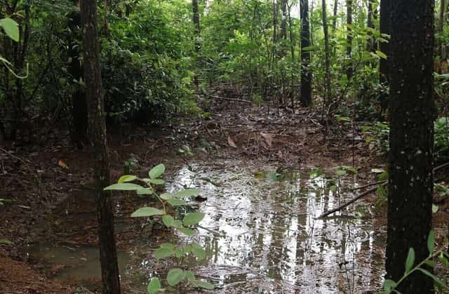
The giant's footprint on the hill in Xich Tho village, once as wide as a &sào; field, is now only the size of a buffalo wallow.
Quang Ninh 5926 view
Update day : 05/11/2023
Source : baoxaydung.com.vn Affiliate links



Monuments close by
See all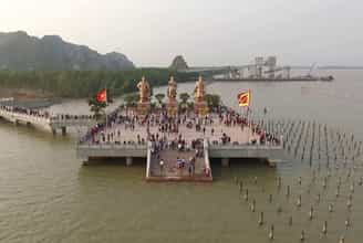
Bach Dang Historical Relic
Bach Dang Historical Relic is located in Quang Yen Town and Uong Bi City. This is the place marking the event when the Tran Dynasty's army and people achieved a famous victory - the Bach Dang Victory, defeating the Yuan Mongol invaders in 1288. In the history of our nation's defense of the country, Bach Dang River has witnessed our army and people three times resoundingly defeat the mighty Northern invaders, all with wooden stakes planted in the Bach Dang river bed. That was Ngo Quyen's Bach Dang victory in 938; 981 by Le Hoan and the peak was the Bach Dang victory in 1288 by Hung Dao Dai Vuong Tran Quoc Tuan. Bach Dang River has become a historical river, Bach Dang stake has become a symbol of the tradition of fighting foreign invaders by waterway of the Vietnamese people. After more than 700 years of sedimentation by the river, the pile pile was deep under layers of mud. It was not until 1953 that people digging soil to build dikes discovered the Bach Dang piles. At first, people did not have the knowledge and awareness to protect cultural heritage, so many piles were pulled up to make rafters and straw piles. After many excavations, archaeologists discovered hundreds of stakes, mainly ironwood, 2.6 to 2.8 m long and 20 to 30 cm in diameter, inserted straight. The average distance between piles is from 0.9 m to 1.5 m. Bach Dang stake yard relic area (including Yen Giang pile yard, Dong Van Muoi pile yard, Dong Ma Ngua pile yard). Yen Giang stake yard relic has an area of about 3,000m2 located at the mouth of Chanh River with a rectangular shape of about 120m long and about 20m wide. Yen Giang stake yard was ranked a special National Monument in 2012. After that, the monument was zoned for protection, an introductory stele was erected, and the access road was embellished to create favorable conditions for tourists to visit. This is also an address for students to learn about history and serve their studies. Currently, Yen Giang pile yard still has about 300 trees in the ground. At the relic site, the pile yard is filled with water to the pond for conservation. Near the Yen Giang stake yard is the Van Muoi copper stake yard with an area of about 6,000 square meters located at the mouth of the Rut River, in Nam Hoa ward, discovered by the people of Quang Yen during the process of farming and digging ponds. After the survey and excavation in 2005. Subsequent archaeological excavations found a total of nearly 200 stakes, showing that wooden stakes planted vertically and diagonally in the Van Muoi field area belonged to many types of wood used. both trunk and branches. The diameter of each pile is from 7 - 10 cm, the pointed part is only about 25 - 30 cm. However, the density of stakes here is very thick, usually 40 - 60 cm apart, some stakes are only 10 - 30 cm apart. According to researchers, this is the southern half of the Bach Dang stake field, while the northern half is the Yen Giang stake field. Because between the two piles there is a strip of high rocky dunes, when the tide is low, the boat cannot cross and is forced to go close to the shore. Therefore, Tran Hung Dao chose a position to place stakes on both sides of the dune to form a V-shaped defense line tightly covering the throat of the Bach Dang River to block the enemy's retreat, creating a glorious victory in the above battle. Bach Dang River in 1288. The pile was then buried under a layer of mud for better preservation. Also in Nam Hoa ward, Quang Yen town, the Ma Ngua copper pile yard with an area of about 2,100m2 was discovered and surveyed and excavated in 2010. This is the third pile yard in the Bach Dang pile yard. Located at the mouth of the Kenh River, about 1 km south of the Van Muoi copper pile. The pile yard is 70 m long and 30 m wide, with stakes of many types of wood with diameters from 6 - 22 cm densely arranged in strips like a wall. The three piles of Yen Giang, Dong Van Muoi and Dong Ma Ngua have created large, complex, hidden underground piles under the water, blocking the escape route to the sea, helping to destroy and capture 600 warships with 40,000 people. Yuan-Mongol generals during their third invasion of our country in 1288. Today, the Bach Dang stake yard relic area in Quang Yen town has been surrounded by a protective embankment. Some of the piles were retrieved and the remaining piles were preserved in an on-site display pit. However, most of the Bach Dang piles at this relic have rotted and broken tops, and the body of the pile is still stuck in the mud, but this is an extremely important evidence of the historical battle on the Bach River. Dang year 1288. With the special historical, cultural and scientific values of the relic site, on September 27, 2012, the Prime Minister signed a decision to classify the Bach Dang Victory historical relic site in 2012. 1288 is a special National Monument. Bach Dang Festival takes place from March 6-9 of the lunar calendar with many solemn rituals and rich festive activities, held at all points in the relic site. To honor the value of our nation's great victory day and commemorate those who sacrificed their lives in the Bach Dang battles. Source: Quang Ninh Electronic Newspaper
Quang Ninh
10618 view
Rating : Special national monument
Yen Tu Historical and Scenic Area
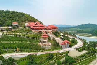
Historically, Yen Tu has always been one of the Buddhist centers of the country, associated with many ancient architecture, built through different historical periods (Ly, Tran, Le, Nguyen). Geographically, Yen Tu is a low mountain range, belonging to the Dong Trieu arc system, a geological region formed in the Quaternary period, with bedrock types, such as sandstone, gravel and ancient alluvium... Geography The area's complex geology and geology have created magnificent landscapes, such as Ngu Doi waterfall, Vang waterfall, Silver waterfall, Heaven's Gate, Tung street, bamboo forest, Yen Tu mountain peak..., where there are unique architectural features. Traditional architecture seems to blend into majestic nature. Yen Tu area has a total natural area of about 2,686 hectares, including 1,736 hectares of natural forest, typical of the Northeast forest ecosystem, which also preserves many rare genetic resources of animals and plants... Interspersed with nature is a system of pagodas, temples, towers... Along the paths leading to the pagodas, temples, and towers, many pine trees are often planted. In this area, there are still more than 200 giant pine trees, belonging to 4 rare groups, planted about 700 years ago. In addition to ancient larch trees, the bamboo forest here is also famous since ancient times... Bamboo is a unique product of Yen Tu, symbolizing the vitality, purity and elegance of nature. Perhaps, that is also the reason why Tran Nhan Tong chose this place to practice and named "Bamboo forest", or Truc Lam, to name the Zen sect he founded. Yen Tu Festival is a spring pilgrimage festival, starting on January 10 every year and lasting for 3 spring months. The Yen Tu area includes several major Buddhist sites and architectures such as: 1. The ancient Bi Thuong Pagoda was built in the Later Le Dynasty, on a Nhat-shaped architectural foundation, and has been restored and embellished many times in history. Worshiping the Eighteen Arhats. 2. Suoi Tam Pagoda was built at the foot of the mountain, next to the bank of Bath stream. 3. Cam Thuc Pagoda Located on the left side of the road into Yen Tu. 4. Lan Pagoda and Giai Oan Pagoda were both built during the Tran dynasty. 5. The Hon Ngoc tower cluster is located on a fairly large, flat mound of land, including three stone towers and one brick tower. 6. Hue Quang Tower Garden now has only 64 towers and tombs, of which 40 towers were newly restored in 2002, 11 stone towers, 13 brick towers, some towers have collapsed, leaving only traces. 7. Hoa Yen Pagoda was built during the Ly Dynasty and was embellished many times throughout history. The pagoda is located halfway up the mountain, facing southwest. 8. Ancient Thien Dinh Am was originally a special ancient tower in Yen Tu, standing alone, behind Hoa Yen Pagoda. The tower is built of red bricks with green glaze, the surface is embossed with many strange patterns and animal faces. 9. One Roof Pagoda is nestled on the side of a high mountain. Half of the pagoda is hidden deep in a mountain cave, the other half is exposed to the outside and has only one roof. 10. Am Thung and Am Duoc are now only ruins. 11. Bao Sai Pagoda is located on the mountainside, facing southwest. 12. Van Tieu Pagoda is located on the mountainside. On both sides of the pagoda there are 2 high mountain ranges, forming a throne that surrounds the pagoda. To the right of the temple there is a stream. 13. Dong Pagoda is located on the highest peak of Yen Tu mountain, cast from bronze. The special historical and cultural values of the relic site have made Yen Tu a sacred place in the spiritual life of Vietnamese people. To affirm the special value of the monument, the Prime Minister decided to classify Yen Tu historical and scenic relics as a special national monument on September 27, 2012). Source: Department of Cultural Heritage
Quang Ninh
10056 view
Rating : Special national monument

Cua Ong Temple Historical Relic
Cua Ong Temple (also known as Dong Hai Linh Tu or Duc Ong Temple) is located in Cua Ong ward, Cam Pha city, Quang Ninh province. The temple worships the main deity, Quoc Khao Hung Nhuong Dai Vuong Tran Quoc Tang, in addition to worshiping Cuu Thien Vu Empire Phu Nhan Vu Hung Dao Dai Vuong and his family and generals. Through historical records, it can be confirmed that Cua Ong Temple was built and existed for more than 100 years. At the beginning, the temple was just a small hermitage made of thatch, bamboo, and leaves; In 1907 - 1916, the temple was restored; In 1916, the Upper Temple, Middle Temple, Lower Temple, and pagoda were built; In 1946, the Lower Temple and Upper Temple continued to be renovated and embellished; In 2014, the master plan of the Cua Ong Temple relic site was approved with an area of 18,125 hectares; By 2016, Trung temple was built and completed in 2017. In addition, there is also Cap Tien temple (people call it "Cua Suot Girl" temple) built during the Nguyen Dynasty. Cua Ong Temple was initially built to worship Tran Quoc Tang, after building additional Ha, Trung and Thuong temples, Cam Son pagoda... specifically as follows: Ha Temple area: includes Mau Temple and Trung Thien Long Mau Temple Mother Goddess Temple: worships three thrones of the Holy Mother (Mother Thuong Thien, Mother Thuong Ngan, Mother Thoai Phu), Jade Emperor, Nam Tao, Bac Dau, Four Adoring Her, Five Worshipers, Mr. Hoang Muoi, Mr. Hoang Bo , Mr. Hoang Bay. Trung Thien Long Mau Temple: worships Trung Thien Long Mau and worships three girls, Cua Suot boy and Cua Suot girl (two people like Kim Dong and Ngoc Nu, symbolizing yin and yang who always follow and protect the mother, protect the land and waters of Cua Suot, protect the temple where Trung Thien Long Mau is located). Currently, Cua Ong Temple still preserves the ordained religion for Cam Pha commune, Hoanh Bo district, Quang Yen province, worshiping Trung Thien Long Mau deity, dated March 18, the 2nd year of Khai Dinh (1917). The stone stele at Ha Temple was built in the year of the Rat (1948). Trung Temple area: worships Kham Sai Dong Dao Tiet Che Hoang Can, who was instrumental in suppressing foreign invaders from the North and defending the East Sea. Here, the Son God and the Water God are also worshiped because Trung Temple is located on the Cam Son mountain range, in front of the East Sea, people in the estuary area as well as boats passing by pray for the help and support of the gods. the Mountain God, the Water God. Thuong Temple area: includes Thuong Temple, Quan Chau Temple, Quan Chanh Temple, Tran Quoc Tang pagoda and tomb. Thuong Temple: worships the main god, Quoc Khao Hung Nhuong Dai Vuong Tran Quoc Tang, in addition to worshiping Cuu Thien Vu Empire Phu Nhan Vu Hung Dao Dai Vuong and his family and generals. * Hung Nhuong Dai Vuong Tran Quoc Tang (1252 - 1313) He is a national hero, the third son of Hung Dao Vuong Tran Quoc Tuan. Currently, a number of ordinations for Hung Nhuong Vuong Tran Quoc Tang are still kept at the temple, affirming his merits, as well as the history of formation and existence of Cua Ong temple. In addition to the miracles, appearances, and ordination records of Hung Nhuong Vuong Tran Quoc Tang, at Cua Ong temple, stone stele, wooden signs, horizontal plates, and parallel sentences have been preserved, through which the main deity of the temple has been identified. is the National Archaeologist Hung Nhuong Dai Vuong Tran Quoc Tang. * At the same time, at Thuong Temple, there are also historical figures such as: - Hung Dao Dai Vuong Tran Quoc Tuan: Hung Dao Dai Vuong, after helping the Tran Dynasty expel the invading Yuan invaders, eliminating great disasters for the nation, was revered by the people. After his death, he became Thuong Tien Cuu Thien Vu Emperor. - General Pham Ngu Lao; Da Tuong; Yet Kieu; Nguyen Khoai; Huyen Du; Cao Mang; Do Hanh; Hung Vu Vuong Nghien, Hung Tri Vuong Hien, Hung Hien Vuong Uat; Tran Binh Trong; Pham Ngo; Tran Thi Kien; Tran Quang Trieu; Tran Quoc Toan; Ha Dac; Truong Han Sieu; Le Phu Tran; Nguyen Dia Lo; Tran Khanh Du; Do Khac Chung; Vi Hung Thang; Nguyen Che Nghia; Holy Mother Thien Thanh (Nguyen Tu National Mother); Princess Quyen Thanh (Vuong Co First); Princess Dai Hoang; Thuan Thanh (Preserved from the Queen) Quan Chanh Temple: worships Quan Chanh, Quan Tuan Tranh and Quan Supervisor. Quan Chau Temple: worships Quan Tri Chau, who governs the Cam Pha region. Tomb: based on the legend and spirit of Cam Pha village, Cam Pha canton, Cam Pha district, Quang Yen province, recorded in 1938, the tomb of Hung Nhuong Vuong Tran Quoc Tang is only symbolic, a place where shows the people's respect towards Him, as well as that of a son towards his father. Pagoda: worships Buddha, Jade Emperor, Nam Tao, Bac Dau, Quan Am Tong Tu, Thuong Tue Trung, Duc Ong, Duc Thanh Hien... like other traditional temples of Vietnam. Cap Tien Temple: worships a young lady - the daughter of Tran Quoc Tang (also known as "The Cua Suot Girl"), the Chief Mandarin and other gods, then worships Buddha, Jade Emperor, Nam Tao, and the North. Dau, Innate Holy Mother. The miracles, identities, and ordinations of the gods are still preserved at Cua Ong Temple, becoming a valuable historical document for generations of descendants to learn about the process of building and defending the country of the Tran Dynasty. Cua Ong Temple relic site has gone through wars and ups and downs of history, but still preserves many ancient architecture (gable walls on both sides of the tube and the Harem) and ancient statues dating back to nineteenth century. With the above special value, Cua Ong Temple Historical Relic was ranked as a Special National Monument by the Prime Minister on December 25, 2017. Source: Department of Cultural Heritage
Quang Ninh
9702 view
Rating : Special national monument

Archaeological relic of Hon Hai Co Tien
Historical and archaeological relic Hon Hai Co Tien belongs to group 65, Bach Dang ward, Ha Long city. From 2001 to present, Quang Ninh Museum has cooperated with the Vietnam Institute of Archeology and the Vietnam Museum of History to survey, excavate and discover many relics bearing typical marks of the late period of Vietnamese culture. Ha Long culture (Late Neolithic period) to the Dong Son Culture period (Metal Age) dating from 4,000 to 2,000 years ago. Here, scientists have unearthed 91 artifacts, 1,000 scientific specimens including production tools, daily utensils, jewelry, beliefs... with ceramic, bone, and stone materials; a burial site with 46 ancient human remains, some of which are relatively complete. The remains were buried bundled with burial items. Quang Ninh Museum also surveyed 4 locations in the valley and foothills, and collected 294 artifacts and over 20,000 scientific specimens including bronze, stone, bone, and ceramic materials such as fish hooks, axes, chisels, jewelry. Here, scientists discovered many pieces of bronze molds of the Dong Son Culture along with pieces of bronze slag used to cast axes, spears, spears... In Area I, Quang Ninh Museum also discovered a population of fossil corals that may belong to the Devonian - Carboniferous period (about 400 million years ago today). Along with archaeological value, Hon Hai Co Tien Relic also has primeval rocky forest with many precious primates and reptiles such as golden-haired monkeys, salamanders, geckos... and a rich flora system. Natural resources of rocky mountain forests such as tea tree, Phat Du mountain, Ha Long orchid, Golden flower Venus, Ha Long Thien Tue... The recognition of the Hon Hai Co Tien relic as a National Monument has contributed to enhancing the cultural value of the World Heritage Site of Ha Long Bay and the important historical position of Quang Ninh with the ancient culture of Ha Long, in Northeast region of Vietnam. At the same time, the monument also creates a unique cultural tourism product right in Ha Long city. Source: Department of Culture and Sports of Quang Ninh province
Quang Ninh
9518 view
Rating : National monument

Tran Dynasty Relic Area in Dong Trieu
Tran Dynasty historical relic site in Dong Trieu belongs to An Sinh, Trang An, Binh Khe, Thuy An communes. Currently, this is the relic that retains the most imprints of the glorious Tran Dynasty. In the year At Dau, 1225, Ly Chieu Hoang ceded the throne to her husband Tran Canh, marking the transfer of power from the Ly dynasty to the Tran dynasty. From here, the Tran dynasty ruled the country for 175 years, with 12 kings, creating the most glorious dynasty in our country's history. The Tran Dynasty (1225 - 1400) with martial arts and literature, opened a heroic era in the history of building and defending the country. According to documents, the Dong Trieu area was the Tran family's first settlement. Afterwards, this land was given by King Tran Thai Tong to his brother Tran Lieu as a thang moc hamlet. When reigning, each dynasty paid attention to two issues: Duyen Trach was the land where the capital was located, and Am Trach was the place where temples and mausoleums were located. Besides Thang Long continuing to be chosen as the capital, the Tran Dynasty also built and developed two cultural centers and two mausoleum areas in the east and south of the capital. Many researchers have identified Dong Trieu as a major cultural and religious center, along with Thang Long - the political and economic center and Thien Truong Long Hung, the birthplace of the Tran Dynasty. The ancient name of Dong Trieu was An Sinh, but it was only during the reign of King Tran Du Tong that the name was changed, and it became the current Tran Dynasty historical relic site. This is a special national relic area including mausoleums, temples, pagodas, and towers with 14 relics spread out. This is a sacred holy land imbued with historical and cultural spirit and is the original hometown of the Tran Dynasty. Since the 13th century, the Tran Dynasty built Thai Mieu, worshiping the Three Patriarchs of Tran, which is the most important relic site. By the end of the 14th century, many tombs of King Tran were moved to Dong Trieu. The Tran Dynasty historical relics area includes 3 groups, the temple relics group, the mausoleum relics group and the pagoda relics group. Temples and mausoleums are attached to the Tran Dynasty's temples. Along with building mausoleums, the Tran Dynasty also built temples and shrines to worship the predecessors, and many pagodas also sprang up accordingly. But at that time, Dong Trieu only played the role of a mausoleum area and had not yet become the Buddhist center of Dai Viet. It was not until King Tran Nhan Tong became a monk that he went to Yen Tu mountain to practice and founded the Truc Lam Zen sect. He unified the previously existing Zen sects and the entire Buddhist church of the Tran dynasty under one umbrella. During this period, Dong Trieu became an important Buddhist center. The Tran kings built here a dense system of temples, tombs, pagodas and towers in a large landscape area stretching up to the slopes of Yen Tu mountain. Ngoa Van Ho Thien Pagoda is where the Buddha King Tran Nhan Tong preached sermons, and is also a place associated with the cause of propagating Buddhism in Dai Viet, training monks at a higher level. On Ho Thien Pagoda there is also a 7-storey stone tower whose architecture is still a mystery to researchers, attracting many researchers and history lovers from everywhere to visit and study. rescue. Quynh Lam Pagoda is considered the first Buddhist university in Vietnam, possessing a Buddha statue of one of the Four Great Elements of An Nam. The tower garden in the pagoda and the stone tower tombs of Zen masters have unique architecture, a typical cultural heritage not only of Quang Ninh province but of the whole of Vietnam. Over time, natural disasters destroyed, war ravaged, many ancient works in the Tran Dynasty historical site in Dong Trieu are only ruins. However, those ruins still retain their value in the hearts of the people. An Sinh in the past, Dong Trieu today is where the Tran Dynasty kings expressed the fallen leaves ideology of returning to the roots of the Vietnamese people. The things that still exist or even the things that are only left underground are still timeless heritages that not only carry the historical value of the famous dynasty but also demonstrate the 700 years of existence of pure Vietnamese Buddhism. Source: Quang Ninh Tourism Newspaper
Quang Ninh
9406 view
Rating : Special national monument
Nearby tourist attractions
See all
Ha Long Bay
Ha Long city, Quang Ninh province, about 180 km from Hanoi, is known as the tourist paradise of the North. With a convenient location, modern infrastructure and developed transportation system, Ha Long city attracts tens of millions of domestic and foreign tourists each year. Ha Long Bay has an area of 1,553 square kilometers including 1,900 large and small limestone islands with vivid shapes. The bay has been honored many times by UNESCO as a world natural wonder and is a tourist destination not to be missed. The weather in Ha Long is divided into two distinct seasons: summer - from May to October and winter - from November to the end of April. The average annual temperature is 25ºC, quite ideal for outdoor tours. With diverse vegetation and favorable climate, you can travel to Ha Long Bay at any time of the year. However, according to experience traveling to Ha Long Bay, you should avoid stormy times in July and August to have the most complete trip. Regarding travel costs from Hanoi to Ha Long city or Ho Chi Minh City. Ho Chi Minh to Ha Long, you can refer to below: Regarding accommodation costs, depending on the area you choose, the room price will have a certain difference. Ha Long room prices usually range from 200,000 VND/night to 2,000,000 VND/night. Food costs also depend on the number of dishes you order, and the number of people eating. However, in general, the cost per meal is not too high. If you eat seafood in a restaurant, the cost is from 150,000 - 500,000 VND/person. The cost of visiting Ha Long Bay is about 250,000 VND - 2,000,000 VND depending on the type of tour you choose. Normally, people who have experience traveling to Ha Long Bay on their own will choose to visit the bay by boat for 250,000 VND/person. It can be seen that the cost for a trip to Ha Long Bay is not fixed but depends on the individual's schedule and entertainment needs of each tourist. However, if you choose to travel on your own, the most suitable cost to eat, rest and visit places for about 2 days will range from 3,000,000 VND to 5,000,000 VND. According to Ha Long Bay travel experience, there are many convenient means of transportation to visit every corner of Ha Long city: Motorbike: You can easily rent a motorbike to explore Ha Long city by yourself at a reasonable price. However, for many tourists, you should ask in advance the price of the car rental and remember the time to return the car to avoid "unjustly losing money". Bus: Ha Long has a bus system connecting famous tourist destinations. The average bus ticket price in Ha Long city is about 7,000 - 10,000 VND/way. Electric vehicle: Electric vehicle is quite a popular means of transportation, especially in the center and tourist destinations in Ha Long. According to Ha Long Bay travel experience, the price of a tram ticket is about 500,000 - 900,000 VND for one trip. You can use this service from 7:00 a.m. to 10:00 p.m. every day. Taxi: This is a convenient means of transportation and suitable for most tourists. Tourist destinations in Ha Long Bay are not far from each other so the cost of traveling by taxi is not a problem. Taxi prices in Ha Long Bay range from 5,000 - 11,000 VND/km, depending on the car company and distance traveled. Ha Long Bay has majestic and poetic natural beauty with thousands of large and small islands and many unique caves. The bay is also recognized by UNESCO as a world natural wonder and attracts a large number of tourists every year. When going around the bay, you can admire beautiful natural scenery with beautiful destinations such as Sung Sot cave, Con Coc island, Dragon Eye island, Ti Top island, Ngoc Vung island,... Bai Chay Beach is an artificial beach located next to Ha Long Bay. This is the most beautiful beach in the city, with clear blue water and fine white sand stretching nearly 1,000 meters. According to Ha Long Bay travel experience, you can freely swim, check in and experience water games. Located on Tuan Chau island, Tuan Chau tourist area attracts tourists with its beautifully decorated and poetic space. When coming to Tuan Chau, you should attend a water music performance and have fun at the outdoor amusement park or the newly opened dinosaur park. Kayaking leisurely on the cool water, hidden behind the Luong cave mountain range will make you feel extremely peaceful. After visiting Luong cave, you can walk to Ti Top island and watch the sunset with friends on a yacht. Quang Ninh Museum is considered a miniature model of Quang Ninh province, a place that preserves the culture and peaceful life of Ha Long people. Young people traveling to Quang Ninh all have "lifetime" photos at this attraction.
Quang Ninh
10442 view
May to October

Tuan Chau Island
Tuan Chau Island is a super famous tourist resort destination in Ha Long city, Quang Ninh. Located about 2km from Ha Long city center, the island has an area of about 400 hectares with many beautiful landscapes, beaches, and tourist areas for tourists to visit. Tuan Chau Island is a super famous tourist resort destination in Ha Long city, Quang Ninh. Located about 2km from Ha Long city center, the island has an area of about 400 hectares with many beautiful landscapes, beaches, and tourist areas for tourists to visit. Tuan Chau Island is a beautiful beach tourist destination, so the ideal time to visit will definitely be in the summer. The time from March to October will be the most suitable time, at this time the sky is clear, the sea water is cool blue, the beach is white sand and the sunshine is extremely beautiful. However, you should note that the summer period from May to July will have very high temperatures, possibly up to 40 degrees Celsius. For those of you with weak health or families with children and the elderly, remember to be careful. kidney. When traveling in the summer, don't forget to bring sun protection items for yourself. Coming to Tuan Chau island, you can participate in activities such as swimming. Swimming is definitely always the first activity when coming to Tuan Chau island area. With a super beautiful artificial beach of up to 5km, fine white sand, cool blue sea water, Tuan Chau beach will definitely be a great medicine to forget daily fatigue. You can immediately dive into the cool ocean water, freely swim or participate in exciting activities. In addition, you can participate in the Tuan Chau water music program. Tuan Chau Island Water Music Performance Palace is a venue for many water music shows combined with extremely spectacular lighting. This place is designed with very special architecture inspired by the Roman school. The area of the Water Palace is 15 hectares with 12,000 seats. The programs here are very professionally invested, on average a performance will last about 40 minutes. And there are many other attractive activities.
Quang Ninh
9563 view
From April to December

Co To Island
Co To is an archipelago of about 50 islands located in the east of Quang Ninh province with an area of 46.2 km². Co To island district currently has 1,500 households, with nearly 6,000 people. The Co To archipelago has more than 50 islands, large and small rocks, of which Big Co To and Small Co To are the two islands with the most beautiful beaches. This is also a place with great potential for tourism development. Coming to Co To, you can visit the following places. First, Cau My Stone Beach. This is a place known as the paradise of love and youth amid the waves of Co To. The entire area is shaped like a mouse's tail, facing the sea, located south of Co To Lon island. Cau My with its sedimentary rock system eroded over tens of thousands of years by sea water creates a unique wonder among the islands of Vietnam. In addition to the rocks, high points from which you can enjoy panoramic views of this landscape will definitely make you feel like you are in the Mediterranean. Next is Hai Dang Co To, located in the eastern archipelago of Van Don island, Quang Ninh province, located on a mountain about 5km from the town, the highest point of the island, built in the late 19th century. The road from the foot of the mountain to the lighthouse is winding under dense forest foliage, rows of purple myrtle flowers, and bumpy rocks on a rarely traveled trail. Co To lighthouse has a bright view of 118m above sea level. From here, looking far away, we can see in the distance the vast ocean disappearing below the horizon, below are the mountains and forests, the beach, the clear blue water of the pearl island of Co To, taking in the view of the dreamlike coastal town, interspersed with green, peaceful forests and humble and simple roofs. Visitors to Co To cannot miss this unique experience. Next, Co To Lon Island Church in Area 4, Cam Pha Parish, Hon Gai County, Hai Phong Diocese, inaugurated on May 28, 2013. This is the first church on the island built to serve the parishioners on the island. This church was built at the foot of a hill with a length of 26.7 m and a width of 9.8 m. Although this is a small church, it is the only church on the island, and is one of the attractions that tourists visit when traveling to Co To. Besides, there are some other great places such as: Hong Van Beach, Van Chay Beach, Thanh Lan Island, Co To Island. Like the beaches of other tourist destinations, on Co To Island you can buy fresh seafood the same morning you return. Fishermen on the island often bring newly caught seafood to sell at the pier for the convenience of tourists. The vendors will also box and ice the seafood for you so you can take it home without worrying about the seafood spoiling. In addition, in Co To there are many impressive souvenirs made from oysters, clam shells, and snails. You can absolutely choose those items for yourself as gifts.
Quang Ninh
10178 view
From March to October

Quan Lan Island
Quan Lan Island is located on Bai Tu Long Bay, including Quan Lan commune and Minh Chau commune in Van Don district, Quang Ninh province. The entire island has an area of 11km2, stretching from the foot of Van Don mountain range to Got mountain with high mountains in the east like a strong wall blocking the waves to protect the island's residents. You can choose to travel to Quan Lan beach in summer or fall because this is the time when the weather is cool and favorable for you to have fun and relax. The period from April to June and from September to November is considered the best time to come to Quan Lan. Besides, you should also note that you should not go in July and August because this is the time when rainstorms often occur, which will affect the trip. The main means of transportation for tourists when coming to the island is the tuk tuk. Each bus can carry about 8-10 people, rushing along small roads to the beach. Normal price is about 100,000/trip. You can also rent a car to take you the whole journey for 2-3 days for about 500,000 VND. In addition, you can also rent a motorbike or ride a motorbike taxi to visit the island. However, motorbike taxi prices here are twice as expensive as on the mainland because gasoline on the island must be transported from the mainland, so you need to consider carefully. Quan Lan Island attracts tourists with beautiful beaches, fresh space, cool blue sea water and extremely quiet, not hustle and bustle like other beaches. Quan Lan has 3 beaches including Quan Lan beach, Minh Chau beach and Son Hao beach. Depending on the time and initial budget, you can choose to bring a camp or learn about the experience of renting a hotel to save maximum costs on your trip to Quan Lan. If you rent a motel or hotel, it is best to book a room in advance to avoid being charged high season prices. Food service in Quan Lan is not yet developed, so you should book in advance if you don't want to go hungry. You should also bring ready-made food and water because there is no fresh water on the island. Some famous types of seafood in Quan Lan are sea worms, geoducks, clams, co ky, cylindrical fish... these are specialties that you cannot miss when coming here.
Quang Ninh
10033 view
March to August
Tra Co Beach
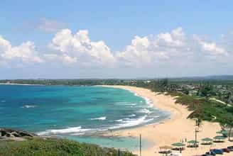
Tra Co Beach is one of the most beautiful coastlines in Quang Ninh with a length of up to 15km. Tra Co Beach is located about 8km from Mong Cai city and about 200km from Ha Long city. Tra Co is famous for its beautiful natural space, cool blue water and golden sand. Tra Co Beach is one of the most beautiful coastlines in Quang Ninh with a length of up to 15km. Tra Co Beach is located about 8km from Mong Cai city and about 200km from Ha Long city. Tra Co is famous for its beautiful natural space, cool blue water and golden sand. Beach tourism is definitely the best in summer. At Tra Co beach, the most ideal time will be from April to July. This time Tra Co beach will bring a super beautiful landscape with clear water, gentle waves, not too heavy, so it is very suitable for swimming. For those of you who want to experience the festivals at Tra Co beach, remember to come here between May 25 and June 6 of the lunar calendar. At this time, many interesting activities will take place such as the God Procession Ceremony, the Boat Procession Ceremony, the Elephant Procession Ceremony,... Visiting Tra Co beach, surely the first thing everyone wants to do is immerse themselves in the clear blue water of this place. Tra Co Beach makes a deep impression with its pristine scenery, blue sea water, and gentle waves throughout all seasons, making many tourists remember it forever. The beauty under the sea on the shore is even more wonderful, with fine white sand beaches, many green casuarina trees or blue morning glory strips creating an extremely wonderful scene. In the early morning or late afternoon, Tra Co beach also entertains visitors with extremely beautiful sunrise and sunset views. At this time, you will clearly see Tra Co beach as if it is wearing a completely new coat. Especially the sunset scene, both brings mesmerizing beauty and creates a feeling of regret when admiring. Da Den Beach, also known as Ngoc Son beach, is a beach located quite close to Tra Co beach. As the name suggests, Da Den beach possesses many black rocks with diverse shapes from small to large. They lie next to each other on the sandy shore, creating a scene that is both mysterious and attractive. Besides, Da Den beach also has a smooth white sand beach, blue water and beautiful wild scenery. Coming here, you will also find super beautiful check-in corners.
Quang Ninh
9784 view
April to July
 AI Travelviet