
 vn
vn en
en ja
ja ko
ko zh
zh






























List of relic sites (1478)
Ho Đeh Ho
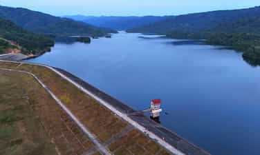
Located 10 km from the center of the district, Da Teh lake appears in the blue cover of the primeval tropical forest and the majestic O -mountain mountains. In 1990, Ho Da Teh was started construction. The Buon of the Ma people in the lake is relocated to a higher land right next to the lake. The large dam connecting the two slopes of the mountain has prevented the stream so that the water no longer flows meaninglessly but gathered to the Liu to rise to the lake. At that time, Ho Da Teh was the "3 most" irrigation project of Lam Dong province: the largest investment capital, the most complete irrigation project, bringing the highest economic efficiency. In 1997, Ho Da Teh completed became the largest irrigation project in Lam Dong province. The lake surface has an area of more than 100 hectares stretching to nearly 10 km, the widest place 400 m, containing 24 million cubic meters of water, covered with primeval mountains. The lake has brought water to irrigate more than 2,300 hectares of agricultural land to make green and rich fields in My Duc, Quoc Oai, Trieu Hai, Quang Tri and Da Teh towns, each day making the new countryside become a worthy countryside, making Da Teh district a new rural district in 2020 is one of the first 3 districts of Lam Dong "to finish" the new countryside. In the language of the people (the owner of this land), Da Teh means hot water (Đà: water, teh: hot). Perhaps, an area of the pan is surrounded and shielded by hills, so the climate here is hot, dry, the water flowing here has also become hotter than other places; Therefore, the whole land of sunshine and dust is called Da Teh. No more harsh heat, the cool water from the primeval forest makes the lake water all year round, both irrigating crops, and providing daily -life water for people in the district, Da Teh Lake also contributes to improving, changing the ecosystem and natural environmental landscape, regulating the environment, radiating cool steam to make the climate soothes, reducing the heat of the whole area. In 2004, Ho was recognized as a national landscape monument. Source of the website of Da Teh district, Lam Dong province.
Lam Dong
6009 view
Rating : National relics.

Elephant Waterfall (Lieng Rooa Waterfall)
Lieng Rowoa waterfall, also known as Voi Waterfall, is located in Nam Ban town, Lam Ha district, 25km southwest of Dalat city. Elephant Waterfall is one of the beautiful waterfalls of the majestic Central Highlands with a height of over 30m and about 15m wide. The old K'Ho villages residing in this land said: In the past, the chief of Jiu Bieng Mountain had a very beautiful daughter. Every time the female painted the voice, the forest leaves stop rustling, the birds stopped singing to listen. Her lover is the son of the chief of the village. He is loved by many people, not only because of his muscular physique, handsome face but also because of the bravery, brave, few people can match. They gave the promise so the husband and wife, but the boy had to set out to kill the enemy and then many moon seasons passed without seeing returning. The miserable girl came to the deserted mountain that they had dated before, singing earnestly and sorrowfully in the hope that the dream people to find the old place. The singing makes B'Ling birds touched. They invited each other to fly far away to detect the news and then let her know that the boy died on the battlefield. However, Son Nu still refused to accept that harsh truth. She kept singing, singing until she was exhausted, collapsed and never got up again. The elephant -covered herd listened to her singing for a long time. Suddenly there was a loud explosion, the sky and earth shook, causing the mountain to break and a stream of waterfall suddenly flowing, flowing white foam. The sound of the waterfall murmur and the rustling of the forest, the sound of the birds singing like continuing the lyrics, the sound of the beautiful and loyal female paint. The K'Ho people named the Waterfall Lieng Lieng Rooa Jiên Bieng - the waterfall of the elephants to restore stone before the passionate love, iron lipstick. It will be a pity to come to Da Lat - Lam Dong without going to Lieng Rooa (Voi Voi) mysterious and poetic. This waterfall is associated with this loyal and tragic love affair has been recognized as a national landscape. The clear water flowed through the marble mountainside to look spectacular, especially when the brilliant sunlight shone down the waterfall, making the rainbow seven colors. To get down the foot of the waterfall, visitors must "conquer" 145 steps of the races: When the stone steps "eat" into the climbing cliffs, when the planks of the beautiful wooden bridge are on the edge of the abyss. The sight is the thousands of forest with the old trees hundreds of years old, the stems and branches are interlaced with vines. In the middle of the vast gills, the green forest layer or dotted with bright red leaves like fire, bright yellow or purple carpets are strangely beautiful. At the foot of the waterfall and in the forest, some large rocks appeared like elephants. Therefore, the sound of the waterfall that made people enjoy it seemed like there was a herd of elephants racing or launching a fountain to play with each other. Behind the white waterfall is launching the dusty dust are deep caves full of mysteries. It is a bat cave that is ingrained to the ground up to 50m with cliffs with very strange shapes and colors. The roots and vines are interwoven, the deeper the cave is thanks to and cold as the witch's dynamic. It was a wind cave with a very narrow entrance but the inside was quite wide, soaring the flute of the wind. Besides the charming and poetic beauty, Voi Thac used to be revolutionary in the two wars against France - America. Newly embellished into tourist attractions in recent years. In 2001, Voi Waterfall was recognized as a national monument - a national landscape. Source of the electronic portal of Lam Dong province.
Lam Dong
5653 view
Rating : National relics.

Da Thien Lake - Valley of Love
Love Valley is one of the most poetic landscapes in Da Lat, about 5 km north of the city center, the Valley of Love has the address at 7 Mai Anh Dao, Ward 8, Da Lat City. It is the place where Da Thien Dam brings together small streams flowing from high hills and mountains, the clear and clear lake of the valley is shaded with green pine. In the 1930s, Governor -General of Indochina and French lovers often chose this scene for dating, then named Valleé D'Amour. By the time of King Bao Dai, this region was called Hoa Binh valley. In 1953, Mr. Nguyen Vy - Chairman of Da Lat Town Council at that time - proposed to change his name to the Valley of Love. Beautiful and attractive love valley by deep valley and pine hill all year round. In 1972, a block of water was built across the valley to form Da Thien Lake, increasing the charm of the common landscape, and appearing two other names besides the valley of love, Dam 3 and Da Thien 3. From here, the valley of love appears in a beautiful eye like a vivid picture. In 1998, the Ministry of Culture and Information recognized Ho Da Thien - Valley of Love was a national landscape. Source of electronic portal of Da Lat city, Lam Dong province.
Lam Dong
5444 view
Rating : National relics.

Lang Bian Mountain
Lang Bian Mountain is located in Lac Duong district, 12km north of Dalat city center. This is a suitable place for ethnologists, for tourists who love traditional culture to cultural research of the ethnic groups of the South Central Highlands. Lang Bian Mountain is also known as Mother Mountain, including 2 tops, with an altitude of 2,167m. The old story said that there was a couple of talented and loving boys and girls in love with each other - K'Lang and her Ho Bian. Due to the curse of the two tribes, the two had to separate. She after death transformed into a mountain range that the Ho-Lach ethnic group called the mother mountain and milk from her breasts has flows into the fresh streams and waterfalls for life. Since then, the two mountains have been named Lang Bian. Lang Biang Mountain, also known as Ba Mountain with a height of 2,189m of the legendary Bidoup series, has long become a regular destination for visitors. Langbiang mountain is also famous for its legend associated with the history of the indigenous people about the famous Heavenly History of Lang and Biang. Since 2004, the Ministry of Culture and Information has recognized Lang Biang as a national landscape monument. Source Department of Culture, Sports and Tourism of Lam Dong Province
Lam Dong
6004 view
Rating : National relics.

Prenn waterfall
Prenn Waterfall is a waterfall in Da Lat city in Lam Dong province. Prenn Waterfall is located next to Highway 20, at the gateway to Dalat city is one of the eco -tourism areas of forests and streams. Waterfall at the foot of Prenn pass is about 10 km from the center of Dalat. The waterfall is located in the remaining primeval forest. The water from the rocky rapids with a height of more than 20m high poured into white like a strip of white silk looks like the hair of the White Mao Tien. Maybe so that some tourists call Tien Sa waterfall. Prenn waterfall originates from Prenn stream, originating from the area of shrimp pit, Bao Dai stream (valley after palace 1 - Da Lat). Prenn stream is also known as the Prenn and Prenn Waterfall, also known as Liang Tarding. Coming to Prenn Waterfall, visitors can visit, entertain and visit Au Lac temple, King Hung temple in Lam Dong province. The legend of Prenn Waterfall is also associated with the development history of the Cham dynasty in the seventeenth century of the Poôme dynasty (1625 - 1651). Since 1998, Prenn Waterfall has been ranked by the Ministry of Culture and Information. Source Department of Culture, Sports and Tourism of Lam Dong Province
Lam Dong
5926 view
Rating : National relics.

Cat Tien archaeological monument
Cat Tien Archaeological Site is a complex of brick architectural ruins with a very large scale, stretching about 15km according to Ta Ngan Dong Nai River from Quang Ngai commune to Duc Pho and Gia Vien communes (Cat Tien district - Lam Dong province). Archaeological excavation results (from 1994 to 2006) many architectural ruins of temple tower, tomb, long house, water trough system, ancient rocky roads, ... have been revealed. The architecture here is large and small, depending on the function, with square or rectangular plots, the main door turned to the east. The excavation process has found more than 1,000 artifacts including many materials such as gold, silver, copper, gemstone, ceramic, ... rich in type such as: idol Linga - Yoni, Ganesa, UMA god, rings, chain seeds, floating gold leaves of the gods, Balamon mascots. Through the type of architecture, the artifact is found that this is a religious mecca influencing the Indian religion and the trace of a unique culture in the past. Cat Tien Archaeological Relic is a big finding of Vietnamese archeology in the late twentieth century, which is important in studying ancient cultures in the South and the Central Highlands. Archaeological excavations show that Cat Tien culture has a fairly long development process: the early period around the fourth century - VI and the late period of the Seventh - 10th century AD. Especially, the development process of Cat Tien culture has a close relationship with the Champa culture in the South Central Coast and Oc Eo - Oc Eo culture of the Southern Delta of Vietnam. In the opinion of the late Professor Tran Quoc Vuong in the scientific conference of Cat Tien archaeological monument, (March 2001) concluded: “This relic has many unique native elements (endogenous) and also has many external factors (external - exogenous). The external factors saw from the southwest are Chan Lap and from the Northeast is Champa, including physical and formless culture. It is possible that the cultural elements are slightly inclined to Chan Lap and the inhuman elements are inclined to the Champa. Therefore, this monument is "standing between and it is itself". Cat Tien archaeological relic is located in the middle of the provincial road 721 connecting Highway 20 (Madagui junction - Domhuoai district - Lam Dong province) with Highway 14 (Sao Bung junction - Bu Dang district - Binh Phuoc province). The relic center is located on the north bank of Dong Nai River close to the core area of Cat Tien National Park, about 190km from Da Lat (north) and Ho Chi Minh City. Ho Chi Minh City is about 180km (south), this is a pretty location on the tourism map, very convenient for tours from Ho Chi Minh City, Da Lat and the Central Highlands provinces to visit. Cat Tien Archaeological Relic is also known as the Holy Land of Cat Tien, which preserves the evidence of a unique culture more than 1,000 years ago. With the wide scene of the monument and a rich number of artifacts and special values such as the floating yellow leaves shaped by the gods, the Balamon religion and the collection of Linga - Yoni of gold, copper, stone, gemstones ... including the giant Linga - Yoni idol is identified as the largest in Southeast Asia (compared to the relics of the same quality). In addition to the Cat Tien archaeological site in Cat Tien district, visitors can also visit the historical and resistance relics of the Party Committee of the Vi area and some living points of the Ma people and the long -standing indigenous people who have been living on this legendary land. Cat Tien Archaeological Archaeological Area bears the indigenous culture, but still shows the absorption of the quintessence of other cultures throughout the historical length from the fourth century to IX. It is associated with an organized and large -scale ancient community, with a unified and tight socio -economic system with high levels of development (the most convincing evidence is the appearance of writing on golden pieces). The formation and development of the monument plays an important role in the historical process of the South Central Highlands - Southeast. With a special special value, Cat Tien archaeological monument (Cat Tien district, Lam Dong province) was ranked as a special national monument by the Prime Minister (in Decision No. 2408/Decision -Prime Minister dated December 31, 2014) Source of cultural heritage.
Lam Dong
5661 view
Rating : Special national relics.

B’lang volcanic landscape
B’lang volcano (also known as Chu R’luh volcano), in Buon Choah commune and Nam Da commune. This is a volcano formed in the final stage of Geological Development History - Global Geological Park (CVDCC) UNESCO Dak Nong. This is the only volcano in Dak Nong Geological Park to create the lava cave system, the most large and unique in Southeast Asia. According to the survey, research by scientists, the process of operating lava lines from the b’lang crater flows in all different directions (Northwest, Northeast, Southwest and Southeast). Up to now, 4 cave systems have been detected, including 50 caves with distribution characteristics and mechanisms to form a cave, rich and diverse cave doors and beautiful. There are many caves distributed in the shallow floor, but there are also many cave distributed in the deep floor tens of meters. B’lang volcano, distributed at an altitude of about 601m above sea level with a depth of the crater is about 59m. The mountain axis is about 160m long, short axis about 100m; The crater area is about 4 hectares, the volcano area is about 1.6 km2. B’lang volcano area is located near carbon, rich in cultural traditions of the M’nong and Ede ethnic groups ... With traditional festivals, professions and cultural and scenic historical sites, the ranking has been ranked favorable to connect tours, tourism routes, exploit and develop tourism in the future. On March 12, 2024, the Ministry of Culture and Sports -Lich issued Decision No. 611 of the national monument ranking for B’Lang volcanic landscape, Buon Choah commune and Nam Da commune. Source of electronic portal of Krong No district, Dak Nong province.
Lam Dong
6076 view
Rating : National relics.
Drai Dlong Waterfall
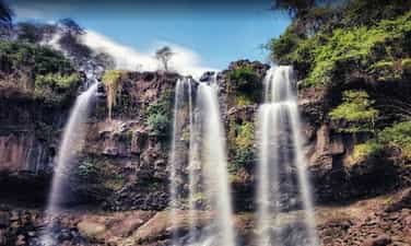
Drai Dlong waterfall is 35 km from the center of Buon Ma Thuot city, in Quang Hiep and Ea M’Drŏh communes, Cu M’gar district, Dak Lak province. Drai in Ede means waterfall; Dlong means high, so Drai Dlong means high waterfall. In addition, this landscape is also known as a three -storey waterfall. Located in the southwest of Quang Hiep commune, made up of two hills covered with an average height of 500m above sea level, the flow of Drai Dlong waterfall originates from the flow of two Ea’Drǒh streams (big streams) and Ea M’Drǎh stream (small stream), to the section near the waterfall about 01 km, blend into each other, meet large rocks, divide and divide the height of 30m to block the height of three branches. The white silk strip from above poured down. From the bottom to look up, the great waterfall, sparkling with silver, surrounded by good green forests with rising trees to adapt to the vertical cliff terrain, there are many rare timber trees such as stars, incense, chit, purple mausoleum, especially cactus growing on rocks. About 01 km from Drai Dlong Waterfall is M’Drŏh (Buon Chay), this is the trading of Ede people. During the years of resistance against the US, M’Drŏh traders, along with forest merchants, traders, Ea Win merchants transported food to the resistance from the A10-B3 station via Ea H’Leo, Krong Bong and to Phu Yen, Khanh Hoa. Buon M’Drǒh is a base of H5, the people in the village have persisted in fighting, organizing patrols to guard, bringing, raising revolutionary officials, bustling, trapping and manufacturing rudimentary weapons to protect the village. During the fierce war, the enemy organized a sweeping, persecuted, brutally beaten, but the people of M’Drǒh from the old, young, boys and girls would rather be beaten, hungry rice, but not to cooperate with the enemy, a heart of the Party to the end. When the enemy discovered that this was a facility that hid revolutionary officials, even M’Drǒh was burned and no longer had any home, so the merchant was also known as the fire. On December 15, 2004, the Ministry of Culture, Sports and Tourism ranked Drai Dlong waterfall as a national landscape monument. Source of electronic portal in Dak Lak province.
Dak Lak
5820 view
Rating : National relics.
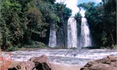
Drai Yong Waterfall
Drai Yong Waterfall is located in Ea M’nang commune, Cu Mgar district and Cuo Knia commune, Buon Don district, 22 km from the center of Buon Ma Thuot city to the Northwest. Drai Yong Waterfall was ranked National Monuments in Decision No. 823/Decision -The Culture and Sports Culture on March 9, 2017 of the Ministry of Culture, Sports and Tourism. The total area of the relics protection area: 83.62 ha (Area I: 5.83 ha; Area II: 77.80 ha). In Ede, Drai Yong Waterfall, meaning "Thunderstorms" or "strong waterfall". This is a beautiful waterfall located in the middle of the Ea Tul stream - a stream originating from Kǒ Kpo stream, Krong Buk district. Ea Tul stream has the flow from east to west, finally flowing into the Serepok River. On his flow, this stream creates three beautiful waterfalls: Drai Kroa, Drai Yong and Drai MPI. In this waterfall system, Drai Yong is the most poetic and majestic waterfall. The upstream of Drai Yong is a nearly 100m wide stream, 48 northern banks are bamboo bushes, half -growing pineapple and regenerated forests that are planted by local authorities to restore landscape and create an environment for the monument. The southern banks are smooth green lawns and lush corn fields. When there was only about 10m from the waterfall, the water from the upstream suddenly swirled back, suddenly broken down a deep valley to create the Drai Yong waterfall. The place where the waterfall has a width of about 80m and a height of about 12m, the water is swirling to create sounds that echo the whole area. Steam, dust from the white, blind flying waterfall like the fog floating in the air, when the sun shines through this steam becomes a dazzling rainbow band in the morning sun. The landscape of Drai Yong Waterfall is a component of the relics of Cu Mgar district and Buon Don district. With a poetic natural landscape, fresh and airy air, Drai Yong Waterfall is an ideal tourist destination, which has a great attraction for enthusiasts of outdoor picnics, wanting to find nature to dispel stress, fatigue after heavy labor days in urban areas that are stable, bustling and dusty. In addition, the ecosystem around the waterfall also preserves many pristine features, close to the center of Buon Ma Thuot city, the traffic is relatively convenient for tourists inside and outside the province as well as international visitors to visit, experience and explore at this scenic name. Source of electronic portal of Cu Mgar district, Dak Lak province
Dak Lak
6013 view
Rating : National relics.

The relics of Ho Lak landscapes
Ho Lak in the language of the Mnong people, the word "Lak" means "water". Ho Lak also known as Lac Thien Ho, located in Lien Son town, Lak district, 56km south of Buon Ma Thuot center on Highway 27 to Da Lat. Lak Lak has an area of more than 500 hectares, this is one of the largest natural lakes in Vietnam, the southwest of the lake with the Krong Ana River (Wife River) is one of the big rivers of the Serepok stream, the west of Lak Lake is the majestic ču Yang Sin sequence like the chest of the strong guy shielding the lake of the four -season lake of the mountain. From the top of Lac Thien Pass of Yang Ro Buon in Lak Yang Tao commune, we will see the lake appears with a splendid beauty - clouds, water, hills, mountains, fields mixed together as a picture of water. Ho Lak is also associated with the legend of the fire and water of Mnong people. The story is that: The day has been, in the past, it was a long time ago, not knowing because of the reason for the god and the fire god suddenly contradicted each other. After a battle, the god lost the battle to enter a rock. Since then, drought began to occur, in a few years, there was no rain, trees and animals died. The villagers face up to the sky, the sound of the resentment. One day, there was a poor boy leaving, determined to find water for the village. He kept going, going forever, once tired, the boy sitting on a rock with an eel lying curled up. He made the eel brought back in a pot, the next morning he suddenly saw a drop of water from the eel's mouth released, stagnant at the bottom of the pot. He felt that: The water god here!. He dropped the eel and kept following the eel mark and went, went forever, until the eel disappeared, it was just a vast lake that appeared before his eyes. The boy rubbed his eyes once, twice, then once again dared to believe that he was not dreaming. Lak Lak has from there. Today, Ho Lak is an attractive tourist destination, coming here visitors will be riding elephants, sailing, learning about the traditional customs and traditions of the Mnong ethnic community at the Mlieng Trading - one of the preserved ancient traders of the province. Besides, Lak Lake is also a large fish bowl of the province, a source of abundant fisheries to serve the lives of the people. In particular, on the top of the hill next to Lak Lake was built by King Bao Dai to rest and watch the landscape. Palace is currently restored and exploited by Dak Lak Tourism Company to serve tourists. On 11/5/1993, Ho Lak was recognized as a national landscape monument. Source of electronic portal in Dak Lak province
Dak Lak
5682 view
Rating : National relics.
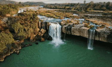
Dray Thuong Waterfall (Gia Long Waterfall)
Dray Thuong Waterfall is located on the Ea Krong River, next to Kuop Buon in Ea Na commune, Krong Ana district, 18km south of Buon Ma Thuot city center. From a distance, Dray Thuong Waterfall stands out a white color on the silver water of the Ea Krong River. The two sides of the river are a vast green of the mountains. Right at the waterfall area, a very majestic image, strong impression that is the image of the Ea Krong river, with the water floating on the upstream, suddenly folded by a stone shelf across the river, about 70m wide. The rushing water in the abyss is about 08m high, echoing a corner of the forest. In the rainy season, the water is filled with the river, we only see a giant, intense waterfall. However, in the dry season, the water flow is completely, forming 09 different large and small waterfalls. Of the 09 waterfalls, there are 05 waterfalls located in the middle of the river from 05 to 10m apart, there is a rumbling water, but there is a gently murmuring water. Dray Thuong Waterfall has since become the love and attachment of the indigenous people here. Expressed through the ancient ancient story of the Ede people full of poetic, about the legend of this Thuong Sung Waterfall. The story says: In ancient times, in an Ede village, there was a very beautiful girl named H’mi, she loved a tall, healthy and gentle boy. Every day, the couple often invite each other to work. One day, after finishing the field, the two invited each other to rest on a rock under the ancient tree. When they were sweating and sweating, they saw a monster, their heads were as big as the mountain, their eyes were like a copper pot, a long beard with their arms, her hair was as sharp as the name, the whole body covered with a white scales, sparkling like silver. The monster flew up to the sky and suddenly fell to the ground like crows grabbing the bait, his legs kicked hard to make a large land sinking and there a giant water column sprayed violently, dragging H’mi was terrified, and her lover was swept away. The boy like a tiger trying to pull his lover but despair, watching his lover disappear into the fog, and sparkling white scales. Since then, the boy turned into a large tree trunk, the root was deep into the rocky rapids, the body of a suffering person who was struggling. And the huge water column turned into Dray Thuong waterfall today. And, at the other end, H’mi was still loyal to crying and crying day and night to reclaim her lover. In addition, Dray Thuong Waterfall is also associated with the following historical event: In the 1930s - 1933, the French colonialists mobilized the people and political prisoners at Buon Ma Thuot's exile house very hard and hard under their torture, torture to build an arc cross through the waterfall along with the hanging bridge across the Ea Krong River. Today, we still see the two sides have two bridges that the French colonialists have built, this is the most convincing history of the cruelty of the French colonialists at that time, there were countless people and political prisoners abandoned the bodies in the forest and abyss. And here, it is also a challenging place, practicing the gods and the will of revolutionary struggle of patriotic communists. On January 4, 1999, the Ministry of Culture and Sports issued Decision No. 01/1999/Decision -The Culture and Sports Culture recognized Dray Sap Thuong Waterfall as a national landscape monument. The management area of the waterfall is 277.5 ha. Source of electronic portal in Dak Lak province
Dak Lak
5107 view
Rating : National relics.
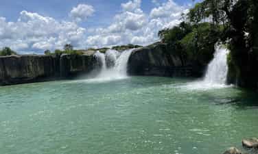
Thuy Tien Waterfall
Located in Giang Tien village, Ea Puč commune, Krong Nang district, about 56 km from the center of Buon Ma Thuot city. Originating from the streams in the deep forest with 4 main waterfalls, each waterfall has its own beauty. Thuy Tien is like a fairy hidden by the mountain forest with the peaceful waterfalls winding among the thousands. Coming to Thuy Tien waterfall, we will be released in the sound of the stream, watching the fanciful picture of nature on both sides of the waterfall, with the cliffs stood up to the middle of the sky, and countless flowers, butterflies, birds, animals. Not only known as a charming painting, but the waterfall is also associated with the ancient folk story of the Ede people. The story is that: In the old days, in an Ede village, there was a boy named Dam Ji, an extraordinary appearance, his limbs solid like stone. Ji is good at hunting, every sword of him is a terrifying animal, but his personality is very impatient and aggressive, if anyone does not mean his intentions, he immediately punish him, so even though he is very talented, he is not admired by everyone, whereas his younger brother is gentle and kind, so he is loved and appreciated by his people. One day, the two brothers went to the forest to hunt for animals, had not hunted any animals but the mouth was thirsty, there was no drop in the forest to drink. While despairing because of thirst, holding the sword in his hand, the hot ji swung on the ground, the sword had just stabbed to the ground and suddenly shook the earth and a stream appeared in front of him, he shouted happily because there was a country to save thirst. He reached out and swung another seven sword to the ground, then at the distance not far from the stream, the wandering, very shaking, the animal panic, he came to see the appearance in front of a stream. Since then, in the forest that the boy often comes to hunting with two streams and streams in the west, everyone named Ea Dah and the east stream are named Ea Puč. But these two streams have two different personalities just like the two brothers Dam Ji. Ea Dah stream in the west has the same personality as the British, very brave and intense. Referring to the name of this stream, people in the area are terrified, if they come here to catch fish, find drinking water to be very wary of air, which will be swept away by the stream, children in the area down to the shower are often lost by the stream. Those who come here to catch fish and praise this stream many new fish to catch fish, if they say this stream has little fish or no fish, the stream will not give the fish, can catch the whole day they will not get any fish. When the angry stream will rise, it will cause floods to get drifted. In contrast, the Ea Puč stream in the east is very peaceful and does not harm people, whoever comes here fishing, catching fish leaves with shrimp and fish full of baskets, so people call the Ea Puč stream as the Hien stream. The stream is like a gentle and kind younger brother who often helps others, unlike the ferocious Ea Dah stream. Besides, Thuy Tien Waterfall is also associated with the beautiful love story between Uncle Ho's army and a beautiful Ede ethnic girl, both bravely fought against the enemy to the last breath to protect the village, protect the revolutionary zone, contributing to the victory of the resistance war against the US to save the country of our people. On March 3, 2009, the Ministry of Culture, Sports and Tourism issued a decision to rank Thuy Tien waterfall as a national landscape. Source of the provincial web portal
Dak Lak
5790 view
Rating : National relics.
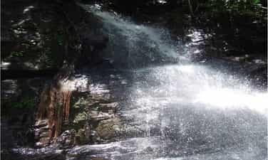
Drai Kpôr waterfall
Drai Kpo Waterfall of Buon Trung (often called Buon M’Toi) commune ču Bong, Ea Kar district, about 100km southeast of Buon Ma Thuot city center. In Ede language: Drai means waterfall, Kpro means souls, spirituality, Drai Kpo water, which means "Soul Waterfall", "Spirit Waterfall". The waterfall has long been attached to the lives of the Ede people in the ču Yang in respect for respect, the place of Yang (the god) reigns, for the cool water, for the green forest and bringing life to the villagers. Dray Kpo Waterfall is originated from the Cu Yang (Mountain) range of 769m high, the Dray Kpôr line is the conformity between Ea Kp Dam and Ea Kpir streams from the č kdroah sequence with an altitude of about 700 m, stretching over 100 m wide, reaching about 50 m, from here the water circuit weaving through the stone slot and then the height of the small circuit is down to a small circuit down to a small valley. Broken to create waterfalls up to 30 m high then joined in the Krong Pac river. The waterfall is the continuation of 4 waterfalls, each with its own appearance. Surrounded by primeval forests with many rich flora and fauna. The 500m from the Buon Buon Base is from 1960 to 1975, which marks the revolutionary miracles during the anti -American resistance war. The story says: In the 1960s of the last century, the US - Diem advocated to further implement the war strategies for South Vietnam. Therefore, when the Act 10-59 is enacted. The strategic hamlet conducted throughout the territory, since this side of the 17th parallel. The Central Highlands is not out of that campaign. And Buon Trung is one of the places where the "tactical" intention of Mi Dan used the upper people as the core force (Furo force) to eliminate the communists lying thoroughly used. The revolutionary Base of Dray Kpor was born in the middle of the fire of war. At the same time, a Liberation Army unit was also born (taking the name H1) and stationed right at the foot of Dray Kpôr waterfall. When discovering this base, the United States - Wei repeatedly conducted white terrorists, Buon Trung continuously burden the bombs from the sky. In addition to the poetic, majestic natural scenery, attached to the resistance monuments and close to the village, Drai Kpôr waterfall also provides water to serve irrigation for Buon Trung fields. On December 15, 2004, the Ministry of Culture and Information (now the Ministry of Culture, Sports and Tourism) issued Decision No. 105/2004/Decision -The Culture and Sports Culture Ranking of Drai Kpôr waterfall as a national landscape monument. Source of electronic portal in Dak Lak province.
Dak Lak
5788 view
Rating : National relics.
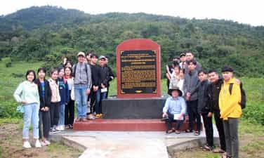
The resistance base of Dak Lak province (1965 - 1975)
The resistance base of Dak Lak province (1965 - 1975) is a place to mark important historical events in the tradition of national struggle and defense of the people of the ethnic groups of Dak Lak province. This place is not only a communication line, transition from the North to the rear in the Central region to the southern provinces but also the place where Dak Lak Provincial Party Committee and other units in the province chose as a basis, living and revolutionary activities. In particular, the base area is also the place where 3 times the Congress of Dak Lak Provincial Party Committee: The third time (1966), the fourth time (June 1969), the 5th time (November 1971); A corridor to transport officials to strengthen the Central Highlands battlefield in the years 1968 -1973. On December 29, 2023, the Ministry of Culture, Sports and Tourism issued Decision No. 4241/Decision -The Culture and Tourism Culture and Tourism on the ranking of the National Monuments for historical monuments of the relics added to the resistance base of Dak Lak Province (1965-1975), Hoa Le, Hoa Phong, Cu Pui, Yang Mao and Cu Don, including 39 locations. According to the leader of the Department of Culture, Sports and Tourism, the historical sites of the relics added to the resistance base of Dak Lak province (1965-1975), Hoa Le, Hoa Phong, Cu Pui, Yang Mao and Dam Dam are one of 43 relics rated historical, cultural and famous landscapes of the province, valuable and great meaning in history, cultural, historical, scientific and historical; expressing gratitude to the generations of his father sacrificed for the cause of national liberation and national defense; Contributing to educating revolutionary traditions, patriotism and national pride of the people, especially for the younger generation. Source of electronic portal in Dak Lak province
Dak Lak
4959 view
Rating : National relics.
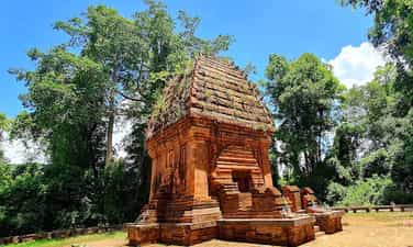
Yang Prong Tower
Cham Yang Prong Tower of Ea Rok commune, Ea Sup district, about 100km west of Buon Ma Thuot city, also known as Green Forest Cham Tower. This is one of the only indigo towers in the Central Highlands built in the late 13th century to worship Siva god in the form of Mukhalinga (great god), praying for the flourishing of the race and happy happiness. Yang Prong Tower, also known as the Green Forest Cham Tower, is a Cham tower located in Village 5 Ea Rok commune, Ea Sup district, Dak Lak province. Legend has it that the tower is the tomb of the head of the old Cham village. In 1906, it was found on the stone frame of the tower of the ancient steles of the Cham king in the late 13th century. The material vestiges around Yang Prong seem to prove this is a old manager of the Cham people in the Central Highlands. The tower is quite intact, higher than 10m, built of hard bricks with many different sizes. The tower has a square jar, the eastern lobby of 1.60m wide. The structure of the square tower, the upper point is like onions, different from the usual Cham architecture. In 1990, many domestic and foreign scientists came to and there were a number of tower research. The scientists all asserted: Yang Prong was built in the 13th century, proving about 700 years ago, the Central Highlands not only had indigenous people but also other ethnic groups. Yang Prong is a monument of great significance for ethnologists, history, architecture ... The tower was built at the end of the 13th century under the reign of Sinhavarman III (Che Man), worshiping Shiva in the form of Mukhalinga, praying for the development of the race, and happy happiness. The Tower of Prong was discovered in the 1904-1911 years by a French ethnicist named Henri Maitre. The scientist described this project in Les Jungles Moi (all forest) published in Paris in 1912. Yang Prong Tower is a red brick architectural block on a blue stone high floor. The tower has a height of 9m, the square bottom is 5m long, each outside is 3 fake doors, a single door opens towards the East direction, where the reign of the gods. Above expanded and soaring pen pyramid, different from the architecture of other Cham towers in the Central. During the war, the tower was searched by gold and mines, so it was much damaged. The tower is also not built on high hills, low mountains without trees like other Cham towers but lying under the ancient canopy of the Ea Sup forest and the peaceful Ea H'leo River. Yang Prong means a great worship tower, a god who specializes in managing crops according to the concept of the ancient Cham people. This is an unfinished project, because when building a tower, Cham people never build one but often a population. Currently, the tower has been recognized as a cultural heritage that needs to be preserved. Despite being embellished, the tower generally retains its ancient and solemn features. Around the tower is surrounded by many years old, quite dense, this is also a testament to the protection efforts of the local government. Not only is a unique artistic architecture, Yang Prong tower has a mysterious ancient Cham nuance and culture, steady ancient existence and sustainability at the same time. On August 3, 1991, the tower was recognized as a national architectural and cultural relic. Source of electronic portal in Dak Lak province
Dak Lak
5441 view
Rating : National relics.

Rich Tung - Go Da
Located in An Khe Town, Gia Lai Province, the old Rich Tung - Go Da Monument complex includes Go Da relics in An Binh ward and 12 Roc Tung relics in Xuan An commune, An Khe town, Gia Lai province. In particular, 4 places excavated are Go Da, Rich Tung 1, Rich Tung 4 and Rich Tung 7. The rest are all excavated and confirmed in the same complex with Ram Tung - Go Da. Stone Located in An Binh ward, An Khe town, Gia Lai province, with coordinates 13058’19,2 ”North latitude, 1080 39’05,1” Kinh Dong, absolute height of 421.5m. The monument is located on the right bank and about 1.5 km from the Ba River, in the hill terrain of the Ba River, which is worn out to accumulate, the elementary dating back wing (Qi). The monument was excavated twice (2015 and 2016), with a total area of 94m2, by the Department of Culture, Sports and Tourism of Gia Lai Province in collaboration with the Vietnam Institute of Archeology and the Institute of Archeology and Ethnology of Novosibirsk of the Russian Academy of Sciences. The mound relics have 1 cultural layer, made from granite in place, containing stone tools and meteorite. Some common characteristics: Most of them are made from quartz, quartzite, large size, outstanding type is a two -sided tip, three -sided spearhead, grated tools, tight tools, pieces of depression, hon ghec, baseball ... are rudimentary, less tuning, other shapes and more ancient than old stone monuments currently known in Vietnam such as Duh Dam (Thanh Hoa). The stone is a relics, manipulating the tools of the old stone residents, at the stage of the Homo Erectus, in the evolution of humanity from here to modern people (Homo sapiens) and is the first cultural evidence of humanity. Rush 1 Located in Xuan An commune, with coordinates 14002’25,3 "North latitude, 1080 40’82,2” Kinh Dong, absolute height of 556m. Located on the left bank and about 2.5km from the Ba River, excavated 3 times (2016, 2017 and 2018); In 2016, excavating holes 1 with an area of 48m2 (6m x 8m); In 2017, excavating holes 2 with an area of 70m2 (10m x 7m), chosen to build a display house on the spot when digging to grade 1.2. at a depth of 0.8m -1.1m (cultural highway); In 2018, excavated 20m2 within 70m2 of hole 2, at a depth of layer 2.2. The remaining 50m2 is preserved in the roof. Rich Tung 1 is a residence relic and place of manipulation, of which the element of residence is quite typical, shown on the surface of the cultural floor, there are a number of stone clusters, solid, higher bonds around, in which high concentration of quartz stone pieces, some stone lymph nodes, pieces of depression and crushed tools. The ruins of the ruins 1, in terms of basic geological structure like Go Da, belongs to the pleistocene period, about the characteristics of the existence of the two -sided ghost tools, all one -sided, pointed nose, scraping, choppers ... with an old stone characteristic. Rich Tung 1 is a residence relic and place of manipulation, of which the element of residence is quite typical, shown on the surface of the cultural floor, there are a number of stone clusters, solid, higher bonds around, in which high concentration of quartz stone pieces, some stone lymph nodes, pieces of depression and crushed tools. Rush 4 Located at the coordinates of 14002’2,7 "North latitude and 108040’35,7” Kinh Dong, 430m high, located about 500m from Ro Rot 1 and on the left bank of the Ba River. The monument was detected in November 2015 and excavated in 2016, 2017 and 2018. The results of the 4 -pit excavation in Roc Xung 4 relic showed that the holes had stratified structure, the same characteristics, reflecting the properties of residence and manufacturing tools. The stone tool complex in the locations of Tung 4 is basically like Rich Tung 1 and Go Da. Tung 7 Located in Xuan An commune, An Khe town, coordinates 14001’452 ”North latitude and 108041’11.3” Kinh Dong, 438m high. The monument was discovered in 2016 and excavated twice (2017 and 2018) with a total area of 40m2. The excavation results obtained a number of stone tools, to tighten, spearhead, scrap, double -sided gauge tools, lymphadenopathy and many pieces of depression. Rush 7 has the characteristics, nature and dates of the similarity as the places excavated in An Khe valley. The discovery and detection of Roc Chung 7 relics has added to the list of old stone places currently known in the hill of An Khe valley, adding evidence of the presence of the ancient people of humanity in Vietnam. The old stone archaeological monuments in An Khe are distributed on the average mound hills of 420 - 450m above sea level, belonging to the transition from the plateau to the coastal plain of Central Vietnam. The in kind in the old monuments of An Khe stone has the unity, stability of materials, types, manufacturing techniques, and a common feature of an old stone -based industry, named An Khe Technology. An Khe technology is characterized by a complex of stone tools made from river pebbles, local streams, large size, hard stone, fine particles, mainly quartz and quartzite. The stone tool is rudimentary with typical types: two -sided jet tools, handxe (Handaxe), spearhead (pick), pointed nose and crude tool (chopper). In particular, the coarse tight tool is mainly distributed in Asia, the two -sided and prominent hand -shaped tools for the old Western stone, while the pointed spearhead and spearhead are most clear in the old stone in An Khe. With the typical values above, Roc Tung - Go Da, Gia Lai Province was ranked by the Minister of Culture, Sports and Tourism of the National Archaeological Monument under Decision No. 3237/Decision -The Culture, Sports and Tourism Culture on November 4, 2020. On December 29, 2022, the Prime Minister Pham Minh Chinh signed a recognition of "Special National Monuments" for Ro Xoc-Gò Da in An Khe town, Gia Lai. Source of cultural heritage.
Gia Lai
6016 view
Rating : Special national relics.
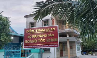
Heritage of the Cham royal family
The warehouse opened the Cham Royal Heritage collection located in Tinh My village, Phan Thanh commune, Bac Binh district, Binh Thuan province. It displays more than 100 original artifacts with bold cultural historical value of the Cham nation and is classified into 8 collection groups. In particular, the most valuable is the crown of King Po Klaong Man and the bun of Queen Po Som with gold material with a very sophisticated and unique pattern carved lines in the early seventeenth century. The collection of the Cham Royal Heritage is a place that fully converges the values of the birth of the ancient Cham dynasty, the costumes, jewelry, crowns, weapons, utensils in the palace, ... being kept by the Descendants of the Cham King, transmitted from this generation to the next generation, over 400 years. Before 1975, the collection of Cham Royal Cultural Heritage was kept tightly in the warehouse for spiritual reasons, beliefs and other important parts such as security and safety for heritage and heritage guard. Until the years 1991 - 1992, the survey, research and scientific records of Po Klaong Mânai temple and the new collection were gradually conducted and completed submitted to the Ministry of Culture and Information ranked in Decision No. 43/Culture/Decision on January 7, 1993. After being ranked, aware of the long -term protection of the remaining collection of the remaining ancestors, the Cham Descendants' family, Ms. Nguyen Thi Thuyen (1911 - 1995), agreed to step by step for the Binh Thuan Museum to design and display the collection in the form of "open warehouse". However, because the house of Mrs. Tham was built in the early years of the 1960s, the space was quite cramped, the lower floor to stay and the upper floor was divided into 2 rooms for display, the family was only open to the research teams, the politicians were the main, not widely served for visitors to admire the original artifacts. Over the years, authorities at all levels and functional agencies have also implemented many things to preserve and promote the value of the Cham Royal Heritage collection. However, the effective promotion is still modest, not commensurate with the value of the heritage. Therefore, it is necessary to have a new approach for the collection to really promote the value in the development of social life, especially the outbreak of cultural tourism. Over the time of surveying and statistics, the Museum of Binh Thuan Province classified the collection of Cham royal heritage into 8 collections as follows: Collection of crowns of the king and queen; Weapons collection: Executioner, sword; Collection of instruments (Pheng La); Collecting worshiping items (beliefs, spirituality); Collection of fabric (brocade and fabric from abroad); Ceramic collection; Collection of paper: Sac Phong a number of Nguyen Dynasty King and some types of documents on land, geography, administrative documents copied in Han Nom characters from the ordained the Nguyen kings; Wood collection: Royal chest, guard hat. Source of Department of Culture, Sports and Tourism of Binh Thuan Province.
Lam Dong
6300 view
Rating : National relics.
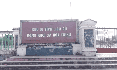
The venue for the co -prosperity
Dong Khoi historical relic area of Hoa Thinh commune is the place to display historical images of Dong Khoi day of the people of Hoa Thinh commune. This is also a place to educate the revolutionary tradition of the commune for young people today and tomorrow, and to serve visitors to learn the meaning of the historical meaning of the Hoa Thinh commune day. This is a national historical monument area by the Ministry of Culture and Information with Decision No. 2005/Decision -Culture and Information on November 16, 2005, ranking the National Monument "The venue for the co -prosperity". Facing the requirements of the new revolutionary struggle, in January 1959, the Party Central Committee issued Resolution No. 15 to determine the basic tasks of the Southern Revolution as "liberating the South from the yoke of the empire and feudalism, the implementation of independence, democracy and plowing farmers, completing the people's democratic revolution in the South", "the basic development path of the Southern revolution is the authorities." Under the light of Resolution 15 of the Party Central Committee, the revolutionary movement in Phu Yen province moved to a new development stage. In September 1960, the first Congress of Phu Yen Provincial Party Committee was held at the Lo Lo base (Dong Xuan mountainous district) to set out the policy and measures to promote the Dong Khoi movement in the plain, recruiting young people to build armed forces, build base areas and mass facilities ... Mr. Duong Du, a historic witness, is one of the revolutionary officials who have emoted the Dong Khoi, the system of the Dong Khoi, the system of Dong Khoi Khoi. After studying, thoroughly grasping the Resolution of the 15th Central Party Conference and preparing forces, at 19:00 on December 22, 1960, the force participating in Dong Khoi started marching from slope to look through the villages and hamlets and then divided into three wings to the headquarters of Hoa Thinh commune, shooting on the enemy's defender platoon. Due to being mobilized before, when listening to gunfire, thousands of people from the directions poured out the road, carrying sticks, spears and armed forces of the district both attacked and rebelled to arrest the Wei Wei, and then focused on the headquarters of Hoa Thinh commune to attend the rally. The force participating in Dong Khoi arrested the vice-deputy representative to hand over the seal, papers, documents ... About 1 am on December 23, 1960, the rally began. The people chanted the slogans: "The American imperial island and the puppets", "The South Vietnam Revolution is definitely successful". At 3 o'clock the same day, the rally ended. Hoa Thinh became the first commune of Zone 5 Delta owned by the revolutionary government. From Dong Khoi Hoa Thinh, the revolutionary force continued to destroy evil and alkaline in the communes of Hoa Dong, Hoa Tan, Hoa My and Hoa Hiep. The liberation area of Phu Yen province expanded with more than 20,000 people, the movement of raising troops, contributing to the revolution to develop more than ever. Also from Dong Khoi Hoa Thinh, thousands of young people of Phu Yen volunteered to join the Liberation Army, escaped into the base, traveling throughout the battlefields of Khanh Hoa and Dak Lak on duty against the US, Wei and Save the country. Source of the website of Hoa Thinh commune, Tay Hoa district, Phu Yen province.
Dak Lak
6070 view
Rating : National relics.
Outstanding monuments
See all
Lang Le Bau Co relic site
Lang Le Bau Co relic site is located in Tan Nhut commune, Binh Chanh district, Ho Chi Minh City. Lang Le Bau Co is associated with the resistance war against the French invasion in 1948 with major battles that went down in history. Lang Le Bau Co relic was recognized as a city-level historical relic in 2003. The reason it is called Lang Le Bau Co relic area is because the name of Lang Le Bau Co relic area was given by local people. The hamlet was established next to the interlaced canals and rivers. Lang Le Bau Co is located inside a large field with many shrimp, crabs, and fish. Along with many species of birds such as mallards, storks, teal, nuthatches, gongs, partridges, herons, and red armpits come to feed here. Therefore, Tan Nhut people call it by the familiar and rustic name Lang Le Bau Co. Lang Le Bau Co relic is considered the gateway to move to the center of Vuon Thom base and attack the enemy headquarters in Saigon. Previously, Lang Le Bau Co relic area was originally a field of overgrown reeds. On April 15, 1948, the French colonialists sent 3 thousand soldiers and many modern weapons to simultaneously attack the Lang Le Bau Co area to destroy the Vuon Thom base. At that time, the revolutionary armed forces in Lang Le - Bau, because of their small force and rudimentary weapons, had the help of local people along with the advantage of terrain. After just over half a day of fighting, it turned to attack, causing the French army to suffer a large number of casualties. The victory at Lang Le Bau Co killed 300 enemies, captured 30 mercenaries, and destroyed many machines, military vehicles, and guns of all kinds of the enemy. However, on our side, there are many officers and soldiers who heroically sacrificed their lives at a very young age. On October 14, 1966, in Lang Le, the Republic of Vietnam Army Ranger Battalion was destroyed by tourist militia. Lang Le Bau Co relic site has great historical significance for the people of Saigon in particular and the whole country in general. Faced with hatred for the French colonialists, Lang Le Bau Co's army and people fought a war of great historical significance that opened the door for our side and the enemy. For our side, the battle opened the door to heroism in a strong resistance position. As for the enemy, they had to retreat into a strategic position and were destroyed. The French colonialists could no longer form a strategy to defeat the Viet Minh. Moreover, at Vuon Thom base, Lang Le Bau Co also took place a determined battle to protect our base and destroy all sabotage plans of the enemy. Lang Le Bau Co relic area, after the Dong Khoi movement in 1960, was also a logistics and springboard for the armed forces to liberate Long An - Saigon - Gia Dinh. To commemorate the sacrifices of our compatriots and soldiers, in 1988 Binh Chanh district built a historical building in Lang Le Bau Co land with an area of 1000m2. Source: Ho Chi Minh City Electronic Information Newspaper
Ho Chi Minh City
18217 view
Rating : City-level relics

Tan Hiep Prison Historical Relic
Tan Hiep Prison, also known as "Tan Hiep Correctional Center", is located in Quarter 6, Tan Tien Ward, Bien Hoa City. Tan Hiep Prison Relic was ranked as a national relic by the Ministry of Culture and Sports on January 15, 1994. Tan Hiep Prison is one of the six largest prisons in South Vietnam and the largest prison in the Southeast region, built in an important military position, northeast of Bien Hoa town. Ahead is National Highway 1; Behind is the North - South railway line. This is an isolated location, convenient for transportation, easy for protecting, guarding, receiving prisoners from other places and transferring prisoners to Con Dao, Phu Quoc... Tan Hiep Prison has an area of 46,520 square meters with 8 prisons, including 5 prisons for communist prisoners and patriots. The prison is surrounded by 4 layers of barbed wire with 9 bunkers, 3 watchtowers with a team of guards and a modern alarm system. It's called "Correctional Center" but inside is actually a gun warehouse, an interrogation and torture room with the most modern tools. Each prison only has an area of nearly 200 square meters but holds 300-400 people, sometimes up to a thousand people. In particular, there are "repentance" rooms and "tiger cages" that are very small and narrow and living conditions are extremely harsh, prisoners live like in a crematorium. The diet was extremely unhygienic. The prison guards bought rotten rice and rotten fish to fertilize the fields, and fried them in oil to feed the prisoners, leading to many people being poisoned. With the determination to escape the imperial prison, return to the Party and the people to continue fighting and liberating the nation, on December 2, 1956, with the agreement of the Eastern Inter-Provincial Party Committee, the soldiers Communists were "detained" in Tan Hiep prison under the direct direction of comrade Nguyen Trong Tam (Bat Tam) - in charge of the prison Party Committee and a number of other comrades who suddenly broke the shackles. was able to free nearly 500 comrades and patriots. This event caused a stir in the Pentagon. America - Diem hastily mobilized both main forces and security forces, civil guards defending the three provinces of Bien Hoa, Ba Ria, Thu Dau Mot and two special forces to encircle and capture the prisoners, but all were defeated. failure. Our comrades and compatriots who escaped from Tan Hiep prison received help and protection from local facilities and returned safely to base. Among the escaped prisoners were comrades: Bay Tam, Hai Thong, Ly Van Sam... who became the core nucleus of the Dong Khoi movement later. In 2001, to partly recreate the crimes of the US - Diem against our comrades and compatriots imprisoned at Tan Hiep prison and describe the entire Tan Hiep uprising on December 2, 1956. , Dong Nai Museum has collected images, documents, and artifacts displayed at the relic and made a model to serve the research and sightseeing needs of all classes of people. Every day, the monument is open to visitors. Source: Dong Nai Electronic Newspaper
Dong Nai
16677 view
Rating : National monument

Nguyen Huu Canh Temple
Nguyen Huu Canh temple, also known as Binh Kinh communal house, is located on the left bank of Dong Nai river, formerly belonging to Binh Kinh hamlet, Binh Hoanh village, Tran Bien canton, now Nhi Hoa hamlet, Hiep Hoa commune, Bien Hoa city. It was ranked as a national historical relic by the Ministry of Culture, Information, Sports and Tourism on March 25, 1991. Nguyen Huu Canh Temple was built around the end of the 18th century. Initially, the temple was small in scale, with walls made of boards and a yin-yang tile roof, about 400m south of the current temple. Documents say: the temple was first rebuilt in the fourth year of Tu Duc (1851); By 1923, the temple was rebuilt at its current location. Nguyen Huu Canh was born in 1650 in Gia Mieu, Tong Son district, Thanh Hoa province in a family with many famous generals in the dynasty. He was a man of both literature and martial arts, accomplished many great victories and was trusted, loved and respected by Lord Nguyen. In the spring of the year Mau Dan (1698), he obeyed Lord Nguyen's order to invade Dang Trong while it was still very desolate. Arriving in Dong Nai, he set up his headquarters at Cu Lao Pho (now Hiep Hoa commune); took Dong Nai land as Phuoc Long district, built Tran Bien palace, took Saigon land as Tan Binh district, built Phien Tran palace, the land expanded thousands of miles. He recruited immigrants to settle down, organized the administrative apparatus gradually and systematically, encouraged land reclamation, and promoted Cu Lao Pho to develop into one of the busiest and most dynamic port towns throughout the century. 18 and officially annexed the new land of the South into the Dai Viet map. After returning from the invasion of the South, the following year he again served Lord Nguyen Phuc Chu's command to lead an army to suppress King Chan Lap and maintain the southern border region. In April of the year Canh Thin (1700), after completing his mission, on the way back to Rach Gam (Tien Giang), he fell ill and passed away on the 16th day of the 5th lunar month, at the age of 51 years old. On the way to his hometown for burial, his coffin was stopped at the land where he once had his headquarters on Cu Lao Pho so that local people could have the opportunity to say goodbye to him one last time. At the mandarin's communal house, local people built a tomb to remember this event. When hearing the news of Nguyen Huu Canh's death, Lord Nguyen was extremely sorry and conferred on him the title of High-ranking official of the Town Chancellor with the title: Thanh Marquis Ceremony and had his tablet enshrined at the Thai temple. Source: Dong Nai Electronic Newspaper
Dong Nai
15300 view
Rating : National monument

La Nga victory relic
La Nga Victory Relic (at km 104-112 on Highway 20 to Da Lat, in Phu Ngoc commune, Dinh Quan district) was ranked a national historical relic by the Ministry of Culture on December 12, 1986. To cheer for the Viet Bac victory in the fall-winter of 1947 and also to deal a fatal blow to the enemy, the command board of squad 10 decided to organize a big battle, to show the enemy that the Vietnamese people were , Vietnamese people do not easily submit to any enemy; With a spirit of courage and ingenuity after nearly half a year of preparation, studying the terrain, and choosing a location: at 15:12 on March 1, 1948, the La Nga ambush battle began and ended at 15:12 on March 1, 1948. 15:57 on the same day, in just 45 minutes. The victory of La Nga delighted the people of Dinh Quan in particular and the people of Dong Nai in general. This is a victory that demonstrates the cunning and courage of our army and people, causing the enemy to be stunned and defeated. From this victory, our force grew stronger and stronger, contributing to defeating the enemy's plan to attack quickly and win quickly, forcing them into a passive position. The scenic complex of Chong Rock, Mai Waterfall, La Nga River and La Nga Victory Monument is an interesting tourist complex of Dinh Quan. The amazing beauty of Hon Ba Chong, Da Voi Mountain, Hon Dia, along with the natural pagoda at the foot of the rocky mountain are typical clusters that create a harmonious beauty for the Da Chong scenic area. Dinh Quan Da Chong Complex is also a place that retains traces of prehistoric life. Here, under the stone roofs, along the streams and on the slopes along the valley, many production and daily life tools of the ancients made of stone, bronze and terracotta were discovered. During the 30-year resistance war. Dinh Quan is an important part of War Zone D. Da Chong witnessed the formation, development, stationing, and combat deployment of revolutionary forces. Today, a part of the land of Da Chong Dinh Quan scenic area has been used and built into the Dinh Quan District Cultural and Sports Center. In the near future, Da Chong Dinh Quan scenic area will be invested in and renovated, contributing to making the natural landscape more beautiful and becoming an attractive eco-tourism destination. Source: Dinh Quan District People's Committee
Dong Nai
15125 view
Rating : National monument

Chot Mat ancient tower
Chot Mat Tower Historical-Cultural Relic, located in Xom Thap hamlet, Tan Phong commune, Tan Bien district, Tay Ninh province, was recognized by the Ministry of Culture and Information (now the Ministry of Culture, Sports and Tourism) as historical - cultural relic on July 23, 1993. Also one of the last three ancient towers remaining in the South of our country. Having undergone many restorations in 1938, 2003 and most recently in 2013. Despite undergoing restorations, the Chot Mat ancient tower relic site has given itself a new look but still remains retains the spirit of ancient architecture. The entire Tower is built of brick and slate with the top of the tower tapering upward, from the ground to the highest point of the tower is estimated to be 10m. In addition, this ancient tower is located on a high mound in the middle of the field, so from a distance it looks like a pen rising gradually. In 2003, the People's Committee of Tay Ninh province decided to approve the investment project to restore, embellish and preserve Chot Mat tower relics and carried out the restoration, restoration, display and opening of the excavation pit in 2003. into use. On November 27, 2019, the Provincial People's Committee issued a Decision regulating the decentralization of management, protection and promotion of the value of historical and cultural relics and scenic spots in Tay Ninh province. Decision to assign the People's Committee of Tan Bien district to directly manage 4 relics, including the National Historical-Cultural relic Thap Chot Mat. In particular, the Chot Mat Tower Historical-Cultural Relic in Tan Phong commune, Tan Bien district was chosen to be part of the tourism development link of Tay Ninh Province. This is a tourist destination worth exploring, contributing to tourism development in Tan Phong commune in particular and Tan Bien district in general. Source: Tay Ninh province electronic information portal
Tay Ninh
14982 view
Rating : National monument

Hoc Mon District Palace
Hoc Mon District Palace is located at No. 1, Ly Nam De Street, Hoc Mon Town, (next to the District People's Committee headquarters) and is the place where many outstanding fighting events have been recorded throughout the long history from 1885 to the Southern days. Complete liberation of the People of 18 Betel Garden Villages. After defeating Chi Hoa Fort, the French colonialists built a 3-storey wooden house here to use as a military post. When Tran Tu Ca took office as Governor of the Palace, he used the Station as the Palace of Binh Long district. Originally a cunning drunkard of the French colonialists, Tran Tu Ca was led by a group led by Mr. Phan Van Hon (Quan Hon) and Nguyen Van Qua (Chanh Lanh Binh) of nearly 1,000 insurgents who came to burn the District Palace, captured and head cut off in the middle of the market. That was February 8, 1885, At Dau Tet. Afterwards, Hoc Mon District Palace was rebuilt with a blue stone foundation, brick walls, and a defense system from the upper floors to the fence. The architecture is similar to the Military Fort, so the locals call it Hoc Mon Fort. Tran took over from Tran Tu Ca as Governor of Ngon district, moving to Tra District and then Tho District. This was a long period of time when the people of the Hoc Mon region suffered from many cruel and despicable scenes from the French colonialists and their oligarchic henchmen mentioned above. With the indomitable tradition of Hoc Mon people. On June 4, 1930, around 6 a.m. in front of the District Palace, hundreds of Hoc Mon people protested demanding "abolition of poll tax, reduction of license and market taxes, and granting land to poor farmers." Tra District invited the leaders into the Palace to negotiate, but they cunningly arrested them, including Mr. Le Van Uoi (Secretary of Tan Thoi Nhi Commune), who was the leader of the protest. People were undaunted and fiercely demanded that Tea District release those detained. The protest group became more and more crowded, the fighting spirit spread somewhat, causing Tra District to give in. On the one hand, they released the detained people, on the other hand, they called the officials in Saigon for help. 2 hours later, the struggle was led by two men, Blachole and Nobbot, who opened fire on the protest group, causing many casualties. But the most impressive historical event at Hoc Mon District Palace was the Southern Uprising on November 23, 1940. Hoc Mon Fort is very solid, built of green stone like a fortress, about 15 meters high, has a gun emplacement and a defense system with battlements guarded by a platoon of green soldiers. On November 22, 1940, France reinforced one more platoon to deal with the situation. On the afternoon of November 22, 1940, Mr. Do Van Coi's army broke into the town, disguised as civilians, ambushed behind the Station waiting for orders to rob the Station. Another army wing has the task of destroying bridges, cutting down trees blocking roads, and occupying offices and houses... The army wing from Phuoc Vinh An, Tan Thong, Tan An Hoi, Tan Phu Trung is led by Mr. Pham Van Sang and Dang Cong Binh commanded, started from Ben Do hamlet, attacked the house, killed 1 person, collected 4 guns, and took control of the situation here (Tan Phu Trung). Immediately this army was ordered to pull back to Hoc Mon. The Long Tuy Thuong army was commanded by Mr. Bui Van Hoat. The army of General Long Tuy Trung was commanded by Mr. Do Van Day and Le Binh Dang. At around 24:00 on the night of November 22, 1940, the sound of artillery fire had not yet been heard in Saigon. After consulting, the army commanders united to attack the enemy's post. Immediately the troops headed straight to Fort Hoc Mon, where District Chief Bui Ngoc Tho resided. Two insurgents named Nghe and Kinh volunteered to enter the front gate and sacrificed their lives. Insurgents from all directions rushed into the Fort like water bursting its banks. Faced with the power of the insurgents and the masses, the soldiers in the Station no longer had the spirit to resist and fled in disarray. The insurgents completely occupied the inside of the station, but upstairs, the enemy still stubbornly used guns to shoot sporadically, at the same time calling Saigon and Thu Dau Mot for emergency help. Because he was eager to capture the name of Tho District, comrade Do Van Day climbed up to the upper floor of the Station by clinging to the gutter. Halfway up, he was hit by bullets, the comrade fell and died later. The battle was at a standstill when enemy reinforcements arrived. Unable to hold out, the insurgents withdrew from the town, dispersed to the villages, the armed forces withdrew to Ben Do hamlet (Tan Phu Trung) and then moved to My Hanh hamlet (Duc Hoa). Although the attack on Hoc Mon Fort (later called Hoc Mon District Palace) failed, it left a deep impression in the hearts of all civilians admiring the courage of revolutionary soldiers in the fight against colonialism. steal the country. During the historic Ho Chi Minh campaign, at 7:00 a.m. on April 30, 1975, Hoc Mon town was completely liberated, the National flag fluttered above the District Palace, where District Chief Nguyen Nhu Sang and his gang sai has been running away since last night. Today, Hoc Mon District Palace is chosen as the District Museum, where many documents are displayed, illustrating the ups and downs of historical periods as well as the revolutionary fighting spirit of the army and people in Hoc Mon district over the past two years. resistance war against French colonialism and American imperialism. A monument placed in front of the Hoc Mon District Palace relic represents the indomitable sacrifice of the army and people of 18 Betel Garden Villages, recognized as a national historical and cultural relic. Source: Hoc Mon District People's Committee
Ho Chi Minh City
14293 view
Rating : National monument

US Embassy building
The US Embassy relics, also known as the "White House of the East", are the origin of sinister military and political plots aimed at long-term annexation of Vietnam. The relic site is a 5-storey building built Built in modern architecture, located at the corner of Mac Dinh Chi - Le Duan Street, Ben Nghe Ward, District 1, Ho Chi Minh City, on a plot of land nearly 5,000 square meters. Previously, the US embassy was located at 39 Ham Nghi Street. At around 10:00 a.m. on March 30, 1963, the US embassy on Ham Nghi Street was hit with explosives by the F21 Commando team, collapsing three floors: 1, 2, 3, so the US decided to rebuild it. Construction began on the building in 1965, most of the materials and construction machinery were transported from the US, under the control of American engineers. According to the design, the building is surrounded by 7,800 Taredo stones that can withstand mines and artillery shells. The main door is equipped with thick steel, the other doors are blocked by a special thick bulletproof layer. All doors use automatic systems, including iron doors blocking the way to the upper floors. Inside the building there are 140 rooms with 200 staff serving day and night. In addition, next to the building is also built an additional row of houses called the "Norodom" area exclusively for C.I.A. employees. When inaugurated, the building had only 3 floors. At the end of 1966, two more floors and a terrace were built to serve as a landing place for helicopters. Surrounding the building is a 3m high wall, at both ends of the wall close to Le Duan Street, 2 high blockhouses are built, guarded day and night. The Embassy was completed in September 1967 with a defense system such as a fortress with 60 guards, a bomb shelter, and a radar screen system to control the facade. Immediately after the building was completed, on September 24, 1967, thousands of students flocked to the gate of the US Embassy to fight for "America to stop bombing the North", "America to go home" and issued a notice denouncing the US for "trampling and seriously violating the right to self-determination of the Southern people". But the outstanding event that happened at the US Embassy was the battle of the City Rangers during the General Offensive and Uprising in the Spring of 1968. The target of attacking the US Embassy was added on January 24, 1968 by Ngo Thanh. Van is in charge of general affairs. Ranger Team 11 took on this important mission, including captain Ut Nho (military region reconnaissance captain) and soldiers: Bay Truyen, Tuoc, Thanh, Chuc, Tran The Ninh, Chinh, Tai, Van, Duc, Cao Hoai Vinh, Mang, Sau and 2 drivers: Tran Si Hung and Ngo Van Thuan. Another equally humiliating event for the US Embassy was the chaotic escape that occurred on April 29 and 30, 1975 by the US and its accomplices. Faced with the rapid attack of the Vietnamese army and people in the historic Ho Chi Minh campaign, over 1,000 Americans and more than 5,000 pro-American Vietnamese jostled, pushed, and kicked each other to compete for a place on the terrace of the building. building to be rescued by helicopter. This relic was granted a certificate of recognition by the Ministry of Culture on June 25, 1976. Currently, the US Embassy building has been demolished and a new consulate in Ho Chi Minh City has been built, but next to it is a memorial stele forever remembering the achievements of the special forces soldiers who died in the battle. . Source: Ho Chi Minh City Youth Union
Ho Chi Minh City
14199 view
Rating : National monument

Tomb of Mai Xuan Thuong
Mai Xuan Thuong was the leader of the Can Vuong movement against the French at the end of the 19th century in Binh Dinh. Mai Xuan Thuong was born in the year of Canh Than, 1860, died in the year of the Pig, 1887, from Phu Lac village, Phu Phong district, Tuy Vien district, Binh Dinh province (now Phu Lac village, Binh Thanh commune, Tay Son district, Binh Dinh province). His father, Mai Xuan Tin, was the chief father in Cao Bang. His mother, Huynh Thi Nguyet, was the daughter of a noble family in the village. Mai Xuan Thuong is inherently intelligent and eager to learn. At the age of 18 (1878), he passed the Baccalaureate at Binh Dinh Examination School. At the age of 25 (1885), he passed the bachelor's exam. Responding to King Ham Nghi's Can Vuong edict, Mai Xuan Thuong returned to his hometown of Phu Lac, recruited insurgents, set up a base on Sung island to raise the Can Vuong flag against the French, then Mai Xuan Thuong brought his forces to join the army. The insurgent army was led by Dao Doan Dich and was appointed by Dao Doan Dich to the position of Military Salary Officer (in charge of food for the insurgent army). From then until 1887, the Can Vuong movement in Binh Dinh developed strongly and spread to Quang Ngai, Phu Yen... attracting tens of thousands of people from all walks of life to participate. On September 20, 1885, Dao Doan Dich died and assigned all his forces to Mai Xuan Thuong. He chose the Loc Dong mountain area (now in Binh Tuong commune, Tay Son district) as his headquarters and organized a flag worshiping ceremony, calling on scholars, literati, and people to join the movement to fight against the French. During that ceremony, insurgents from many regions in Binh Dinh province agreed to honor him as the Marshal leading the uprising and raised the slogan: "First to kill the left, later to attack the West". In early 1887, the French army under the command of Lieutenant Colonel Cherrean and the royal army led by Tran Ba Loc along with Minister Trira launched a major attack on the headquarters of the Can Vuong movement in Binh Dinh, the battle The fighting between the insurgent forces and the French enemy was extremely fierce, the fight was unequal, and in the end the insurgent force was pushed back. In March 1887, after a fierce battle in Bau Sau (An Nhon town, Binh Dinh province), Mai Xuan Thuong was seriously injured, the insurgents withdrew to Linh Dong secret area. On April 21, 1887, Tran Ba Loc surrounded and captured the Linh Dong secret base and captured a number of insurgents, including Mai Nguyen Soai's mother. On the night of April 30, 1887, Mai Xuan Thuong sent a suicide squad to break into Tran Ba Loc barracks, relieve the captured people, and he and a group of 50 subordinates crossed the mountain into Phu Yen and continued to resist. battle, but when she reached Phu Quy Pass (boundary between Binh Dinh and Phu Yen), she was captured by Tran Ba Loc's ambush and taken to be beheaded at Go Cham (East of Binh Dinh Citadel). The mausoleum of patriot Mai Xuan Thuong is located on a high hill of the Ngang mountain range (in Hoa Son village, Binh Tuong commune, Tay Son district, Binh Dinh province) about 50km northwest of Quy Nhon city; The mausoleum was built on a land area of 1988m2, inaugurated on January 22, 1961. Overall, the mausoleum is designed in the style of an ancient mausoleum, surrounded by low walls. The Lang gate (three gates) is made up of 4 square pillars, the top is tied in the style of a gourd and a vase, bearing the architectural appearance of a communal house or temple gate of the late 19th century. In the middle of the Mausoleum is Mai Xuan Thuong's tomb, rectangular in shape in the East - West direction; At the head of the grave is a stone stele engraved with an inscription recording the biography and career of Mai Xuan Thuong: The relic was ranked at the National level by the Ministry of Culture and Information on April 20, 1995. Source: People's Committee of Tay Son District, Binh Dinh Province
Gia Lai
13925 view
Rating : National monument

Mac Dynasty Citadel in Cao Bang (Na Lu Citadel, Ban Phu Citadel, Phuc Hoa Citadel)
During the period when the Mac dynasty had its capital in Cao Bang, in order to prevent the Le dynasty from attacking, the Mac dynasty restored and repaired Na Lu citadel (now in Hoang Tung commune, Hoa An) and Ban Phu citadel (now in Hung Dao commune). ), Phuc Hoa citadel, in addition to building many other citadels in Cao Bang, making Cao Bang a political and military center in the far Northeast border region at that time. Na Lu citadel and Phuc Hoa citadel are two citadels built before. According to the records of Be Huu Cung in Cao Bang Thuc Luc, Na Lu citadel and Phuc Hoa citadel began in the reign of Tang Y Tong in the year Giap Than, the 5th Ham Thong era (874). Based on the presence of many ancient tombs with stone inscriptions containing the names, addresses, and hometowns of the citadel builders who died here during the Ham Thong Dynasty, it can be confirmed that these two citadels were built during the Tang Dynasty. Na Lu Citadel was built over many different dynasties. When the Mac dynasty came to Cao Bang, it was rebuilt with bricks. Na Lu citadel has a nearly rectangular shape, has a total area of about 37.5 hectares, a length of about 800 m, a width of about 600 m, the citadel has 4 gates. Ban Phu citadel in the capital of Nam Binh, Nam Cuong country of Thuc Phan in the past in Cao Binh (Cao Bang), the Mac dynasty renovated the royal palace in the inner circle of the old capital of Nam Binh and called it Ban Phu citadel or Royal Palace. In the ancient capital of Nam Binh of the Nam Cuong country and the Mac dynasty, Ban Phu citadel still has clear traces. The capital city of Nam Binh consists of two citadels, to protect the citadel, the outer ring has a circumference of about 5 km, including a low hillock area, around the foot of the hill is covered with vertical canvas like a wall, convenient for navigation. Build defense lines. The western wall of the citadel runs parallel to the bank of the Bang River to the beginning of Bo Ma village, connecting the southeast wall of the citadel, flowing in front of Ban Phu, following the foot of the hill to meet National Highway 4, the northeastern side running along the foot of the hill close to the outside of National Highway 4. , up to the top of the mound is the northwest side, continue running along the foot of the hill, out to the river bank and meet the west wall, forming a closed citadel. When the Mac Dynasty established the capital, it repaired and built a number of additional works, in which Ban Phu Citadel (inner citadel - the king's working place) was built higher on the old citadel walls from the Thuc Phan period. The citadel is located on a flat land. Along with rebuilding the capital, the Mac dynasty also built a system of posts and ramparts quite thick around the capital and a number of important border points, forming a system of protecting the capital and protecting the border. gender. Phuc Hoa citadel (Phuc Hoa district) was built in a square style, about 400 m in each direction, including two citadel rings, the distance between the two rings is 80 m. Currently, the southern wall has been completely destroyed. Phuc Hoa Citadel has 2 main gates: The North Gate is open to the national highway to Ta Lung Border Gate today, people often call it Pac Gate, this gate is built in a rectangular style, 8 m wide, 5 m high. , including two gates made of thick, very sturdy wood; The second gate is in the south, opening to the river bank. Both gates were flattened long ago, and now there are no traces left. Near the citadel, in the northwest suburbs along the riverbank, there are many traces of brick kilns. People said that during the process of labor and exploration, many intact brick kilns were found in this area. Through research and surveys, it has been shown that in Cao Bang, the Mac dynasty renovated, embellished and built many citadels and fortresses, including repairing, embellishing and rebuilding Ban Phu citadel, Na Lu citadel, and Phuc citadel. Hoa. These fortifications have formed a quite solid system of protecting the capital. Up to now, of the ancient citadels built by the Mac Dynasty during the capital period in Cao Bang, some of the citadels built of earth only have traces left, but the citadels built of stone are still very clear. Source: Cao Bang Electronic Newspaper
Cao Bang
13525 view
Rating : National monument

WARRIORS' MEMORIAL AREA AT THREE GIONG FORCES, NATIONAL HISTORICAL MONITOR
Nga Ba Giong relic is a revolutionary historical relic located in Hamlet 5, Xuan Thoi Thuong commune, Hoc Mon district. Surrounded by three roads: Phan Van Hon, Nguyen Van Bua and Provincial Road 19. Nga Ba Giong relic site is a memorial site for historical events in two wars against foreign invaders. Recognized as a national historical site in 2002. Giong Junction (also fully known as Giong Bang Lang Junction) is located in Xuan Thoi Tay village, part of 18 old betel garden villages formed from 1698 to 1731. For a long time, Giong Junction is a place with a folk name that has entered the history of the hometown of 18 betel garden villages of Hoc Mon - Ba Diem. Legend has it that in the past, this place was a relatively high land and a place where many linden trees grew, so this place got its name from there. After the Southern Uprising (November 23, 1940) failed, the French colonialists increased their repression and fierce terror against the revolutionary movement in the Hoc Mon - Ba Diem region. They set up three shooting ranges in Hoc Mon to kill Party leaders and patriotic comrades from their hometown of Hoc Mon and surrounding areas. Giong intersection is the third shooting range to record the heinous crimes of the French enemy and his henchmen against the people of Hoc Mon. Learning from the experience of 2 previous shooting ranges (1 at the old theater in the center of Hoc Mon District, 1 next to the well behind Hoc Mon Hospital today), they executed public shootings, forcing people to come and watch for the purpose of intimidation. revolutionary spirit of Hoc Mon people. But that firing squad backfired. The Hoc Mon people witnessed with their own eyes the cruelty of the French colonialists and the noble sacrifices of the communist soldiers, so their patriotic fire flared up even more fiercely. . For this third shooting range, they did not dare to build it near the center of the District anymore, but moved it to the Giong Junction area as a desolate, sparsely populated area to avoid people's resistance. Here, they built a shooting range with a solid mound of land 12m long, 2.2m high, in front of which were planted 6 shooting posts, each 1.7m high, the shooting direction facing the field (Ba Tram Lac). In 1941, here they secretly executed many times without letting the people see, hundreds of communist soldiers and patriots were killed by them. With the extremely sacred historical significance of Giong Junction, the place that marked the barbaric crimes of the French invaders, the place that demonstrated the indomitable fighting will and noble sacrifices of our comrades and compatriots later on. the Southern Uprising (November 23, 1940); After the complete liberation of the South (April 30, 1975), Hoc Mon district quickly restored and embellished the Nga Giong Junction revolutionary historical relic site to educate traditional generations of youth. This place has become a tourist attraction and a place to organize traditional festivals during major annual holidays of Hoc Mon district and the city, especially the anniversary of Southern Uprising Day (November 23). Currently, with the consent of the city, the district is renovating and building Giong Junction into "Giong Junction Martyrs' Memorial Area". Source: Hoc Mon electronic information portal
Ho Chi Minh City
13395 view
Rating : National monument