


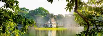


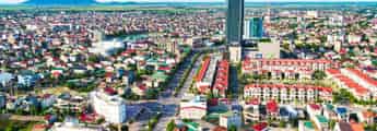
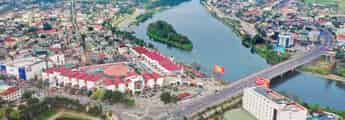
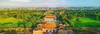
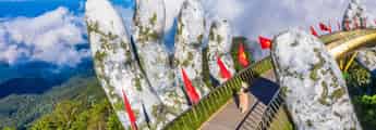


List of tourist attractions (1509)

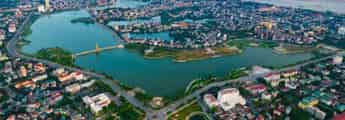
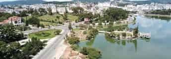
Tam Giang Dam
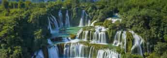
Tam Giang Dam is located about 30km from the center of Tuy Hoa city, about 1km from Mang Lang church - one of the famous tourist destinations of Phu Yen, and is a spillway blocking the Cai River. The place where three rivers meet is usually called Tam Giang, but here there is only one river flowing through. Before 1945, when there was no dam, local people had a hard time bringing water to their fields. They had to go to the forests to find the biggest trees to bring back to block the river. But during the rainy season, the floodwaters flow rapidly and these temporary embankment trees are swept away. And in the years that followed, that job kept repeating. After that, the government built a dam about 800m long made of sturdy cement with a three-step design, with 3 water-blocking embankments. Seen from a distance, Tam Giang Dam looks like a waterfall with streams of water flowing down and creating white foam. Although the scale is not as large as the Dong Cam dam, the Tam Giang dam plays a very important role in bringing irrigation water to the vast fields in An Thach, An Ninh and An Dan communes of Tuy An district. Furthermore, this dam also helps a lot by becoming a road connecting the two sides of the river. People can easily walk, ride bicycles or motorbikes across the Cai River without having to take a boat across the river, helping to save time and effort. Thanks to the Tam Giang dam, traveling between the two banks has become more convenient (Photo: Collected) Coming here, you will feel a peaceful space, quietly watch the people in the river countryside and feel like you have let go of all the worries and fatigue of life. Not only can you immerse yourself in the charming nature of the river, when you come here you can also enjoy attractive specialties. Cai River eel is a dish you should not miss. Eel meat is firm, fragrant, skin is crispy, chewy and fatty with high nutritional value. Cai River eel is often processed into dishes such as eel hotpot, grilled eel with lemon leaves, eel cooked with melon, roasted eel with salt and chili,... Tam Giang Dam is not only an important irrigation project of Tuy An district but it is also an attractive tourist destination because of its wild and rustic beauty like the people here.
Dak Lak
8840 view


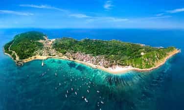
Bai Xep
Bai Xep is a beach in An Chan commune, Tuy Hoa city, Phu Yen. The beach at Bai Xep is only 500m long but possesses unique harmonious natural landscapes with sparkling golden sand and pristine rocky beaches, giant black rock headlands protruding into the sea, grasslands and casuarina forests. run endlessly long. To come and admire the beauty of Bai Xep, go straight on Le Duan street to Tuy An. This beach road is paved with flat asphalt with green poplar trees along both sides of the road, which is extremely beautiful. Before you get there, it makes you feel extremely cool and relaxed. It was only when it became a scene for the popular movie "I see yellow flowers on the green grass", that Bai Xep really became known to a large number of tourists, so this place has not been exploited much for tourism. The landscape still retains its original wildness. Bearing the characteristics of a beautiful beach, Bai Xep possesses a brilliant golden sand beach embracing clear jade green water. Taking each gentle step into the sea, you will feel the clear, cool water as if you were in an ice lake, dispelling the heat and so much stress and fatigue. Follow the trails to go up the big rocks and admire the captivating beauty of Bai Xep, "blue mountains and blue water", all in your sight. On these majestic stone steps, dense cactus fields protrude right in front of the sea mixed with patches of dry grass soaked in rain and sun, along with the sound of the wind blowing and the murmuring waves resounding. poetic sea. Perhaps the most impressive is still the vast green lawn like a small steppe on top of Ganh Xep. Not only do you come to admire the poetic natural scenery, but you can also immerse yourself in the rustic, simple life and quiet rhythm of Phu Yen's coastal people. On summer afternoons, you will see innocent children roaming around, having fun and flying kites on the vast lawns, or people diligently working hard on the beach. During your visit to Bai Xep, combine exploring Ghenh Da Dia and Ganh Den as well as don't forget to enjoy Phu Yen's attractive seafood dishes such as oyster porridge, squid hotpot, tuna... to have Phu Yen experiences. Complete peace.
Dak Lak
8650 view


Ganh Da Dia
Ghenh Da Dia is a place in An Ninh Dong commune, Tuy An district, Phu Yen province. This place is unique with its landscape in that the rocks here are either round or square, creating a natural scene that seems to have been intentionally arranged by nature. Based on many surveys and studies, it is believed that about 200 million years ago, during volcanic activity in the Van Hoa plateau, lava erupted along the flow leading to the sea. When encountering cold sea water, combined with the phenomenon of stress, the frozen lava blocks crack largely along longitudinal veins, creating rock blocks with different shapes. From above, the rapids look like a giant honeycomb, shiny black and rugged. Or it can be compared to plates, jagged, stacked on top of each other in a brick kiln. This place is blessed by nature with poetic, lyrical beauty, harmonious with water and mountains, as beautiful as a watercolor painting. Ghenh Da Dai is a beautiful wonder that attracts and holds tourists. From Tuy Hoa city, you drive 30km north, to Chi Thanh town, turn right to the east, go another 15km to reach Da Dia rapids. If you want to enjoy the fresh sea breeze and idyllic scenery of the Central Coast, the Tuy Hoa coastal road, about 35km long, will be a great choice for you. From Tuy Hoa city, you drive 30km north, to Chi Thanh town, turn right to the east, go another 15km to reach Da Dia rapids. If you want to enjoy the fresh sea breeze and idyllic scenery of the Central Coast, the Tuy Hoa coastal road, about 35km long, will be a great choice for you. Every year, at the beginning of February and August of the lunar calendar, fishing festivals often take place. Visitors coming here on this occasion will have the opportunity to admire Da Dia rapids and participate in special festivals. Only by coming here, standing on the beach and witnessing it with your own eyes, can you truly believe the magic that nature brings to this place. Stones with different shapes lie haphazardly like piles of cups and plates in ceramic kilns. The sea waves here are also strangely strong. Day and night it hits the shore, creating white foam that covers the entire area. Along Da Dia rapids, you will occasionally encounter some low spots. Every time it rains, sea water accumulates. This place suddenly became like an artificial lake. You can lean your back against the rocks, immerse yourself in the sea water and enjoy the fresh air, watching some trapped crabs, starfish or jellyfish. Or down below the edge of the rapids is a large cave deep into the mountain. Legend has it that this is a consequence of war. At noon, if you want to find somewhere to rest, Bang beach is an ideal place. Under the spreading eagle canopy, enjoy fresh seafood and the typical flavor of Tuy Hoa sea. Not far away is Ganh Den lighthouse. From here you can enjoy a panoramic view of the sea as well as Phu Yen Da Dia rapids. Despite the wind still blowing, the waves still lapping, even the bombs and bullets, Da Dia Rapids still stands there proudly and mysteriously. If you have the opportunity to come to Phu Yen, please visit Da Dia, listen to the wind tell stories, listen to the waves write poetry. Compared to Nha Trang or some other famous tourist destinations, Ghenh Da Dia is much cheaper and more affordable. You can easily feel comfortable choosing a motel or hotel that suits your budget. You can both relax and enjoy the beautiful scenery here. Some hotels you can choose from are: Saigon Phu Yen hotel for 800,000 VND/night; Anh Tuan 2 hotels for 550,000 VND/night. If you are a lover of wild nature, you can choose for yourself relaxing spaces to camp or sleep in tents at Bang beach near Ghenh Da to enjoy a wonderful night. The sunny and windy land of Phu Yen has been generously gifted by nature with beautiful landscapes and amazing natural wonders that fascinate people - Ghenh Da Dia Phu Yen is one such wonder. The talented hands of the creator have created a beautiful and wild natural landscape, attracting tourists from all over to admire the beauty and admire the beauty of this place. If you are truly a lover of the purest beauty of nature, you should not miss Ghenh Da destination in your travel guide.
Dak Lak
8859 view


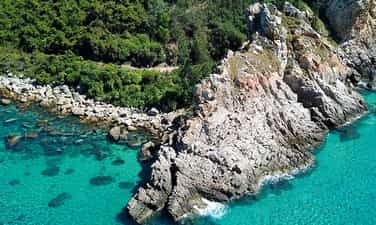
Cape Vi Rong
Cape Vi Rong, also briefly known as Cape Dragon, legend has it that in the past, this mountain was still intact, shaped like a carp's fin, so it made people think of a rocky mountain with dragon scales and called it a mountain with dragon scales. is "Dragon Scale Stone". Cao Bien - a general at that time - saw that the mountain had a lot of spiritual energy condensed, so he cast a spell to cut off the dragon's scales to eliminate bad things - while he was looking for a land of prosperity. When slashed, the dragon's blood poured down, condensing into many small red rocks mixed in the nearby sandbanks. If you walk on the sand, there will be times when you accidentally see vermillion stones, which are the dragon's blood as the legend says. When viewed from afar or from above, you will see that Quy Nhon Vi Rong Cape jutting out into the sea is a very proud, indomitable rock amidst the vast ocean waves. A dragon seemed to want to break out of its confinement, leaning towards the sea. The silver waves crashed into the rapids, releasing white foam like the dragon's mouth was spraying water. You will feel fascinated when looking at that scene and want to have a camera to capture the beautiful moments that nature has carved and sculpted very skillfully. And that's just the outside, in the heart of the mountain there is a cave that goes out to the sea. If you like to experience it, you can go inside to explore, but it's still very difficult. You can admire the extremely vivid natural scenery. You can also climb to the highest point of the mountain, have a panoramic view of the sea, you will see fishing boats coming in and out, undulating rocky mountains, mountains one after another, you will see the beach. White sand stretches as far as the eye can see with cool green trees planted along the shore,... just standing and looking at it will give you a feeling of relaxation, comfort, being immersed in nature, hearing the sound of crashing waves. rocky rapids, the sound of the wind blowing from afar brings with it the characteristic taste of the sea. In addition to conquering the mountain and admiring the majestic scenery of Mui Vi Rong Binh Dinh, don't forget that you can swim right at the foot of the mountain. This place has long stretches of pure white sand dunes and beaches with cool, clear blue water that you can see through to the bottom for you to have fun with. There are also small rocks near the shore so you can sit on them to rest, splash in the water or check in for beautiful sparkling photos with relatives and friends. In addition, in winter, this is an extremely ideal surfing location for those who love this adventure sport. Swim in the sea and then enjoy rich seafood dishes such as squid, shrimp, fish,... right into the village you can explore and visit Tan Phung market with the most delicious and fresh seafood caught. from the sea every day. If you have delicious bait, you must definitely drink My Tho wine, a specialty of this place that you cannot help but try. Sip a few cups of wine and grilled dried squid with friends, sit around for a while and see how happy life can be. The road to Mui Vi Rong is like the road to a fairyland. You can climb mountains to see nature, swim, have fun and eat delicious food, but it doesn't stop there, if you come in April. Every year in the lunar calendar (from the 11th to 14th day of the 4th lunar month), you can also have fun and explore the "Fishing Festival" to pray for favorable weather and good business with many activities taking place during the lunar calendar. Festivals such as racing, boi singing, cheo mau at Ong Nam Hai mausoleum,... to experience the culture rich in national identity.
Gia Lai
9200 view


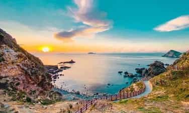
Eo Gio
Located in Nhon Ly commune, only about 20km from Quy Nhon city, Binh Dinh province, Eo Gio is a famous tourist destination that attracts tourists because of the wild and harmonious natural beauty of the river. Water, clouds and mountains converge. As one of the ideal backpacking destinations, Eo Gio still has a wild beauty with a blue strait, surrounded by high rocky mountains with many strange shapes, creating a curved position as if to hug the waist. This beautiful inlet sea. Is that why this place is called Eo Gio? Located in the east of Phuong Mai peninsula, surrounded by Quy Nhon city with a long coastal rocky mountain range and a number of high peaks such as Den Mountain, Hon Mai, Hon Yen, Hon Chop The highest area is about 200-300 and At the farthest point of the arc is Eo Gio. Right from the road to Eo Gio, you will admire the magnificent natural scenery through rows of casuarinas along both sides of the long asphalt road, in the distance are majestic mountains, towering in the sea space. Blue, white sand is wonderfully beautiful. Coming closer, Eo Gio Quy Nhon looks like a small strait surrounded by high, graceful rocky mountains, "hugging" the beach. Not inferior to any beach in the Central region, Eo Gio possesses clear blue water on the shore of sparkling golden sand, whispering and rushing waves crashing against the rugged rocky shores, emitting cool white foam. . Under the clear blue water are schools of small fish swimming freely among beautiful and colorful coral reefs. At the foot of the mountain is De rock beach with bumpy roads and countless rocks covered with rocks eroded by sea water over the years. The stones here come in many sizes and interesting shapes, creating an extremely unique masterpiece of stone and water. The unique and attractive feature of Eo Gio is created from rocks and water. Over the years, water has eroded the rock, and the weathering process of the sea breeze has created 19 bird's nest caves with very funny names such as Ky Co cave, Ba Nghe cave, Bat cave, Suc Khoe cave... Thanks to that. Phuong Mai peninsula has become the locality with the second most bird nest caves in our country after Nha Trang. Coming here in the early morning, you can lie down comfortably on the large, flat rocks and watch the beautiful sunrise amidst the poetic and splendid natural space of sea, sky, mountains and water. In the morning light, the sound of ocean waves crashing against the shore mixed with the gentle sound of the wind creates a wonderful harmony, dispelling many worries of everyday life. Coming to Eo Gio, don't forget to experience walking on the coastal walking path halfway up the majestic mountains. The road is made up of thousands of long steps, built with white and red handrails, both safe and beautiful so you can freely admire the scenery and take "shimmering" pictures. From here, looking out into the distance, you will feel overwhelmed by the wild, majestic and "picturesque" natural scenery of Eo Gio. In addition, you can also travel by canoe to explore Ky Co beach or visit the fishing village not far away and enjoy extremely fresh seafood caught by the people here. . Located right near Eo Gio is an ancient fishing village famous for its majestic pagoda named Tinh Xa Ngoc Hoa, a majestic pagoda located peacefully on Eo Gio. This place is also known for the largest two-faced Guan Yin Buddha statue in Vietnam, facing the ocean, carrying the wish of peace, prosperity and happiness for the honest fishermen here. Every year, Tinh Xa Ngoc Hoa Pagoda always attracts many tourists from all over to make pilgrimages to worship Buddha and admire the peaceful and sacred pagoda. With the majestic natural beauty of rolling mountains, vast blue sea and white sand, Eo Gio will certainly be a destination that brings many unforgettable impressions to visitors. Especially for young people who love to explore and adventure, this place is truly an interesting check-in place with friends.
Gia Lai
9424 view


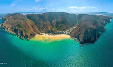
Ky Co
Ky Co is located more than 20 km southeast of Quy Nhon city center. This is considered the most interesting tourist destination in Quy Nhon with two sides facing the mountains and one side facing the sea. Very suitable for motorbike travelers. You can travel by car, but traveling by motorbike will be more convenient for visiting and exploring this place. Quy Nhon has a temperate climate, so you can come here at any time of the year, but for the most convenience, you should go from February to August. At this time, the weather is cool, with little rain. Rain makes it easier to travel and visit. Coming here, you will be overwhelmed by the majestic wild beauty and harmony of nature. Standing from afar, you will see the majestic mountains, the shady green trees, the air is clear, the wind blows strongly on you, bringing with it the typical salty and acrid breath of the sea. Ky co has an arc like the crescent moon of everyday days. You will feel the interesting thing when coming to Ky Co beach: the water here is very cool and shallow. You can freely immerse yourself in the jade water, swim 100m away and the water is only up to your neck. White, soft sand strips, cool green trees, green coconut trees hanging down on the sand. What's more interesting than when you're bored of playing around in the clear blue water, you can walk barefoot next to the coconut trees and idly sing a few love songs to the sea. The whole scene becomes sparklingly beautiful under the sunlight. Ky Co beach is sparklingly beautiful like a treasure chest filled with precious stones. The sunlight shines on the sparkling blue sea surface, making it look like it's silver from afar, and the grains of sand sparkle like tiny diamonds. The rocks here are linked together. When the tide rises, water rushes in between the rocks, creating beautiful artificial swimming pools. The water does not flow down, but seems to want to hold and settle into the rocks, playfully playing and caressing the foot of the mountain like naughty children. The artificial swimming pool is very cool, the water is so clear you can clearly see the bottom of the pool. An artificial swimming pool can accommodate 5-7 people. Very suitable for family exploration. It's very safe for children to swim in it. In the morning, when the sun just rises, the water in Ky Co sea is as clear as a mirror reflecting the sky. You can go to the beach early to watch the romantic sunset. The drops of morning dew that remained on the fallen leaves dripped drop by drop into the smooth sand. So quiet, so peaceful and pleasant. The red sunlight gradually appeared behind the mist and clouds. The boats float on the sea with peaceful songs for a bright and bountiful day. Not only that, there are also cliffs and large rocks, the higher the square base, the sharper they become, rising in the middle of the sea, looking like small towers or spikes poking into the sky. When the tide recedes, a path along the cliff will appear. You can also walk along the mountain range near the shore to visit the sea. Wading in the cool water, playing with the ocean waves, turning over seaweed stalks to catch small sea animals. In particular, you should schedule to fully enjoy Ky Co Quy Nhon beach by watching coral at Bai Dua. Going by boat to Bai Dua is very popular, you can ask and make an appointment with the boat owners in the beach area on the first day of arrival to plan to go to Bai Dua on a sunny day, avoiding cloudy and gloomy days. . If you come here, you must definitely immerse yourself in the clear blue water to clearly feel the excitement and wonderfulness of Ky Co beach. Dubbed the Maldives of Vietnam, Ky Co has a wild beauty that captivates people's hearts. For those who love to experience and explore, camping overnight in Ky Co will definitely be a memorable experience. You can bring a tent, some snacks and choose specialties of Nhon Ly beach to BBQ right on the beach. In addition to swimming, visitors here can also comfortably participate in activities and games held on Ky Co beach such as parachutes, water motorbikes, banana floats, etc. And if you go in a large group, Can also organize interesting team building games for everyone.
Gia Lai
9458 view


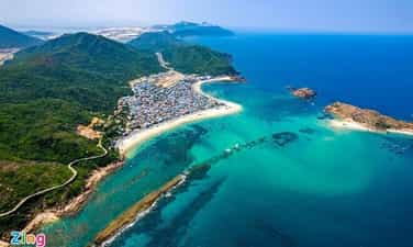
Hon Kho
Hon Kho Island, also known as Hon Kho Island, is located in a complex of 32 islands near the shore of Binh Dinh province, about 19km from Quy Nhon city. Hon Kho is beautiful, peaceful, soft, not dry like its name. How to go to Hon Kho is also extremely simple. From City. From Ho Chi Minh City, you can take a plane, bus or train straight to Quy Nhon. Then rent a car to go all the way to the end of Thi Nai bridge, through Nhon Hoi Economic Zone, along Mai Huong Bay to reach the fishing village of Nhon Hai commune. Then you continue to rent a boat to get to this beautiful island. There are many boats with different services and prices for you to choose from. The price of a dry island ticket from the mainland to the island by boat ranges from 100K - 1200K. The biggest highlight of this island is probably the beautiful wilderness that has been preserved until now, with almost no human intervention. Not only that, this island also has many rocks and stones scattered throughout the island in many different shapes and sizes. Hon Kho is peaceful and pristine without too much human intervention. Therefore, when you come here, you can feel freedom, generosity, and simplicity. Around the island there are not many tall shady trees, but only green grass mixed with rocks, creating a very special wild scene. The most impressive thing about Hon Kho is the beautiful sea road. When the tide recedes, a cliff mixed with sand gradually reveals itself, creating a more than 500m long sea path leading from Nhon Hai fishing village to the island. This is a unique sea route that only exists in fairy tales but cannot be found anywhere else. However, it is not always possible to see this mysterious sea route because the water level fluctuates depending on the season. The wooden bridge around the strait is also a favorite place for many young people. Standing on the bridge, you can see the extremely impressive blue sea. On one side are majestic rocky mountains, on the other side is a romantic blue sea, creating a charming and unforgettable scenery. Hon Kho also has a clear blue sea on a white sand beach like any other beach in Quy Nhon, but what makes visitors excited is the feeling of freedom and generosity because they are separated from the city and immersed in nature. nature that this island offers. This is considered an ideal day trip destination for groups of friends who love to explore, or for those who want to have a relaxing day after all the fatigue of work. Not only that, you can also rent fishing boats from fishermen here to take them around the island or visit places with coral beaches at extremely affordable prices. For those who rent a boat from the mainland to the island and want this service, the price will range from 200,000 - 300,000 VND depending on the boat owner, for groups of about 5 - 10 people. The time to go from Quy Nhon to Hon Kho is only about 15-20 minutes, very fast. If you travel to dry islands on your own, you can rent a taxi from Quy Nhon city center for comfort and coolness. If you want to join a boat to the dry island, you should go early between 8 and 10 am because this is the most crowded time, making it easier to find people to join the boat. Going on a wooden boat costs about 100k/1 round-trip ticket, renting a private boat (10 seats) is about 500k/boat/1 round-trip ticket, joining a canoe costs about 200k/1 round-trip ticket, renting a private canoe (15 seats) is about 1200k/canoe/ 1 round trip ticket. Hon Kho has very few trees and almost no trees are taller than your head so it is extremely sunny. So if you don't want to come home from going out with tanned skin, you should be fully equipped with hats, hats, and sunscreen! The cafes here are just small temporary huts, so you can proactively prepare some drinks and snacks to bring along.
Gia Lai
9799 view


Cu Lao Xanh
Cu Lao Xanh is beautiful all year round, but you should avoid the end of July and August because this is the time when many storms will endanger your trip to Quy Nhon. Also, you should not go in the winter. The remaining ideal time to explore the island is February to June, September to October. Cu Lao Xanh is located in Nhon Chau island commune, Quy Nhon city, Binh Dinh province, only about 12 nautical miles from the mainland, equivalent to about half an hour by speedboat. But if you want to have an interesting experience, you can spend 2 hours traveling by wooden boat with local people to the island. In the bright yellow sunlight, Green Island appears with a clear blue color, the The boat anchored near the shore waiting for time to set sail. The first time you set foot on the island, visitors will be extremely surprised and delighted by the wild and peaceful beauty of the island. The island appears with endless green mountain ranges, majestic rocks in front of countless ocean waves, clear sea water, clearly revealing colorful coral reefs; fresh seafood dishes... With what nature bestows, Cu Lao Xanh is an ideal destination for tourists who love to explore amazing natural tourism. Once you arrive at Cu Lao Xanh, don't forget to go to the Harbor Bridge to watch the sunrise and see the bustling market scene every morning, or immerse yourself in the clear water, go snorkeling to see coral at Nho beach and Bon beach. .. In particular, coming to Cu Lao Xanh, many people cannot help but enjoy being introduced, visiting and exploring the lighthouse that is more than a hundred years old. History also records that in 1890, after a ship sank because it hit a reef in the Quy Nhon sea area, the French decided to build a lighthouse on Cu Lao Xanh, named Plogam Bir. . The purpose of the French building a lighthouse on Cu Lao Xanh was to guide ships and boats into and out of Quy Nhon port conveniently and safely. The lighthouse is located on the highest mountain on the island, 119m above sea level. Cu Lao Xanh Lighthouse is a wonderful blend of East and West architectural styles; It has both the "breath" of Gothic architecture and the appearance of Eastern architecture. The lighthouse consists of 4 parts, harmoniously distributed: The base of the tower has 32 steps made of bricks; cylindrical tower body, 19m high; Inside there is a 58-step spiral staircase and headlights that illuminate 27 nautical miles (nearly 50km). The entire lighthouse architecture is built of large boulders, with walls more than 1 meter thick. This is one of the earliest and most modern lighthouses built in Vietnam Those who have the opportunity to go to Cu Lao Xanh lighthouse once cannot help but be ecstatic about the morning dew, sunrise on the sea, or the red sunset at dusk. If you don't mind the night sea, experience fishing with fishermen in the nearby waters. It will be great to follow the rhythm of pulling fresh fish into the boat, to see with your own eyes, to handle the fresh fish that have just left the sea. The experience of working with fishermen is a wonderful experience. In addition, Cu Lao Xanh has many rocky beaches such as Thao Nguyen beach and Dong beach. There are large blocks of stone, of various shapes and colors, and arranged next to each other in a very orderly manner. All create a harmonious landscape picture combining rocks and sea and sky.
Gia Lai
9303 view


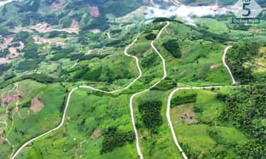
Viola Pass
Vi O Lac Pass - a mysterious destination on Highway 24 connecting Kon Tum (the heart of the Central Highlands) with the coast of Quang Ngai province. This pass starts from Thach Tru intersection, Duc Lan commune, Quang Ngai and ends at Kon Tum city with a total length of about 50km. The pass peak is 1,300m above sea level, not only considered a symbol of the boundary between Quang Ngai and Kon Tum but also the weather dividing point between East Truong Son and West Truong Son. According to history, the original name of the pass is "Vi Ho Lak", but through word of mouth over time, people gradually got used to calling it Vi O Lak pass. Some theories suggest that this name comes from the Violet flower, however, here people only see one type of wild flower on the pass, the torus. It can be said that Vi O Lak Pass with its natural beauty and majestic scenery has become a must-visit tourist destination when you travel to Quang Ngai. Vi O Lac Pass, located in the heart of majestic mountains, is a destination that fascinates people with its wild and unique natural beauty. Although located halfway up the mountain, next to the winding trail are rows of tall, green and ancient trees. This has created a beautiful natural screen, helping the space of this pass become airy and windy. When standing in the middle of the pass at an altitude of 900m above sea level, with just a distant look, you will quickly be fascinated by a vast natural picture: immense green mountains, gentle Re river. Winding among the green carpets and especially in the ripe rice season are golden terraced fields located close to the stilt houses. All of these beautiful landscapes have created a poetic, strangely cute Vi O Lac pass scene. Every step up, every bend you pass, you will definitely feel the change in space and climate. In particular, when reaching the top of the pass in the early morning or evening, a sea of floating, hazy white clouds will appear to cover the entire view, creating a mysterious and magical scene. Standing in front of that beauty, all worries and fatigue disappear, leaving only the soul soaring and light in the vastness of nature. Vi O Lak Pass can be seen as a vivid natural picture, a work of art of creation, where every moment spent here contains magical and memorable things. Vi O Lak Pass with its height and danger is always a challenge for those who want to conquer it. Especially, when one side is a majestic cliff and the other is an abyss with dangerous turns, choosing the right time to explore the pass is extremely important. The 6th lunar month of each year, when the sky begins to clear and the golden rays of sunlight become brighter, is the most ideal time for you to conquer Vi O Lak Pass. At this time, you will experience a clear blue sky, warm sunshine and at the same time admire the floating clouds in the distance. The ripening rice season at Vi O Lak Pass is also an experience not to be missed. Golden terraced fields shining in the sunlight mixed with stilt houses amidst the dim kitchen smoke, create a very beautiful and peaceful natural picture.
Quang Ngai
7394 view


Cape Ba, An village
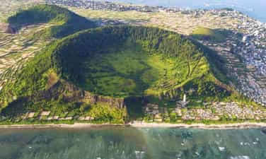
When mentioning Quang Ngai, surely those who love to travel will immediately think of Ly Son island district. However, in Quang Nam, there is another pristine land like "Ly Son Island in the mainland" waiting for tourists to explore. Mui Ba Lang An is located in Binh Chau commune, Binh Son district. The reason for this name is because this is a way to combine the names of three adjacent auspicious places including Van An, An Chuan and An Hai. Here, visitors will enjoy the extremely peaceful life of the Central region's sea and islands. The people of Mui Ba Lang An are also the people who reclaimed Ly Son island, and directly participated in the fight to protect the sovereignty of Hoang Sa island and sea. During the French colonial period, this place was also called Ba Tang tend. This is not only a resort destination but also famous for its rich history, always the pride of Quang Ngai people. Currently, Mui Ba Lang An has been expanded in area and is only about 22km southwest of Cu Lao Re island. This is a cape that helps create the shape of the coastline in our country, and will definitely be an attractive destination for tourists. This cape is made up of volcanic sedimentary cliffs and clear jade blue sea. Looking from above, one can see the extremely magical and seductive beauty. Near Ba Lang An Cape, there is also an inactive volcano crater about 30 square meters wide. Inside the crater, there is a lot of seaweed growing, and the outside is covered with a dense layer of coral with many bright colors. All of these points are blended together, creating a unique wild beauty that can rarely be found anywhere in Quang Ngai. Visiting Ba Lang An cape, visitors will have the opportunity to experience many interesting things such as walking along the beach to admire the scenery and take photos. In addition, you must definitely visit Ba Lang An lighthouse. Just spending about 30 minutes up the lighthouse, visitors will have the opportunity to see the majestic panorama of the cape. After posing and taking many beautiful photos, visitors can continue to admire the beautiful natural landscape. If you are a lover of the sea and enjoy experiences, want to touch your feet and feel the cool ocean water or try touching the undulating rocks below the beach, you can move down to Ba Lang An cape. Surely this will be an impressive experience during your trip to explore Quang Ngai. In particular, when visiting Ba Lang An cape, visitors will have the opportunity to enjoy and breathe the simple life of fishermen on boats and baskets going out to sea. Boats moored on the shore will be an indescribably simple moment that you will not see in the city. However, this place has not really received much investment in tourism development. Therefore, visitors may have to travel further to find the ideal hotel or homestay to stay. Coming here, visitors can go back and forth in the same day because the road is quite convenient and not too far from the center. If you want to stay overnight at the beach, you can ask to sleep at a local family's house. Besides, visitors should prepare comfortable clothes when traveling to Quang Ngai to be able to operate easily. At the same time, sunscreen is indispensable, as well as a jacket, and sunglasses, etc. These are all important accessories because the weather here is quite hot. The most beautiful time that tourists should not miss to come to Ba Lang An cape is from May to August. This is the time when the weather is beautiful and the waves are calm. Because it is not the rainy season, it is very suitable for swimming and admiring the beautiful mountain scenery. However, this is also the peak season for beach tourism in Quang Ngai. Therefore, service prices may increase higher than at other times of the year. You should avoid traveling to Cape Ba from September to February of the following year. This is the rainy season in Quang Ngai, in addition to long rainy days, there are big storms that make strong ocean waves, which will be a factor affecting the quality of your trip.
Quang Ngai
8472 view


Sa Huynh salt field
Wearing endless beauty over time, Sa Huynh salt fields are a place for visitors to see the stretching salt fields, the beautiful white colors and feel the essence of the folk craft villages here. Located in Pho Thach commune, Duc Pho district, Quang Ngai, this is not only a salt field with more than 100 years of history, but also symbolizes the connection with the heritage and culture of this land. With more than 600 households and an annual salt output of 8,000 to 9,000 tons, Sa Huynh salt field is not only an important source of salt but also represents the spirit of traditional craft villages, blending with famous craft villages. Others like Hon Khoi and Ca Na are located along the Central region. Since the 19th century, Sa Huynh salt fields have witnessed more than 100 years of preserving tradition. However, salt making in Sa Huynh was not always known as a beautiful landscape. In the past, this place has gone through many ups and downs, from the "bitter salt village" when the effort put in did not achieve results, to the value of salt not being expected and the lack of local brands. But since the day the Intellectual Property Department issued the certificate of "Sa Huynh Salt" in 2011, everything has changed. Salt makers do not hesitate to invest and apply new production models, with Sa Huynh salt making on tarpaulin or cement floors. The results have shown an improvement in quality, with sand impurities reduced by up to 95%, output significantly increased and salt value increased by 20 - 30%. In particular, this new method helps shorten production time and change the landscape of the salt fields. To do this, 6 dikes with a total length of more than 5km were built, paving the way for the development and improvement of the salt fields. This proves the enthusiasm and will for progress of Sa Huynh salt makers, as they constantly learn and share knowledge, building a bright future for Sa Huynh salt grains. With more than 120 hectares of area, Sa Huynh salt fields are like a brilliant carpet, each small field interwoven with each other, understanding the delicate interaction between sunlight and sea water. The concrete and silver foil create a unique reflection of color, turning this beautiful scene into a field that sparkles like diamonds and attracts all eyes. White salt dunes spread evenly across the fields, like embodiments of mountain and forest nature. When the sparkling golden sunlight combines with the farmer's bamboo burden, the painting blends yellow and white to create a captivatingly beautiful scene, blending simplicity and charm, like a mysterious portrait. . When you enter the salt field, this is not only a famous Quang Ngai tourist destination, but also an interesting work of natural art from the hands of farmers. Right from 5 a.m., local farmers gathered to start an enthusiastic working day. They arranged seawater from canals and ditches into the bladder, then sprinkled bait salt and waited for the sunlight to crystallize the salt. Salt making in Sa Huynh requires 3 sun exposure to achieve white and large salt grains. This is an elaborate process, performed under intense sunlight, to create unique and delicious quality salt. In addition to the salt making experience, you also have the opportunity to see unique homemade motorbikes here. These carts, although old, have been converted to carry salt instead of being used for carrying loads. This has improved people's lives and created a sense of fun. If you have the opportunity, please shop and support these pure grains of salt, to see the care and love that people put into each grain of salt.
Quang Ngai
8469 view


Minh Long white waterfall
White Waterfall is located in Thach An commune, Minh Long district and about 23 km southwest of Quang Ngai City center. The waterfall is hidden in the historic Truong Son mountain range and has recently been discovered by people. This is an ideal destination for those who want to rest and relax on the weekend and is a favorite place for backpackers today. To go to White Waterfall, from the center of Quang Ngai city, go southwest to Chua market town, Nghia Hanh district. After that, there will be a small pass. If you follow that road, you will reach Minh Long district and continue about 5 km to reach the White Waterfall. The road to the waterfall is now being rebuilt very beautifully, the road is also quite steep so it brings an interesting feeling to backpackers. To get here, an advice for you is to ask local people for directions as you go because following google map will not be accurate. If you don't want to ride a motorbike, you can go by car or catch the bus from Quang Ngai - Minh Long for only 16,000 VND/trip. To Minh Long district, you can catch a motorbike taxi to the waterfall, or rent a motorbike. Motorbikes for only 80,000 VND-120,000 VND/day. White Waterfall is about 40 m high, the water flows day and night into the two lakes below. The waterfall is surrounded by the green of rolling hills and mountains, creating a very poetic and lyrical scene. The waterfall is divided into 3 branches, of which the leftmost branch is the main branch (this is where the water flows the most and most intensely), the remaining 2 sub branches on the right flow less water. At the foot of the waterfall there are 2 large lakes, the water here is very clear and blue, the cool water is very suitable for people to immerse themselves in the refreshing water to dispel the heat of the city. Not only that, this lake is also home to juvenile fish, so you can bring fishing rods and enjoy this delicious, unique dish right on the shore. The water flow is strong and light depending on the season. To admire the strongest water flow, you should come here during the rainy season, when there is a lot of water flowing from above, causing the water flow to be very strong, creating a wonderful scene. Pretty. If you like the peace and simplicity of White Waterfall, you should go in the dry season, when the water flows very gently and smoothly. Coming to White Waterfall, not only can you bathe freely in the cool water and take wonderful photos, but you can also camp, picnic, organize group games, light campfires and lots of other interesting things. The waterfall has been turned into a tourist area so you can have peace of mind about eating, resting, and entertainment. Next to the waterfall there is an empty lot, which is a very suitable place for camping overnight, singing and dancing, and enjoying outdoor BBQ dishes. Around the waterfall, there is also a place suitable for young people who love nature and want to explore: the primeval forest and the villages of the Hre people. If possible, you can also ask permission from the forest management board to camp and play here. Leaving behind the stuffy air of the city and the hot summer afternoons, try coming here once, enjoy the cool air here and you will feel really comfortable and not want to leave. get out of here for a bit.
Quang Ngai
8488 view


Ly Son Island
With two distinct rainy and sunny seasons, the best time to travel to Ly Son is from April to August. During this time the weather is stable, it rains little and is sunny. But you should avoid going during the peak season from April to June, so you don't have to endure crowds. September to December is the season of rain, storms and rough seas. From late December to April is the season of green moss covering the rocky beaches along Ly Son coast. Note, you need to monitor the weather before departing to avoid being stuck on the island for several days due to rough seas, monsoons... The main means of transportation is by boat from Sa Ky port. There are many high-speed boat companies here that take tourists to Ly Son island with ticket prices around 300,000 - 340,000 VND (round trip). Remember to bring your ID card or driver's license to buy tickets. Travel time from port to island is about 35 minutes. From Hanoi and Ho Chi Minh City, tourists book flights to Chu Lai airport with a one-way ticket price of about 1,200,000 VND, flight time 1 hour 30 minutes. The airport is about 42 km from Sa Ky port, you can travel by taxi, one-way price is about 350,000 VND or take a bus that stops in Quang Ngai City to save costs. In addition, visitors have the option to fly to Da Nang, from here take a taxi or train to Quang Ngai City, the train ticket price is 180,000 round-trip. The port is 20 km from the city center. Ly Son has many motels, hotels, and homestays, averaging from 200,000 - 400,000 VND per night. For travelers who prefer a place with a youthful style, they should choose homestay Bep's House, Bé Ecolodge or DHT Hang Cau motel. In addition, visitors can refer to Ly Son Pearl Hotel & Resort with sea view. Visitors can experience staying one night at Be island. Suggested homestays are Ly Son Bungalow with colorful wooden houses, XaLaBin with high rooms with sea view or Sea Breeze. Coming to Ly Son, visitors can rent an electric car for 300,000 VND per trip to explore around the island. In addition, you can rent a motorbike, priced at 150,000 VND per day, to visit places such as: Thoi Loi Peak, Garlic Fields, Cau Cave, To Vo Gate, Hang Pagoda, Duc Pagoda,... and many famous places. another language. Regarding cuisine in Ly Son, restaurants are concentrated along the port, some suggested restaurants are Phat Hai restaurant, Khoi Chieu restaurant... There are also Dai Hang seafood rice restaurant, Ut Ngoc restaurant. Ly Son's specialties are mainly seafood, especially king crab, lobster, conch, ta ma fish, fish cakes... Some other specialties are garlic salad, seaweed salad, crab vermicelli, and melons. black watermelon, giant snail, banh it gai leaf... Visit the dry food stalls on the island to buy garlic and dried seafood as gifts.
Quang Ngai
8635 view


Tam Thanh mural village
Tam Thanh Bich Hoa Village belongs to Tam Ky city, Quang Nam province. This is a poor fishing village located on the coast. The walls in this village were painted by the talented hands of Vietnamese and Korean artists. There is no denying it anymore, this is the village name that is at the top of young people's searches recently. Tam Thanh attracts tourists because of its unique, creative, and new beauty, and statistics show that after only the first 4 months of being praised in the press, the number of visitors flocking here is extremely large. From now on, Tam Thanh was changed to wear a beautiful new color, no longer a poor coastal fishing village. The paintings combine the beauty of Korean art while still imbued with the simplicity of the South Central region. Colorful paintings take you back to beautiful childhood memories. The paintings have made the poor countryside of Tam Thanh seem to be recreated again. It's like stepping into a new page, a place filled with hope for a prosperous and happy life, a bountiful harvest, calm seas, and it makes life here no longer dull and heavy. Making a living is even more difficult. Rudimentary walls and fences have been replaced with funny drawings and patterns like children's stories. The small roads in the village also become incredibly poetic. The paintings not only attract tourists to visit the unique village but also make the lives of the people here more gentle and relaxing, different from the sad colors of the past. Visitors to Tam Thanh mural village, especially young people, all share that they are very interested in this model, when art has truly merged with life, becoming a part of daily life. We all hope that this model will continue to be expanded and developed in many other localities, so that every Vietnamese village becomes a story, every life becomes memorable. And above all, we need to send our sincere thanks to our talented and enthusiastic Korean artist friends who have spread the love of art to a small village.
Da Nang
6216 view


Seven-acre coconut forest
Bay Mau coconut forest in Cam Thanh Hoi An, when put into tourism exploitation, has become an attractive destination for tourists. The reason for this name is because in the past, this forest had about 7 acres of coconut trees growing freely. To date, the forest has grown to more than 100 hectares but people still keep the name Bay Mau coconut forest because it is so familiar and dear to Hoi An people and tourists. Because it is located right in the brackish water area, it is very suitable for nipa coconuts to grow. There are 2 ways to get here, from Hoi An ancient town you can go here by road or river. If you go by boat, you start from the wharf on Bach Dang street, right near Hoi An market. You will follow the flow of the Hoai River down East, about 5 kilometers to get there. If you go by road, you go along Tran Phu street, go straight to Nguyen Duy Hieu, see the intersection, turn right onto Tran Nhan Tong street, go about 4km more and Bay Mau Cam Thanh Coconut Forest will appear before your eyes. Friend. This place, during the years of resistance against the French colonialists and American imperialists, became a revolutionary base, helping our troops fight to defeat the enemy with many glorious victories. The local guerrilla force relied on the hidden terrain and many easy-to-hidden places to organize many surprise battles, even when our army was too thin but the enemy was very numerous and we still defeated them. During the enemy raid, the enemy was equipped with more modern weapons than we were, had artillery and air force to fight, but still could not defeat us. One can mention the typical battle in 1948, when the French colonial infantry, with the support of tanks, attacked the Bay Mau Coconut Forest in Hoi An to destroy all our armed forces. But without fear, the local guerrilla force, familiar with the terrain, organized a secret attack, following close to the enemy. We threw grenades into the trunk of the vehicle, making the enemy extremely frightened, forcing them to abandon the raid. but turned around and retreated to Hoi An. Because they saw that many raids had failed, they forced people in surrounding communes to clear the entire forest so that we would have no shelter and no surprise attacks. However, they did not achieve their plan. After only a short time, the Coconut Forest grew lush and green again, causing their raids to fail miserably. After ending in victory, expelling the French colonialists, in 1954, when the Geneva Agreement was signed, Ngo Dinh Diem took over Quang Nam. They caused many bloody massacres such as in Vinh Trinh and Cho Duoc. And yet, they constantly organize raids to "Indict the Communists", "Destroy the Communists", and hunt down the Communists day and night. And during that time, the coconut forest helped high-ranking officials of the Hoi An City Party Committee and Quang Nam Provincial Party Committee have a safe place to hide and not be captured by them. In 1966, when the US imperialists brought troops into the South, they conducted many large-scale raids and the liberated area of Cam Thanh with the enemy's location of Bay Mau Coconut Forest was also among them. On June 13, 1966, they mobilized 4 mixed American-puppet companies consisting of 1,000 soldiers and 28 helicopters to attack the Cam Thanh area and the coconut forest. Not only are they equipped with modern weapons, they also receive support from 5 motorboats mounted with machine guns along with long-range artillery from the support of neighboring posts. Yet in just 3 days of fighting, taking advantage of the terrain of the coconut forest, our troops organized many counterattacks to break up the enemy's raids, destroy many enemy troops, and cause great losses to the enemy. From 1967 until the day Safety Hoi won, many times the guerrillas and soldiers immersed themselves in the coconut forest, launched many surprise raids, making it difficult for the enemy to react in time, so we were able to defeat them. the enemy's air force, artillery, and naval vessels in a spectacular manner. This place contributes to becoming a safe haven, making Cam Thanh an important springboard in the East for our forces to attack the inner city of Hoi An with many glorious, once-famous victories, helping Hoi An was completely liberated, ending 20 years of resistance against the US to save the country by our army and people. Bay Mau coconut forest in Hoi An is a base that has gone down in the history of the homeland as a death zone, a grave for enemy corpses because so many enemy soldiers died here. Although many of the defensive and combat structures of our army in the past no longer exist, the coconut trees still exist with strong vitality and tenacity, growing green all year round as if marking the heroic and glorious achievements of our people. The army and people of Hoi An during the two resistance wars against the French colonialists and the American imperialists. Coming here, visitors will be able to visit the forest entirely on a boat in the style of the Southwestern region. However, the characteristic point that distinguishes this coconut forest from the western rivers is that here people do not use common boats as a means of transportation but use basket boats. Let's talk about basket boats. When visitors come here with questions and curiosity, the boatman will explain the origin of this boat, when did they exist, why do people use basket boats instead of normal boats... All your questions will be explained. Come here to experience the feeling of traveling on this special vehicle and find the answer for yourself. My experience is that you should go around the 8th month of the lunar calendar, then you will be able to admire the nipa palm bushes in their ripening season and enjoy the delicious and delicious dish of sprinkled coconut rice. You should avoid going in November and December because the rains can leave you stuck in your room and unable to enjoy the journey. Under the control of the supple rower, the boat slowly moved deep into the Bay Mau Coconut Forest. The tall green coconut trees cast shadows into the water. On the trip, the boatman will pick coconut leaves to make funny natural jewelry such as hats, rings, glasses... extremely lovely gifts for tourists. While going down the quiet water, admiring the vast green coconut groves, listening to the boatman sing a Quang folk song, or immersing yourself in the story of the resistance war through the warm, loving voice of the Central people, you will become into an experience you never want to end. Thanks to its hidden terrain, Bay Mau coconut forest was chosen as a base and is associated with the glorious victories of Hoi An's army and people in two national resistance wars.
Da Nang
6274 view


Ha My Beach
Previously, few people except local people knew about Ha My beach until the British Telegraph voted this place as one of the most beautiful beaches in Asia. This is a great honor for the people of Quang Nam in particular and the Vietnamese tourism industry in general when Ha My beach stands next to famous names such as Emirates Palace Beach (UK), Phranang Beach (Thailand). ), Kabira Bay (Japan). The road to Ha My is quite easy to find because it is located right on the coastal road connecting Da Nang city with Hoi An ancient town. Here, you can lie down all day on the sandy beach, sunbathe, catch the small waves rolling and chasing each other to the shore without worrying about being disturbed by the crowds and surrounding noises like in other tourist attractions. famous beach. The white sandy beach is a "specialty" of the Central Coast, the blue sky and sea are the same color, and the rows of shady nipa palms stretching across the sand together create a rare peacefulness in a tourist city. When you go to Ha My beach, don't worry too much about where to stay or what to eat. Although this place is still quite new and has not yet been promoted for tourism, there is no shortage of restaurants and accommodations here. Around the beach there are many places from affordable to luxury such as homestays, motels, hotels, resorts with prices from 400,000 VND. Seafood is not inferior to other places with a full range of attractively prepared dishes that make visitors sometimes forget that they are vacationing on a pristine beach, not a famous tourist destination with beautiful scenery and delicious food. delicious. Take advantage of the time that Ha My beach still retains its natural, rustic and deserted features, reward yourself and your loved ones with a vacation to this beautiful beach right away.
Da Nang
6191 view


An Bang Beach
An Bang Beach is a Hoi An tourist destination in Cam An ward of the ancient city of Hoi An. In the past, it was only a beach where people in the area came to bathe in the early morning, so this place still retains its beauty. Wild and pure, with no artificial differences. An Bang beach is peaceful, filled with contemplation and quiet, in complete contrast to the vibrant and bustling Cua Dai beach of youthful, modern life. Just a few kilometers from Hoi An city, tourists come here, set foot on the smooth white sand, admire the light purple sea morning glory flowers growing on the gentle sand, step into the clear, fresh blue water that makes people feel happy. for a comfortable soul, gently harmonizing with nature, letting go of all the worries of a hustle and bustle life. Tourists will be amazed by the unique beauty of An Bang beach, a wide beach with the blue color of the sea and the sky as the main theme, alternating with the ivory white color of the vast sandy shore like a thin sheet of silk. across. Prominent on it is the image of simple, simple basket boats of fishermen. The air is fresh, airy and peaceful. Coming here, open your arms and take a deep breath to feel the fresh, clean air. The salty taste of the sea breeze will make you feel relaxed, like you are lost in a fairyland. . Coming to An Bang Beach is all about rest and relaxation. You will feel like you have let go of all the fatigue, sadness, and busy worries of life. Early in the morning, when tourists walk on the beach, they will see images of little girls and boys diligently catching wind cuffs, basket boats in the distance floating in the ocean waves. Many tourists who do not like the noise and cramped conditions often come to An Bang beach to enjoy the silence and quiet beauty of this place, to swim comfortably, lie down on chairs to read books, and bask in the sun. sunny sea, quietly looking at Cu Lao Cham island in the distance and when the sun is high, shelter under coconut leaf roofs to avoid the sun. The waves of An Bang beach are large and strong, very suitable for tourists who are passionate about underwater ball throwing, wave jumping, and windsurfing. Coming to Hoi An tourist destination - An Bang beach, tourists should go early in the morning, play all day without getting bored on the beach and return to Hoi An city when night falls. You can also stay in motels from simple to modern to see the sky full of sparkling stars mixed with the echoing sound of ocean waves pounding on the sandy shore day and night. An Bang beach is included in the list of 50 most beautiful beaches in the world voted by CNNGo in 2011. An Bang beach is known to many domestic and international tourists and has become a famous landmark among the top destinations. Hoi An tourism. You can welcome the sunrise on the sea, what's more interesting than waking up early in a far away place? Step by step lightly on the smooth sand surface, drops of morning dew slowly and gently glide on the coconut leaves, drifting gently into the sand. The sun slowly rose from the sea, the first warm rays of morning sunlight shining. The whole sea seemed to be submerged in red. At this time, the water surface is so clear it looks like a mirror reflecting the sun. At noon, when the sun rises high, bright golden rays of sunlight shine down on the ground, the entire sea frame creates a sparkling space like you are lost in a treasure trove of sparkling gems. There are many eateries and resorts popping up here. Walking around An Bang beach, visitors will see beautiful small shops, airy space, and introverted architecture. You can sit in the restaurant and sip food and drinks while admiring the sea view. The space is airy, peaceful and rustic. There are many coconut or palm leaf huts here. After swimming, you can lie on the cots and hammocks to rest and sunbathe. Not only can you swim in the sea, but when you come here you can also try adventure games on the sea such as windsurfing and canoeing on the sea. Or you can rent a canoe or water motorbike to cruise around the shore. The sea is an indispensable pleasure. Moreover, there are also bars opened by people from your country. Visitors will enjoy having fun while admiring the beautiful scenery right on the beach. These bars are no different from music parties on the beach. It's quite interesting to sip a glass of wine, music blasting in your ears... the atmosphere is bustling. In addition, when coming to An Bang beach in Hoi An, visitors can also enjoy many delicious sea dishes such as squid, lobster, various types of sea fish... attractively prepared. And fresh and delicious specialties of Hoi An. All combined will bring visitors a feeling of happiness filled in each of their senses. Even though it is a coastal area, when you come here you can still enjoy all of Hoi An's specialty dishes. Some dishes you can enjoy when coming here are: Cao Lau, Stir-fried Mussel Cake, Banh Dap Stir-fried with Mussels, Cake fish soup, wet cake with grilled meat, banh beo, banh xeo... Although not a new dish, it has a very unique and unique flavor, creating a specialty brand in Hoi An. If you are too familiar with a noisy, bustling place and want to find a place that is both peaceful, quiet and has rustic, poetic beauty, you should come to An Bang Beach. Come here to enjoy the feeling of excitement between paradise on the island and the simplicity, quiet and sweetness of the sea.
Da Nang
5594 view


Khe Lim
Khe Lim is a prominent tourist destination located in Dai Hong commune, Dai Loc district, Quang Nam province, about 20 km southwest of Ai Nghia town. On beautiful sunny days, tourists stand at the foot of Ha Nha Bridge located on Highway 14B, looking towards the top of Am Thong Mountain, where there are steep, upside-down cliffs and a waterfall that pours white foam day and night like mist. The mountain falls down to the foot of the mountain, creating many floors with a height of up to 100 m, making visitors surprised by the passionate painting full of vitality. Hoi An Khe Lim tourist destination originates from a stream that flows through many areas where there are many species of trees with rare wood and high economic value, such as ironwood trees. Since ancient times, people living in the area have known Khe Lim for its unique natural beauty, not only because there is a water stream about 20 meters wide that rumbles down from above day and night, forming a large stream with Many large and small rocks that have existed for a long time are covered in green moss and are stacked on top of each other, all creating a majestic and captivating scene. On both sides of the stream in this tourist destination are large, peaceful primeval forests with rich and diverse species of animals and plants carrying a bright green color full of the vitality of nature. The temperate climate helps flowers and grass grow strongly, wild orchids bloom and exude a gentle fragrance in the breeze, bringing serenity and relaxation to visitors. In that picture of thousands of blooming flowers and lush trees, the majestic image of the Hio Hiu mountain range in the South stands out, making everyone who has ever set foot here surprised and loved it. The higher you go and the deeper you go inside, the denser the forest becomes, the vines are tangled and intertwined, so even though it's summer weather with bright sunlight, the air here is still cool and pleasant. bear. At the end of the craggy and dangerous mountain road, a beautiful landscape opens before the visitors' eyes, with immense blue sky, white clouds, endless mountains and forests, and a clear stream, melodious like the sound of a guitar. Someone's voice echoes, in the whispering and rustling of leaves and sometimes the gentle swaying sound of yellow leaves on large flat rocks, the width of which would take 4 or 5 people to hug. With gray-brown, yellow, and moss-green colors with mysterious shapes, this place is enough for dozens of tourists to play, rest, and bathe in the cool water of the stream. Raising your eyes halfway up the mountain, visitors will be attracted by the waterfalls pouring white foam, covering the green trees, blending with the bright yellow sunlight to create a truly colorful rainbow. glittering, magical, sometimes very similar to the hastily variegated yet artistic palette of the forest artist, the beautiful scenes captivate people's hearts. A fresh atmosphere is welcoming, visitors should take a deep breath to enjoy the fresh air of the mountains and forests, nature and feel relaxed, all the fatigue and worries of everyday life seem to disappear. disappear into the white water foam, listen to stories about the vestiges of Am Pagoda on the top of Am Thong mountain with mysterious folk anecdotes passed down from generation to generation by people. Today, with its unique natural beauty, Khe Lim has become one of the prominent tourist destinations, tourists come here to relax and have many beautiful memories with relatives and friends.
Da Nang
6201 view


