


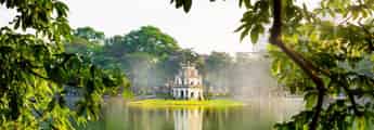

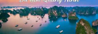


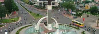


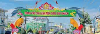

List of tourist attractions (1509)

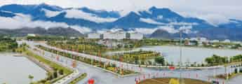
Mother Thu Monument
Mother Thu monument is located on top of Cam mountain, Phu Thanh village, Tam Phu commune, Tam Ky city, Quang Nam. Every year, the Mother Thu monument area is a tourist attraction that attracts many tourists from near and far. Located about 7 km from Tam Ky City, adjacent to many other famous tourist attractions. Visitors can easily get here by many means: car, motorbike or bus. If tourists travel by car from Da Nang city to Tam Ky, it will take about 2 hours. At the intersection, turn left onto Thanh Hoa street. Just follow the directions of the road sign and you will immediately find the Mother Thu monument. Traveling by motorbike is also a hobby for young people who are passionate about traveling. But because the road is winding with mountains on both sides and there are often no gas stations along the way, visitors should be careful and fill up their gas tank before the trip. After nearly 7 years of construction and completion, the Mother Thu monument was inaugurated in March 2015. With a total area of 15 hectares on the top of the vast Cam Mountain, visitors are overwhelmed with the space close to nature and the majestic mountains and forests here. The 18.5m high monument is made of sandstone with statue blocks made of marble running along a 120m arc. In the middle of the monument is a portrait of mother Nguyen Thi Thu engraved with simple, rustic features, kind beauty and immense love for her children. On both sides of the statue are cliffs made up of natural stone blocks arranged close together skillfully and smoothly like the rhythmic levels of a symphony. The low, high, up and down tones seem to symbolize the arduous years of the children's history. Those are like all the emotions of happiness, sadness, hope, and nostalgia of children far away from home, longing for their Mother. The dexterity of the portrayer truly makes visitors feel choked and moved by the image of the sacred Mother Thu Monument. Surrounding the monument is a large lake of more than 1,000 square meters. If visitors look from the outside, they will see streams of water flowing from inside the wall of the Mother Statue to the surface of the lake. The image of the Second Mother holding her children in her arms has a humane meaning, symbolizing the overflowing emotions, deep love, and gratitude of the Mother towards her children, towards the heroic and devoted soldiers. with the Fatherland during the years of fierce struggle. Going inside, visitors will see a museum with an area of 400 square meters. Right from the first step in, visitors will immediately see the gallery, then the preservation room - This is the place where heroic Vietnamese mothers are registered along with photo materials, movies, and introductions. about the mother's life during the fierce years as well as her wholehearted dedication to the Vietnamese Fatherland. Tourists just need to take a walk around to explore and will easily imagine the hardships and immense love of the Mother for the Vietnamese soldiers that cannot be compared to anyone else. . Take a quick photo of these moments to see that these are truly meaningful, sacred moments that can only be felt when visitors come here. In front of the Mother Thu monument is the front gate square with 8 giant tall pillars. These are legendary pillars, each 11m high with a diameter of nearly 2m. If you go in from the outside, you will see on both sides are tall pillars depicting symbolic images of mothers in all parts of the country to show gratitude and appreciation for the great contributions of women. Vietnam is resilient, indomitable, loyal, and capable. Along the main entrance to the monument, visitors will see 30 stone lamps on both sides, symbolizing 30 years of hardship and the tireless wait of the heroic Vietnamese Mother waiting for her children to return from battle. . Just seeing these images makes the hearts of tourists visit the majestic Mother Thu monument amidst the vast blue sky. Visitors can visit behind the monument where artisans carved poems about the Vietnamese Heroic Mother onto a large rock. The rich, emotional, and profound poems praising Mother make visitors feel wistful and excited, and everyone who comes here doesn't want to leave. With a large campus, Quang Nam city has built 12 waiting houses with open, airy space surrounded by many trees and flowers. This is where visitors can rest, eat and take commemorative photos with friends and family.
Da Nang
6029 view


Thanh Ha Pottery Village
Thanh Ha Pottery Village is a traditional craft village formed long ago in the 16th century. Previously, the pottery village was formed in Thanh Chiem village and then moved to Thanh Ha ward, Hoi An city. Hoi An Quang Nam as it is today. Experiencing the history of many ups and downs in the port town of Hoi An, the craft village also had glorious periods in the 17th - 17th centuries, famous as a "national treasure" and was promoted to the king, which is why it has a good reputation. distant. Many storms of time have passed through this place, and there were also periods when it seemed like the pottery profession here had fallen into oblivion, but with the heart and love for the profession, the village artisans are still determined to make a living once again. the beauty as well as the soul of a traditional craft village. We wonder, what will Thanh Ha village be like now if the pottery profession no longer exists? It's hard to answer, but visitors to Hoi An now don't need to worry about that anymore. Thanh Ha ceramics is reviving and constantly transforming strongly. Currently, the craft village has become an attractive destination for domestic and international tourists, especially since the ancient town of Hoi An was recognized as a "world cultural heritage". Exploring Thanh Ha village, visitors will not only be able to immerse themselves in the rustic and peaceful village space but also be free to choose souvenirs for relatives and friends or experience making their own products. Unique ceramic. Thanh Ha ceramics are special because they are made from brown, dense, flexible and highly adhesive clay. For that reason, when walking along Hoi An ancient town, you will see the main colors are brown, yellow, dark red... These are the color of earth, the color of wood and also the color of roof tiles made from pottery villages. Coming here, you can also witness the process of creating beautiful ceramic products by talented and skillful artisans. Through many stages, the clay blocks are shaped by hand on a turntable. After that, they bring their products out to dry in the sun or on a wood stove to dry quickly. Finally, these items are put into the kiln. A ceramic item is made with such meticulousness and sophistication. Thanh Ha workers are not only skillful and creative, but they are also people who love their job, love their hometown, cherish, care for and put their soul into every piece of land. Not only can everyone directly observe the stages of creating a ceramic product through the talented hands of artisans in the village, but they can also create their own products that bear their own personal stamp. core. According to veteran artisans in Thanh Ha, the process of making a genuine Thanh Ha ceramic product requires a great deal of effort and dedication, as well as the talent of the craftsman's hands to breathe the most quintessential soul into the soil. . From choosing the soil, preparing the soil to molding it on the sculpting table, the kneading hands seem to focus their whole mind on each rotation of the turntable, and then until the final product is produced, there are many more steps. more sophisticated, meticulous and elaborate. Once the product has taken shape, it continues to undergo scorching sunlight and ink to draw patterns before being put into the kiln. The most important step in the firing process is the fire, the fire level and time must be accurate, otherwise the whole batch of pottery will be damaged, and all the effort will turn into broken pottery. When visiting Thanh Ha village, don't forget to visit Thanh Ha Terracotta Park - the largest ceramic park in Vietnam! This is considered a "unique" ceramic museum in the country with many market areas, exhibitions, and museums displaying unique ceramic products. The most special of these is probably the miniature world area, which vividly recreates Vietnamese architectural works and world wonders in ceramic. Along with the tourism development of Hoi An ancient town, the products of Thanh Ha pottery village in Quang Nam have become closer to tourists from all over the world. And from there, tourists come to Thanh Ha village to visit, shop and immerse themselves in the growing world of ceramics. Tourists leaving Thanh Ha without buying a small, beautiful ceramic item as a souvenir to bring back as a gift for friends and relatives is a waste of the trip.
Da Nang
5752 view


Hoi An Ancient Town
Hoi An is famous for its traditional, harmonious architectural beauty of houses, walls and roads. Along with many ups and downs of history, Hoi An ancient town still retains its ancient, quiet, moss-covered beauty in every tiled roof, brick, row of trees... as is the simplicity in the personality and pure, sincere soul of the local people. The most common housing type is one- or two-story tubular houses with narrow width and very long depth. The house is made from materials with high strength and durability due to the harsh climate here. The two sides are separated by brick walls and wooden frames, divided into three compartments with a walkway in the middle. Each house in Hoi An ensures harmony between living space and nature. Each house has a paved courtyard and decorated with water tanks, rockeries, and ornamental plants, creating an overall beauty. With unique architecture, the house space in Hoi An is always airy, filled with sunlight, people and nature seem to become one. These things bring a free and comfortable life to local people and enjoyment to tourists during their trip to Hoi An. The streets in the Old Quarter are arranged horizontally and vertically in a checkerboard style with short and beautiful streets, winding, embracing the houses. Walking through each of those beautiful and peaceful small streets, visitors not only enjoy delicious food but also see a part of the daily life of Hoi An people, a peaceful and simple life. Hoi An's architectural relic complex is extremely rich and beautiful, so this place has been and will always be an attractive place for domestic and foreign tourists to visit, explore and fully enjoy their vacation when booking a hotel right in Hoi An ancient town. Traveling to Hoi An, visitors will realize that it seems that time has stopped here in each yin-yang tiled roof covered with moss, the old moldy gray walls, preserved from ancient times and existing to this day. It would be a mistake if you travel to Quang Nam without visiting the "symbol of Hoi An" - Covered Bridge. This place also has another name: Japanese Pagoda, located adjacent to Nguyen Thi Minh Khai street and Tran Phu street. This unique architectural work is also printed on the 20,000 VND polymer banknote. The Cau Pagoda is curved, made of wooden planks spanning the creek connecting to the Hoai River. The 18m long bridge has a roof covered with yin and yang tiles, facing the Thu Bon river. The special thing is that although it was built by the Japanese, the Covered Bridge has bold Vietnamese architecture. Above the main door are embossed three Chinese characters, Lai Vien Kieu, meaning the bridge of friends from far away. This place was often visited by Japanese merchants around the mid-16th century. Above the bridge there is a small temple during the time of the North Deity god Tran Vu, specializing in controlling storms and floods, bringing joy and happiness to everyone. At both ends of the bridge, there are groups of monkey and dog statues sitting in adoration. Through many years of time and restoration, Covered Bridge is still a unique structure, an architectural beauty of Vietnamese style. This is a priceless asset and was officially chosen as the symbol of Hoi An Besides, to better understand the life and culture of Hoi An people, tourists should visit some famous ancient houses and spiritual and social works such as the ancient houses of Quan Thang, Duc An, Tan Ky,... or some assembly halls such as Phuc Kien, Chao Chau, Quang Dong... These are beautiful places in Hoi An to help visitors experience the typical cultural space of Hoi An. Tan Ky Ancient House is an ancient house honored to become a National Heritage and is the only place to welcome Heads of State and politicians at home and abroad. The ancient house combines Chinese, Japanese and Vietnamese architecture. With the typical tubular architecture of the ancient city, this place consists of two overlapping horizontal bars, symbolizing heaven and earth and five vertical bars symbolizing the five elements. The house's harmonious architecture speaks to the dream of harmony between people and nature in Hoi An.
Da Nang
6168 view


Cu Lao Cham
Cu Lao Cham - Hoi An tourist destination is located right in Tan Hiep island commune, Hoi An city, Quang Nam province, about 15 km drive from Cua Dai beach. Cu Lao Cham is a historical cultural relic consisting of 8 islands: Hon Ong, Hon Dai, Hon Lao, Hon Kho Con, Hon La, Hon Tai, Hon Mo, Hon Kho Me. Among these islands, the main and largest island with a large concentration of population, commercial and tourist activities is Hon Lao. With the advantage of favorable terrain as well as being favored by nature, Cu Lao Cham is located in an area with great ecological diversity, surrounded by many rare seafood species with high economic value, colorful coral reefs are preserved right in the natural underwater environment for development, making this place a paradise for tourists who are passionate about exploring and conquering nature, or those who love the wild beauty of underwater nature. The entire main island has up to 7 beaches from Northwest to Southeast: North beach where there are many natural caves; Ong beach has many bustling restaurants and is also the most crowded beach; Lang beach is a fishing wharf with Cam hamlet residential area; Xep beach still looks pristine because it has not yet been exploited for tourism; Chong beach has a beautiful beach, has a freshwater bath area, and straight rows of coconut trees, while Bim beach attracts tourists by being open for free bathing. This place is often a place to take souvenir photos because of the clear blue water, has an artistic rock beach, and Huong beach, although difficult to bathe in because of many boats anchored here, is also quite attractive to tourists because of its freshly caught seafood. Each island in the Cu Lao Cham cluster has its own unique characteristics, attracting tourists. Usually, tourists will choose the tourist destination Hoi An Cu Lao Cham from March to August every year, because this is the time when the climate is most beautiful, the weather is warm, covered with golden sunshine, the sea is clear and calm. In other months, only permanent residents live here because the sea is rough, often with sudden storms or lasting many days, the island becomes an isolated area. Traveling to the attractive Cu Lao Cham, visitors will have truly comfortable moments immersing themselves in the natural beauty, relaxing their minds and having fun to the fullest with a scuba diving trip with modern and safe diving equipment with a guide at Xep beach, Ong beach, Lang beach, visitors will be able to explore the vast ocean world that can only be seen through movies, the internet, visitors can also roam in the deep forest or have a campfire on the beach at night. In addition, visitors can enjoy unique cuisine here such as the unique Nang Nang snail with a conical shape, black and gray shell or fist-sized stone crab with delicious and not fishy crab meat, enjoy abalone with crispy fragrant meat and is difficult to exploit so it is rare, fresh seafood such as shrimp, squid, lobster, bird's nest, wild vegetables with 16 types of wild leafy plants with herbal medicinal flavor, growing wild at the foot of the mountains, this dish is also served with chili garlic sauce. The unique cuisine of this country... all are meticulously prepared, appealing to any guest, no matter how gourmet. Many tourists, not only domestic but also international, when coming to Cu Lao Cham, spend a little time buying some sun-dried squid, the type made from squid brought from the sea that is still fresh, dried only once in the crispy sun, or dried squid, canned bird's nest with a very typical flavor of the sea to take home as gifts for relatives and friends. In October 2003, a nature reserve at the Hoi An Cu Lao Cham tourist destination was established to preserve wildlife on the island, classified as one of Vietnam's 15 marine protected areas. With its beautiful beauty, rich flora and fauna, and historical relics that have existed for hundreds of years, Cu Lao Cham was officially recognized by UNESCO as a world biosphere reserve on May 25, 2009. In addition to fun activities, cuisine, and swimming, visitors can also learn more and participate in traditional festivals here such as the fishing festival, the day when people pray to the sea god to grant peace and smooth sailing, catch a lot of seafood when setting sail for the boat to set sail, or the nest anniversary festival is an opportunity for people to remember and pay tribute to the ancient ancestors who contributed to the discovery of the bird's nest exploitation industry - the dish that brings Very high economic value for people living on the island.
Da Nang
5775 view


My Son Sanctuary
My Son Sanctuary is a project started by King Bhadravarman in the 4th century and completed at the end of the 13th century. Under the reign of King Jaya Simhavarman III in the early 14th century, My Son was an architectural complex with more than 70 temples with unique styles and designs typical of the Champa kingdom. Most of the architecture here is influenced by Hindu culture. Due to the devastation of the war, by 1975, My Son only retained 32 structures including 20 temples and towers that still retain their original architectural features. On December 1, 1999, My Son Sanctuary was officially recognized by UNESCO as a World Cultural Heritage. Through many ups and downs of history, My Son still stands strong until today. As is known, the architecture of My Son Sanctuary is greatly influenced by Hinduism. All temples and towers are made of brick and stone and face east - this is the direction of the rising sun and is considered the place where the gods reside. The temple structure here is divided into 3 main parts: the tower base, the tower body and the tower top. The special thing is that each temple tower at My Son worships a different king or god. Because of this, each project is considered an important piece of the puzzle through each dynasty of Champa. My Son relic area will have areas including: Area A: This is the first area to visit. Here you can see the entire My Son Sanctuary, but most of the buildings in Area A are in the process of being restored. Area B: Located in the western hill area, there is 1 main tower and 3 auxiliary towers. Area C: Located in the southern hills and is also the most unique area with many temples, towers, reliefs, inscriptions, and extremely impressive works. When coming to My Son Sanctuary, don't miss the opportunity to experience the unique Kate festival of the Cham people. This is a traditional festival held in July each year according to the Cham calendar, an opportunity to remember grandparents and ancestors and pray for the fertility of all things. Visitors will witness many traditional rituals such as: water procession, peace offering, palanquin procession or admire performances with a variety of musical instruments. In addition to visiting historical buildings, visitors can also admire the Apsara dance inspired by the Apsara sandstone sculpture. The Apsara dance titled "The Soul of Stone" and the performance of beautiful Cham girls to the sound of Paranung drums and Saranai trumpets will fascinate all visitors. Regarding the most favorable time to go to My Son, you need to note that in Quang Nam there will be two main seasons: the rainy season (September - December) and the dry season (February - August). The dry season will of course be a much more favorable time. To visit My Son Sanctuary, you should choose from February to April, at this time the weather is very cool, the sun is not too harsh, so it is easy to move around and visit.
Da Nang
5902 view


Nam O Beach
Nam O rapids is in Lien Chieu district, located 17km northwest of Da Nang. To get to this rapid, from the central bus station of Da Nang city, you move along Ton Duc Thang street and then to Nguyen Luong Bang street. After passing Xuan Thieu beach, turn down the small path into the fishing village and you will see a long stretch of sand appearing in your sight. This place not only has smooth golden sand beaches but also a rocky beach stretching along the coast. The rocky rapids divide Nam O beach into two parts: Nam O rapids and Nam O beach, creating a poetic and interesting tourist complex. Large and small rocks protruding from the water are covered with layers of green moss, creating a wild and exciting beauty that attracts tourists. From a distance, they look like a magical, shimmering strip of blue silk. For the people of Nam O, this is a precious gift given by nature. The image of rocks hidden under the clear blue sea water is magical, next to it is "The most majestic landscape in the world" - Hai Van Pass, creating a charming mountain and water picture full of poetry and majesty. The scene makes anyone who comes here fall in love the first time. Sunset and sunrise are the two best times to take photos at Nam O reef. Many people are not afraid to wade out to places with many moss-covered rocks to get the most satisfactory photos. As the southern gate of Dai Viet about 7 centuries ago, Nam O is not only a place where a large number of residents live and trade, but is also famous for its traditional water craft villages and firecracker making. Legend has it that in the ancient land of Nam O, there was a mossy rock rapid located in the Nam O forest, which was the hiding place of Princess Huyen Tran on her way to escape from Champa. From this beach, you can take an eco-tour to experience new things by: using a boat to go west along the Cu De river to visit the Ka Tu ethnic village, or visit Son Tra Peninsula.
Da Nang
5621 view


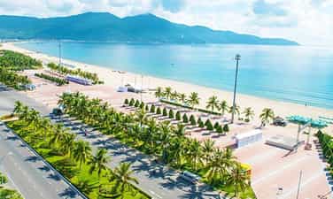
My Khe Beach
More than 10km east of Quang Ngai city center, there is a beautiful, vast stretch of beach called My Khe. Located in Co Luy village, Tinh Khe commune, Quang Ngai city, My Khe beach is located next to the banks of Kinh river, not far from Sa Ky port and only 3km from Son My relic site. With whispering waves from the clear blue water hitting the smooth white sand beach in a romantic, cloud-filled space, My Khe beach will definitely attract you from the first time you set foot there. Not only does it have blue sea, white sand, golden sunshine, My Khe beach also possesses the pristine nature of immense green poplar forests occupying a part of the sandy shore of the poetic crescent sea. Near the coast are simple, peaceful fishing villages with gentle and rustic Quang fishermen. On the sea surface, basket boats and fishing boats float lazily on the calm sea surface, adding to the simple features of human life here in the already extremely romantic and poetic sea landscape. . Coming to My Khe beach - Quang Ngai, not only can you admire the natural scenery of the picturesque sea, enjoy the peaceful space, immerse yourself in the cool water to dispel the fatigue of life, but You can also organize camping on the shore, organize games on the beach and have fun with relatives and friends. Once you come here, don't forget to enjoy delicious dishes made from the rich variety of seafood from the freshwater upstream of the Kinh River mixed with the salty taste of My Khe sea. In addition to activities at sea, combine your trip with a visit to the Son My war relic site, only 3km away, for a more complete Quang Ngai travel experience.
Quang Ngai
8122 view


Fantasy Park
Fantasy Park is located on the top of Ba Na Mountain, part of the Ba Na Hills resort area and is also the only indoor amusement park in the world today located on a mountain top. With an area of more than 21,000 square meters, Fatasy Park Da Nang currently holds the record for being the largest indoor amusement park in the world. Fantasy Park Ba Na was designed and built based on ideas from two extremely famous novels, "Journey to the Center of the Earth" and "Twenty Thousand Leagues Under the Sea" by French writer Jules Verne. . This place is divided into 3 different areas, with countless attractive and interesting games for all ages. Coming here, you will be transformed into famous characters in the story, participating in exciting adventures and explorations. All games at Fantasy Park Da Nang are located indoors so you can come here to have fun at any time of the year. However, according to experience going to Fantasy Park, you should explore this place in the summer, from March to August every year. This is the time in Da Nang where there is little rain and sunny weather, so it will be very convenient to explore Ba Na Hills and have fun at Fantasy Park. In addition, if you don't like crowds, don't want to have to line up to buy tickets and want to save money, you can explore Fantasy Park during the low season, from December to January. year. Fantasy Park Da Nang is the only place in Vietnam today that has a wax museum. Here, you will have the opportunity to see and take photos with replicas of world famous figures from all different professions. From heads of state, actors, singers to sports. One of the most attractive games at Fantasy Park, extremely loved by adventure enthusiasts, is the free fall tower. You will be taken from the ground up to a height of about 30 meters. Then suddenly free fall at high speed. This game will definitely make you "suffocate" with fear. However, it will also leave you with unforgettable impressions. Coming to Fantasy Park Ba Na, you should not miss the opportunity to explore Jurassic Park. Here, you will feel like you have gone back in time to about 150 million years ago to see with your own eyes giant, life-like dinosaurs. When traveling here, you should note that Fantasy Park is a large entertainment complex, with hundreds of different games for all audiences. However, it is difficult for you to experience all the games here, so please select the most attractive games in advance. If you have health problems such as: fear of heights, blood pressure, heart, etc., you should not experience thrilling games here. The area of the play area is extremely large and always crowded, so if you bring children, you need to keep an eye on them to avoid getting lost. You can prepare snacks and drinks in advance to replenish your body's energy when needed.
Da Nang
6471 view


Asia Park Asia Park
Located on the banks of the Han River with an area spanning over 860,000 square meters, Asia Park is one of the leading entertainment areas in Vietnam and Southeast Asia with countless outdoor games. and a vibrant indoor, interesting cultural space and giant Sun Wheel, one of the top 10 largest ferris wheels in the world. The park is divided into 3 main areas including: Modern outdoor amusement park, Central area with Sun Wheel and cultural park with many miniature architectural works of Asian countries. The cultural park is an impressive highlight at Asia Park. Coming here, you will experience a "miniature Asia" with architectural works, landscapes as well as unique cultural, artistic and culinary activities from more than 10 Asian countries including: Japan Japan, Korea, China, India, Nepal, Indonesia, Singapore, Thailand, Cambodia, and Vietnam. The identity of each country is expressed through each unique cultural mark. If in the Japanese cultural area, rows of carp lanterns are hung, representing the bravery and strength of Japanese men, then in the Indian cultural area, we feel the boldness of Buddhist culture. religion through traditional Indian festivals and traditional weaving and printing villages. The outdoor amusement park is designed with countless interesting and exciting games suitable for all audiences. The most attractive games include: Roller coasters, slides, free fall towers, sky trains,... making Asia Park a must-see for tourists who love the thrill of strong sense. Coming to Asia Park, you definitely cannot miss the Sun Wheel - One of the 10 largest ferris wheels in the world. From the height of 115m of the wheel, you can get a panoramic view of Da Nang city from above. At night, the Sun Wheel becomes even more sparkling because it is lit up by more than 13,000 LED lights, creating a unique highlight in the beautiful coastal city of Da Nang. As the most modern skytrain system in Vietnam, the Monorail train system at Asia Park is also a notable point. Joining the journey to explore Asia Park on the train, you will admire the panoramic view of the park and see Da Nang from above. Besides, a series of masterpieces such as the Clock Tower, City Gate, Dragon Boat, Buddha Statue... are also destinations located in the Central Area near Asia Park's Sun Wheel. In addition, in the central entertainment area there is also a family entertainment area with many interesting games such as air gun shooting, electronic slot machines, carnival games, etc. In addition to the entertainment areas, inside Da Nang Asia Park there is also a food area with Da Nang restaurants and cafes as well as a shopping area with 2 large souvenir stalls. With a vast area, the park is also gradually completing a multi-purpose performance area with a large water surface used to organize music and sports events, water music performances, and unique artistic fireworks. .
Da Nang
5979 view


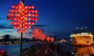
Bridge of Love
Love Bridge Da Nang is located on the east side of the Han River, Tran Hung Dao Street, Son Tra District, Da Nang City. The bridge has an arc shape and has been in operation since 2015. Love Bridge is located between Dragon Bridge and Han River Bridge, so from here, you can see many beautiful and famous landscapes of the city. . The Love Bridge in Da Nang is inspired by famous love bridges in the world such as: Italy, France, Russia, Germany. This is the place to prove and promise for couples, the meaning of the love lock represents a strong, eternal love. Therefore, the bridge is a suitable tourist destination in Da Nang for couples. The love bridge with cute locks on the bridge wall is an attractive and romantic place for couples. This is also a great place for couples to record the happiest moments of their lives.
Da Nang
6407 view


Than Tai hot mineral spring
It can be said that Da Nang is a place blessed by nature with many mountain and river landscapes. Da Nang has the sea, rivers, and majestic wild mountains and forests. Than Tai Mountain is surrounded by Thanh Long Mountain and Bach Ho Mountain, located within the campus of Ba Na Nui Chua nature reserve, in Phu Tuc village, Hoa Phu commune, Hoa Vang district, Da Nang city. At this mountain, thousands of meters deep underground, there are faults and deformations of lava layers due to the strong movement of the earth's crust. The violent underground changes cause high temperature and pressure to erupt hot mineral water through the rocks, creating nature's precious hot springs. Taking advantage of the precious resources bestowed by nature, Than Tai Mountain has been exploited into a majestic eco-tourism area. Than Tai Mountain Hot Springs Park (Hot Springs Park) is an attractive tourist destination in Da Nang for tourists to cool off in the summer, as well as a place to enjoy healthy relaxation. Located about 30 km west of Da Nang city, Than Tai Mountain hot spring park is not difficult to find for tourists. Coming here, you can go on a tour, or you can make a self-guided trip because the way to get here is quite easy. Young people often design short trips for themselves to come here to relax with friends. Just run along Highway 14B, heading up to Dong Giang mountainous district after reaching Tuy Loan intersection, you will arrive. Because it is quite close to Ba Na Hills, tourists will often combine travel routes to come here. Natural hot mineral springs are the most special and unique feature that Than Tai Mountain tourist area owns. This type is an advantage for this tourist area, when previously Da Nang only invested in beach tourism, islands, forests and eco-tourism areas. Hot mineral springs can be said to be the main reason for any tourist to come here. Than Tai Mountain Hot Spring Park will allow visitors to enjoy and experience hot mineral baths in the Japanese bathing style (Onsen bath). It is known that this is an extremely beneficial activity for your health. Hot mineral bath is the best solution to regulate and excrete the body, detoxify the body, and beautify your skin. For women, Than Tai hot spring is always the first choice. Understanding the needs of women, Than Tai Mountain regularly discounts on holidays and Tet, especially on holidays for women such as March 8 or October 20. No need for expensive cosmetics, no need for chemical treatments for sensitive skin, going to hot mineral springs is the most affordable and most effective choice. Hot mineral spring water is the combined effect of three physical treatments: hydrotherapy, thermotherapy and mineral therapy. What could be more wonderful than coming here, immersing yourself in the hot mineral water, listening to the chirping of birds in the tropical forest, inhaling the smell of the jungle, wandering around and enjoying the beautiful scenery in harmony with nature? . The stress and fatigue of everyday life will disappear in an instant, leaving a peaceful and relaxing space for the soul.
Da Nang
7065 view


East Sea Park
With a convenient central location right near Pham Van Dong beach, My Khe beach - One of the most attractive beaches on the planet, East Sea Park is an attractive place to visit not only for people in the city. city but also for many tourists when traveling to Da Nang city with many interesting and vibrant activities taking place every day. The park is geographically located directly overlooking the East Sea and the Hoang Sa archipelago, so the city's people named the park East Sea as a way to express pride, patriotism and affirm democratic sovereignty. clan. In addition, the park is also known with many different names such as "Peace Park", "Love Park" or "Festival Park". Each name partly represents a unique characteristic of this tourist destination. One of the special things that attracts visitors to East Sea Park is the thousands of white pigeons fluttering in the sky. Coming here, you will admire the image of flocks of pigeons flying in the air and then swooping down gently next to the large yard next to the immense waves of My Khe beach, creating an extremely beautiful and peaceful image. right in the heart of the city. In addition, you can also feed them, harmonize and play with these friendly pigeons to "rediscover" the feelings of peace and relaxation in your soul. These will definitely be experiences you should not miss when coming to East Sea Park - Da Nang. Not only is it known as "Hoa Binh Park", people here also refer to East Sea Park as "love park" perhaps because the park's extremely romantic and poetic scenery has a magical attraction. with everyone. The rows of green coconut trees swaying in the wind on the clear blue seashore and the sparkling golden sand beach dyed in sunlight stretching to the smooth green grass, all seem to blend and create a poetic, autumnal natural space. attracts many couples to visit, go on dates as well as choose it as a wedding photography location, marking their hundred years of happiness. From here, visitors can also look out into the distance and admire the fishing boats and oil tankers operating peacefully on their homeland's waters or look to the Northeast, on the Son Tra peninsula is the statue. The tallest Avalokiteshvara Buddha in Vietnam. Furthermore, East Sea Park is also a place to organize many festivals, culinary festivals, cultural events, exhibitions and participate in teambuilding activities, game shows and exciting sports such as surfing, kayaking, parachuting. hovering in the air,... The park's public amenities are also gradually being equipped to serve visitors from everywhere.
Da Nang
10283 view


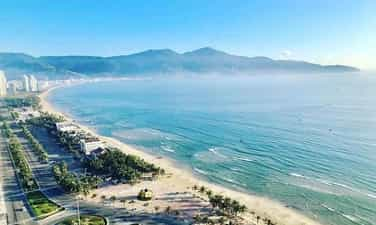
Son Tra Peninsula
Son Tra Peninsula has an area of about 4,439 hectares, with a tropical monsoon climate, average annual rainfall of 2,184mm, in the hot season the temperature is about 28-29 degrees Celsius, in winter the temperature is about 18-22 degrees Celsius. Son Tra Peninsula is a giant shield, the green lung of Da Nang city. Here is Tien Sa port, one of the three largest ports in Vietnam, a place for economic exchange, where many large international cruise ships welcome tourists to visit Da Nang. Coming to Tien Sa beach with fine sand and blue water of the sea is an eternal, serene beauty with ecological values voted by the world as one of the most beautiful beaches on the planet. From the top of Son Tra, visitors can admire the entire city of Da Nang in the shape of a bow, the Marble Mountains, Ba Na Mountain Chua and the majestic Hai Van Pass. Son Tra Peninsula is a diverse and rich nature reserve. Son Tra forests are almost in pristine form with unique flora and fauna. Here there are rare animals recognized by the world such as the red-shanked douc langur, red-faced chicken, etc. There are many stops to attract tourists such as Ban Co peak where there is an extremely interesting statue of a fairy sitting playing chess, Linh Ung Pagoda where the largest statue of Avalokiteśvara in Vietnam with a height of up to 67m, Thousand-year-old banyan tree... And right at the foot of the mountain, visitors can go to the poetic Da stream, or immerse themselves in the cool water of the sea, watching the clean and smooth sand beaches around the peninsula, the rocks piled up along the shore being eroded and wiped clean by the steady rising and falling tides. The whole area of But beach, Rang beach, Nam beach, Om beach, Bac beach... in addition to scuba diving services to see coral and cruises at sea, visitors can also visit and explore nature, have entertainment such as water motorbikes, parachutes, and participate in fishing festivals of coastal residents, which will certainly leave an unforgettable impression and satisfy tourists coming here. The appropriate time to travel to this place is from March to September. At this time the weather is sunny, dry, and there are rarely storms. If you go in the winter, there will often be fog, making it very difficult and unsafe to travel.
Da Nang
8916 view


Ngu Hanh Son
Ngu Hanh Son Mountain - an impressive tourist destination in Da Nang, also known by the people here as Non Nuoc Mountain, is formed by a complex of five limestone mountains according to Metal - Wood - Water - Fire - Earth with many legendary stories that still resonate today. The name Non Nuoc mountain has been around for a long time and is included in local people's songs: "In the afternoon, clouds cover Son Tra, Thunder rumbles in Non Nuoc, the sky turns to rain". Visitors coming here will be amazed by the majestic and magical natural scenery that the Creator has bestowed on this place. Ngu Hanh Son is located on a vast, vast white sand beach near the coast stretching from Cat Tien Sa peninsula to Non Nuoc beach, in Hoa Khue village, Son Thuy hamlet, Hoa Vang district, now Hoa Hai ward, Ngu Hanh Son district, less than 8 km drive southeast from Da Nang city center. Ngu Hanh Son is famous throughout the country for the unique beauty of a sky, sea, and water with long-standing profound historical, cultural, and spiritual values. Walking on the mountains of Ngu Hanh Son, visitors can freely pick up beautiful marbles. The interesting thing here is that each mountain has a different color of stone, such as the stone in Kim Son is quiet blue, the stone in Tho Son is earthy brown, the stone in Moc Son is pure white, the stone in Thuy Son is pink and the stone in Hoa Son is bright red, each type of stone is a color corresponding to the five elements in feng shui of the Orient and perhaps its name. of those five mountains was also placed for that reason. Ngu Hanh Son is not only diverse in gemstones but also has many rare and valuable herbs such as: Thien Tue, Canh Thien, Moc Tinh, Truong Sinh Agar, Cung Nhan Thao, and Ly Ly. Coming to Ngu Hanh Son - one of the tourist destinations in Da Nang, visitors can also improve their knowledge about many rich animal species such as bats, sea swallows, gentle monkeys, etc. Walking slowly, breathing fresh, airy air and seeing many colorful wild flowers giving off fragrant scents, most of which are wild orchids, there is nothing more enjoyable. The land of Ngu Hanh Son is not only legendary, not only five elements, spiritual, not only a land of natural talent, spiritual land, but also a piece of history, associated with people and names that have entered the history books. Tourists will visit the grave of General Tran Quang Dieu's mother and the temple of Princess Ngoc Lan - King Minh Mang's younger sister, or visit the poetic autographs of the Le and Tran dynasties printed on cliffs covered with moss over the flow of time, all creating an eloquent testament to a legendary Marble Mountains, a land of spiritual masterpieces. Walking along the trails, tourists who are passionate about exploration will have the opportunity to visit the unique and amazing cave system, which is one of a kind beauty here. To explore and admire all the main caves of Ngu Hanh Son, visitors will have to invest 2 to 4 days with a tight schedule such as visiting Quan Am cave of Kim Son, Huyen Vi cave of Hoa Son or Am Phu, Linh Nha, Huyen Khong, Van Thong, Thien Long, Thien Phuoc Dia caves of Thuy Son, visitors will experience many different levels of emotions when going to those caves. According to many tourists, the most outstanding of all are Am Phu cave, Huyen Khong cave and Van Thong cave. Am Phu Cave of Kim Son Mountain with many legends that are both real and virtual, has long been spread everywhere, inherently all things always exist in two opposing directions: day must have night, when people are born, there must be death, if there is heaven, there must be hell because the cave has two corners to heaven and to the underworld. The cave was named that way during the reign of King Minh Mang in the early 19th century, when the king visited this mountain. The underworld is understood as the world of the dead, but according to Buddhism, death is not the end but a transition to reincarnation to another realm. Good and evil will be clearly defined in black and white. Huyen Khong Cave at a tourist destination in Da Nang is an open-air cave with a flat floor, a circular dome with 5 ventilation holes to the outside. On sunny days, the cave glows with natural light pouring in, creating a shimmering mysterious space. At the top, there is a statue of Shakyamuni Buddha, below is the altar of Ksitigarbha Bodhisattva, on the left is the altar of Lady Fairy, where business tourists come to pray for wealth and fortune. The temple of Lady Thuong Ngan is where most tourists come to pray for health and peace. Around the dome of the cave, there are many rocks clinging to the walls, creating strange shapes such as: the face of an old man, the image of a crane, an ostrich, the image of two elephant heads with trunks hanging down to the ground, the image of a stork with a long sharp beak pressed against the cave wall... Van Thong Cave is located in the heart of a circular mountain with a pipe slanting up towards the mountain. In the cave, there is a stone stele with the three ancient words "Ngu Uan Son" written on it. In the middle of the cave is a very large Buddha statue. Behind it is a road leading up to the cave. The deeper you go, the narrower it gets and towards the top of the mountain. Visitors must cling to the rocks to get up. At the end of the cave is a door to the outside about the size of a porch with a diameter of about 1 meter. From the top, light shines in, creating a brilliant and magical aura. When visitors stand at Vong Giang Dai on Thuy Son mountain, they can see far away and see the famous river that once entered the poetry of the Truong Giang River with its blue water, stretching endlessly. In addition to the beauty of mysterious caves, Ngu Hanh Son is also mentioned a lot for its pagodas leaning against the mountain. Although not too high, the space is very peaceful, quiet, and sacred. On Kim Son mountain there is a pagoda in Quan Am cave, on Hoa Son mountain there is Linh Son pagoda, on Tho Son mountain there is Long Hoa pagoda, Hue Quang pagoda, on Thuy Son mountain there is Tam Thai pagoda. Tam Thai Pagoda in Da Nang tourist destination is an ancient pagoda and Buddhist relic, the main hall worships a large bronze Maitreya Buddha sitting on a lotus, on both sides are statues of Quan Thanh and Bodhisattva. The pagoda is also a place where many pilgrims visit and pray to Buddha on holidays. Visiting the pagodas, standing quietly looking at the space with mountains and green trees, breathing the pure atmosphere at the pagoda door, visitors will feel their mind relax, a moment of silence lets their soul wander, harmonizing with heaven and earth, a rare thing in the bustling life of a noisy city.
Da Nang
9231 view


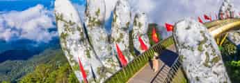
Golden Bridge
The Golden Bridge with the support of giant hands is being shared rapidly on social networking sites and travel communities, making many people surprised. Golden Bridge, a new project of Sun World Ba Na Hills. Construction started in July 2017 and was completed in April 2018. It recently went into operation and welcomed the first visitors to Da Nang. Possessing an extremely unique and novel design, unprecedented in Vietnam, the bridge was built at an altitude of more than 1,400 meters above sea level, with a total length of about 150 meters, with 8 bridge spans, the largest span being 21.2 meters. The bridge's surface is made of wood, 3 meters wide and 5 cm thick. Along both sides of the walkway are planted many Green Queen flowers, above is a railing made of gold-plated stainless steel. It can be seen that this bridge is designed and shaped to resemble the image of a woman using her hands to support a golden silk strip across. With its unique image, the Golden Bridge in Ba Na Hills has made many people surprised and admired the creativity of the designers and builders of this project. Not only can you admire the beauty of this unique project, coming here you will also be able to freely admire the majestic and breathtaking beauty of the surrounding mountains and forests. The feeling of walking above the floating clouds, admiring the beautiful scenery below will be an extremely wonderful experience for many visitors. Many beautiful photos have been taken by tourists coming here, many viewers thought this was some foreign tourist destination. But when they learned that it was the Golden Bridge on top of Ba Na, everyone was extremely surprised and excited and wanted to come immediately to admire this beautiful scene. It can be seen that Da Nang not only possesses amazing natural landscapes, but also works built from the human mind and hands are also presented in this city in an extremely unique way, in which it is impossible not to mention the Golden Bridge in Da Nang, a highly artistic work.
Da Nang
10297 view


Ba Na Hill
Da Nang has transformed itself into an interesting tourist and resort destination, no longer the barren Central region as before. Explore and enjoy unique experiences at the tourist destination Da Nang - Ba Na Hills. The shopping area at the tourist destination Da Nang - Ba Na Hills has up to 20 souvenir shops, offering more than 2,000 diverse products. They are distributed throughout the tourist area, from the train station, wax statue display area, to Doumer restaurant and Fantasy Park... Here, you can easily find unique and meaningful souvenirs to give to your loved ones such as gemstone paintings, sand paintings, pebble paintings, embroidery paintings, lacquer paintings, scroll paintings, origami paper folding. , hand-painted dresses... In addition, you can also choose high-end gifts such as 3D statue carvings, cosmetic lines, high-end essential oils produced specifically for Ba Na... Especially at French Village, there is a shopping area with a full range of high-end goods from fashion, cosmetics, jewelry, and branded handbags. After experiencing Da Nang destinations at Fantasy Park or Love Flower Garden, visit the luxurious European cuisine area to enjoy unique delicacies. You can enjoy fast food and grilled food from famous restaurants such as Morin, Kavkaz, Buffet Club, La Crique&Café Postal, KavKaz Vista... Du Dôme Square is located atop the Medieval Castle in Fantasy Park, with creative architecture and panoramic views of Ba Na Mountain. Four tall columns and classic colors at this culinary square take you back to the Middle Ages. To fully experience the beauty of Ba Na overnight, you can stay at 3-star or 4-star hotels. These locations provide luxurious spaces, comfortable rooms and many good services. The 3-star Morin Hotel and the 4-star French Village offer distinct architecture but common luxury in a classic, elegant French style. The interior is meticulously decorated, with beautiful views and fireplaces in each room, ensuring coziness on cold winter nights. Shopping, enjoying cuisine and experiencing relaxation are three great experiences to explore the majestic beauty of Ba Na mountain.
Da Nang
9036 view


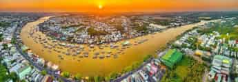
Tam Giang Lagoon
Known as the brackish water lagoon with the largest area in Southeast Asia, Tam Giang lagoon is a favorite destination for tourists from far away when visiting the dreamy land of Hue as well as an ideal place to attract photographers. Photographers come to capture wonderful images and moments of nature. Tam Giang Hue Lagoon - The beauty of Vietnam's homeland. Be captivated by the peace of Thai Duong Ha fishing village. Thai Duong Ha fishing village is a small oasis located right on the lagoon, this is where fishing households live by catching fish and seafood. This place is known to have existed for a long time and has many traditional cultural beauties of our nation that are still preserved. Coming to Thai Duong Ha fishing village, you will enjoy many fresh brackish water seafood dishes at cheaper prices than other places. In addition, you can also experience and visit Vietnamese communal houses, festivals associated with the people here such as Cau Ngu festival and peaceful and quiet countryside life. Perhaps the most attractive beauty of Tam Giang lagoon is its poetry, a beautiful but sad place, the vastness of nature and the stillness of the scenery that easily catches the eye of those who love landscape photography. Coming to Tam Giang lagoon at every time of the day, you will be attracted by its unique beauty. If in the morning the sunrise shines brightly, reflecting on the sparkling water surface, then in the late afternoon, this brackish lagoon has something magical. , very soulful of Vietnamese countryside like the old days. Vietnam's homeland is beautiful, there are many peaceful and beautiful places like Tam Giang lagoon that you need to explore. If you come to Hue, don't forget to visit Tam Giang to see how beautiful and peaceful our country is.
Hue
5605 view


Bach Ma Mountain
Bach Ma Mountain is located at the end of the Truong Son range and is the center of the only strip of green forest in Vietnam stretching from the East Sea to the Vietnam - Laos border. Unlike the guardian of Phu Yen's land and sky, who stands alone like Da Bia Mountain, Bach Ma Mountain appears like a charming landscape painting that makes visitors come here still reluctant to return. Hue is a city with pleasant, fresh weather. So conquering Bach Ma Mountain in Hue will be great because it is covered all year round with mountains and forests, so the climate here is easy to breathe, the higher you go, the cooler it gets. With the advantage of being close to the sea, the average summer temperature here ranges from 20 - 26 degrees Celsius, and in winter from 4 degrees - 10 degrees Celsius. Therefore, the weather in Bach Ma mountain range is mild and cool. On mild sunny days, it is not too harsh and makes you feel uncomfortable or hot. On days with a few thunderstorms, the weather will become calmer. Conquering the 1450m high mountain peak is not easy. Looking up from afar, visitors will be overwhelmed by the majestic beauty, hidden behind layers of fog, making Bach Ma Mountain more poetic and magical than ever. Having the advantage of being a place with a wonderful climate, the nature and flora here are very rich and diverse with more than 2,000 species of plants and about 1,500 species of animals, including many species of animals and plants named in books. Vietnamese red. Get lost in the vast, natural space of Bach Ma Mountain. Visitors can also enjoy the famous beauty of streams and breathtaking high waterfalls. Standing tall in the Bach Ma mountain range, flowing day and night. Do Quyen Waterfall is 400m high, 20m wide with a rolling white waterfall, highlighting a corner of Bach Ma mountain and forest like a girl who fell asleep and never woke up. The cool, fresh water mixed with the cool air here gives visitors a very comfortable feeling, all worries seem to disappear. On sunny summer days, visitors will see that on both sides of the waterfall are the precious Rhododendron flowers blooming, glowing red and the whole sky looks like it is covered with a long red silk carpet with no end in sight. Stop here, take some beautiful nature photos, it won't be a mistake to get lost in this place. Standing from the top of the waterfall, looking out into the distance, it's like seeing a white sky with sparkling afternoon sunlight shining down, making this scene sparklingly beautiful and magical. The vertical waterfall is up to 250m high, it is very interesting when you check-in with a few friends or your family when coming to Do Quyen waterfall.
Hue
5749 view


